TagMap(375)
-
 2001-06-22
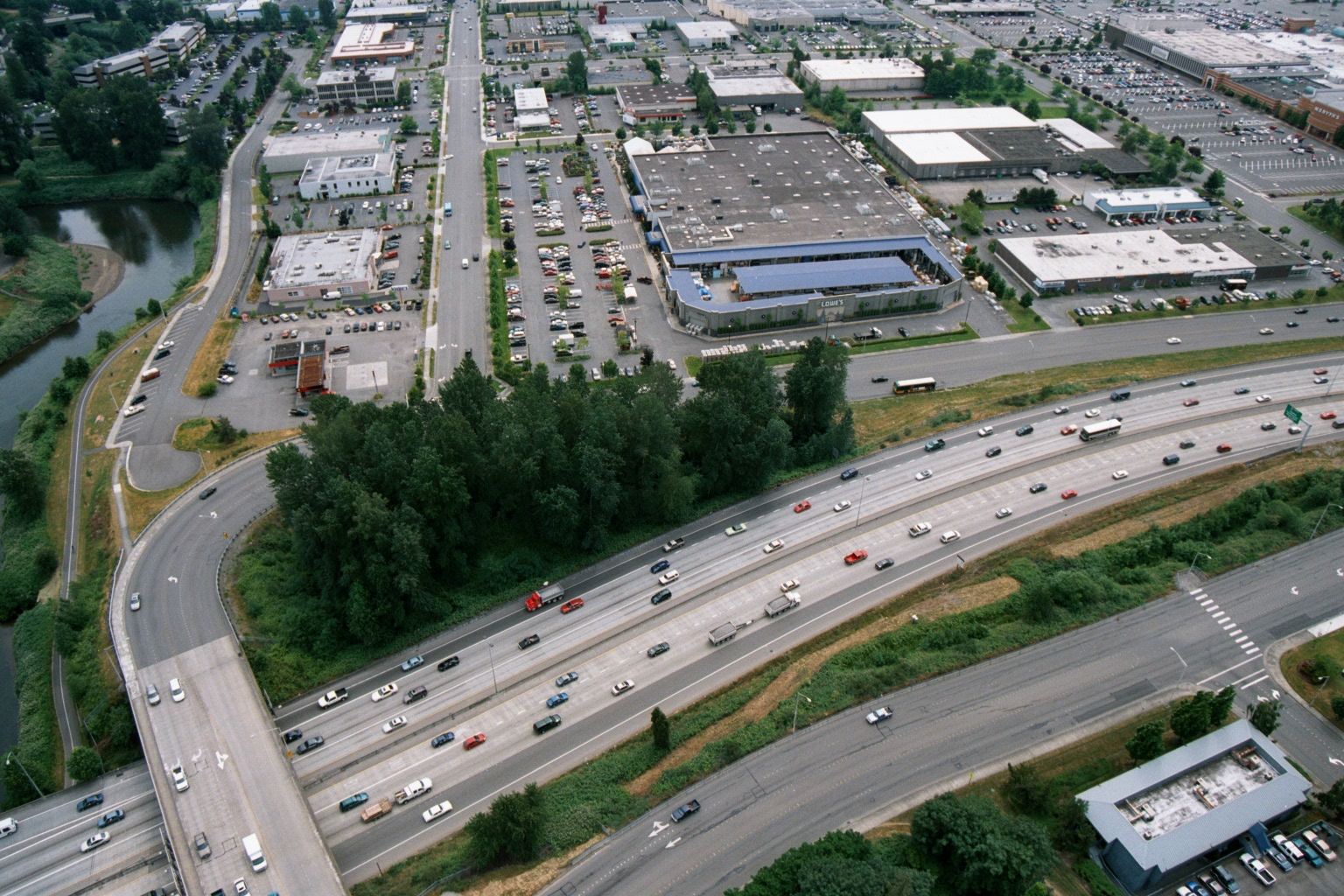
Aerial View of Freeway and Big-Box Retail Zone Including Lowe’s, with Waterway
Aerial photograph showing a multi-lane freeway (likely I-5 or similar Pacific Northwest interstate) intersecting with a commercial retail zone. A Lowe's home improvement store logo is visible among the big-box retail buildings, with a river or waterway visible to the left and extensive parking lots throughout. -
 2001-06-22
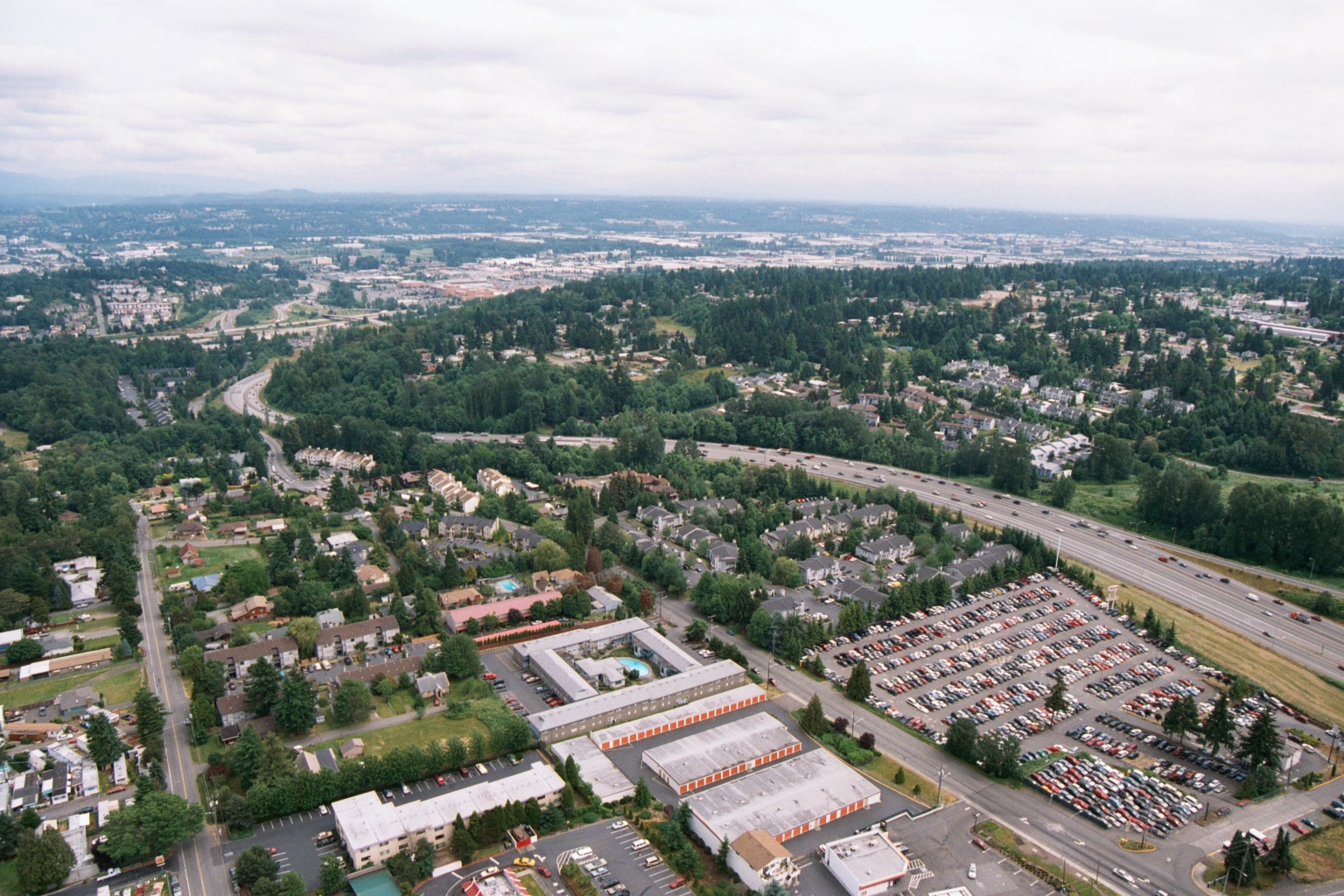
Aerial View of Suburban Residential and Commercial Area Near Sea-Tac Airport
Aerial photograph showing a suburban residential and commercial area bisected by a multi-lane interstate highway, consistent with the greater Seattle/Sea-Tac region based on the Pacific Northwest vegetation, terrain, and urban development patterns. Visible features include a Public Storage facility (identifiable by orange-and-white branding), large parking lots, apartment complexes, and dense evergreen tree coverage stretching toward the horizon. -
 2001-06-22
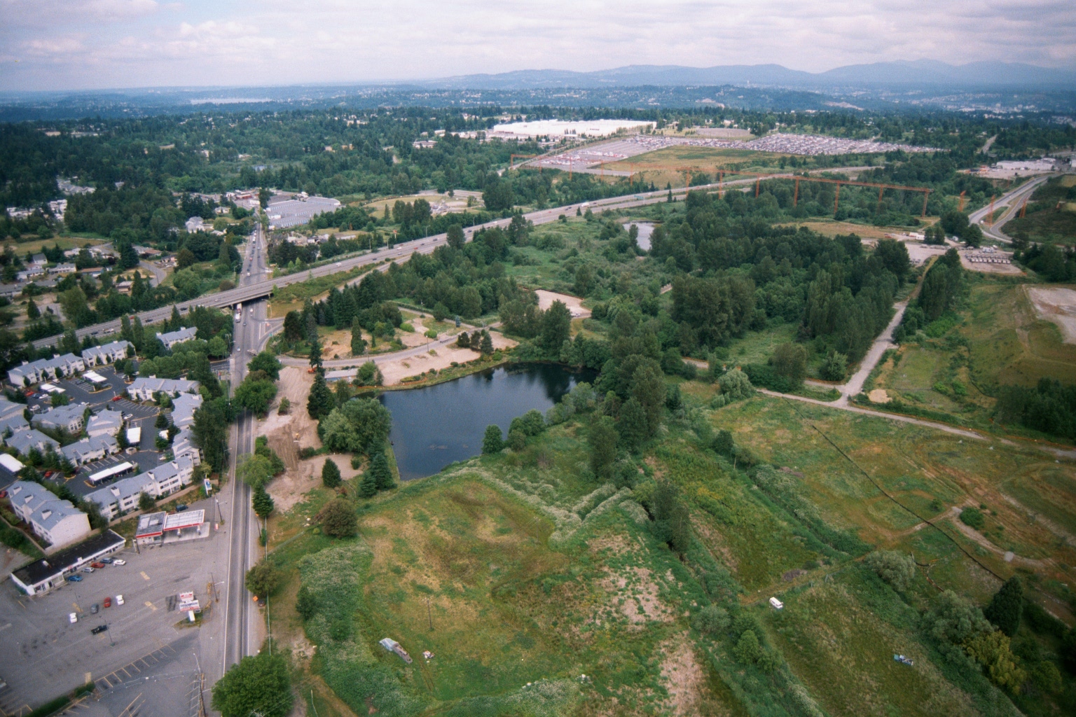
Aerial View of Highway Interchange and Development Near Sea-Tac Region
Aerial photograph showing a highway interchange, a small pond or retention basin, residential and commercial development on the left, and extensive undeveloped or semi-developed land to the right. Mountains and a broad forested valley are visible in the background, suggesting a Pacific Northwest setting consistent with the Seattle/Sea-Tac region. -
 2001-05-24
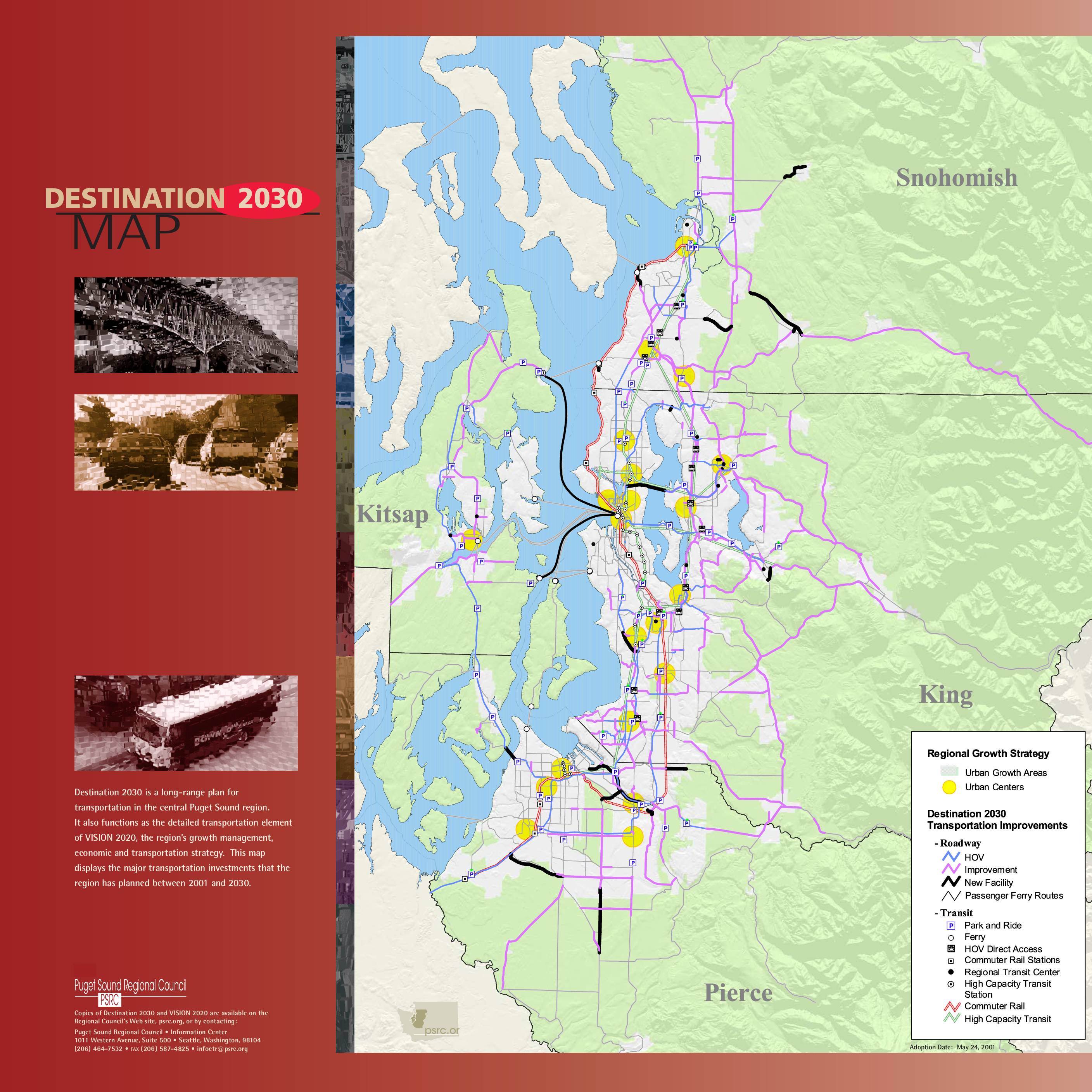
Destination 2030 map
Destination 2030 is a long-range regional transportation plan for the central Puget Sound area, adopted on May 24, 2001, by the Puget Sound Regional Council. It serves as the transportation element of VISION 2020, the region's growth management and economic strategy, and outlines major transportation investments planned between 2001 and 2030. The plan covers roadway improvements, HOV lanes, ferry routes, commuter rail, and high-capacity transit across Snohomish, King, Kitsap, and Pierce counties. -
 2001-05-06
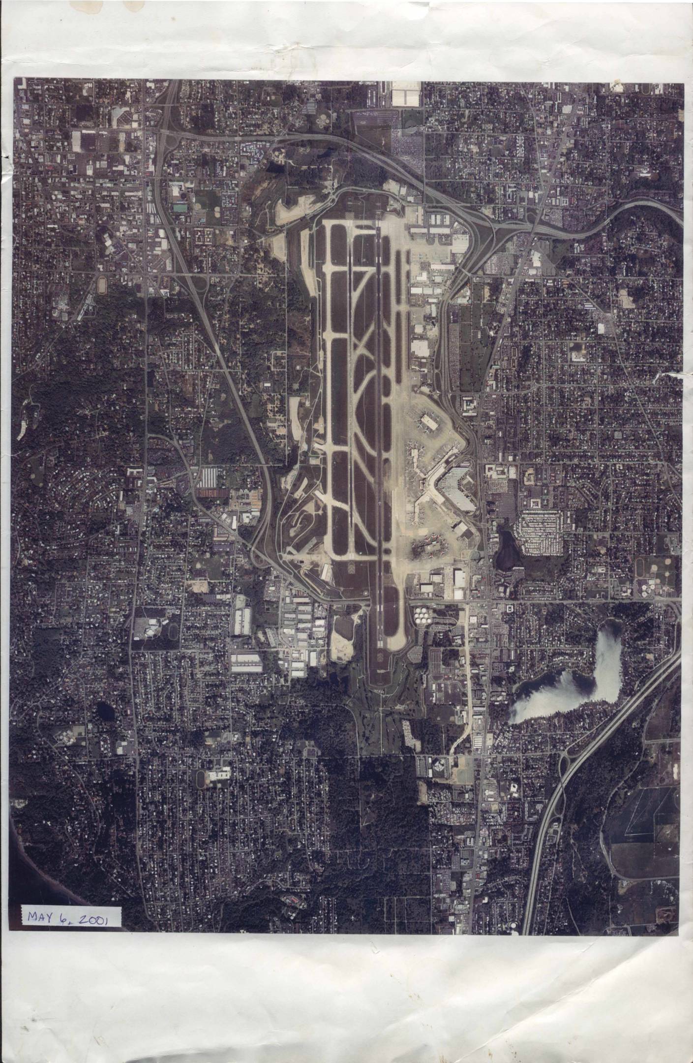
Sea-Tac Airport aerial photograph, May 6, 2001
An aerial photograph of Seattle-Tacoma International Airport (Sea-Tac) and its surrounding neighborhoods, taken on May 6, 2001, by Walker and Associates Photogrammetric and GIS Services of Seattle, WA. The image, printed at an approximate scale of 1 inch equals 1,700 feet, shows the airport's runways, taxiways, terminals, and the densely developed residential and commercial areas nearby. It is identified under negative number 1245 SEATAC PP-3 and work order number 26599, and is copyrighted 2001. -
 2001-05-01
EXH AR031166: Wetland Photographs and Maps — Master Plan Update Improvements, Sea-Tac Airport
Wetland photographs and maps prepared by Parametrix, Inc. for Port Of Seattle, May 2001, as part of the Master Plan Update Improvements for Seattle-Tacoma International Airport. Document AR031166 includes a Wetlands Atlas covering North and West Sides of Sea-Tac Airport, with 15 map sections showing surveyed wetland boundaries, estimated wetland boundaries, and other estimated or -
 2001-05-01
EXH AR050379: Wetland Photographs and Maps — Master Plan Update Improvements, Seattle-Tacoma International Airport
Wetland photographs and maps prepared by Parametrix, Inc. for the Port Of Seattle, documenting wetlands and other Waters of the U.S. in the Miller Creek Basin near Seattle-Tacoma International Airport (STIA) as part of the Master Plan Update Improvements. AR 050379–050381. Includes photo point map showing delineated wetlands verified and not verified by ACOE (Army -
 2000-03-08
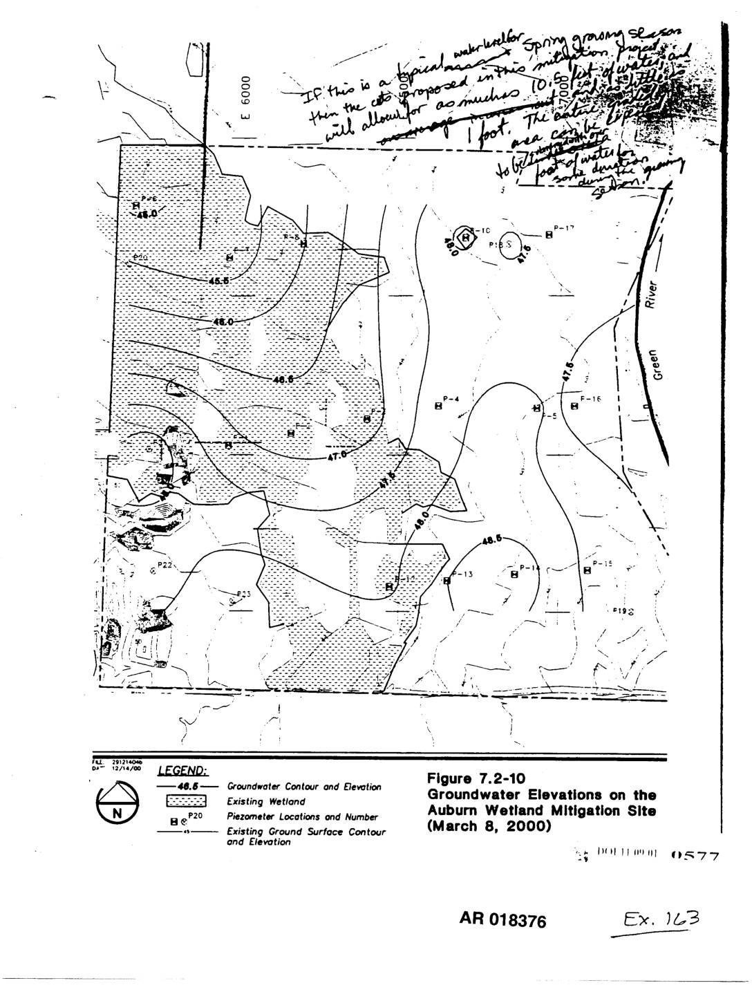
EXH AR018376: Groundwater Elevations on the Auburn Wetland Mitigation Site (March 8, 2000)
Figure 7.2-10 showing groundwater contour elevations on the Auburn Wetland Mitigation Site as of March 8, 2000. Map displays piezometer locations (P-1 through P-23), groundwater contour lines with elevations ranging from approximately 45.5 to 48.5 feet, existing wetland areas, and existing ground surface contours near the Green River. Handwritten annotations reference spring groundwater levels, 0.15-foot -
 2000-01-24
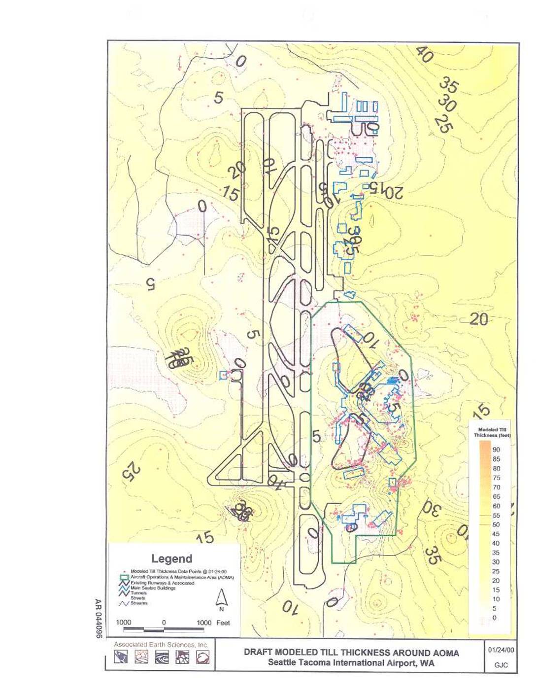
EXH AR044096: Draft Modeled Till Thickness Around AOMA, Sea-Tac Airport
Draft modeled till thickness map around the Aircraft Operations & Maintenance Area (AOMA) at Seattle-Tacoma International Airport, WA, prepared by Associated Earth Sciences, Inc. on 01/24/00. Contour map showing till thickness in feet (0–90 ft range) with data points from 01-24-00, depicting existing runways, main SeaTac buildings, tunnels, streets, and streams. Administrative Record document AR -
 1999-12-02
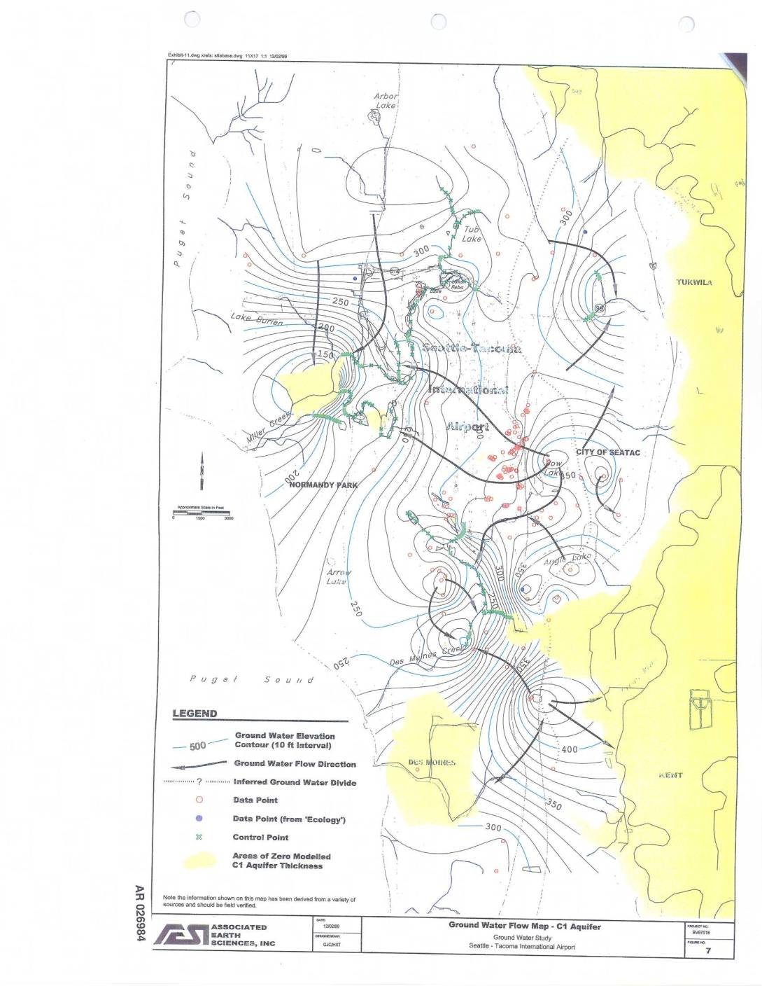
EXH AR026984: Ground Water Flow Map – C1 Aquifer, Ground Water Study, Seattle-Tacoma International Airport
Ground Water Flow Map for the C1 Aquifer prepared by Associated Earth Sciences, Inc. (project no. 8V07019, figure 7) as part of a Ground Water Study at Seattle-Tacoma International Airport, dated 12/02/99. The map covers the Sea-Tac Airport area including Normandy Park, City of SeaTac, Tukwila, Des Moines, and surrounding Puget Sound shorelines. Shows ground