TagMap(375)
-
 2005-01-01
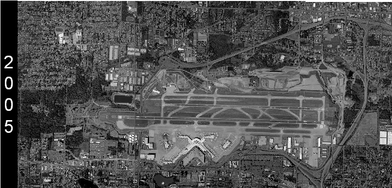
Sea-Tac Airport Aerial Photograph 2005
Grayscale satellite or aerial photograph of Seattle-Tacoma International Airport (Sea-Tac) dated 2005, as indicated by the year label on the left margin. The image shows the airport's parallel runways, terminal area, and surrounding urban context. -
 2004-03-15
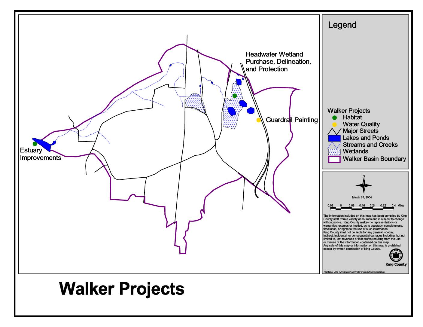
Walker projects
This King County map, dated March 15, 2004, identifies Walker Basin environmental projects including Estuary Improvements, Headwater Wetland Purchase and Protection, and Guardrail Painting. The map highlights key natural features such as lakes, ponds, streams, creeks, and wetlands within the Walker Basin boundary. Projects are categorized by type, including habitat and water quality initiatives, and are plotted against major streets and waterways in the area. -
 2004-03-15
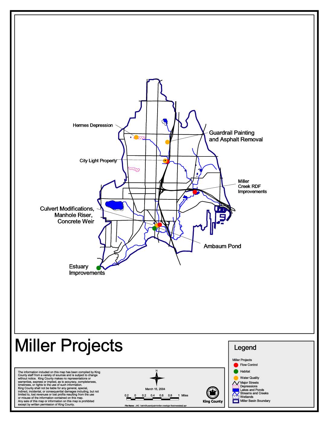
Miller Projects map
This King County map document, dated March 15, 2004, identifies and locates various Miller Creek basin improvement projects in the Seattle area, including flow control, habitat, and water quality initiatives. Featured projects include Estuary Improvements, Ambaum Pond, Miller Creek RDF Improvements, Culvert Modifications, Guardrail Painting and Asphalt Removal, and work at the City Light Property and Hermes Depression sites. The map serves as a visual reference for environmental and stormwater management efforts within the Miller Basin boundary. -
 2004-03-09
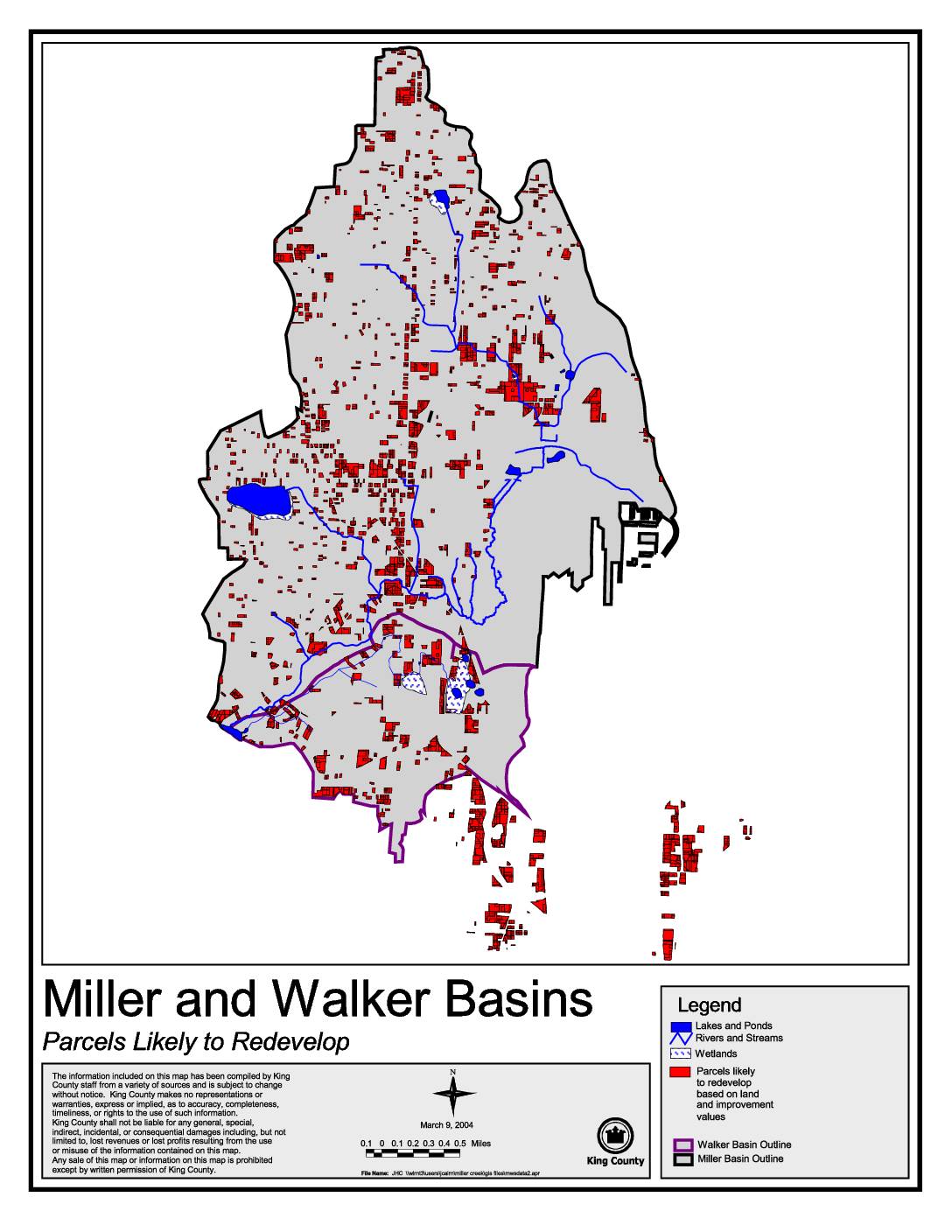
Miller and Walker Basins: Parcels likely to redevelop
This King County map, dated March 9, 2004, identifies parcels within the Miller and Walker Basins that are likely to redevelop based on land and improvement values. It highlights features such as lakes, ponds, rivers, streams, and wetlands alongside redevelopment-candidate parcels marked in red. The map was produced by King County staff using data from multiple sources and is intended to support land use planning in these two drainage basins. -
 2003-12-08
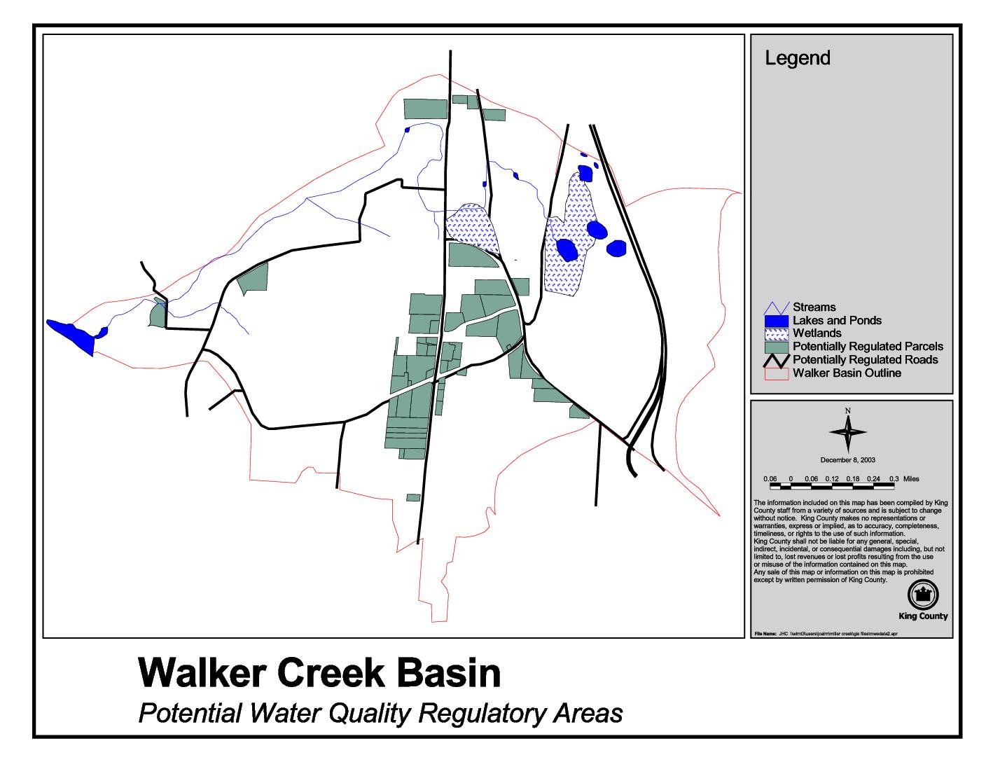
Walker Creek Basin potential water quality regulatory areas
This King County map, dated December 8, 2003, identifies Potential Water Quality Regulatory Areas within the Walker Creek Basin, highlighting features such as streams, lakes and ponds, wetlands, potentially regulated parcels, and potentially regulated roads. The map was compiled by King County staff to support water quality planning and regulation in the basin. Note that while this document relates to King County environmental planning, it does not directly address Sea-Tac Airport noise policy. -
 2003-09-23
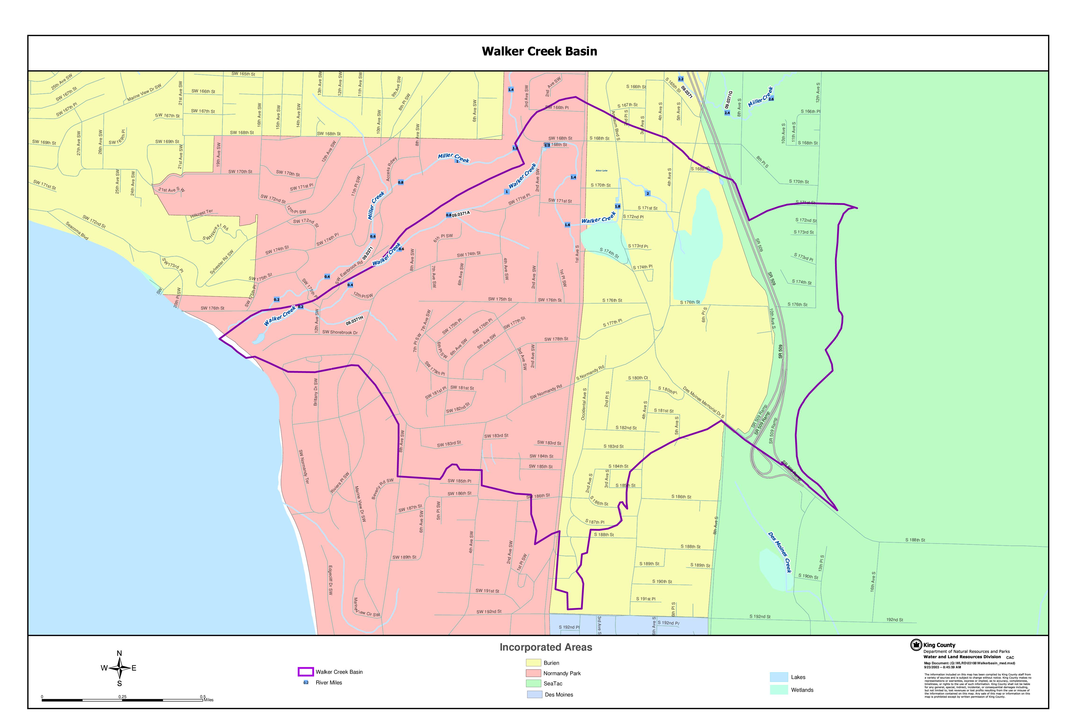
Walker Creek Basin map
This King County Water and Land Resources Division map document depicts the Walker Creek Basin, a watershed area located near Sea-Tac Airport encompassing portions of the incorporated cities of Burien, Normandy Park, SeaTac, and Des Moines in Washington State. The map identifies key waterways including Walker Creek, Miller Creek, and Des Moines Creek, along with wetlands, lakes, and river mile markers within the basin boundary. Created in 2003, it serves as a geographic reference for water resource and land use planning in this urbanized watershed area. -
 2003-09-01
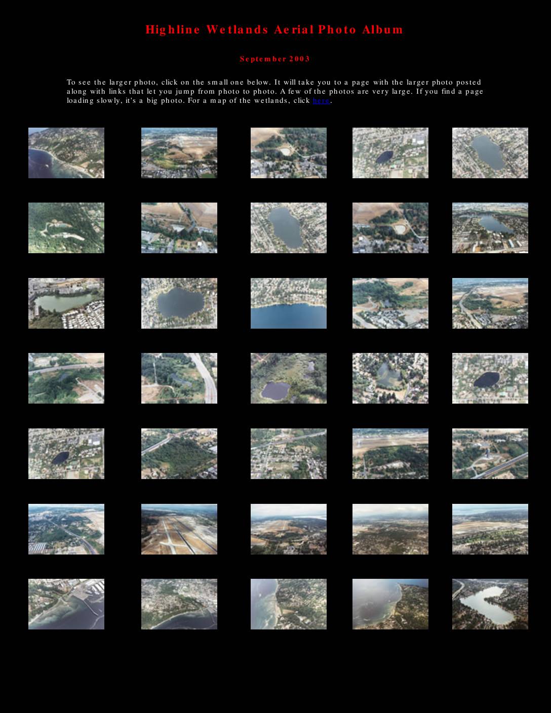
Highline Wetlands aerial photo album
The Highline Wetlands Aerial Photo Album, compiled in September 2003, presents a collection of aerial photographs documenting wetlands, lakes, and waterways in the Sea-Tac Airport area of Washington State. The album covers locations including Miller Creek, Walker Creek, Lake Burien, Angle Lake, and other water resources affected by the proposed Third Runway construction at Seattle-Tacoma International Airport. An accompanying map illustrates the runway's projected impact on local water resources, identifying proposed fill areas and the third runway site relative to surrounding communities such as Burien, Normandy Park, and Des Moines. -
 2003-02-15
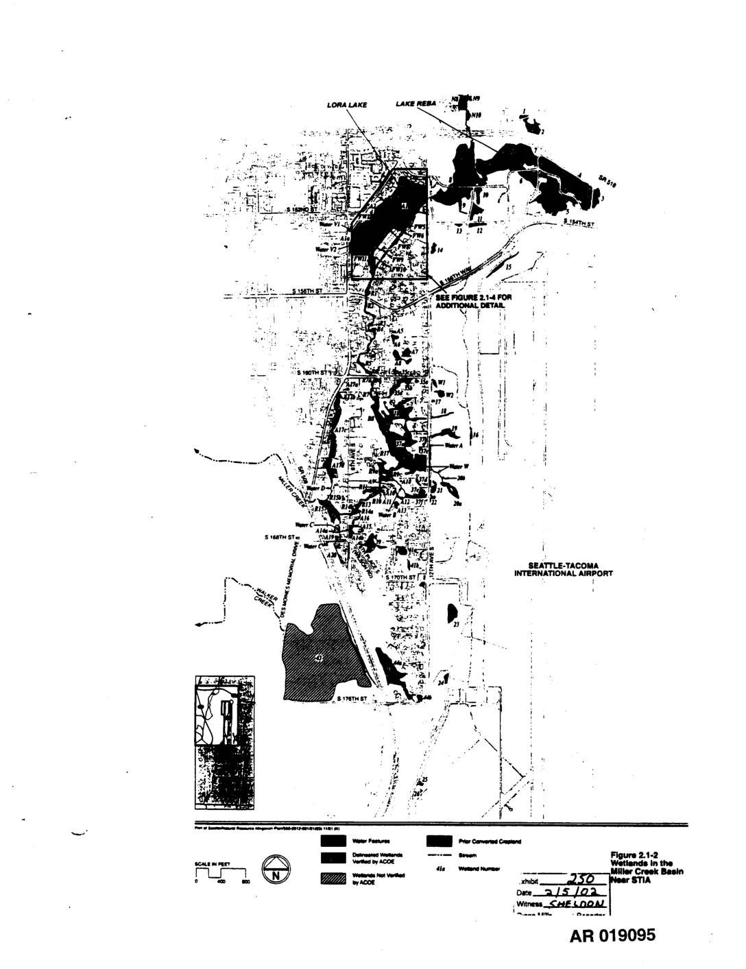
EXH 250: Figure 2.1-2 — Wetlands Miller Creek Basin Near STIA
This figure (2.1-2) is a map showing the locations of wetlands in the Miller Creek Basin near Seattle-Tacoma International Airport. It identifies water features, delineated wetlands verified by the Army Corps of Engineers (ACOE), unverified wetlands, streams, prior converted cropland, and individual wetland numbers across the basin area bounded roughly by S 154th Street to the north and S 176th Street to the south. The map was entered as Exhibit 250 and witnessed by Sheldon on 2/15/02. -
 2002-10-25
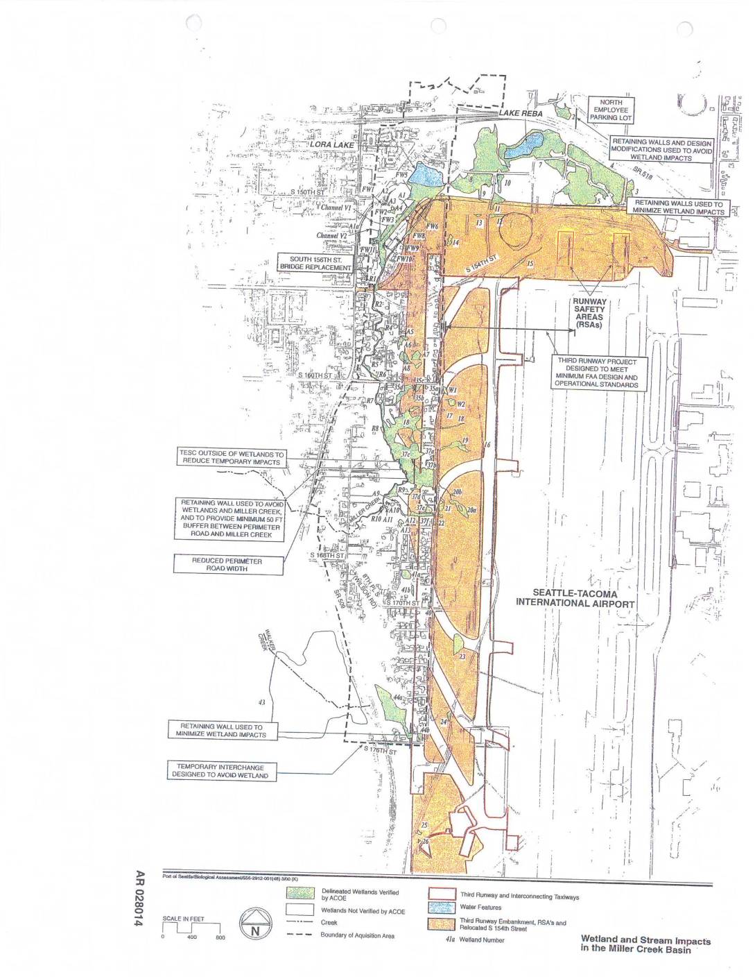
EXH AR028014: Wetland and Stream Impacts in the Miller Creek Basin — Sea-Tac Airport Third Runway Project Map
AR028014. Port of Seattle biological assessment map depicting wetland and stream impacts in the Miller Creek Basin related to the Seattle-Tacoma International Airport Third Runway project. Shows delineated wetlands verified by Army Corps of Engineers (ACOE), wetlands not verified by ACOE, creeks, boundary of acquisition area, third runway and interconnecting taxiways, third runway embankment and -
 2002-10-23
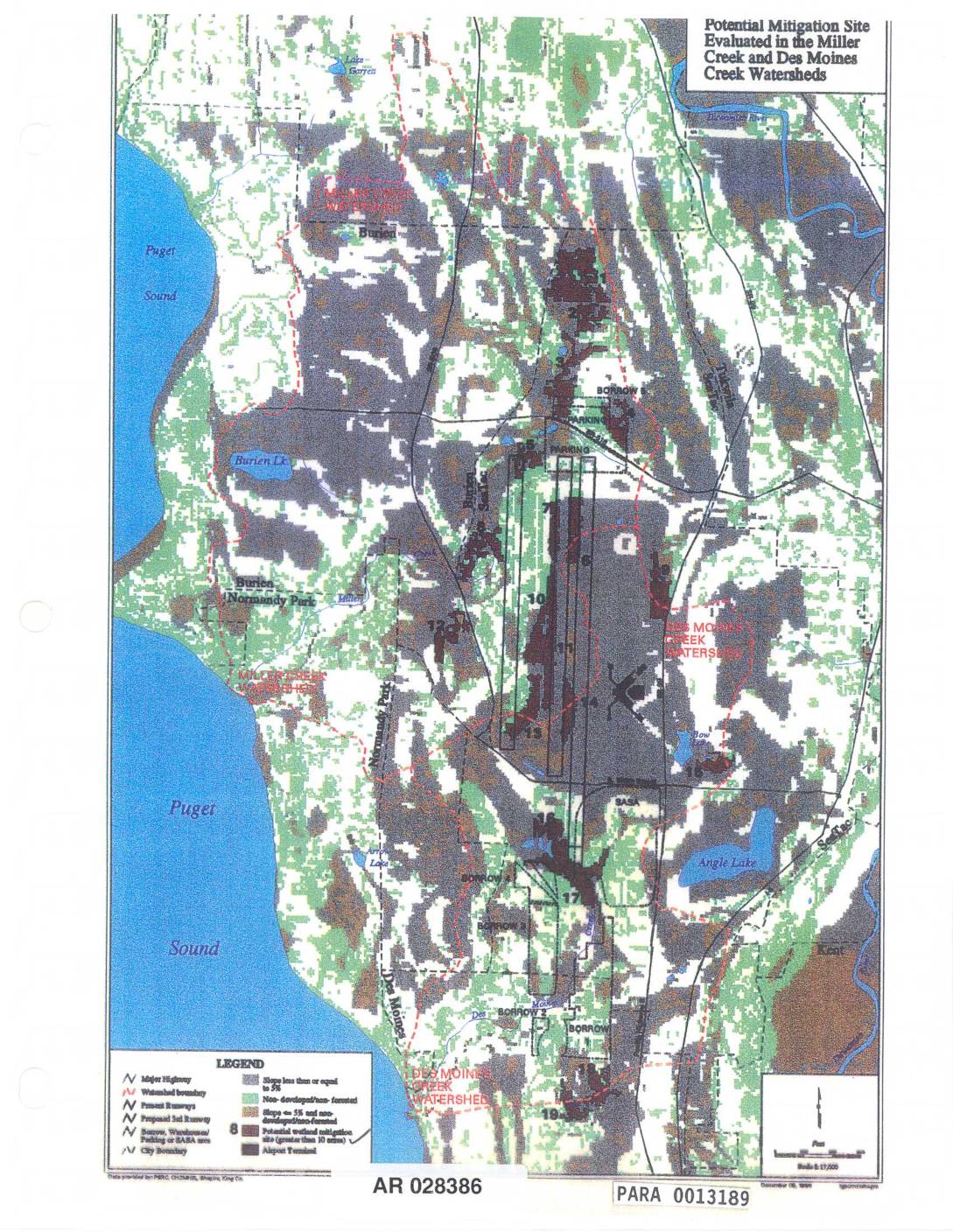
EXH AR028386: Potential Mitigation Sites Evaluated in the Miller Creek and Des Moines Creek Watersheds
Map (AR 028386, PARA 0013189) showing potential mitigation sites evaluated in the Miller Creek and Des Moines Creek watersheds near Sea-Tac Airport. Displays numbered mitigation sites greater than 10 acres, airport runways (present and proposed 3rd runway), borrow/warehouse/parking/SABA areas, watershed boundaries, Puget Sound shoreline, Burien, Normandy Park, SeaTac, Angle Lake, Bow Lake, Burien Lake, Lake