TagMap(375)
-
 2013-01-01
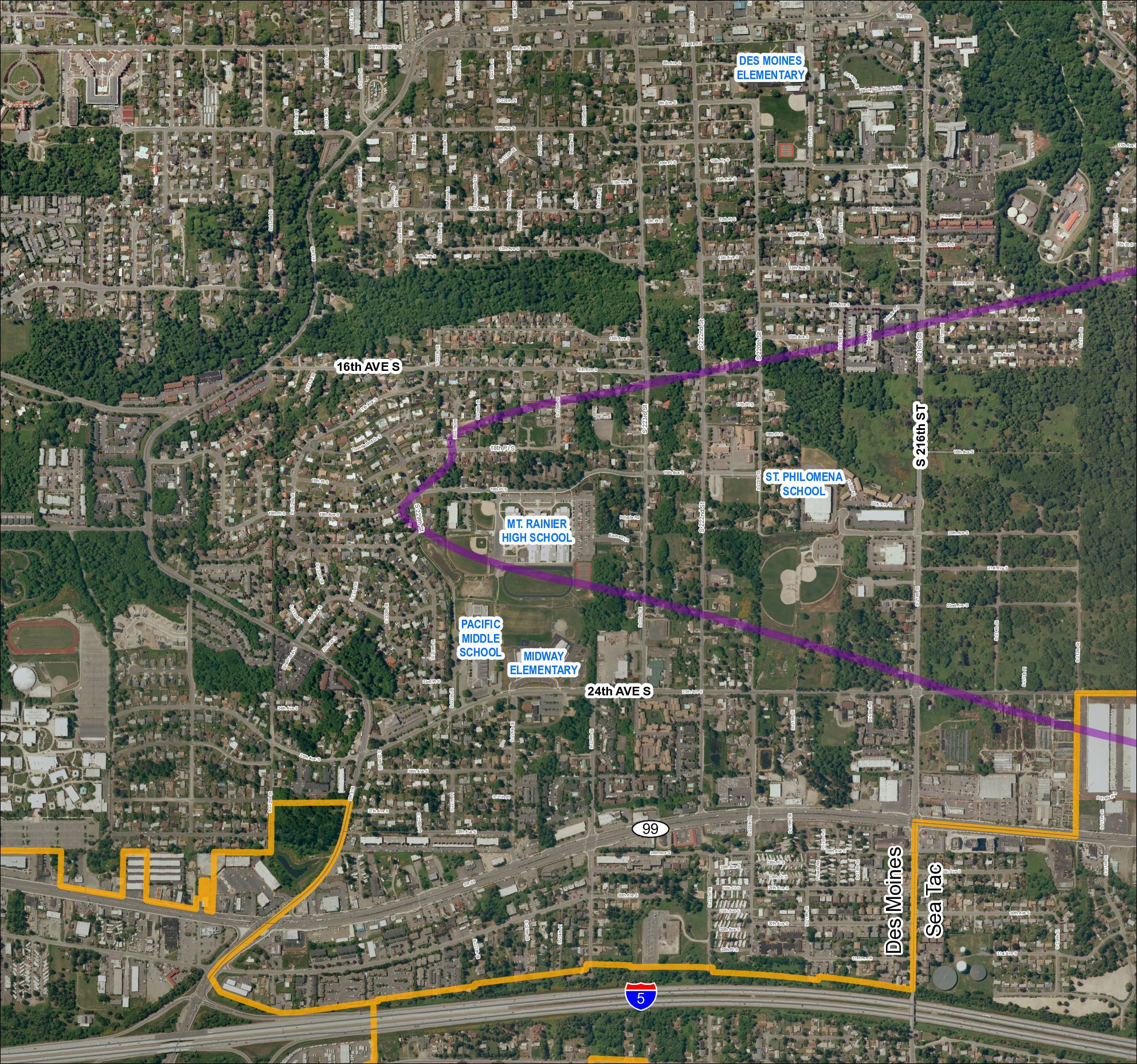
Grid 1: 2013 Baseline Map — Des Moines and Sea-Tac Area Schools
This map covers the Des Moines and SeaTac area in Washington State, showing residential streets, major roads including SR 99, SR 509, SR 516, and Interstate 5, along with several schools such as Mt. Rainier High School, Pacific Middle School, Midway Elementary, Des Moines Elementary, and St. Philomena School. A purple diagonal corridor crosses the map, likely representing a flight path or noise contour zone associated with Seattle-Tacoma International Airport, while an orange boundary outlines a specific study or impact area in the southern portion of the map. The document appears to be part of an airport noise or land-use planning study examining how SeaTac flight operations affect surrounding communities. -
 2013-01-01
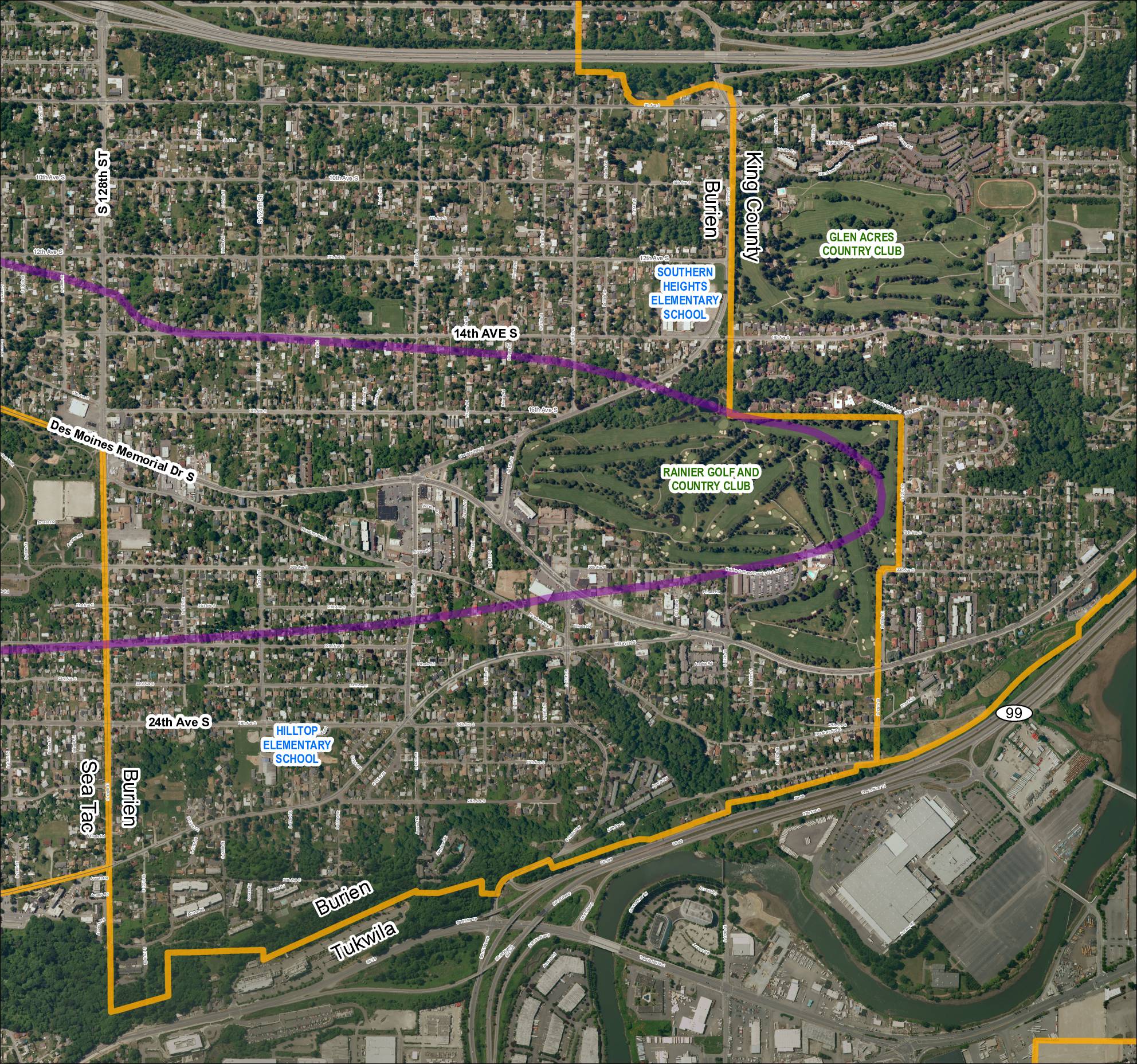
Grid 5: 2013 Baseline Map
This aerial map depicts the area surrounding Sea-Tac Airport, covering portions of Burien, Tukwila, and unincorporated King County in Washington State. It highlights key landmarks including Southern Heights Elementary School, Hilltop Elementary School, Rainier Golf and Country Club, and Glen Acres Country Club, along with major roadways such as SR 99, SR 599, and Des Moines Memorial Drive S. A purple corridor overlay traces what appears to be a noise-impact or flight-path study boundary through residential neighborhoods near the airport. -
 2013-01-01
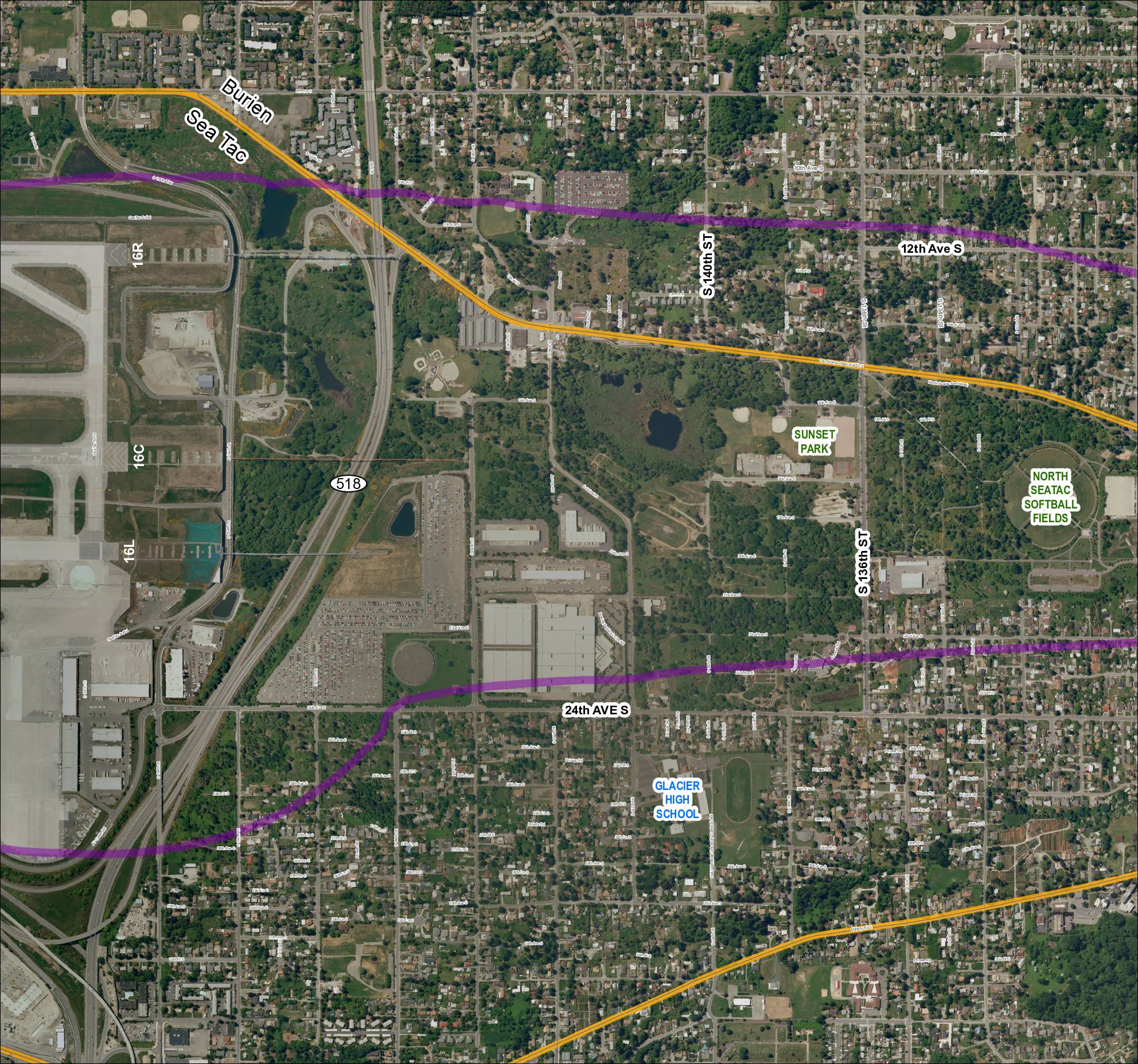
Grid 4: 2013 Baseline Map — Sea-Tac Airport Area
This aerial map shows the area surrounding Seattle-Tacoma International Airport, including the cities of Burien and SeaTac, with runway designations 16R, 16C, and 16L marked along the western edge. Two colored flight-path or noise-contour lines — one purple and one gold — are overlaid on the map, tracing routes that extend east through residential neighborhoods, parks such as Sunset Park and North SeaTac Softball Fields, and past landmarks including Glacier High School. The map appears to be part of a noise or flight-path policy study documenting how aircraft departure and arrival corridors affect surrounding communities along SR 518 and adjacent streets. -
 2012-03-01
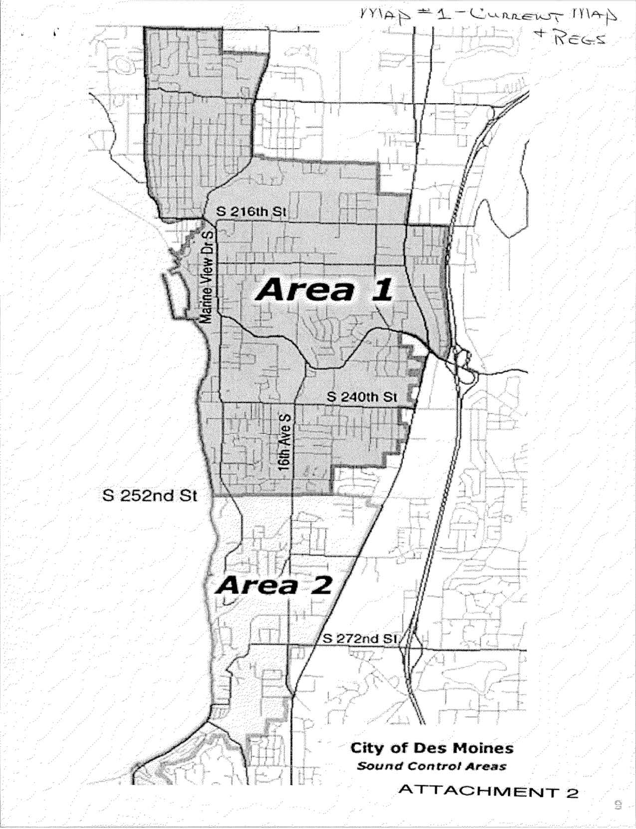
Des Moines Sound Control Areas Map — March 2012 Study Session
A map labeled 'City of Des Moines Sound Control Areas' (Attachment 2) depicting two designated sound control zones: Area 1, bounded approximately by S 216th St to the north and S 240th St to the south along Marine View Dr S and 16th Ave S, and Area 2, extending south to approximately S 272nd St. A handwritten note at the top reads 'MAP #1 – Current Map + Regs,' indicating this is part of a Sea-Tac Airport noise policy or regulatory archive. -
 2011-11-15
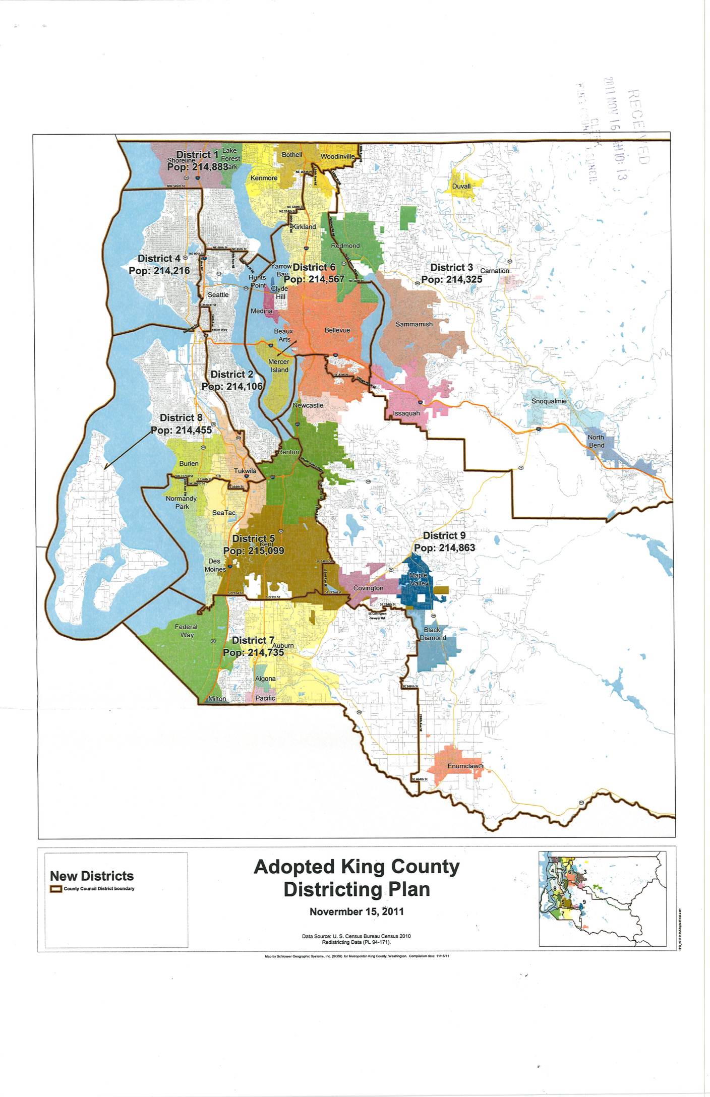
Adopted King County Districting Plan
This document presents the Adopted King County Districting Plan, approved on November 15, 2011, which redrew the boundaries of the nine King County Council districts based on 2010 U.S. Census data. Each district was drawn to achieve roughly equal population, with counts ranging from approximately 214,106 (District 2) to 215,099 (District 5). The plan covers the greater King County area, including communities such as Seattle, Bellevue, Auburn, Federal Way, and areas near Sea-Tac Airport. -
 2011-01-01
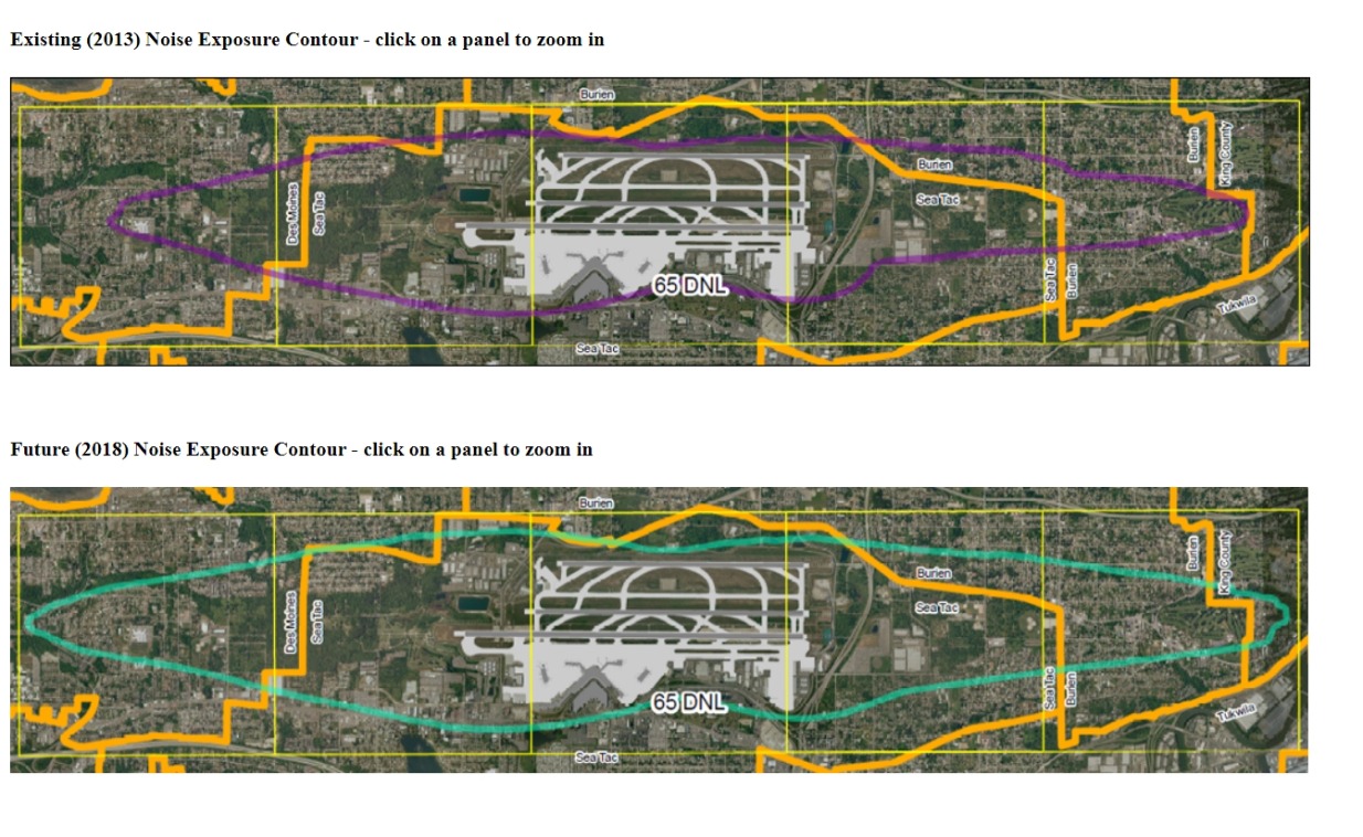
Sea-Tac Airport 65 DNL Noise Exposure Contour Maps: 2013 Existing vs. 2018 Future (Part 150 Study)
Two aerial noise exposure contour maps for Seattle-Tacoma International Airport showing the 65 DNL boundary for 2013 (existing, in purple) and 2018 (future, in teal/green), with an outer study area boundary in orange. The contours extend over surrounding communities including Burien, SeaTac, Des Moines, Tukwila, and unincorporated King County. -
 2007-01-01
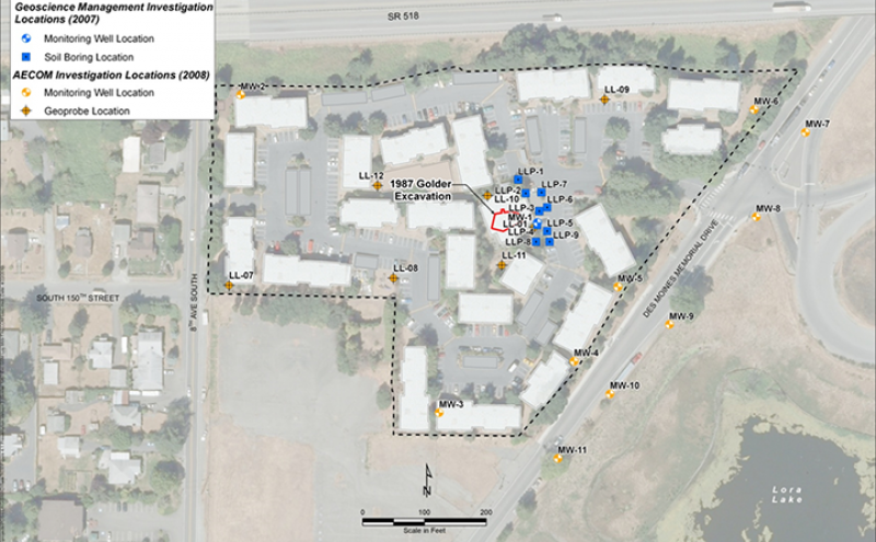
Environmental Investigation Site Map Near Des Moines Memorial Drive — Geoscience Management 2007 and AECOM 2008 Phases
Aerial site map showing environmental investigation locations near South 150th Street and Des Moines Memorial Drive, referencing a 1987 Golder Excavation site. The map identifies monitoring wells, soil borings, and geoprobe locations from two investigation phases: Geoscience Management (2007) and AECOM (2008), with labeled points including LLP, LL, and MW series markers consistent with a contamination investigation near Sea-Tac Airport. -
 2006-05-24
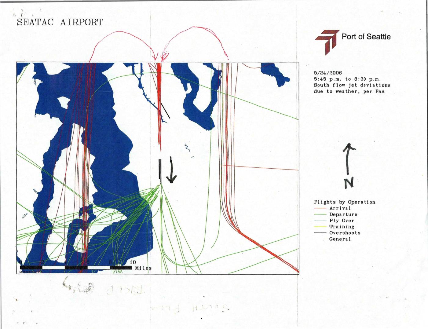
Sea-Tac Airport Flight Track Map: South Flow Jet Deviations Due to Weather, May 24, 2006
This Port of Seattle document shows a flight-track map of Seattle-Tacoma (Sea-Tac) Airport activity on May 24, 2006, between 5:45 p.m. and 8:30 p.m. During this period, south-flow jet aircraft deviated from their standard routes due to weather conditions, as confirmed by the FAA. The map distinguishes arrivals, departures, fly-overs, training flights, and overshoots by color, illustrating how unusual flight paths spread noise impacts across a wider area of the surrounding region. -
 2006-02-17
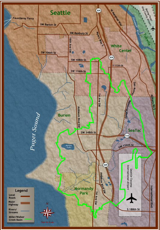
Miller and Walker Creeks Basin Plan map
A regional map showing the Miller/Walker Creek Basin (outlined in green) overlaid on the communities of Seattle, White Center, Burien, SeaTac, and Normandy Park, with Seattle-Tacoma International Airport prominently labeled. The map includes a legend distinguishing local roads, major roads, major highways, rivers/streams, and the Miller/Walker Creek Basin boundary, and notes it is not to scale. -
 2005-01-15
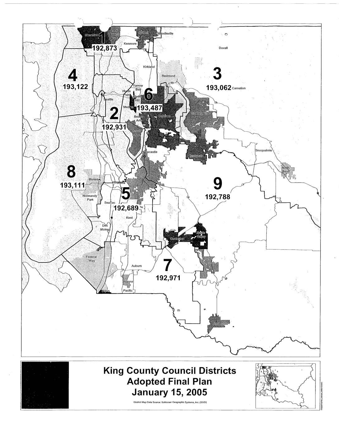
King County Council Districts Adopted Final Plan
This document presents the King County Council Districts Adopted Final Plan, dated January 15, 2005, showing the boundaries and population figures for all nine council districts in King County, Washington. The map, sourced from Schlosser Geographic Systems, Inc. (SGSI), depicts districts covering communities from Woodinville and Carnation in the north to Auburn and Pacific in the south, including areas around Sea-Tac Airport in District 5. Population counts across the nine districts range from approximately 192,689 to 193,487 residents each.