TagDes Moines(255)
-
 2015-05-21
Sustainable Airport Master Plan (SAMP): City of Des Moines Council briefing
This May 2015 briefing presented the Port of Seattle's Sustainable Airport Master Plan (SAMP) for Seattle-Tacoma International Airport to the City of Des Moines Council. The plan addresses rapid passenger and operations growth within a constrained airport footprint, outlining the need for strategic land use planning, potential expansion onto additional Port-owned properties, and relocation of existing facilities to maintain airfield capacity and add terminal capacity. Key topics covered include economic impact, sustainability, activity forecasts, development constraints, and public outreach. -
 2015-03-01
City of Des Moines 2015 Surface Water Comprehensive Plan
The City of Des Moines 2015 Surface Water Comprehensive Plan is a technical planning document prepared by Parametrix engineers in March 2015 for the City of Des Moines, Washington. It addresses the management and infrastructure of the city's surface water systems, covering stormwater and drainage planning for the community. The plan was certified by licensed professional engineers and serves as a long-term guide for surface water improvements in the Des Moines area. -
 2014-12-31
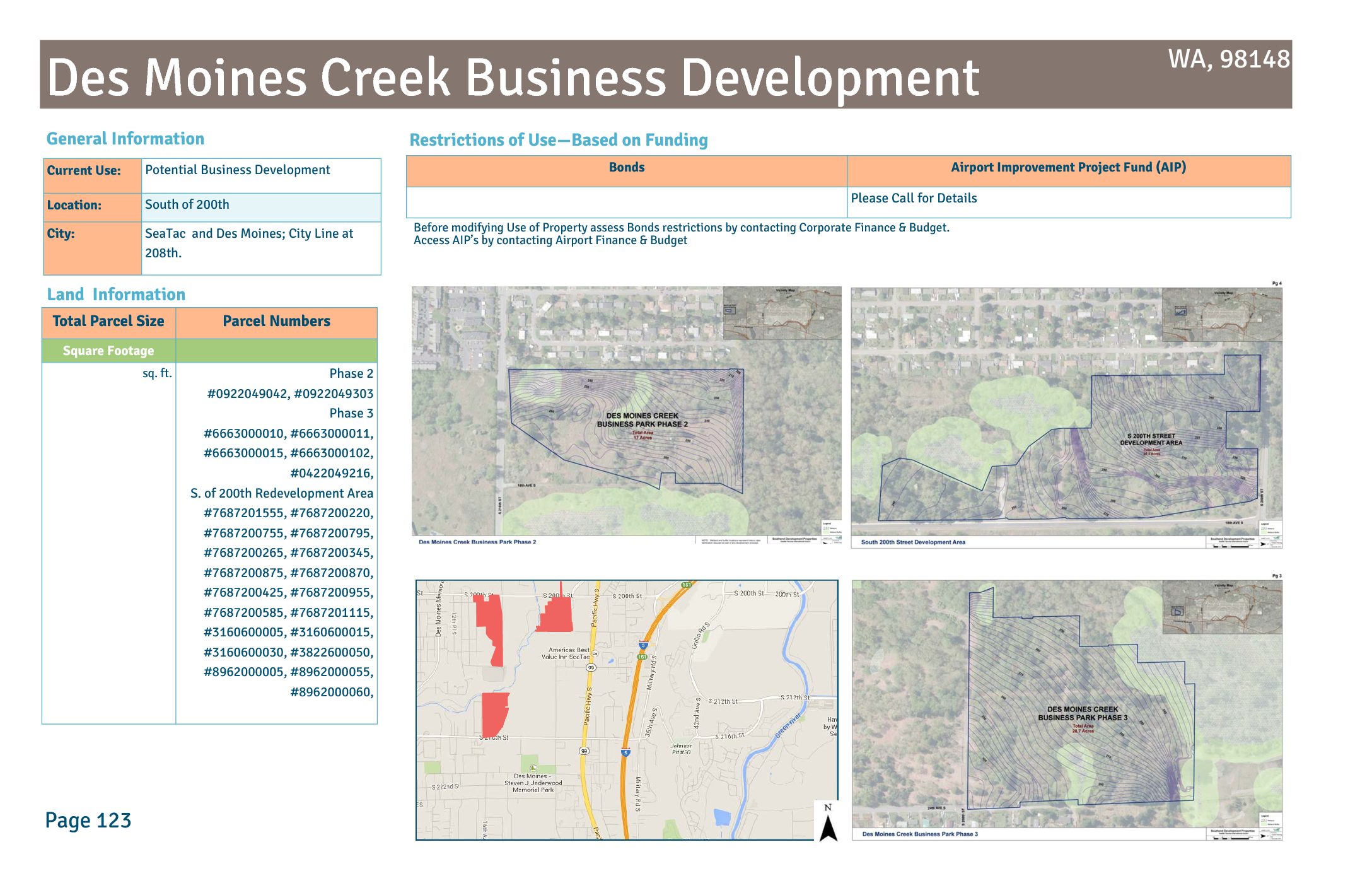
Des Moines Creek Business Development land information
The Des Moines Creek Business Development area, located south of S 200th Street in SeaTac and Des Moines, Washington (98148), is a Port of Seattle property currently designated for potential business development across multiple phases, including Des Moines Creek Business Park Phases 2 and 3 and the South 200th Street Development Area. The land is subject to use restrictions tied to Bond financing and Airport Improvement Project (AIP) funds, requiring consultation with Airport Finance & Budget before any change in use. The site spans several parcels across both cities, with the city boundary running along S 208th Street. -
 2014-08-14
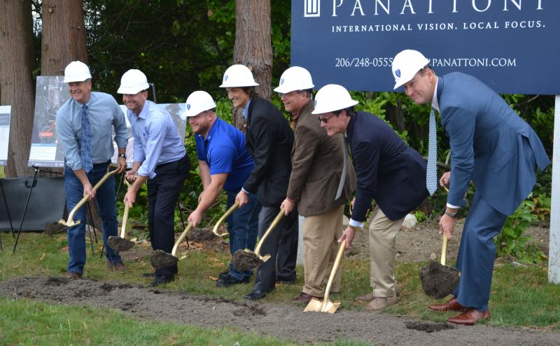
Des Moines Creek Business Park Groundbreaking
A group of men wearing white hard hats perform a ceremonial groundbreaking with gold-painted shovels. A Panattoni sign is visible in the background with the tagline 'International Vision. Local Focus.' and a 206-area-code phone number, indicating a Seattle-area development project. -
 2014-01-01
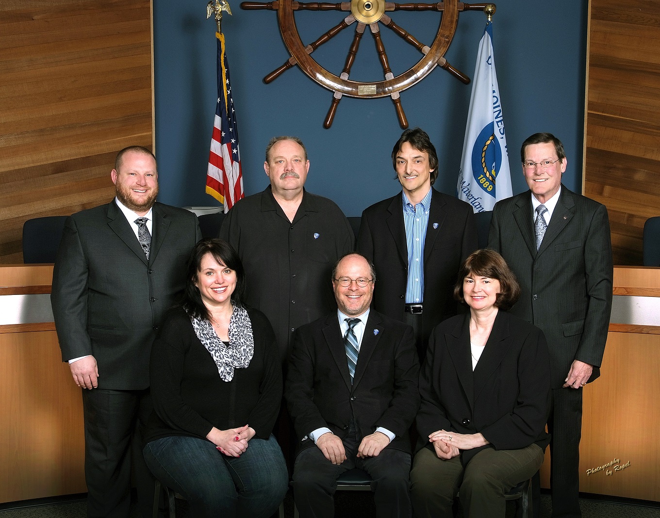
Des Moines City 2014
A formal group portrait of seven individuals — four standing, three seated — in what appears to be a city council chamber. Visible elements include an American flag, a decorative ship's wheel, a city flag bearing the year 1889, and a watermark reading 'Photography by Repel.' -
 2013-12-05
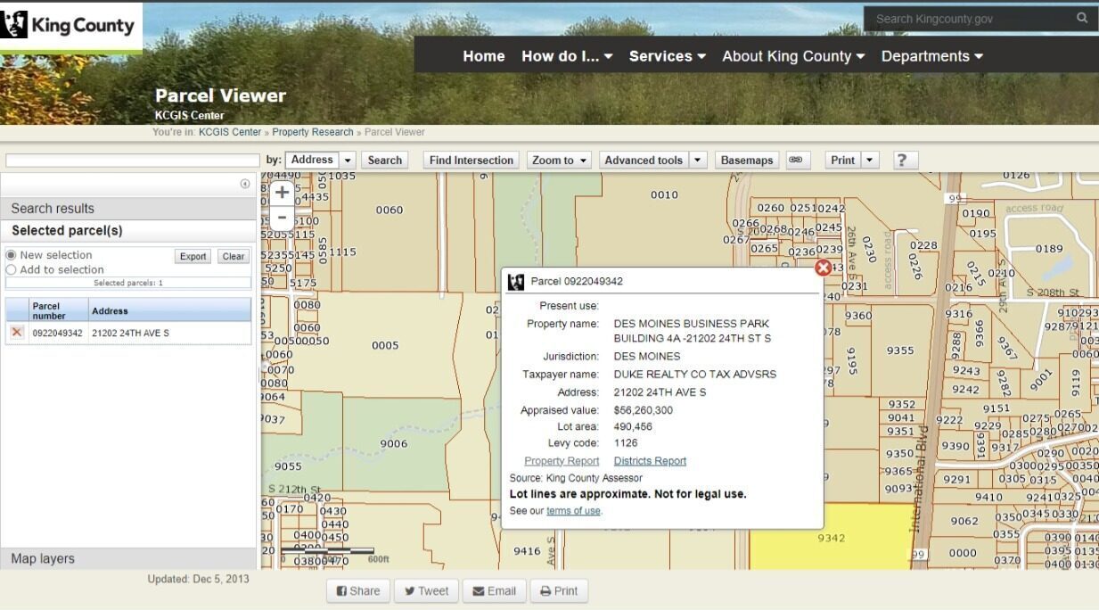
King County Parcel Viewer – Des Moines Business Park Parcel 0922049342
King County GIS Parcel Viewer screenshot dated December 5, 2013, showing parcel 0922049342 at 21202 24th Ave S, Des Moines, WA, identified as Des Moines Business Park Building 4A. The parcel, held by Duke Realty Co, has an appraised value of $56,260,300 and a lot area of 490,456 square feet, located within the Sea-Tac Airport vicinity under levy code 1126. -
 2013-11-01
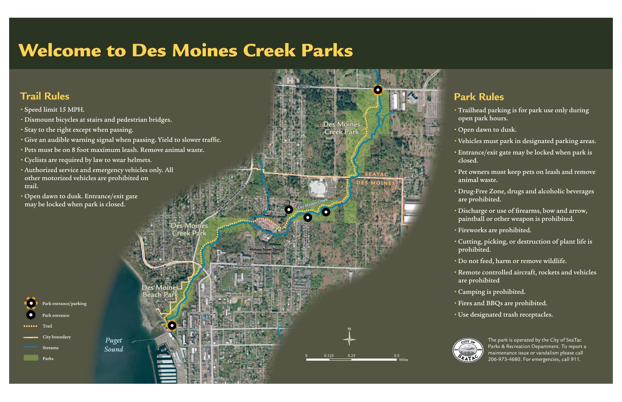
Welcome to Des Moines Creek Parks: Trail Rules, Park Rules, and Ecological Enhancements Map
Des Moines Creek Parks, located near Sea-Tac Airport in the cities of SeaTac and Des Moines, Washington, offers a multi-use trail system with a 15 MPH speed limit, helmet requirements for cyclists, and a dawn-to-dusk schedule. The park prohibits alcohol, firearms, camping, fires, and motorized vehicles, while requiring pets to remain on leash. A regional partnership between the Cities of SeaTac and Des Moines, Port of Seattle, King County, and the Washington State Department of Transportation has led to ecological restoration efforts along Des Moines Creek, including stormwater detention facilities, high-flow bypass pipes, fish passage improvements, and native plant restoration to support salmon and other wildlife. -
 2013-09-25
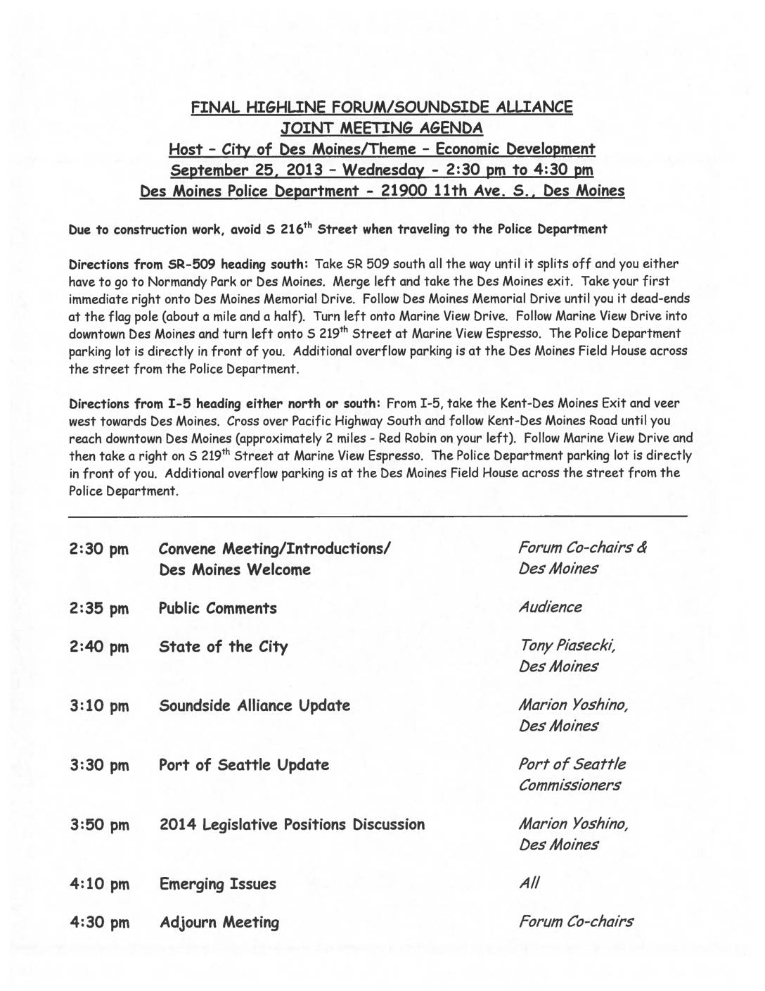
Highline Forum/Soundside Alliance Joint Meeting Agenda: Economic Development, Des Moines, September 25, 2013
This document contains the agenda and presentation materials for a joint meeting of the Highline Forum and Soundside Alliance held on September 25, 2013, hosted by the City of Des Moines at its Police Department. The meeting focused on economic development, covering topics such as zoning and permitting reforms, current city projects, a Port of Seattle update from commissioners, and a discussion of 2014 legislative positions. The Soundside Alliance, a coalition of communities affected by Sea-Tac Airport operations, used this forum to coordinate regional policy priorities related to airport noise and development impacts. -
 2013-01-01
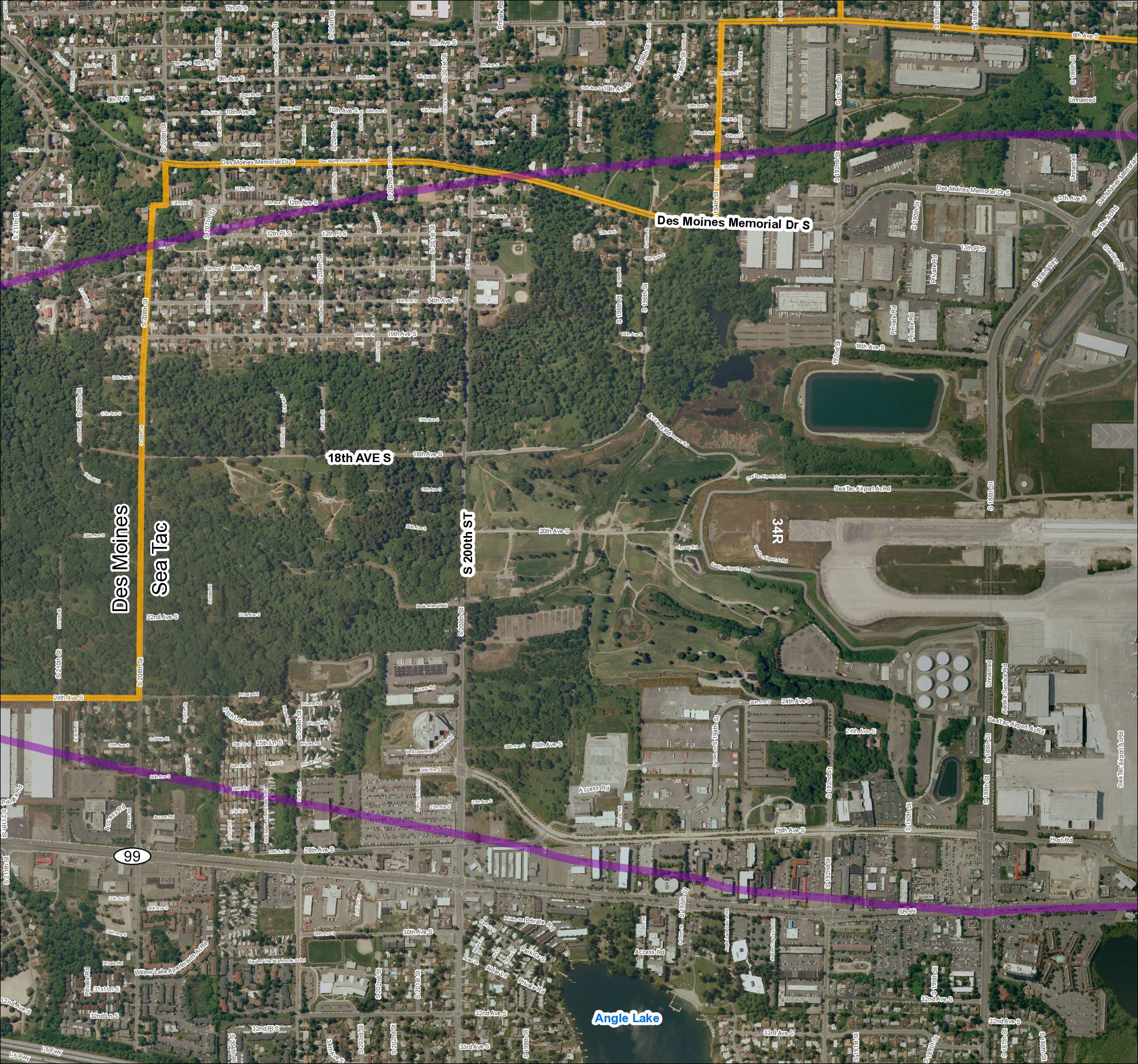
Grid 2: 2013 Baseline Map — Des Moines / Sea-Tac Area
This document is an aerial map of the area surrounding Seattle-Tacoma (Sea-Tac) International Airport, covering the cities of Des Moines and SeaTac in Washington State. It highlights key roadways such as Des Moines Memorial Drive S, SR 99, S 200th Street, and 18th Avenue S, along with airport-specific features including runway 34R and various airport access roads. The map appears to delineate study or noise impact boundaries marked in orange and purple, likely used for airport noise planning and policy analysis purposes. -
 2013-01-01
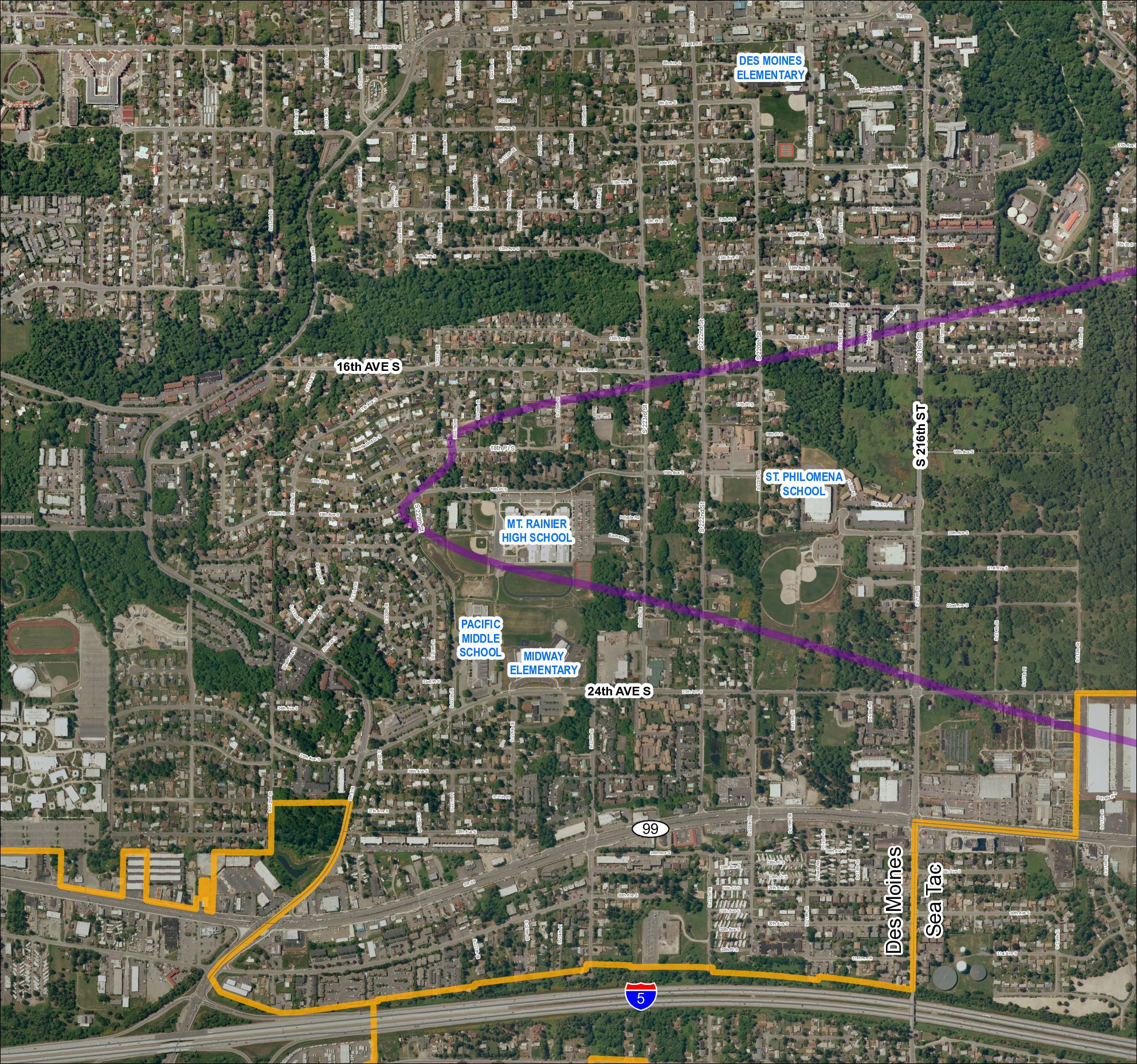
Grid 1: 2013 Baseline Map — Des Moines and Sea-Tac Area Schools
This map covers the Des Moines and SeaTac area in Washington State, showing residential streets, major roads including SR 99, SR 509, SR 516, and Interstate 5, along with several schools such as Mt. Rainier High School, Pacific Middle School, Midway Elementary, Des Moines Elementary, and St. Philomena School. A purple diagonal corridor crosses the map, likely representing a flight path or noise contour zone associated with Seattle-Tacoma International Airport, while an orange boundary outlines a specific study or impact area in the southern portion of the map. The document appears to be part of an airport noise or land-use planning study examining how SeaTac flight operations affect surrounding communities.