TagDes Moines(255)
-
 2019-01-01
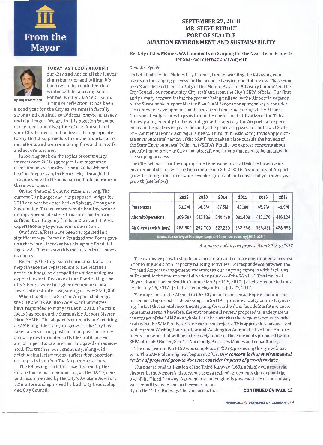
From the Mayor: City finances and Sea-Tac Airport update
In this Winter 2019 edition of Des Moines City Currents, Mayor Matt Pina outlines the city's strong opposition to Sea-Tac Airport's expansion plans, arguing that rapid growth between 2012 and 2017—including surging passenger numbers, aircraft operations, and air cargo—has already caused disproportionate noise, health, and environmental impacts on surrounding communities. The city formally called on the Port of Seattle to conduct a comprehensive environmental review under Washington State's SEPA laws before approving any further capacity-building projects, and specifically demanded that issues such as nighttime flight noise, fuel dumping, ultra-fine particle emissions, and Third Runway usage be included in the scoping process. Members of the city's Aviation Advisory Committee also voiced concerns about the health toll on residents, outdated federal standards, and the need for alternatives such as a second regional airport. -
2018-12-06
You Can’t Build Your Way Out Of This (A Letter To Mayor Matt Pina Of Des Moines)
Written after the City Council’s Study Session which covered the 2019 Legislative Agenda with a lot of emphasis on siting a second airport. Your Honour, Still awaiting a reply on my last letter. 😀 But I digress. There was much discussion tonight on the siting of a second airport. Although I certainly hope for another -
 2018-12-03
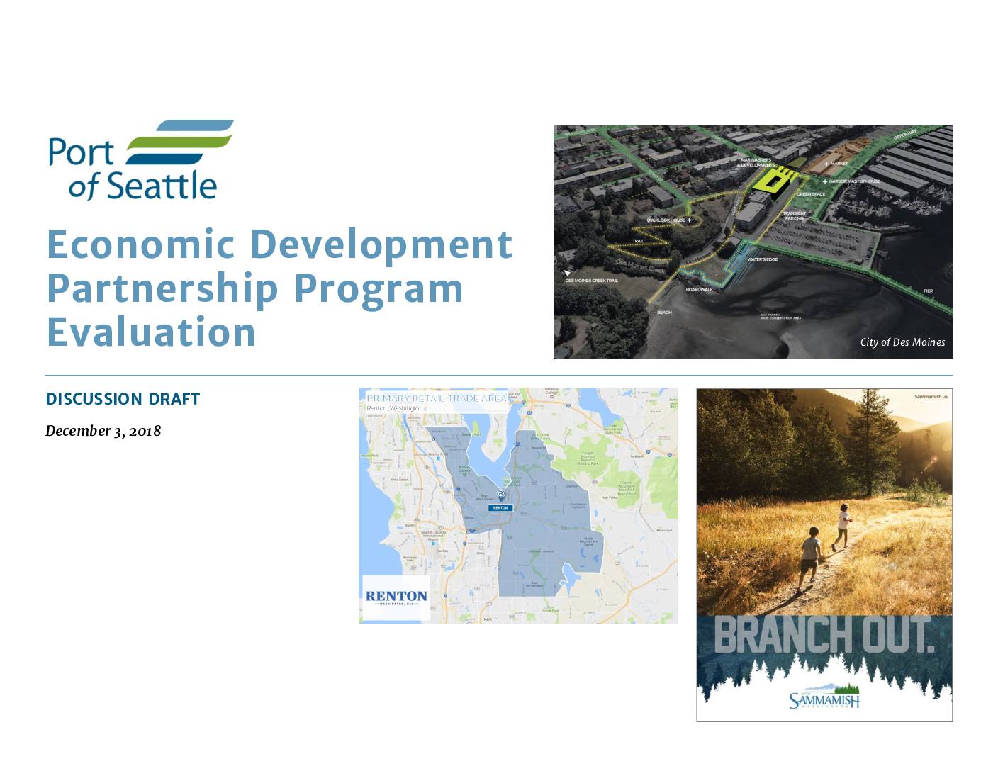
Economic Development Partnership Program Evaluation
This December 2018 discussion draft, produced by Community Attributes Inc. for the Port of Seattle, evaluates the Economic Development Partnership (EDP) Program, which supports economic development initiatives in communities near Seattle-Tacoma International Airport, including the cities of Des Moines, Renton, and Sammamish. The report examines retail trade areas and local development opportunities as part of the Port's broader effort to partner with neighboring jurisdictions on economic growth strategies. It represents an early-stage working document intended to guide further discussion and decision-making. -
Crime Reports
An on-line crime reporting system using Google Maps. The default location in this link is for Des Moines, but you can enter any city or zip code to get markers for all recent activity. -
 2018-09-10
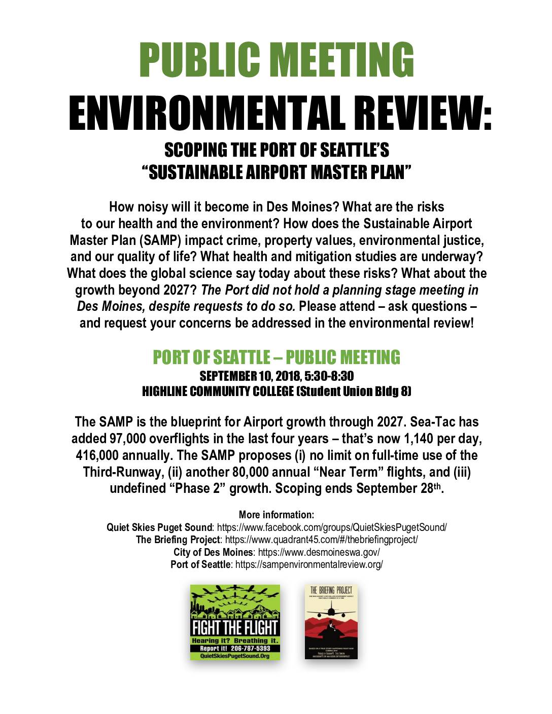
Public meeting: Environmental review scoping the Port Of Seattle’s “Sustainable Airport Master Plan”
A public meeting was held on September 10, 2018, at Highline Community College to allow Des Moines residents to weigh in on the Port of Seattle's Sustainable Airport Master Plan (SAMP), which outlines Sea-Tac Airport's growth strategy through 2027. The plan proposes removing limits on Third Runway use and adding 80,000 more annual flights on top of the existing 416,000, raising community concerns about noise, health risks, property values, and environmental justice. Residents were urged to attend and submit comments before the scoping period closed on September 28, 2018. -
 2018-08-14
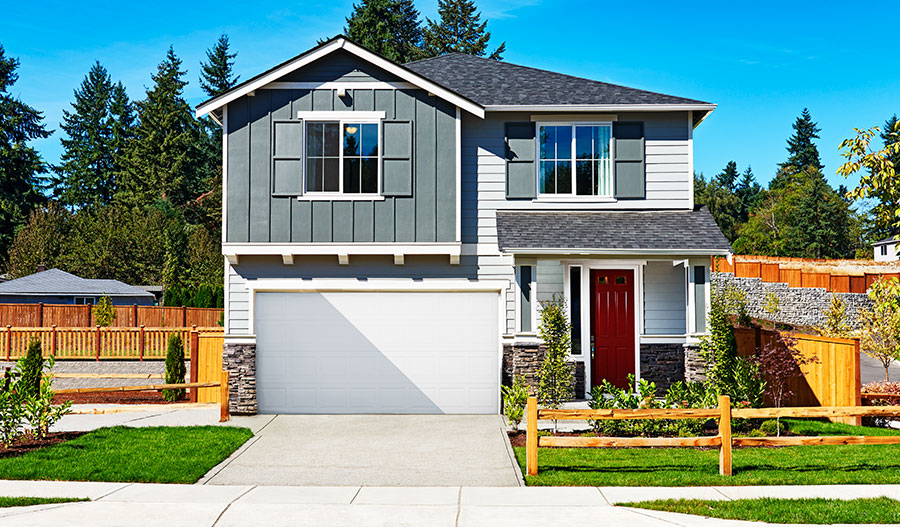
Blueberry Lane
https://www.richmondamerican.com/washington/seattle-tacoma-new-homes/des-moines/blueberry-lane It looks so nice–because you can’t hear a JPEG. 😀 Next time you are driving through Des Moines, pass by this development at 196th and Des Moines Memorial Drive. This area is directly under the flight path at prox. 600 ft of altitude, which now makes it officially the housing estate closest to the -
 2018-01-30
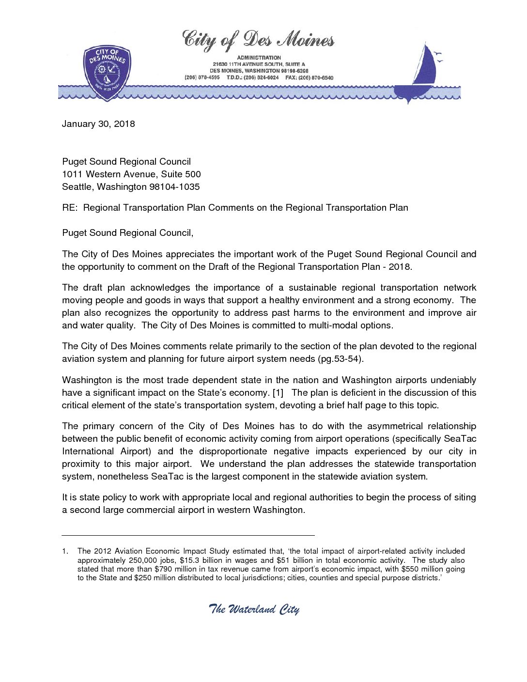
Regional Transportation Plan comments on the Regional Transportation Plan
In a January 2018 letter to the Puget Sound Regional Council, Des Moines Mayor Matt Pina raised concerns about the disproportionate noise, air quality, and environmental burdens placed on Des Moines residents by Seattle-Tacoma International Airport's rapid growth, arguing these impacts are inadequately addressed in the Draft Regional Transportation Plan. The city called for sustainability, human health, and community impacts to be central factors in any decision to expand SeaTac's capacity or site a new regional airport. The letter also requested that the plan include discussion of a potential passenger ferry terminal in Des Moines as a multi-modal transportation alternative. -
 2018-01-01
Ayn Rand Quote on Avoiding Reality
A typeset quotation attributed to Ayn Rand reading: 'You can avoid reality, but you cannot avoid the consequences of avoiding reality.' The quote is rendered in italic serif font with the attribution in smaller blue text below. -
 2018-01-01
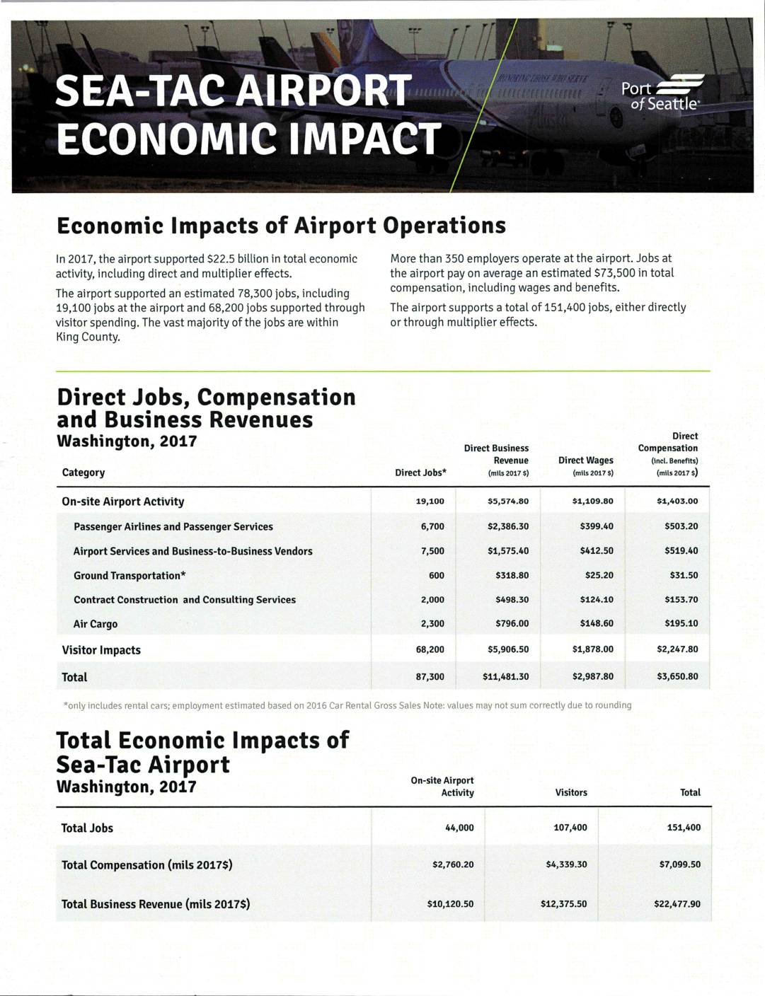
Sea-Tac Airport economic impact
A 2017 economic impact report from the Port of Seattle shows that Seattle-Tacoma International Airport supported $22.5 billion in total economic activity and approximately 151,400 jobs across the region, including direct employment and multiplier effects. More than 350 employers operate at the airport, with on-site jobs averaging $73,500 in total compensation, and the surrounding communities of King and Pierce counties benefiting significantly from visitor spending and airport-related business revenues. -
 2018-01-01
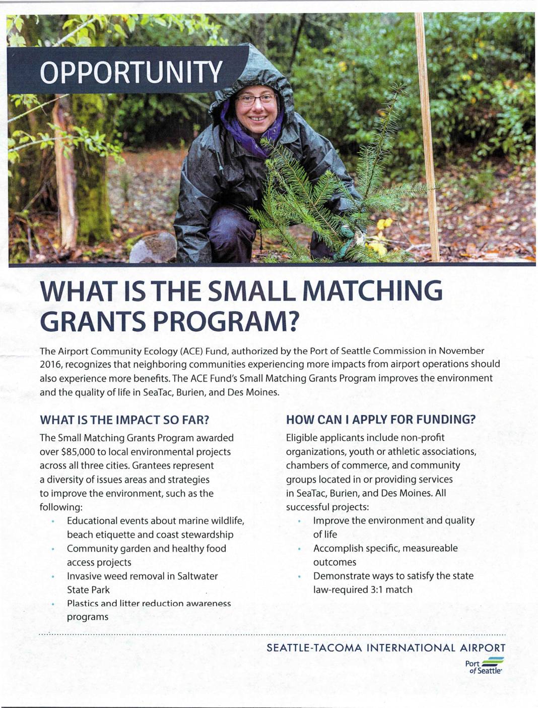
What is the Small Matching Grants Program?
The Port of Seattle's Airport Community Ecology (ACE) Fund offers a Small Matching Grants Program providing funding to non-profit organizations and community groups in SeaTac, Burien, and Des Moines to support local environmental improvement projects. Applicants must demonstrate a 3:1 match for every dollar of Port funding requested, meaning three dollars of community value must be identified for each grant dollar awarded. The program has distributed over $85,000 to projects ranging from invasive weed removal and community gardens to marine wildlife education and plastics reduction awareness.