TagMap(375)
-
 1973-09-07
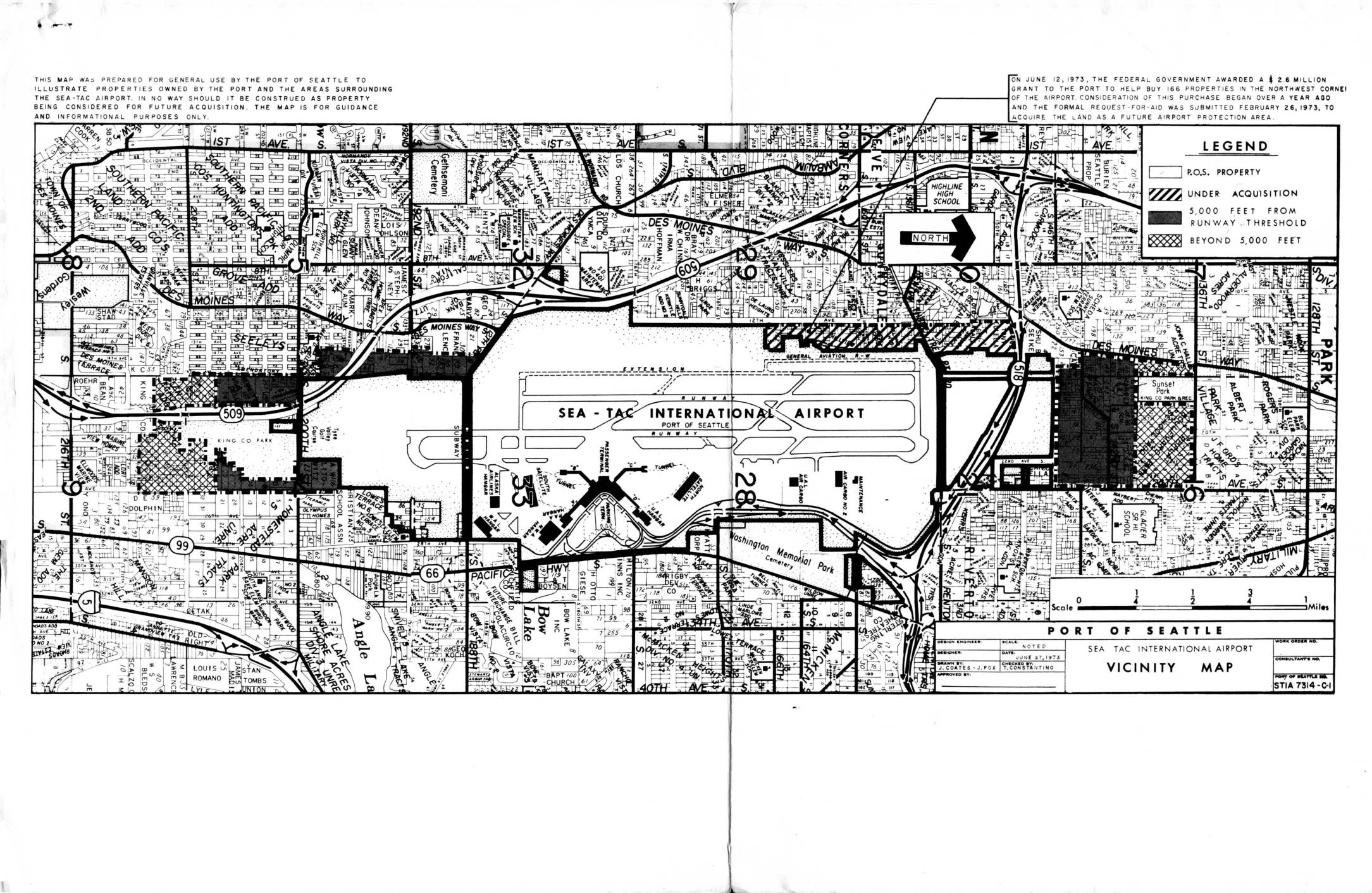
Report and recommendations re interim land acquisition, Sea-Tac International Airport
In September 1973, the Port of Seattle outlined a plan to acquire approximately 610 residential properties and 75 acres of open land surrounding Sea-Tac International Airport to create expanded clear zones north and south of the runways. The total estimated property cost was $15.46 million, with the Port anticipating over $8 million in federal FAA assistance and covering the remainder from airport revenues between 1974 and 1977. Under the best-case scenario, actual land acquisition could not begin until after July 1, 1974, following required environmental impact statements, housing relocation plans, and a multi-month FAA review process. -
 1973-04-15
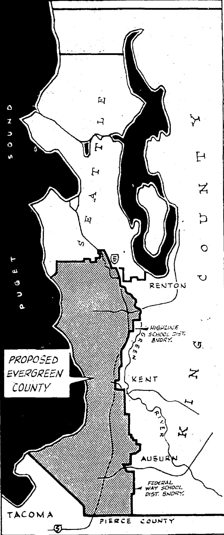
Proposed Evergreen County 1973-04-15
A black-and-white map depicting the 'Proposed Evergreen County,' a suggested new county to be carved from the southern portion of King County, Washington. The map shows boundaries relative to Seattle, Renton, Kent, Auburn, Tacoma, Pierce County, Puget Sound, the Green River, and references the Highline School District boundary and Federal Way School District boundary. -
 1973-01-01
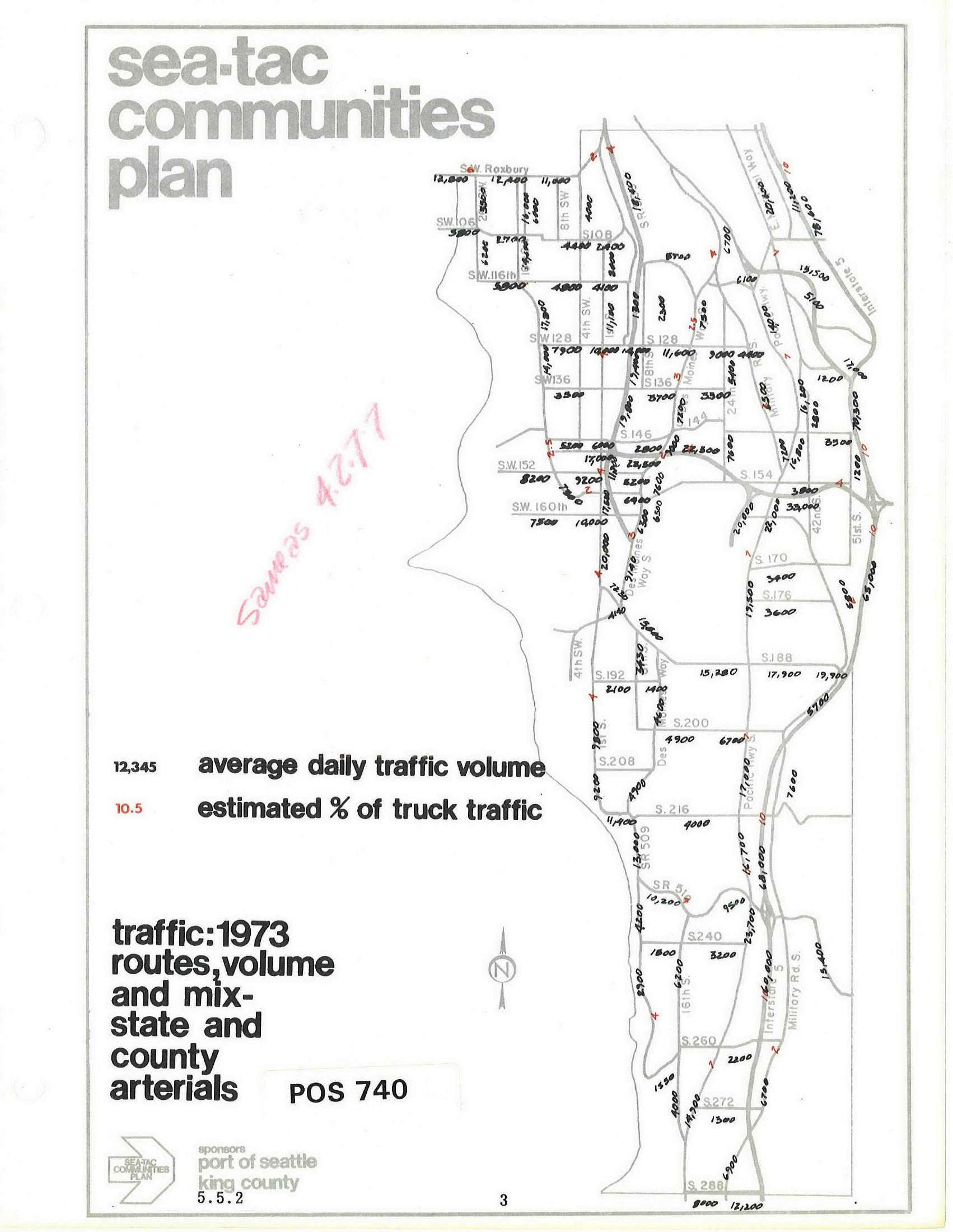
Sea-Tac Communities Plan: 1973 Average Daily Traffic Volumes on State and County Arterials
Map document from the Sea-Tac Communities Plan (document number POS 740, section 5.5.2) showing 1973 average daily traffic volumes and estimated truck traffic percentages on state and county arterials in the Sea-Tac area. Sponsored by the Port of Seattle and King County, the map displays street-level traffic counts across roads including SW 106th through S 288th, with a handwritten notation 'Savings 4,277' in red. -
 1970-01-01
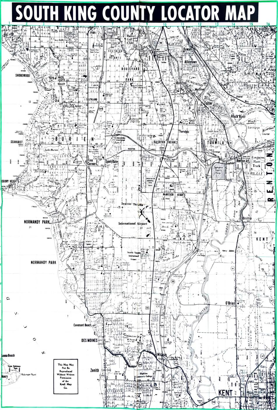
South King County Locator Map
This South King County Locator Map, produced by the Kroll Map Co., provides a detailed street-level view of communities surrounding the Seattle-Tacoma International Airport, including Burien, Des Moines, Normandy Park, Tukwila, Renton, and Kent. The map shows the airport's central position within the region and the dense residential neighborhoods directly affected by its flight paths. It is a key reference document for understanding the geographic scope of communities subject to Sea-Tac Airport noise impacts and related land-use policy decisions. -
 1970-01-01
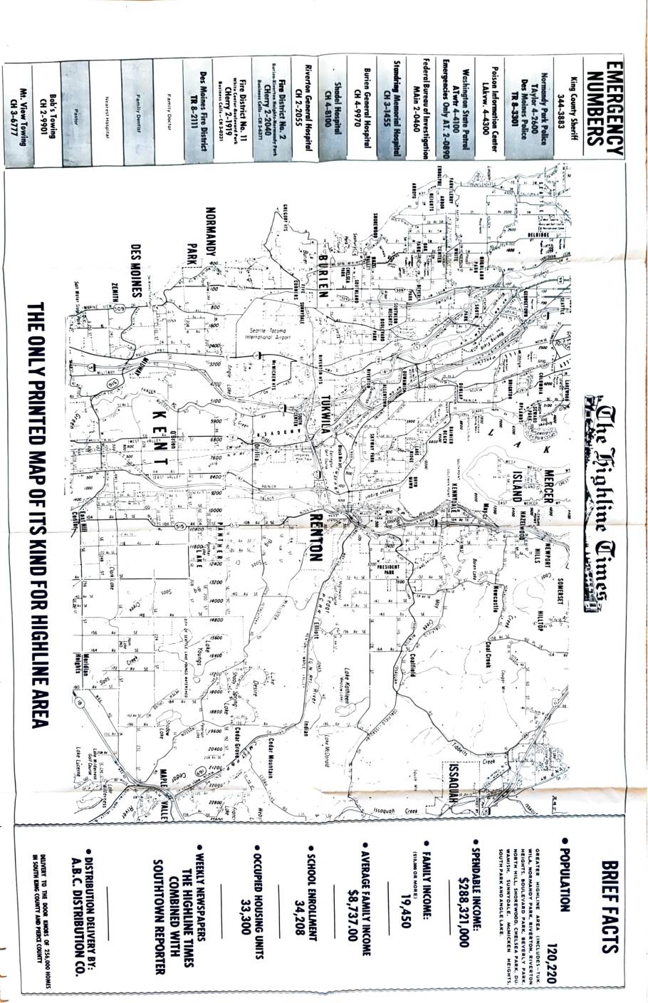
The Highline Times: South King County map with brief facts
This document is a community map and fact sheet published by The Highline Times, a weekly newspaper serving the Greater Highline area of South King County, Washington, which includes communities such as Tukwila, Normandy Park, Burien, Renton, and surrounding neighborhoods. It provides demographic and economic statistics for the region, including a population of 120,220, an average family income of $8,737, and 33,300 occupied housing units. The map also lists local emergency phone numbers for agencies such as the King County Sheriff, local hospitals, and fire districts, and notes that the newspaper was distributed to 256,000 homes in South King County and Pierce County. -
 1966-10-25
Official Voters Pamphlet, State of Washington, 1966
This is the 1966 Official Voters Pamphlet for the State of Washington, published by Secretary of State A. Ludlow Kramer, covering 14 state measures on the November 8, 1966 general election ballot. The pamphlet includes ballot titles, explanations, and arguments for and against three citizen initiatives, three legislative referendum bills, and eight proposed constitutional amendments. Topics addressed include tax sharing, Sunday blue laws, freight train crew requirements, school facility bonds, and various constitutional changes — but the document contains no content related to Sea-Tac Airport or aircraft noise policy. -
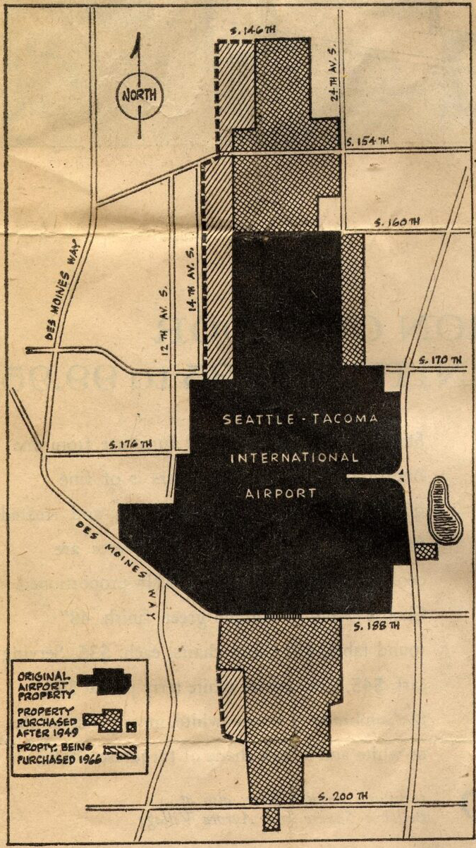
Seattle Times 1966 Airport Expansion Becomes Routine (map)
A map showing the land boundaries of Seattle-Tacoma International Airport, distinguishing between original airport property (solid black), property purchased after 1949 (crosshatch pattern), and property being purchased in 1966 (diagonal hatch pattern). The map shows surrounding streets including Des Moines Way, S. 146th through S. 200th Streets, and avenues including 12th, 14th, and 24th Ave S. -
 1966-04-17
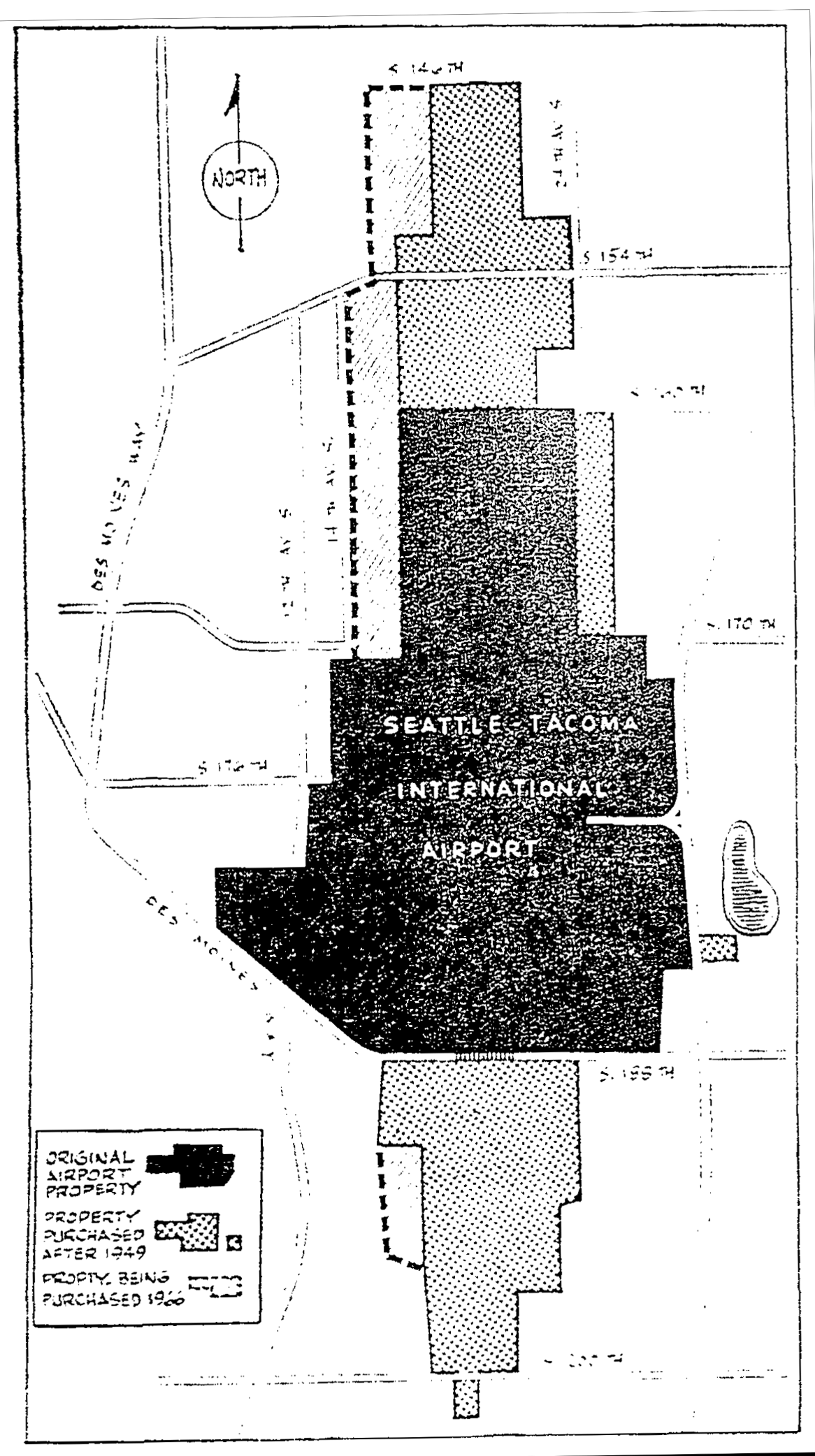
Seattle Daily Times 1966-04-17 airport property purchases
A map showing the land acquisition history of Seattle-Tacoma International Airport, distinguishing between the original airport property, property purchased after 1949, and property being purchased in 1960. The map shows surrounding streets including S. 146th, S. 154th, S. 170th, S. 176th, S. 188th, and S. 200th, as well as Des Moines Way and nearby avenues. -
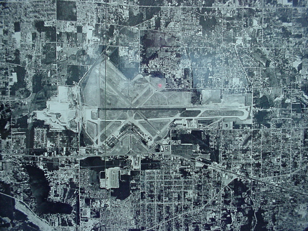 1961-01-01
Aerial Photograph of Airport Runways, 1961
Black-and-white aerial or satellite photograph showing a major airport with multiple runways arranged in an X/parallel configuration, surrounded by a dense urban grid. The image appears to be a planning or reference map with a faint grid overlay, but contains no visible text, labels, or date information to identify the specific airport or time period. -
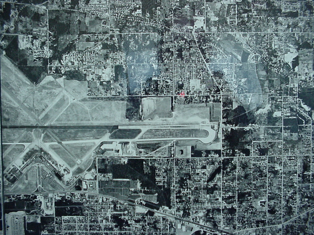 1961-01-01
Sea-Tac Airport Aerial Photograph circa 1961
Black-and-white aerial photograph showing a mid-20th century airport facility with multiple intersecting runways and taxiways, surrounded by a residential and commercial street grid. The image appears to be a planning or survey document, possibly a composite of multiple aerial tiles given visible seam lines.