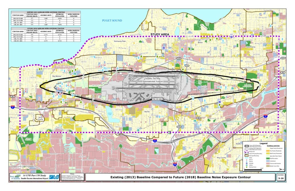
This exhibit from the Seattle-Tacoma International Airport 14 CFR Part 150 Noise Study compares the existing 2013 baseline noise exposure contours with projected 2018 baseline contours around Sea-Tac Airport. The data shows that the DNL 65+ dBA noise contour area is expected to shrink from 7.3 to 5.9 square miles, with affected housing units dropping from 3,771 to 1,887 and estimated population exposure falling from 9,712 to 4,879. Nine noise-sensitive facilities remain within the contour in both scenarios, and the maps illustrate how the impacted area covers portions of SeaTac, Burien, Des Moines, Tukwila, and unincorporated King County.Open full document
Notes
A 14 CFR Part 150 study map for Seattle-Tacoma International Airport comparing the existing 2013 baseline noise exposure contour with the projected 2018 baseline noise exposure contour. The map displays DNL 65 dBA and above contour bands with associated data on contour area, housing units, estimated population, and noise-sensitive facilities. The future 2018 baseline shows a reduction in affected area from 7.3 to 5.9 square miles and housing units from 3,771 to 1,887 compared to the 2013 baseline.