Notes
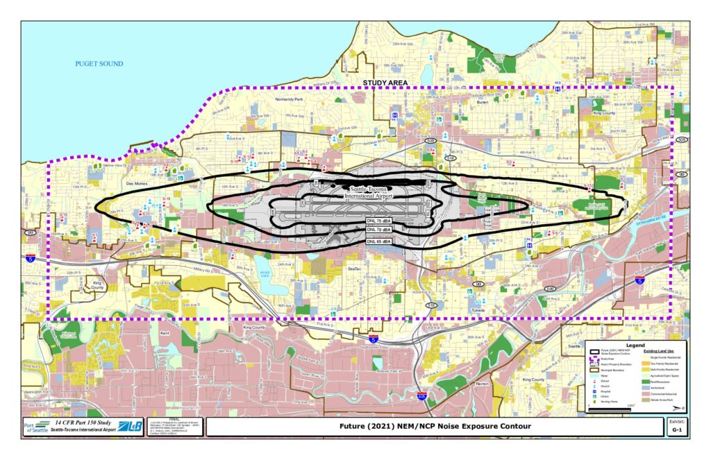
Exhibit G-1 from the Seattle-Tacoma International Airport 14 CFR Part 150 Study, prepared by Landrum & Brown on January 22, 2013. Shows the Future (2021) NEM/NCP (Noise Exposure Map/Noise Compatibility Program) noise exposure contours at DNL 65 dBA, DNL 70 dBA, and DNL 75 dBA overlaid on existing land use for the Sea-Tac Airport study area. Map covers municipalities including Seattle, Burien, SeaTac, Tukwila, Des Moines, Renton, Normandy Park, and King County. Land use categories shown include single-family residential, two-family residential, multi-family residential, agriculture/open space, park/recreation, institutional, commercial/industrial, and mobile home park. Sensitive receptors marked include schools, churches, hospitals, nursing homes, and libraries. Contour file reference: SEA213xQSv2.