TagMap(375)
-
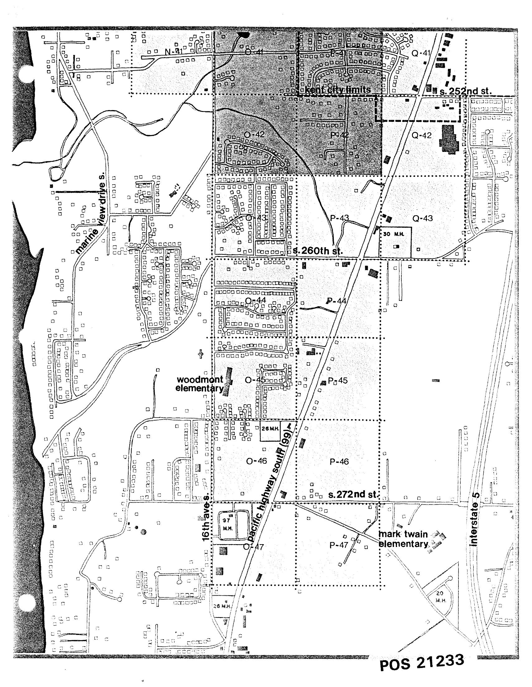
STCP Residential Land-Use Planning Map: Pacific Highway South Between S. 252nd St. and S. 272nd St.
A black-and-white planning map (reference number POS 21233) showing residential and land-use grid sections along Pacific Highway South (SR-99) between S. 252nd St. and S. 272nd St., including Kent City Limits, Marine View Drive S., 16th Ave. S., Interstate 5, Woodmont Elementary, and Mark Twain Elementary. The map identifies mobile home (M.H.) counts and parcel patterns relevant to airport noise impact analysis in the Des Moines/Kent area south of Seattle-Tacoma International Airport. -
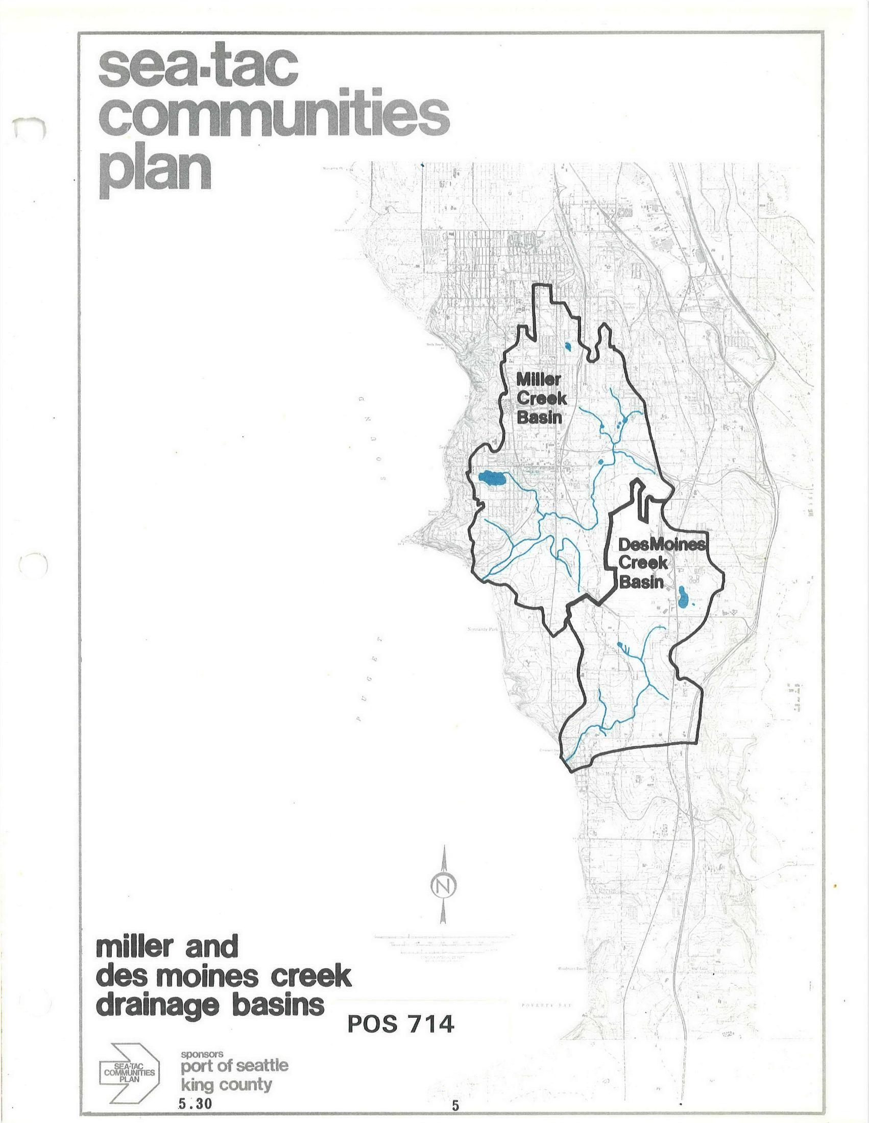
STCP Map: Miller Creek Basin and Des Moines Creek Basin Drainage Areas
A map document (POS 714, section 5.30) from the Sea-Tac Communities Plan, sponsored by the Port of Seattle and King County, depicting the Miller Creek Basin and Des Moines Creek Basin drainage areas with waterways shown in blue. The document is part of a regional planning effort covering communities in the Sea-Tac area of King County, Washington. -
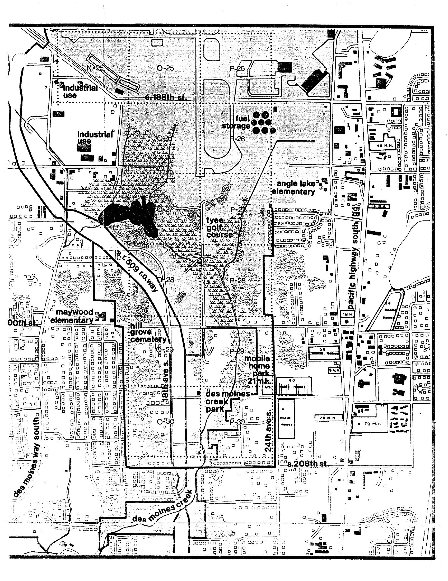
STCP Land Use Plan Map: S. 188th to S. 208th Street South of Sea-Tac Airport
A detailed land-use planning map covering the area south of Seattle-Tacoma International Airport, spanning roughly S. 188th Street to S. 208th Street and Des Moines Way South to Pacific Highway South (99). Identifiable features include Tyee Golf Course, Hill Grove Cemetery, Maywood Elementary, Angle Lake Elementary, Des Moines Creek Park, a mobile home park, fuel storage facilities, and the S.R. 509 right-of-way corridor, with grid parcels labeled by alphanumeric codes (N-25 through P-30). -
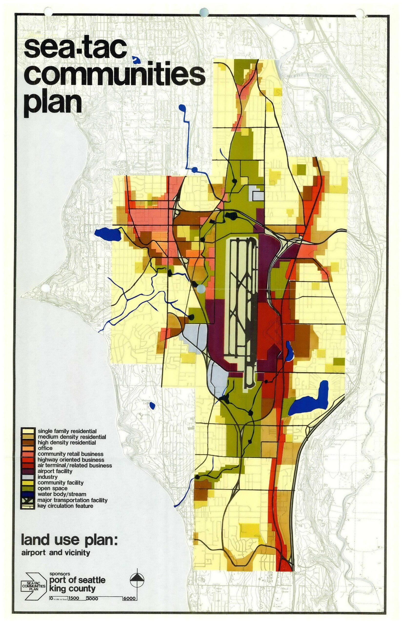
Sea-Tac Communities Plan Land Use Map: Airport and Vicinity
A color-coded land use planning map titled 'Sea-Tac Communities Plan,' subtitled 'Land Use Plan: Airport and Vicinity,' sponsored by the Port of Seattle and King County. The map depicts zoning categories including single-family residential, high-density residential, highway-oriented business, air terminal/related business, airport facility, open space, and water bodies in the Sea-Tac airport area. -
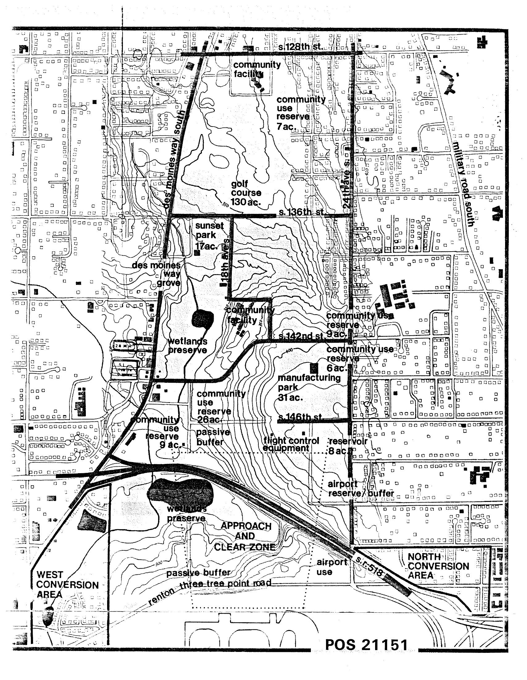
STCP Land Use Plan Map — Sea-Tac Airport Area
Planning map labeled POS 21151 showing land use designations around Seattle-Tacoma International Airport, including a golf course (130 ac.), wetlands preserves, community use reserves, manufacturing park (31 ac.), reservoir (8 ac.), Sunset Park (17 ac.), and conversion areas. The map shows streets including S. 128th St., S. 136th St., S. 142nd St., S. 146th St., Military Road South, and Des Moines Way South, with an Approach and Clear Zone marked near the airport runway. -
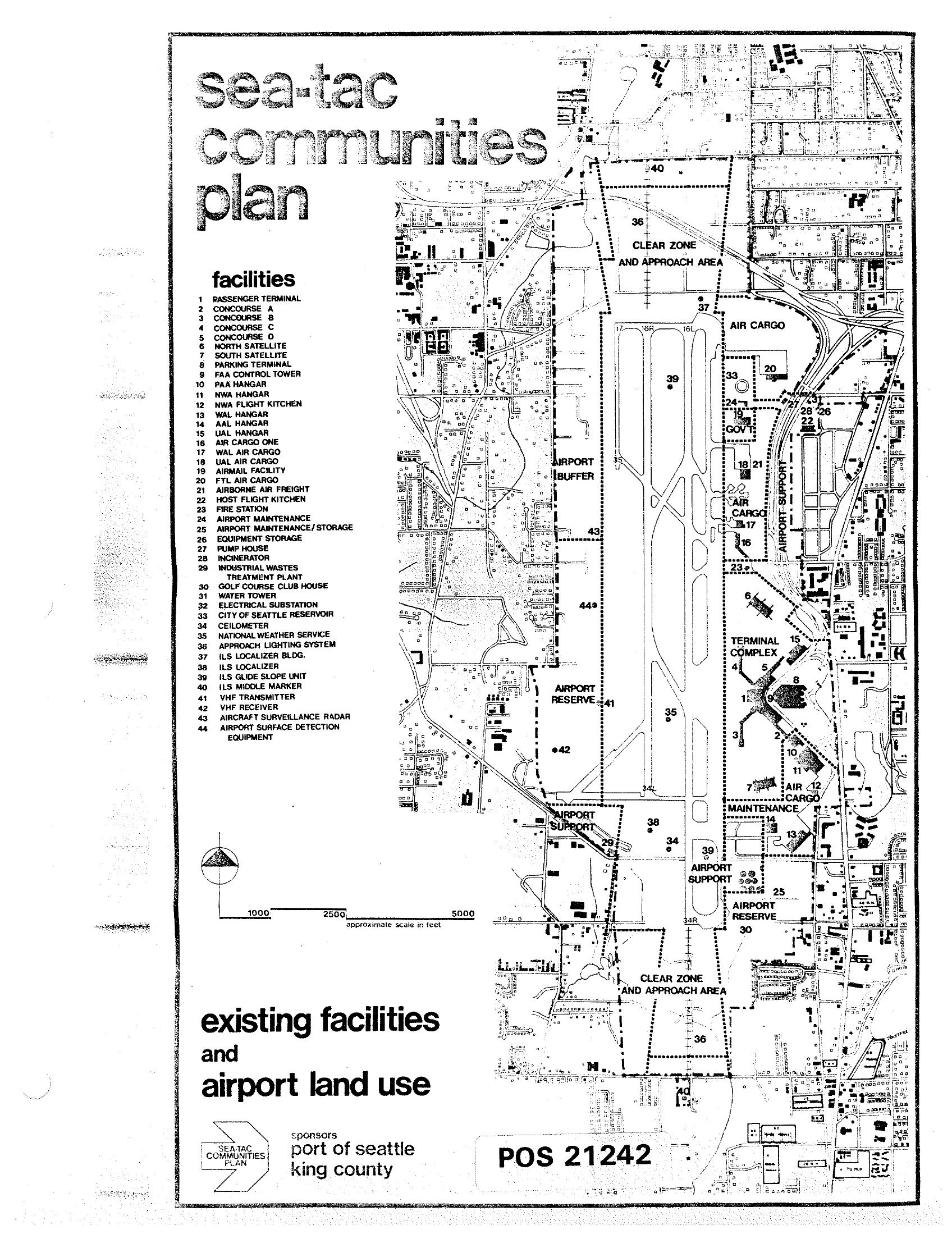
Sea-Tac Communities Plan — Existing Facilities and Airport Land Use Map
A planning map titled 'Sea-Tac Communities Plan' showing existing facilities and airport land use at Seattle-Tacoma International Airport, numbered 1–44 with a detailed legend identifying structures such as the Passenger Terminal, concourses, hangars, cargo facilities, navigation aids, and support buildings. The document is identified as POS 21242 and was sponsored by the Port of Seattle and King County. -
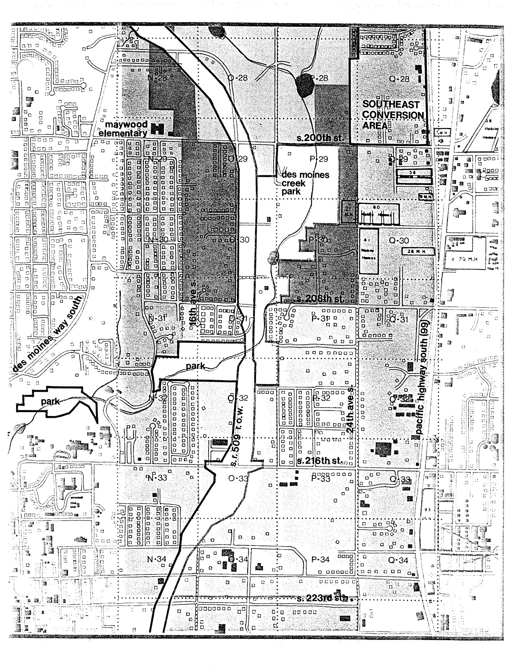
Des Moines Creek Park and Surrounding Area Land Use Map (STCP)
A planning map covering the area south of S. 200th Street to S. 223rd Street near Sea-Tac Airport, showing grid sections labeled N through Q (rows 28–34), major features including Des Moines Creek Park, Maywood Elementary School, Des Moines Way South, Pacific Highway South (SR 99), 46th Ave S, 24th Ave S, and the SR 509 right-of-way. The upper right corner is designated 'Southeast Conversion Area,' consistent with noise-impact land-use conversion planning documents associated with Sea-Tac Airport. -
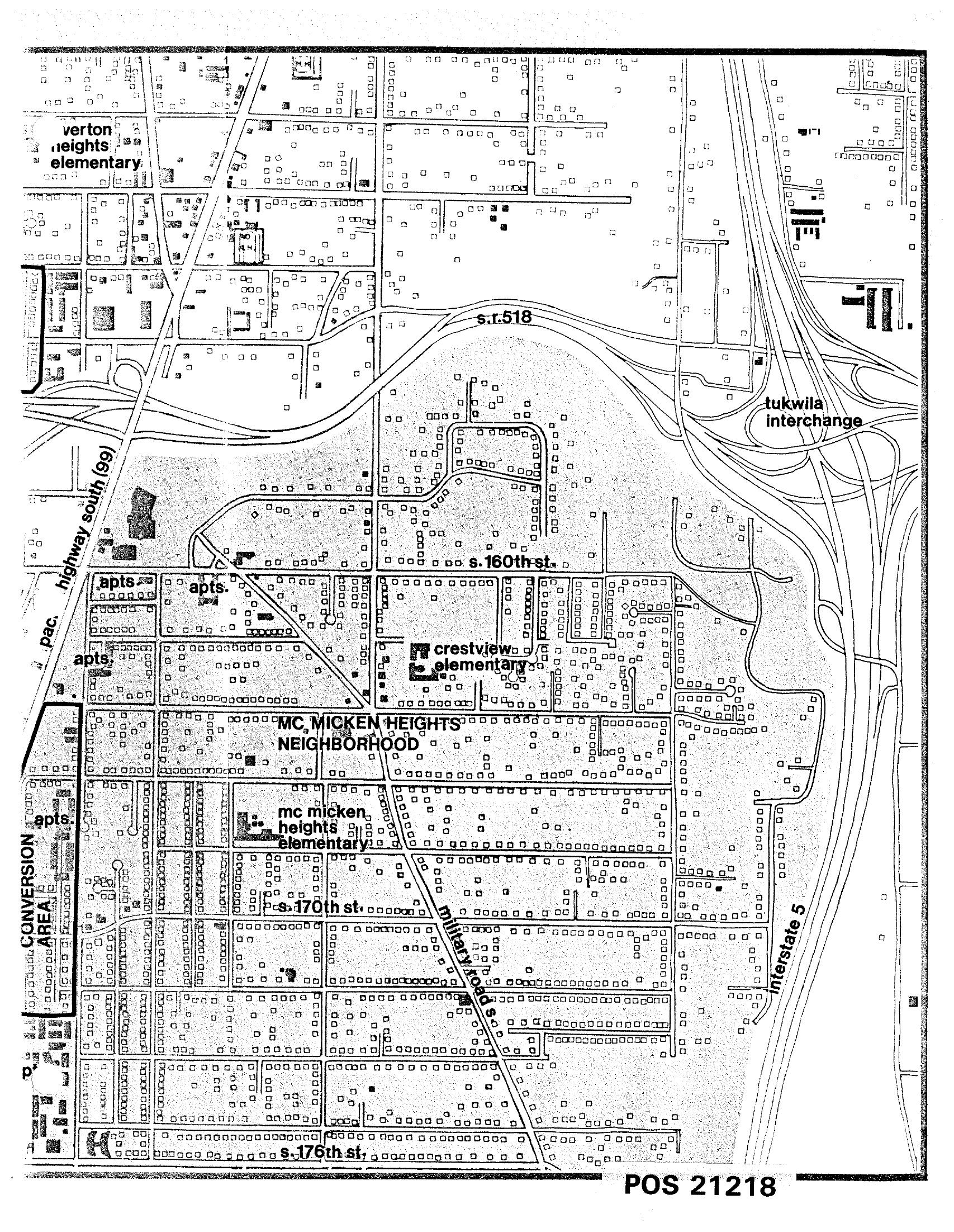
STCP Land-Use Map POS 21218 — McMicken Heights Neighborhood
A detailed land-use map labeled POS 21218 depicting the McMicken Heights Neighborhood in the Sea-Tac/Tukwila area, showing streets including S. 160th St., S. 170th St., S. 176th St., Highway 99 (Pacific Highway South), Interstate 5, and S.R. 518, along with landmarks such as Crestview Elementary, McMicken Heights Elementary, Verton Heights Elementary, the Tukwila Interchange, and a designated Conversion Area with apartment complexes. The map appears to be part of a noise or land-use planning document related to Sea-Tac Airport. -
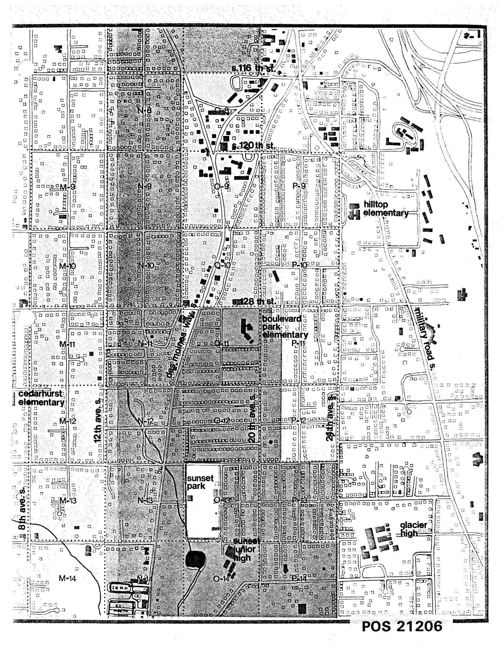
STCP Street Map with Labeled Schools South of Seattle
A detailed street grid map labeled POS 21206 showing a residential area south of Seattle, including named landmarks such as Hilltop Elementary, Boulevard Park Elementary, Cedarhurst Elementary, Sunset Junior High, and Glacier High School. Streets visible include S. 116th St., S. 120th St., S. 128th St., 8th Ave. S., 12th Ave. S., 24th Ave. S., Des Moines Way, and Military Road S., with grid squares labeled M through P and rows 8 through 14. -

STCP North Reinforcement Area Program Application Map (POS 1054)
This planning map, document number POS 1054 (page 6.6.5, sheet 8), was produced under the Sea-Tac Communities Plan sponsored by the Port of Seattle and King County. It depicts the North Reinforcement Area program application, showing land-use designations including acquisition zones (gray), cost-sharing insulation areas (blue), conversion areas (West and North), streams and ponds, current airport lands, and key landmarks such as Highline High School, Sunny Terrace Elementary, Sunnydale Elementary, and Riverton Heights Elementary, within the grid bounded roughly by S. 144th St. to S. 152nd St. and SR-509/SR-518.