TagDes Moines(255)
-
 2022-08-19
Child Learning About Marine Life at Educational Exhibit
A young child smiles at an orange octopus stuffed animal at what appears to be an outdoor educational booth. A green circular 'Poogooder' logo is visible on a white display board to the right. -
 2022-08-19
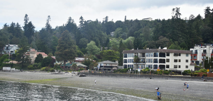
Waterfront Community with Aviation Infrastructure
Image shows a waterfront community with residential buildings, beach area, and forested hills in the background. Several people are visible on the beach, and the scene appears to be in the Pacific Northwest region near what could be an airport-impacted community. -
SR-509 surplus-cropped
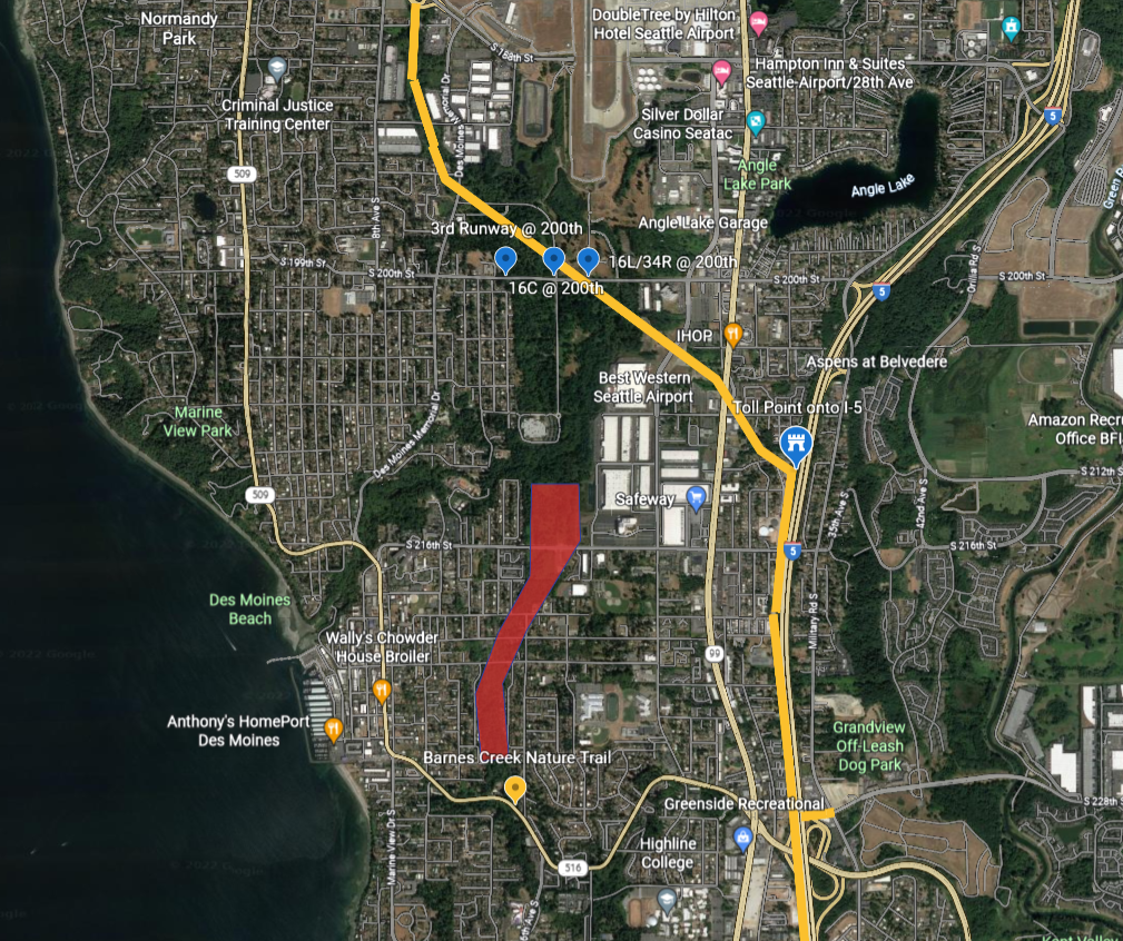
Satellite map of the Des Moines/SeaTac area south of Seattle showing marked approach corridors for Sea-Tac Airport runways 16C, 16L/34R, and the 3rd Runway at S 200th Street. A red polygon highlights a noise-impact or study zone extending southward through residential Des Moines roughly between S 216th Street and S 228th Street, near Barnes Creek Nature Trail and Des Moines Beach. -
 2022-07-12
Ground lease agreement: Des Moines Creek West
This is a Ground Lease Agreement between the Port of Seattle and PDC Seattle LPIV BB/TH, LLC for the property known as Des Moines Creek West, presented at a Port of Seattle Commission meeting on July 12, 2022. The agreement establishes the terms under which the tenant may develop and operate a business park project on Port-owned land near Seattle-Tacoma International Airport, covering provisions for rent, construction obligations, environmental compliance, and tenant rights. Key definitions include conditions for the lease commencement date, force majeure events, and restrictions on property use, including limitations related to flight kitchen operations serving SeaTac Airport airlines. -
 2022-07-10
Part 5: The Environment — Chapter 5.1: Air Quality
This document presents an air quality study conducted by Environmental Systems Laboratories, Inc. for Sea-Tac Airport, examining pollutant levels—including particulates, carbon monoxide, hydrocarbons, nitrogen oxides, and oxidants—at and around the airport. Using monitoring data collected in 1973–1974 from seven sites near the airport and surrounding communities, the study assessed existing conditions and predicted future air quality impacts under various aviation and land use scenarios. -
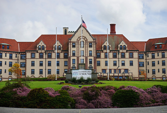
Masonic Home of Des Moines, Washington (Now Landmark on the Sound)
The image shows the Landmark on the Sound facility, a large historic building with red tile roofs, an American flag, and a clearly visible sign reading 'Landmark on Sound.' This property is located near Renton, Washington, in the Sea-Tac Airport noise impact area and has been associated with discussions about airport noise mitigation and land use planning. -
 2022-03-24
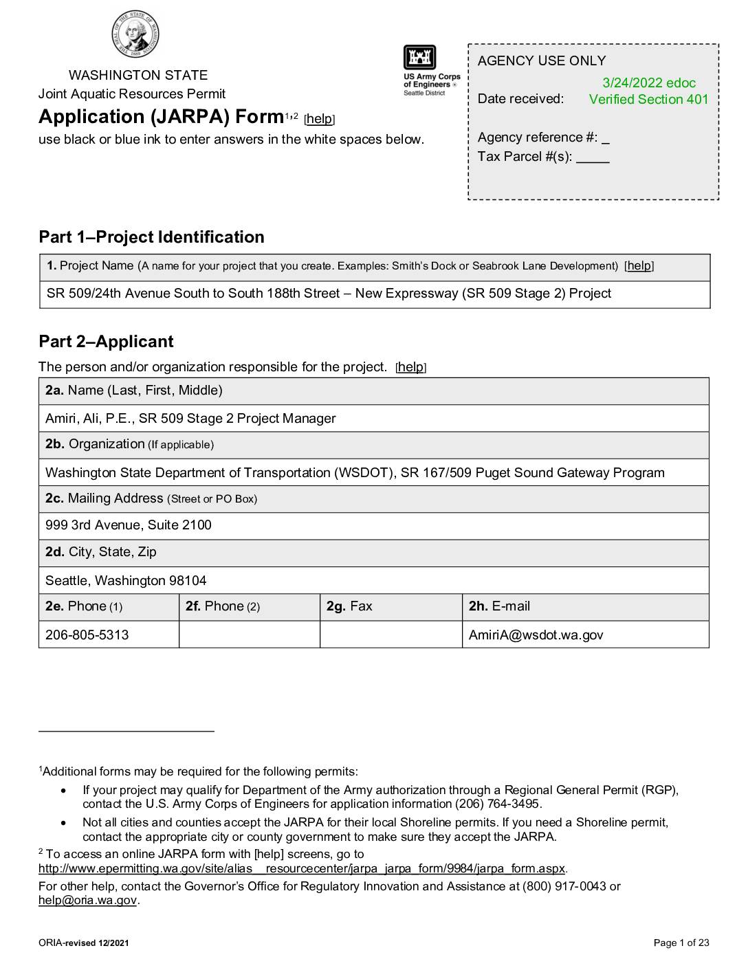
SR 509/24th Avenue South to South 188th Street – New Expressway (SR 509 Stage 2) Project JARPA
This is a Washington State Joint Aquatic Resources Permit Application (JARPA) submitted by the Washington State Department of Transportation (WSDOT) for the SR 509 Stage 2 Project, which involves constructing a new expressway between 24th Avenue South and South 188th Street in the cities of Burien, Des Moines, and SeaTac, King County. The project corridor runs through publicly owned land and spans multiple sections of townships near Sea-Tac Airport. The application was received on March 24, 2022, and covers permits related to aquatic resources affected by the highway construction. -
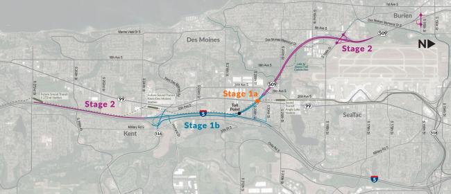
SR509 Stages Map
A project staging map shows the SR 509 extension and I-5 connector route divided into Stage 1a (toll point near Des Moines Memorial Drive), Stage 1b (along Military Road S toward Kent), and Stage 2 (extending northwest toward Burien and southeast toward Kent via SR 99). The map covers the Des Moines, SeaTac, Burien, and Kent areas of Washington State, with route numbers 99, 509, 316, and 5 visible. -
 2022-03-23
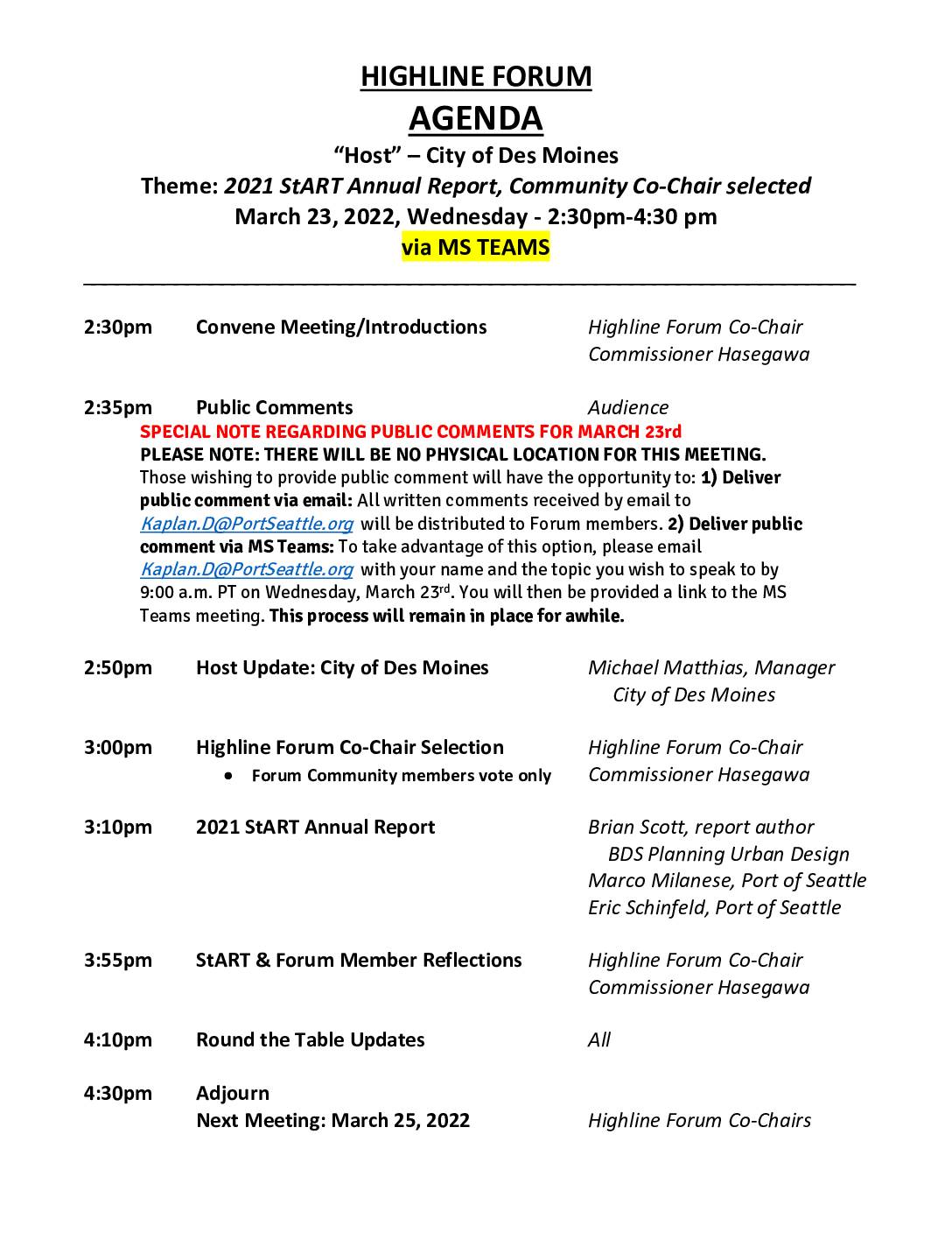
Highline Forum agenda: March 23, 2022
The Highline Forum held a virtual meeting on March 23, 2022, hosted by the City of Des Moines, focusing on the 2021 StART (Sea-Tac Airport Roundtable) Annual Report and the selection of a new Community Co-Chair. The meeting, conducted via Microsoft Teams, included presentations by Port of Seattle representatives and BDS Planning Urban Design on airport noise mitigation efforts affecting Highline-area communities. The document also lists all six 2022 Highline Forum meeting dates, with hosts ranging from local cities such as Tukwila, Federal Way, and SeaTac to institutions like Highline College and the Highline School District. -
 2022-01-10
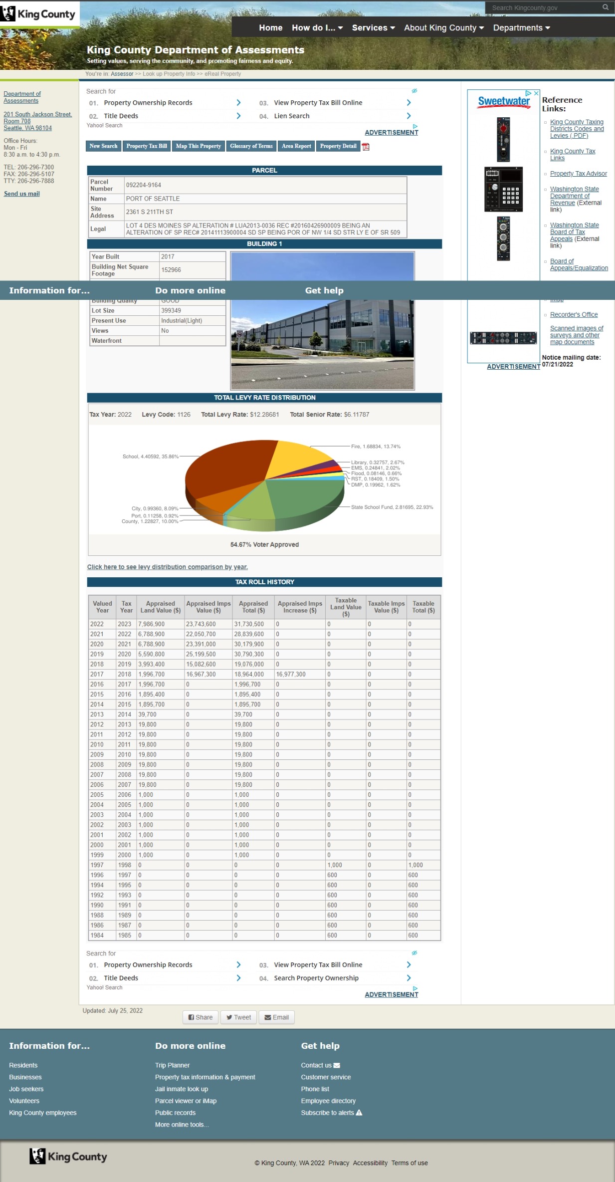
King County Assessor eReal Property Record – Port Of Seattle Parcel 092204-9164, 2361 S 211th St
This is a King County Department of Assessments eReal Property page for Parcel 092204-9164, owned by the Port of Seattle, located at 2361 S 211th St, Des Moines, WA. The record shows a Building 1 constructed in 2017 with 152,966 square feet, zoned Industrial (Light), and includes tax roll history dating back to 1984 and a 2022 Total Levy Rate of $12.28681 under Levy Code 1126.