TagBoeing(91)
-
 1981-05-13
King County Council Notice: Proposed Motion 81-322 Rescinding Motion 4668, Building and Land Development File 224-78-R (Port Of Seattle Reclassification)
★ 32In December 1979, the King County Council passed Motion 4668 approving a rezone request by the Port of Seattle (Building and Land Development File No. 224-78-R), subject to conditions including the Port providing 5 acres for a neighborhood park and agreeing not to develop a 55-acre Westside Greenbelt buffer area for ten years. In May 1981, the Council proposed Motion 81-322 to rescind and replace Motion 4668, with key differences in the conditions outlined on page 2 of each motion. The matter, which had been appealed by both the applicant and neighboring property owners, required a separate public hearing in affected communities as part of the site plan approval process. -
 1978-08-08
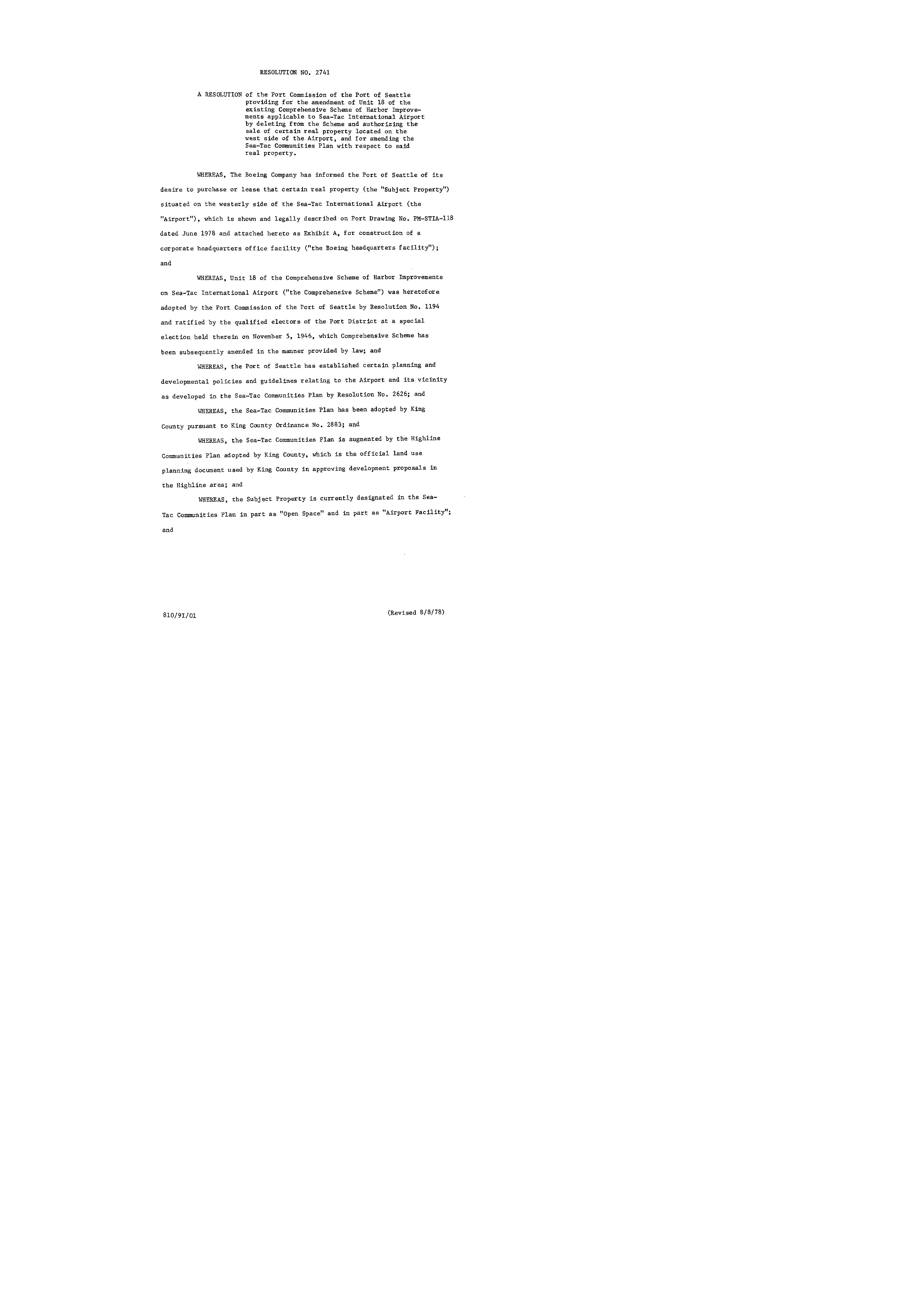
Resolution No. 2741: Amendment of Unit 18 of the Comprehensive Scheme of Harbor Improvements and the Sea-Tac Communities Plan for Boeing headquarters facility
Resolution No. 2741 from the Port Commission of the Port of Seattle authorized amendments to the Sea-Tac Communities Plan to allow Boeing to purchase or lease property on the west side of Sea-Tac International Airport for a corporate headquarters facility. The resolution redesignated the subject property from 'Open Space' and 'Airport Facility' to 'Office/Park--Buffer Use Area,' finding that the Boeing facility was consistent with community buffer objectives and would not result in significant adverse environmental impacts. The change was contingent on zoning reclassification, FAA approval, and other required permits and approvals. -
 1978-03-15
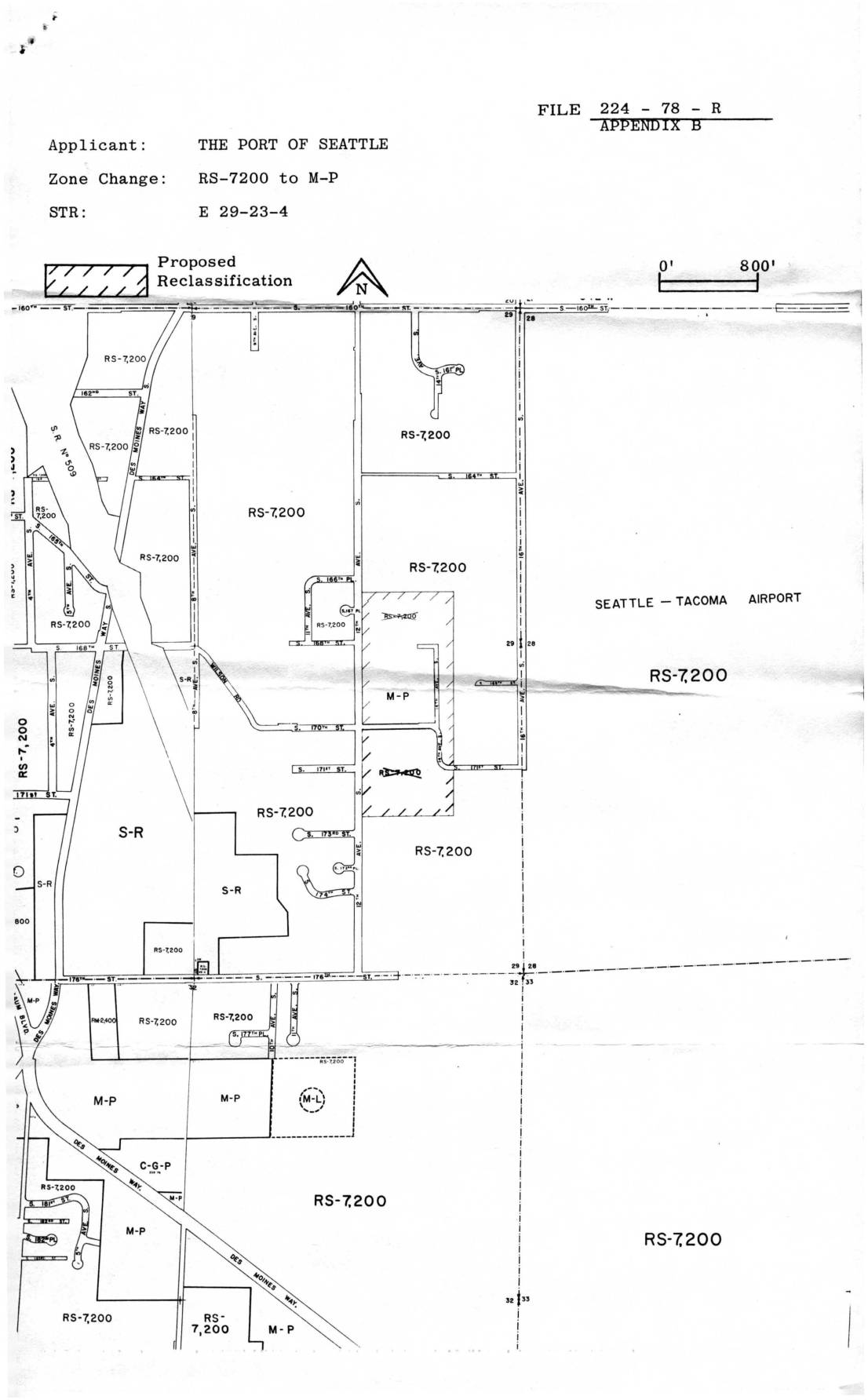
File 224-78-R Appendix B: Port Of Seattle Zone Change Map, RS-7200 to M-P, STR E 29-23-4
This 1978 King County Building & Land Development document relates to a zoning reclassification application (File 224-78-R) filed by the Port of Seattle, proposing to change land near Seattle-Tacoma Airport from residential (RS-7,200) to manufacturing-park (M-P) zoning. The accompanying map shows the affected parcels in section E 29-23-4, located adjacent to Sea-Tac Airport, where multiple residential zones were targeted for conversion. A notice was mailed to area resident Virginia Dana at 2648 South 142nd Street, Seattle, in March 1978. -
 1978-03-09
Final Environmental Impact Statement for the Proposed Boeing Company Corporate Headquarters Facility
This March 1978 Final Environmental Impact Statement, prepared jointly by King County and the Port of Seattle, evaluates the proposed construction of a Boeing Company Corporate Headquarters Facility on the western boundary of Sea-Tac International Airport. The project required zoning reclassification, community plan amendments, and various permits for a site located east of 12th Avenue South between South 166th Place and South 173rd Street. The document was prepared under the Washington State Environmental Policy Act (SEPA) and related county regulations. -
 1978-01-01
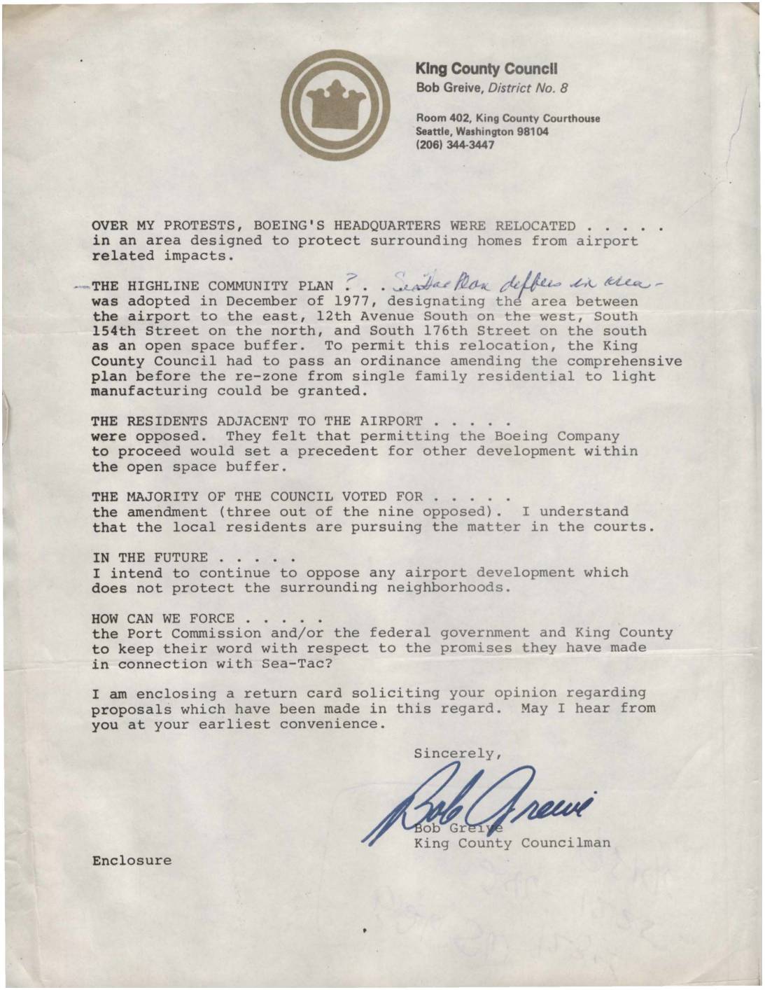
Letter from King County Councilman Bob Grieve on Boeing HQ Relocation and Highline Community Plan
King County Councilman Bob Greive wrote to constituents expressing his opposition to the relocation of Boeing's headquarters into an open space buffer zone near Sea-Tac Airport, an area designated under the 1977 Highline Community Plan to protect nearby residents from airport-related impacts. Despite his protests, the King County Council voted to amend the comprehensive plan and rezone the land from single-family residential to light manufacturing, with only three of nine council members opposing the measure. Greive vowed to continue fighting airport development that threatened surrounding neighborhoods and asked residents for their input on how to hold the Port Commission, federal government, and King County accountable to their promises regarding Sea-Tac. -
 1978-01-01
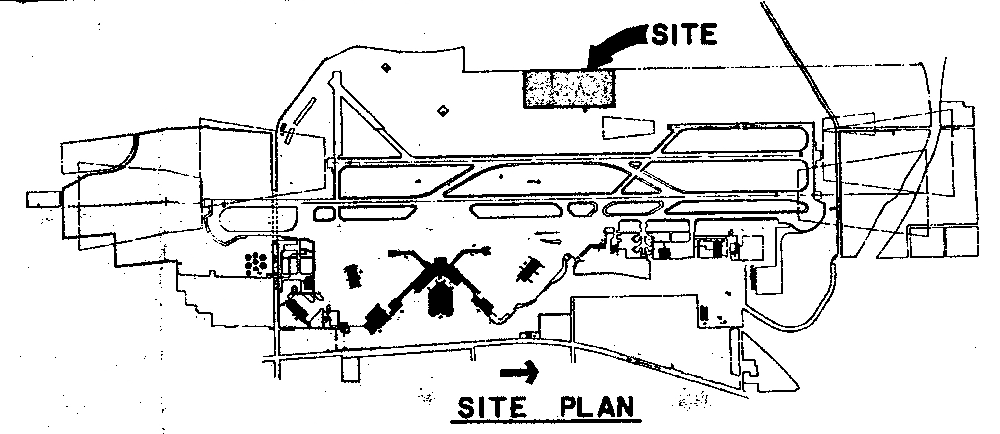
Boeing Headquarters Proposal Map
A site plan diagram of Seattle-Tacoma International Airport, with an arrow and label identifying a specific 'SITE' location in the northern portion of the airport property. The plan shows runway configurations, taxiways, terminal areas, and surrounding land uses. -
 1977-08-11
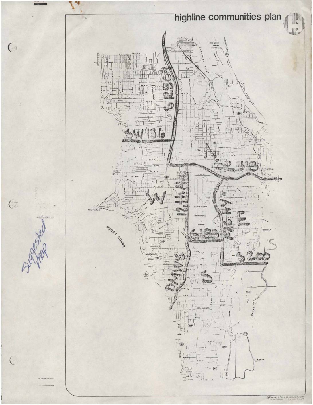
Highline Communities Plan: Policy Advisory Committee Meeting Minutes, August 11, 1977
These documents are from the Highline Communities Plan, a King County planning effort covering neighborhoods surrounding Seattle-Tacoma International Airport. The materials include community boundary maps dividing the Highline area into North, West, East, and South zones with approximate 1980 population figures, and minutes from a Policy Advisory Committee meeting held August 11, 1977. The meeting, attended by representatives from the Port of Seattle, FAA, Boeing, King County, and community groups, addressed Boeing's proposed office facility on the west side of Sea-Tac Airport, including discussions on site design, landscaping, parking, and a public viewpoint park. -
 1971-04-01
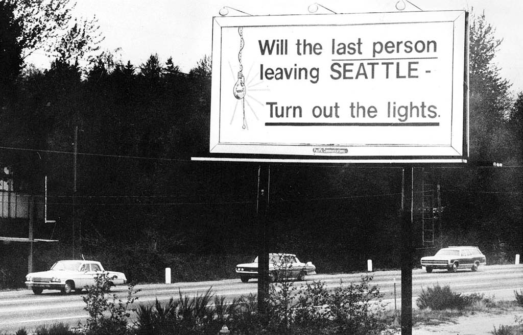
Will the Last Person Leaving Seattle Turn Out the Lights billboard, April 1971
A famous billboard along a Seattle-area highway reading 'Will the last person leaving SEATTLE – Turn out the lights,' erected during the Boeing Bust economic downturn of the early 1970s when massive layoffs caused a sharp population decline in the region. The black-and-white photograph shows vintage early-1970s automobiles passing beneath the sign, with a light bulb graphic hanging from the text. -
 1969-02-08
Sea-Tac International Airport: Part 3 — Boeing Bust to Deregulation
The Port of Seattle built Seattle-Tacoma International Airport during World War II to relieve pressure on existing airports such as Seattle’s Boeing Field. Following the war, Sea-Tac quickly established itself as the region’s aviation hub, but it had to undertake major improvements to accommodate newer jet aircraft and steadily increasing numbers of passengers. During the -
Boeing 707 #17586
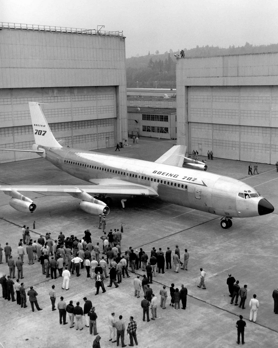
The prototype Boeing 707 jet airliner is rolled out of the assembly hangar before a large crowd of Boeing workers and observers. The aircraft's fuselage prominently displays the 'BOEING 707' designation, marking a historic milestone in commercial jet aviation history, likely from the mid-to-late 1950s.