TagSR509(120)
-
 2017-08-15
Puget Sound Gateway Program SR 509 Completion Project
WSDOT presentation by Senior Transportation Planner Thomas Noyes to the SDOT Freight Advisory Board on August 15, 2017, covering the Puget Sound Gateway Program SR 509 Completion Project and SR 167. Topics include direct freight links from Port of Seattle and Port of Tacoma to regional distribution centers and Eastern Washington, direct access to Seattle-Tacoma -
 2017-08-15
Puget Sound Gateway Program SR 509 Completion Project
WSDOT presentation by Senior Transportation Planner Thomas Noyes to the SDOT Freight Advisory Board on August 15, 2017, covering the Puget Sound Gateway Program SR 509 Completion Project and SR 167. Topics include direct freight links from Port of Seattle and Port of Tacoma to regional distribution centers and Eastern Washington, direct access to Seattle-Tacoma -
 2017-07-26
Puget Sound Gateway Program SR 509 Completion Project: Highline Forum presentation
A July 2017 presentation by the Washington State Department of Transportation outlines the Puget Sound Gateway Program's SR 509 Completion Project, which aims to build new freeway connections linking the region's major ports and Seattle-Tacoma International Airport to surrounding communities and Eastern Washington. The project includes plans for tolling to help fund construction and is intended to improve freight movement, airport access for passengers and air cargo, and regional economic development. -
 2017-07-26
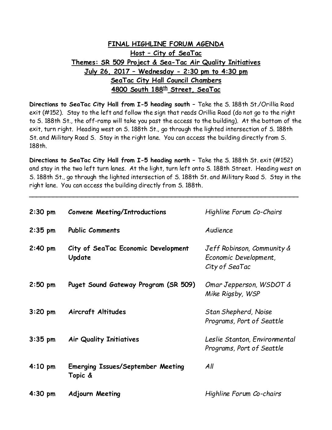
Final Highline Forum agenda: SR 509 Project & Sea-Tac Air Quality Initiatives
The Highline Forum held on July 26, 2017, at SeaTac City Hall brought together community stakeholders, city officials, and representatives from WSDOT and the Port of Seattle to discuss key regional topics including the SR 509 Puget Sound Gateway Program, aircraft altitude concerns, and air quality initiatives near Sea-Tac Airport. Presentations were delivered by Port of Seattle staff covering noise programs and environmental initiatives, alongside updates on SeaTac's economic development. The meeting provided a public forum for emerging issues and planning for future discussions on airport-related impacts to surrounding communities. -
 2016-05-25
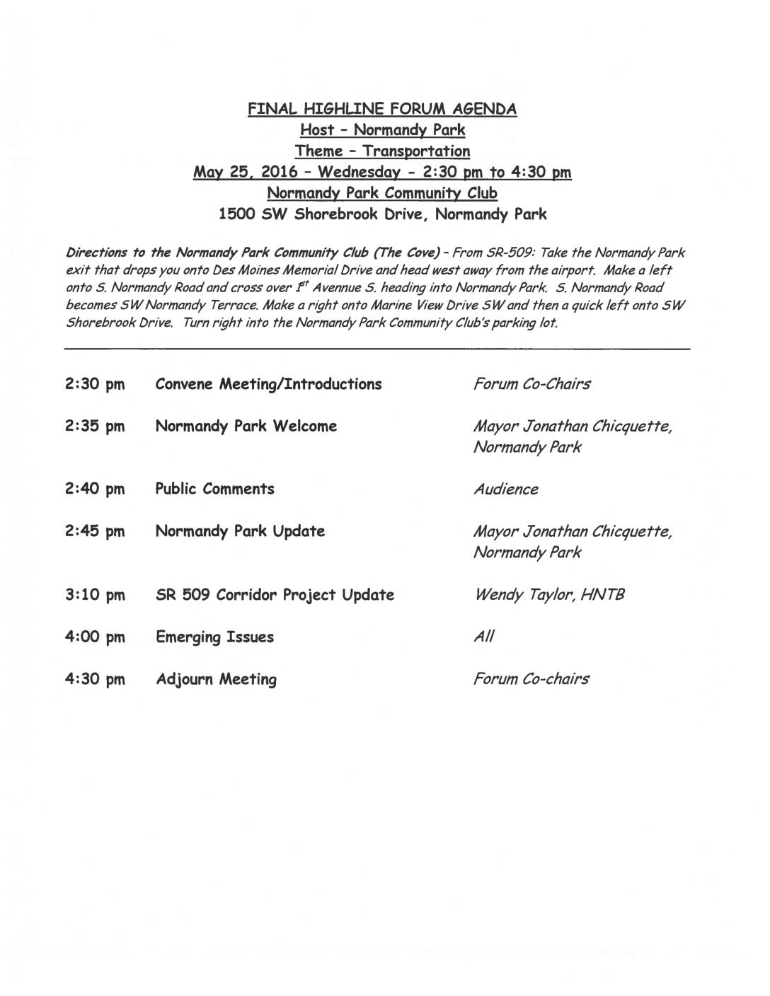
Highline Forum Agenda: Transportation — SR 509 Puget Sound Gateway Program, May 25, 2016
This document contains the agenda for a Highline Forum meeting held on May 25, 2016, at the Normandy Park Community Club, focused on the theme of transportation. The meeting featured a presentation by Wendy Taylor of HNTB on the SR 509 Puget Sound Gateway Program, a highway corridor project in the Seattle area near Sea-Tac Airport. The forum brought together local officials, including Normandy Park Mayor Jonathan Chicquette, to discuss regional transportation updates and emerging issues affecting the Highline area. -
 2014-06-15
Airport Key Map: Sea-Tac Airport Property Zones
★ 32This Airport Key Map, published by the Port of Seattle on June 15, 2014, provides a general reference overview of property zones surrounding Seattle-Tacoma International Airport. It identifies distinct areas including the Airfield, Terminal, Commercial, South of Airfield, South of 200th, and North of Airfield zones, and distinguishes between Port of Seattle property, lease boundaries, non-Port property, land available for redevelopment, and the proposed SR 509 corridor. The aerial photo, taken in Spring 2012, is intended for general reference only and is not approved for navigation use. -
Frank Hansen (obituary Seattle Times)
Frank Hansen, longtime commercial airline pilot and the first mayor of the City of SeaTac, died of cancer at his home on Dec. 21, 2013. He was 87. Frank was born on Nov. 18, 1926 in Spokane, Wash., the fifth of six children. His mother, Vesta Alexander, was the descendant of Spokane homesteaders. His father, -
 2013-03-27
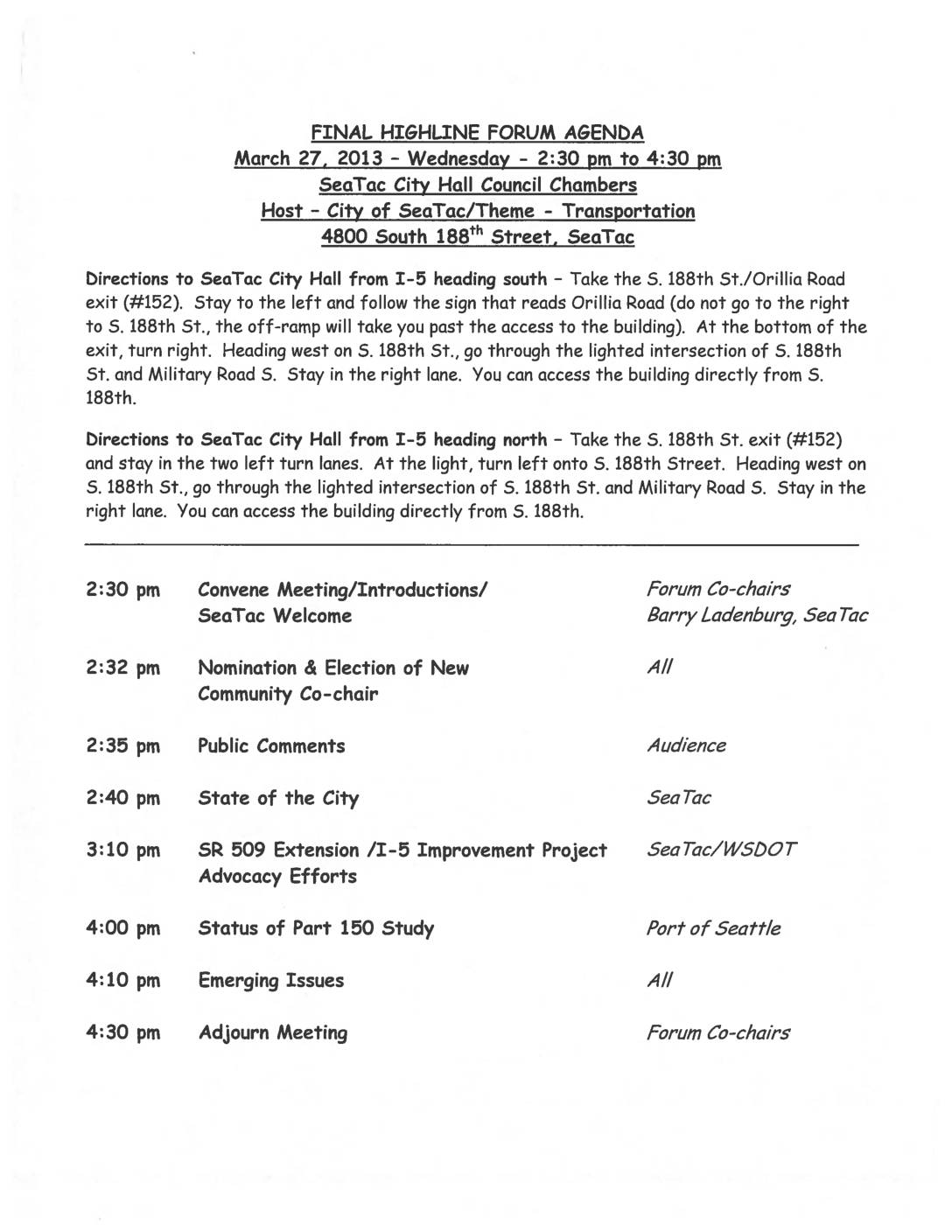
Highline Forum Agenda: March 27, 2013
The Highline Forum is a collaborative body representing Southwest King County cities, schools, and the Port of Seattle that meets to share information and work on regional initiatives. A March 27, 2013 meeting held at SeaTac City Hall focused on transportation topics, including the SR 509 Extension/I-5 Improvement Project and a status update on the Port of Seattle's Part 150 noise study, which directly relates to Sea-Tac Airport noise mitigation policy. The Forum operates by consensus and is governed by procedures that assign the Port of Seattle as the lead disseminator of all Forum-related information. -
 2013-01-01
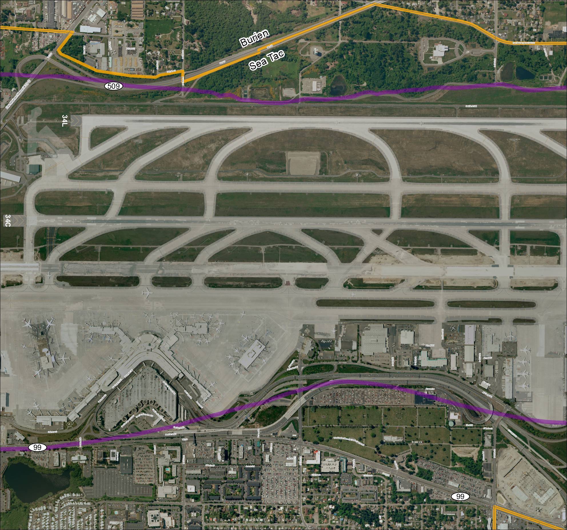
Grid 3 2013 Baseline Map: Sea-Tac Airport Runways and Surrounding Area
This aerial map depicts Seattle-Tacoma International Airport (Sea-Tac) and its surrounding communities of Burien and SeaTac, showing the airport's runway layout including runways 34L and 34C, along with key roadways such as SR 99, SR 509, and various access roads. Highlighted routes in purple and orange appear to mark designated corridors or boundary lines relevant to airport planning or noise study areas. The map provides a geographic reference for understanding the airport's footprint and its relationship to neighboring residential and commercial zones. -
 2003-01-01
SR 509: Corridor Completion/I-5/South Access Road final environmental impact statement and Section 4(f) evaluation
This January 2003 Final Environmental Impact Statement evaluates proposed highway improvements in southwest King County, Washington, including an extension of SR 509 and upgrades to I-5 between South 210th Street and South 310th Street to improve regional access to Seattle-Tacoma International Airport. Three build alternatives and a No Action Alternative are assessed, with the SR 509 extension designed to accommodate two general purpose lanes and a center high-occupancy vehicle lane in each direction. The project was jointly prepared by the Federal Highway Administration, Washington State Department of Transportation, Port of Seattle, King County, and the Cities of SeaTac and Des Moines.