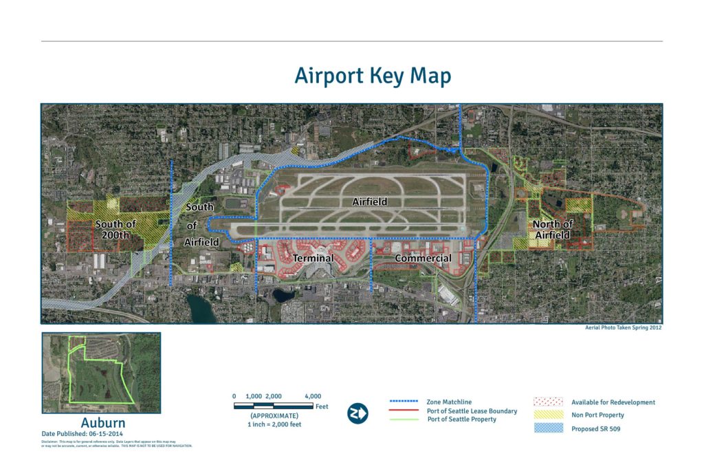
This Airport Key Map, published by the Port of Seattle on June 15, 2014, provides a general reference overview of property zones surrounding Seattle-Tacoma International Airport. It identifies distinct areas including the Airfield, Terminal, Commercial, South of Airfield, South of 200th, and North of Airfield zones, and distinguishes between Port of Seattle property, lease boundaries, non-Port property, land available for redevelopment, and the proposed SR 509 corridor. The aerial photo, taken in Spring 2012, is intended for general reference only and is not approved for navigation use.Open full document
Notes
Port Of Seattle Airport Key Map published 2014-06-15 showing Sea-Tac Airport property zones including Airfield, Terminal, Commercial, South of Airfield, South of 200th, and North of Airfield areas. Map depicts Port Of Seattle lease boundaries, Port Of Seattle property, zone matchlines, non-Port property, areas available for redevelopment, and the proposed SR 509 corridor (approximate alignment). Aerial photo base taken Spring 2012. Scale 1 inch = 2,000 feet. Auburn inset map included. Part of the Sustainable Airport Master Plan (SAMP) documentation.