TagSR509(120)
-
 2021-11-17
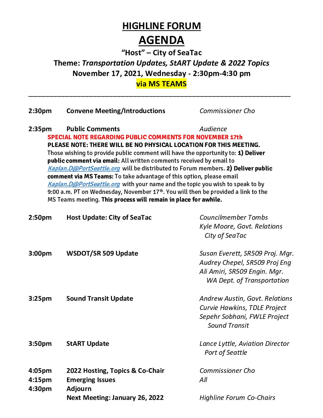
Highline Forum agenda: Transportation updates, StART update & 2022 topics
The Highline Forum held a virtual meeting on November 17, 2021, hosted by the City of SeaTac, covering transportation updates including WSDOT's SR 509 project, Sound Transit developments, and a StART (Sea-Tac Airport Roundtable) update from the Port of Seattle's Aviation Director. The meeting was conducted via Microsoft Teams with no physical location, and public comments were accepted by email or through the online platform. The agenda also included planning for six bimonthly Highline Forum meetings scheduled throughout 2022, running from January through November. -
 2021-11-04
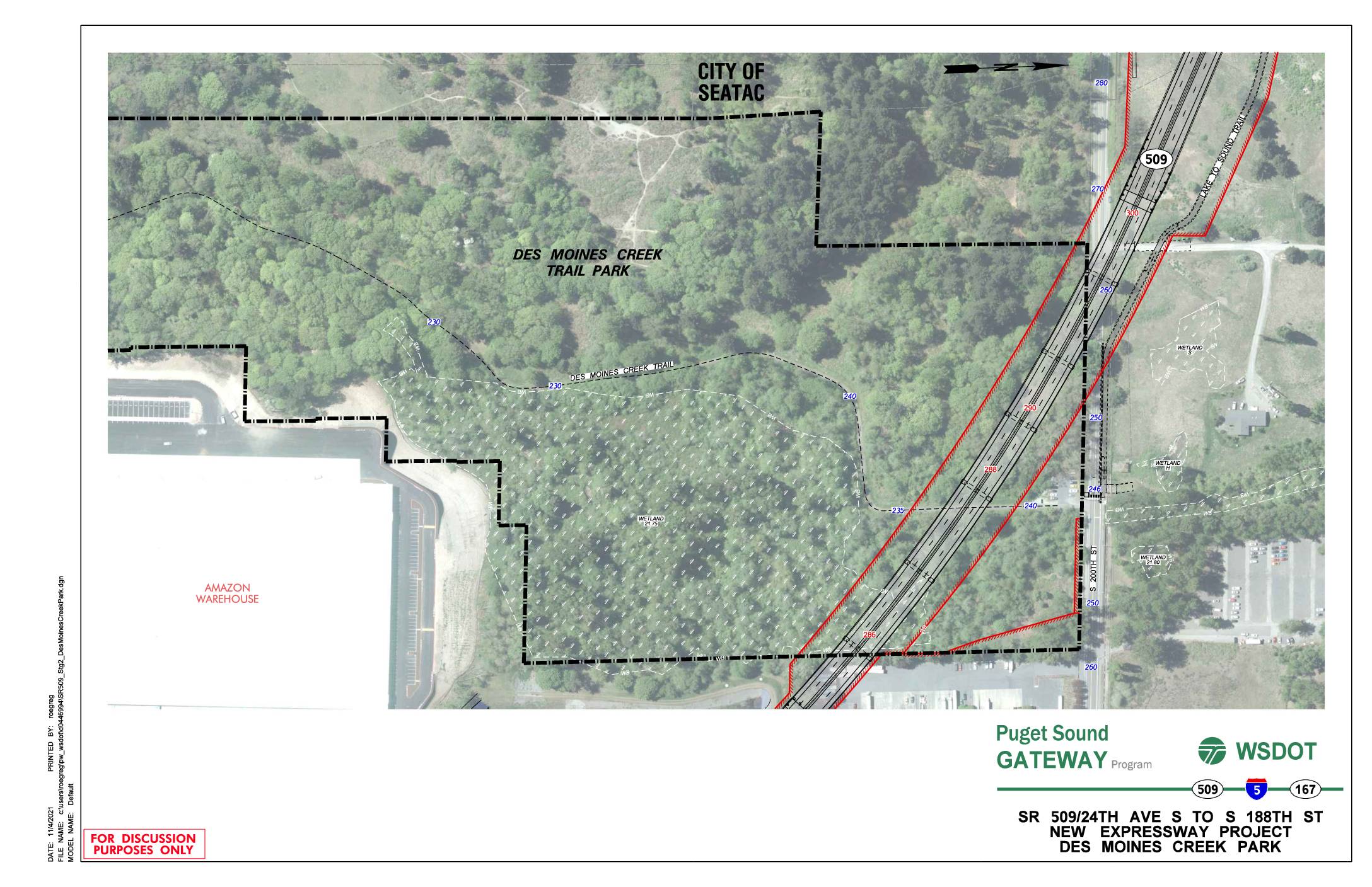
SR 509/24th Ave S to S 188th St new expressway project: Des Moines Creek Park
This WSDOT discussion document from November 2021 shows a planning map for the SR 509 Puget Sound Gateway Program's new expressway project, spanning from 24th Ave S to S 188th St near Des Moines Creek Park in the City of SeaTac. The map highlights the proposed highway alignment (shown in red) running adjacent to Des Moines Creek Trail Park, identifying wetland areas, contour elevations, and nearby features such as an Amazon warehouse and the Lake to Sound Trail. The project represents a major infrastructure expansion in the SeaTac area that would affect the Des Moines Creek Park corridor and surrounding natural resources. -
 2021-02-09
SR509 Surplus Land Purchase: Supporting Development of the Des Moines Creek West Property
In February 2021, the Port of Seattle Commission was asked to authorize the purchase of a 14.3-acre strip of former SR-509 highway right-of-way from WSDOT for approximately $3.15 million. The land, located in Des Moines, WA adjacent to the Port's Des Moines Creek West property, was intended to support development near Seattle-Tacoma International Airport. The acquisition aimed to consolidate Port-controlled land in an industrial corridor close to the airport's flight path. -
 2020-11-18
Puget Sound Gateway Program SR 509 Completion Project: Highline Forum Presentation
The Washington State Department of Transportation (WSDOT) presented the Puget Sound Gateway Program to the Highline Forum in November 2020, outlining plans to complete SR 509 in King County and SR 167 in Pierce County. The SR 509 project includes creating a new south access point to Sea-Tac Airport, improving freight connections to the ports of Seattle and Tacoma, and reducing congestion on local roads. The program also proposes tolling as a tool for sustainable congestion management. -
 2020-05-01
SR 518 Corridor Planning Study
The SR 518 Corridor Planning Study, published by the Washington State Department of Transportation (WSDOT) in May 2020, examines the stretch of State Route 518 running from SR 509 to Interstate 5 (milepost 0.00 to 3.42) in the Seattle area near Sea-Tac Airport. The study was conducted by WSDOT's Management of Mobility Division to evaluate transportation conditions and identify potential improvements along this key corridor. It was formally approved by WSDOT leadership in November 2019 and includes standard civil rights and accessibility notices in both English and Spanish. -
2020-05-01
SR 518 Corridor Planning Study
The SR 518 Corridor Planning Study, published by the Washington State Department of Transportation (WSDOT) in May 2020, examines the stretch of State Route 518 running from SR 509 to Interstate 5 (milepost 0.00 to 3.42) in the Seattle area near Sea-Tac Airport. The study was conducted by WSDOT's Management of Mobility Division to evaluate transportation conditions and identify potential improvements along this key corridor. It was formally approved by WSDOT leadership in November 2019 and includes standard civil rights and accessibility notices in both English and Spanish. -
Puget Sound Gateway program kicks off
Connecting SR 167 and SR 509 to I-5 Puget Sound Gateway program will help move freight faster. (Photo – Port of Tacoma) State and regional leaders celebrated the beginning of the Puget Sound Gateway Program this month. This multiyear program will complete SR 167 in Pierce County and SR 509 in King County. These new -
Construction starting on missing links in SR 167, SR 509
…In King County, SR 509, which currently ends at South 188th Street, will be extended to I-5. The extension will have two lanes in each direction. A new interchange will be built at S. 188th St. The Washington State Department of Transportation said extending 509 will serve as an alternative to I-5, SR 99 and -
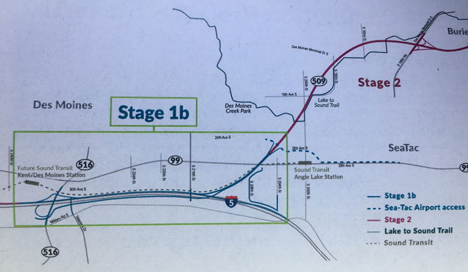
SR509 Completion Project I-5 Connector Overview
A planning map showing Stage 1b and Stage 2 alignments of the Lake to Sound Trail in the Des Moines and SeaTac, Washington area. Key landmarks labeled include Des Moines Creek Park, Sound Transit Angle Lake Station, the Future Sound Transit Kent/Des Moines Station, SR-509, SR-516, SR-99, and I-5, with trail segments distinguished by color-coded legend lines including Sea-Tac Airport access routes. -
 2019-08-02
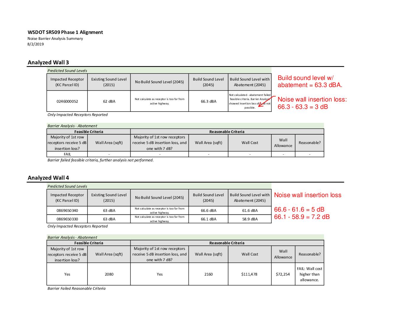
WSDOT SR509 Phase 1 alignment noise barrier analysis summary
This 2019 WSDOT report analyzes noise barriers along the SR509 Phase 1 highway alignment near the Sea-Tac area, evaluating whether proposed sound walls meet feasibility and cost-reasonableness standards. Wall 3 was rejected because it could not achieve the required 5 dB noise reduction for nearby residents. Wall 4 met the technical noise-reduction threshold but was ultimately rejected because its estimated cost of $111,478 exceeded the allowable budget of $72,254.