TagSeattle(33)
-
 2023-07-10
Exposure disparities by income, race and ethnicity, and historic redlining grade in the greater Seattle area for ultrafine particles and other air pollutants: supplemental material
https://ehp.niehs.nih.gov/doi/full/10.1289/EHP11662 -
 2023-07-10
Supplemental material: Exposure disparities by income, race and ethnicity, and historic redlining grade in the greater Seattle area for ultrafine particles and other air pollutants
This environmental health study examines how exposure to ultrafine particles and other air pollutants varies across the greater Seattle area based on income, race and ethnicity, and historical redlining grades assigned by the Home Owners' Loan Corporation (HOLC). Researchers analyzed pollutant concentration data from 2019-2020 alongside census and demographic data to identify disparities between communities. The supplemental materials include statistical tables and scatterplots supporting the main findings on environmental inequality across Seattle neighborhoods. -
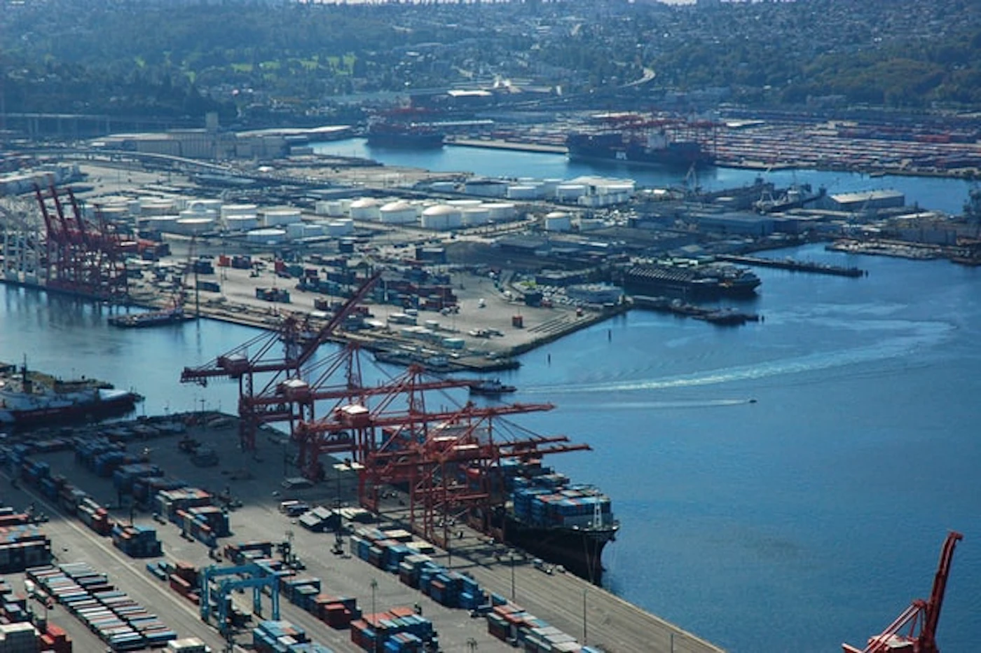
Aerial View of Port of Seattle Container Terminals and Cargo Ships
Aerial photograph of the Port of Seattle showing container terminals with red gantry cranes, stacked intermodal containers, and cargo ships docked along Elliott Bay. The industrial waterfront facility is visible with the broader Seattle urban area and green hillsides in the background. -
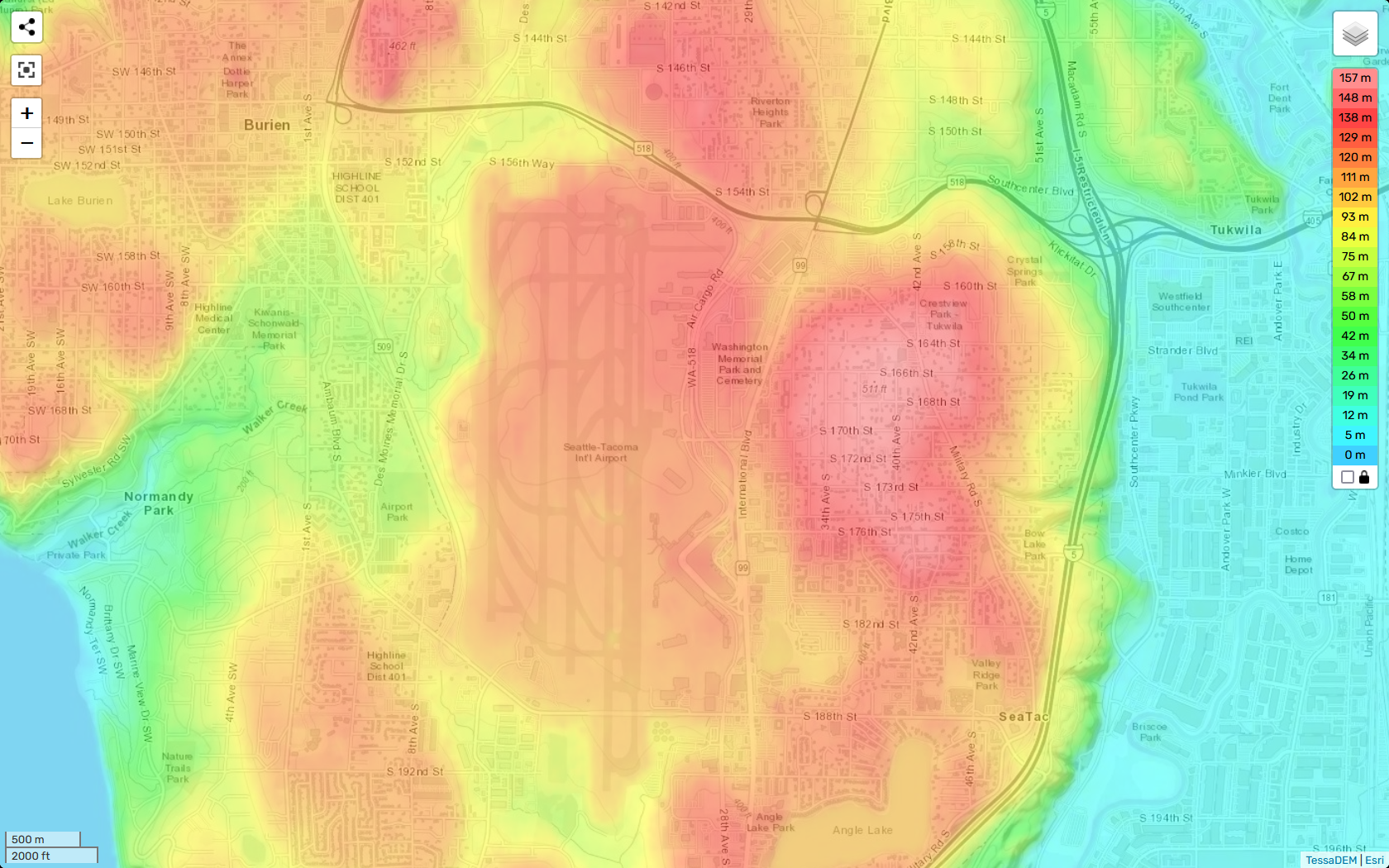
TessaDEM Elevation Heatmap of Sea-Tac Airport and Surrounding Communities
A TessaDEM/Esri elevation heatmap centered on Seattle-Tacoma International Airport and surrounding communities including Burien, Tukwila, SeaTac, and Normandy Park. The color scale ranges from 0 m (cyan/blue) to 157 m (deep red), with the highest elevations visible in the airport's central plateau and adjacent residential areas to the east near S. 164th–S. 182nd Streets. -
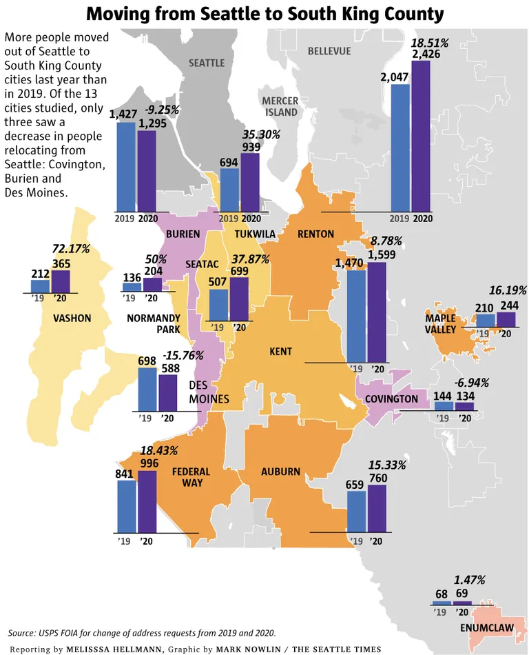
Seattle Times Infographic: Exodus from Seattle to South King County Cities, 2019–2020
A Seattle Times infographic by Mark Nowlin, reporting by Melisssa Hellmann, showing USPS change-of-address data comparing 2019 and 2020 relocations from Seattle to 13 South King County cities including Renton, Tukwila, SeaTac, Federal Way, and others. Of the 13 cities studied, only Covington, Burien, and Des Moines saw decreases in people relocating from Seattle. -
 2022-01-01
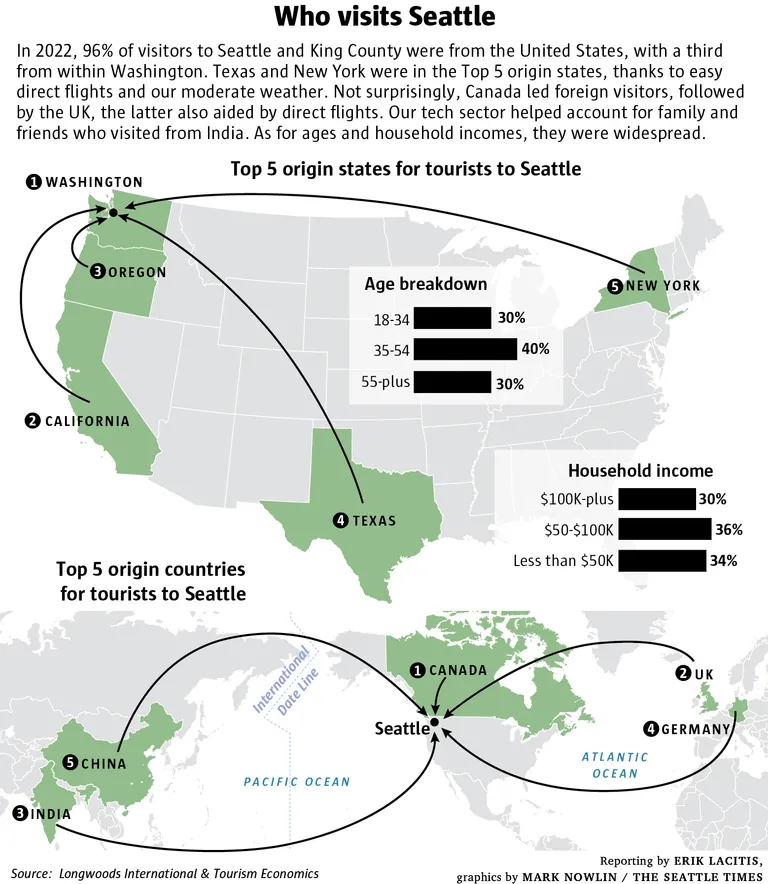
Seattle Times Infographic: 2022 Seattle and King County Visitor Origins and Demographics
A Seattle Times infographic (reported by Erik Lacitis, graphics by Mark Nowlin) showing that in 2022, 96% of Seattle and King County visitors came from the U.S., with top origin states being Washington, California, Oregon, Texas, and New York, and top foreign origin countries being Canada, UK, India, Germany, and China. The graphic also breaks down visitor age groups and household incomes, sourced from Longwoods International and Tourism Economics. -
 2021-03-29
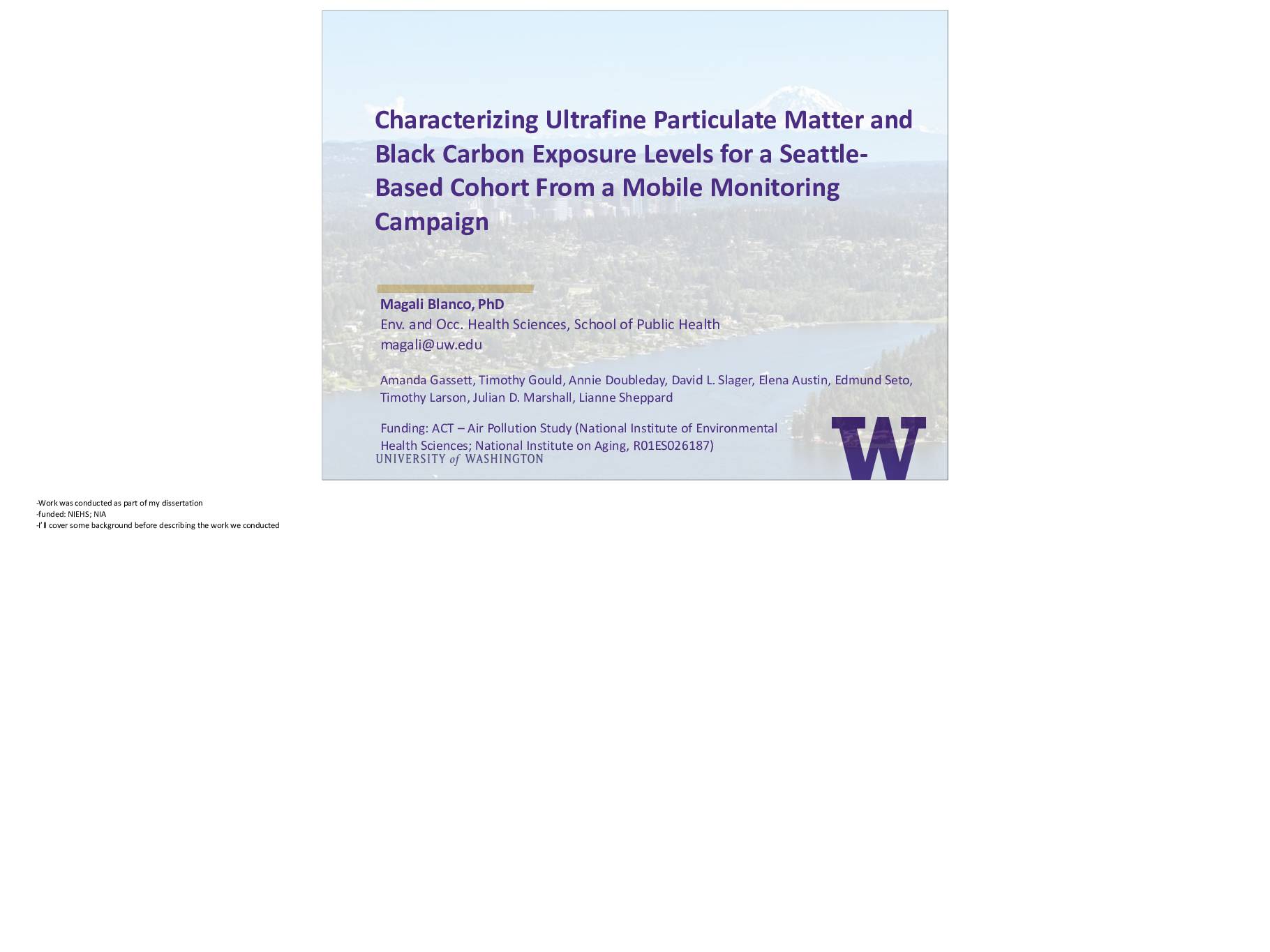
Characterizing Ultrafine Particulate Matter and Black Carbon Exposure Levels for a Seattle-Based Cohort From a Mobile Monitoring Campaign
This research presentation describes a mobile air monitoring study conducted in Seattle to measure ultrafine particulate matter and black carbon pollution levels for elderly residents participating in the Adult Changes in Thought (ACT) study, which investigates aging and dementia. Researchers used a vehicle-mounted monitoring system to collect repeated short-term air quality samples across the Seattle area, aiming to estimate long-term pollution exposure for cohort participants aged 65 and older. The study is funded by the National Institute of Environmental Health Sciences and the National Institute on Aging. -
 2017-04-07
Westside Seattle, Vol. 99, No. 14
The April 7, 2017 edition of Westside Seattle, a neighborhood weekly serving Ballard, Burien/Highline, SeaTac, Des Moines, West Seattle, and White Center, features a front-page illustrated cartoon highlighting community concerns about aircraft noise over North SeaTac Park, with an inside story on Port noise complaints. The issue also covers local retail news, including Whole Foods canceling its planned West Seattle store and Amazon Fresh opening in Ballard. -
 2008-03-01
2005 inventory of Seattle greenhouse gas emissions: Community & corporate
This 2005 report from the City of Seattle's Office of Sustainability and Environment measures greenhouse gas emissions across the Seattle community and city government operations. It uses two approaches: a geographic inventory tracking emissions within Seattle's boundaries, and a corporate inventory covering the city government's facilities and operations. The report was compiled by consultant Roel Hammerschlag and audited by Envirometrics, Inc., serving as a baseline reference for Seattle's climate planning efforts. -
 2005-06-01
Seattle Waterfront: An Illustrated History
Seattle Waterfront: An Illustrated History by Paul Dorpat (2005) is a detailed historical survey of Seattle's waterfront development, covering topics from early Native American settlements and pioneer-era railroad history to post-World War 2 urban planning proposals. The work traces the physical and cultural evolution of the waterfront through historical maps, photographs, and written accounts spanning from the 1840s through the modern era. Note: this document focuses on Seattle's waterfront history and does not contain content related to Sea-Tac Airport noise policy.