TagSeattle(36)
-
2001-06-22
Aerial View of Sea-Tac Airport and SR-99 Corridor Looking North
Aerial photograph looking northward toward Seattle-Tacoma International Airport (visible in the upper right background with runways and terminal facilities). The foreground shows the intersection of what appears to be SR-99 (Pacific Highway South) and local roads, with large surface parking lots, Interstate 5, and suburban commercial and residential development characteristic of the SeaTac/Tukwila area. -
2001-06-22
Aerial View of Sea-Tac Airport, Interstate 5, and Surrounding Communities
Aerial photograph looking northward toward Seattle-Tacoma International Airport (SEA-TAC), showing the airport terminal, control tower, runways, and aircraft gates on the right, with Interstate 5 interchange in the foreground and Puget Sound visible on the horizon. Residential neighborhoods, commercial properties, and parking areas in the cities of SeaTac or Des Moines are visible in the foreground, illustrating the airport's proximity to surrounding communities relevant to noise-impact planning. -
1997-09-12
EXH AR023208: Sediment Characterization Hamm Creek Restoration Project Duwamish Turning Basin
This 1997 report by Science Applications International Corporation characterizes sediment quality in the Duwamish Turning Basin near Seattle, Washington, as part of the Hamm Creek Restoration Project. It presents results from chemical testing, biological bioassays, and sediment sampling to evaluate contaminant levels and compare them against sediment management standards. The study was prepared for the U.S. Army Corps of Engineers, Seattle District. -
1994-01-01
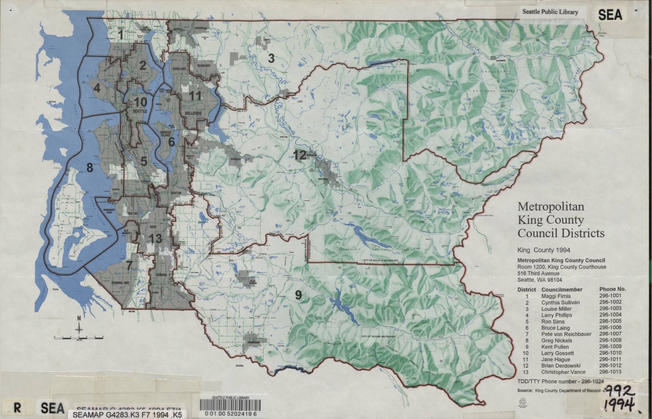
Metropolitan King County Council Districts Map, King County 1994
This 1994 map from the Seattle Public Library shows the Metropolitan King County Council Districts, dividing King County, Washington into 13 districts. It lists each district's elected councilmember and contact phone number, with the council headquartered at Room 1200, King County Courthouse, 516 Third Avenue, Seattle. While primarily a political boundary reference document, it provides geographic and governance context for the King County region surrounding Sea-Tac Airport. -
1981-01-01
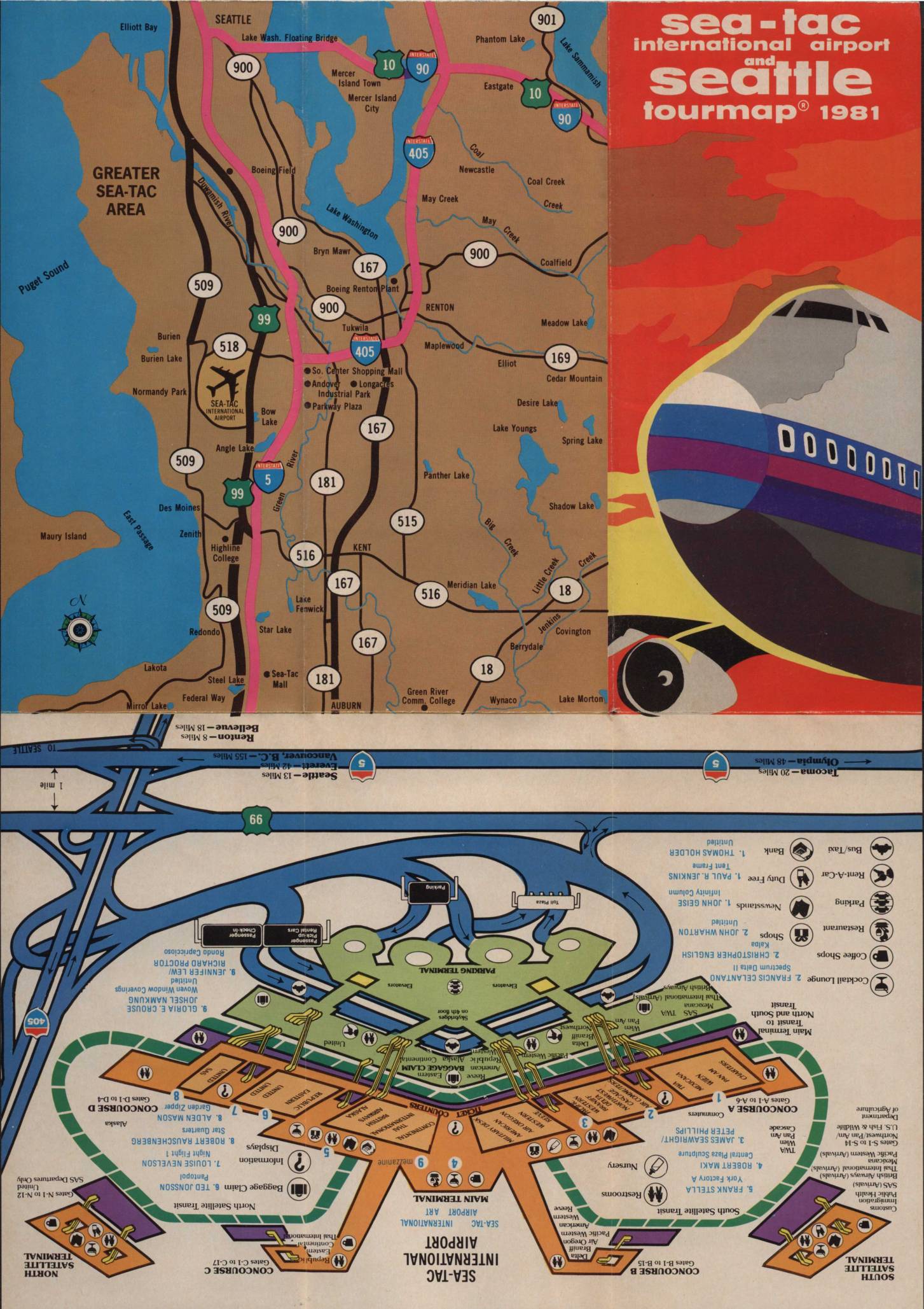
Sea-Tac International Airport and Seattle tourmap 1981
This 1981 Sea-Tac International Airport and Seattle Tourmap provides a comprehensive guide for air travelers, featuring detailed maps of the Greater Sea-Tac area, a terminal layout showing concourses, gates, and passenger services, and a visitor's map of downtown Seattle. The document includes practical airport information such as emergency phone numbers, baggage claim procedures, parking details, and descriptions of on-site amenities including restaurants, a satellite transit system, and chaplain services. While primarily a travel and navigation guide, it offers a snapshot of the airport's physical layout and operational environment during the early 1980s. -
1971-04-01
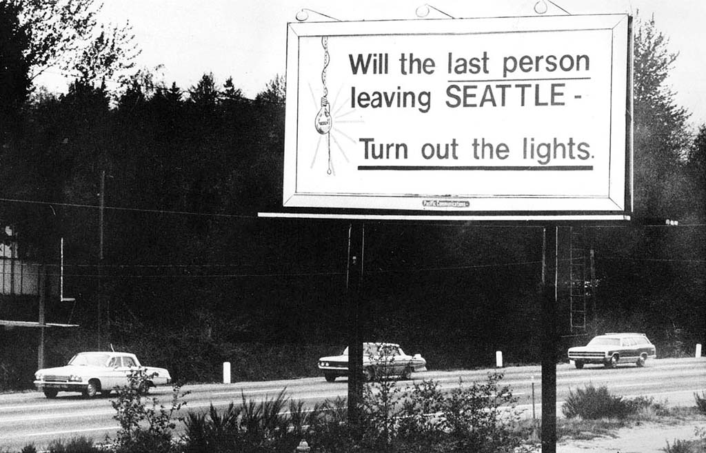
Will the Last Person Leaving Seattle Turn Out the Lights billboard, April 1971
A famous billboard along a Seattle-area highway reading 'Will the last person leaving SEATTLE – Turn out the lights,' erected during the Boeing Bust economic downturn of the early 1970s when massive layoffs caused a sharp population decline in the region. The black-and-white photograph shows vintage early-1970s automobiles passing beneath the sign, with a light bulb graphic hanging from the text.