TagPuget Sound(124)
-
 2014-06-01
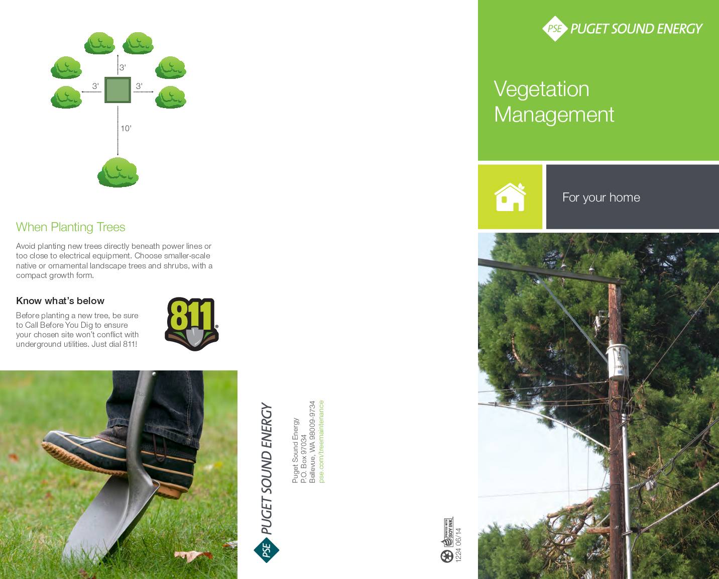
Vegetation management for your home
This Puget Sound Energy brochure explains the company's vegetation management program, which focuses on trimming or removing trees near power lines to prevent outages and maintain reliable electrical service across Washington state. It outlines methods such as selective tree removal and directional pruning, and advises homeowners to avoid planting large trees beneath power lines or near electrical equipment. Residents are encouraged to call 811 before digging and to choose smaller native or ornamental trees suitable for planting near utility infrastructure. -
 2013-12-31
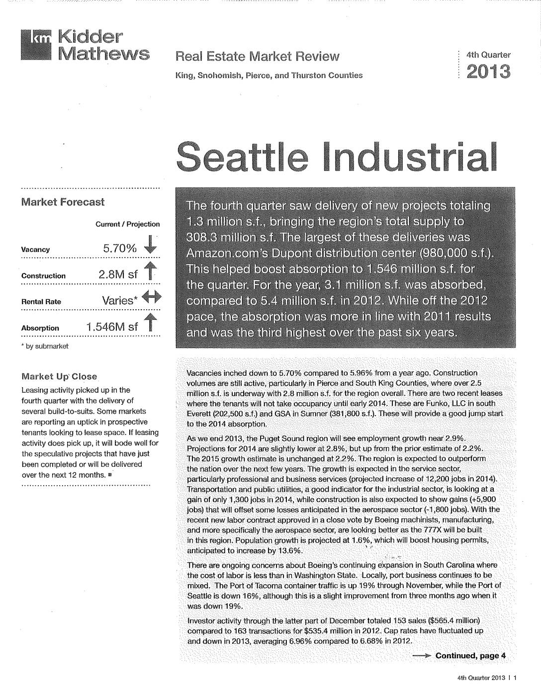
Seattle Industrial Real Estate Market Review: 4th Quarter 2013
This Kidder Mathews report reviews the Seattle-area industrial real estate market for the fourth quarter of 2013, covering King, Snohomish, Pierce, and Thurston Counties. It highlights a regional vacancy rate of 5.70%, 2.8 million square feet under construction, and 3.1 million square feet absorbed for the year, with major deliveries including Amazon.com's Dupont distribution center. The report also covers employment growth projections, port activity, and submarket-level leasing rates and sales data across the Puget Sound region. -
 2013-11-01
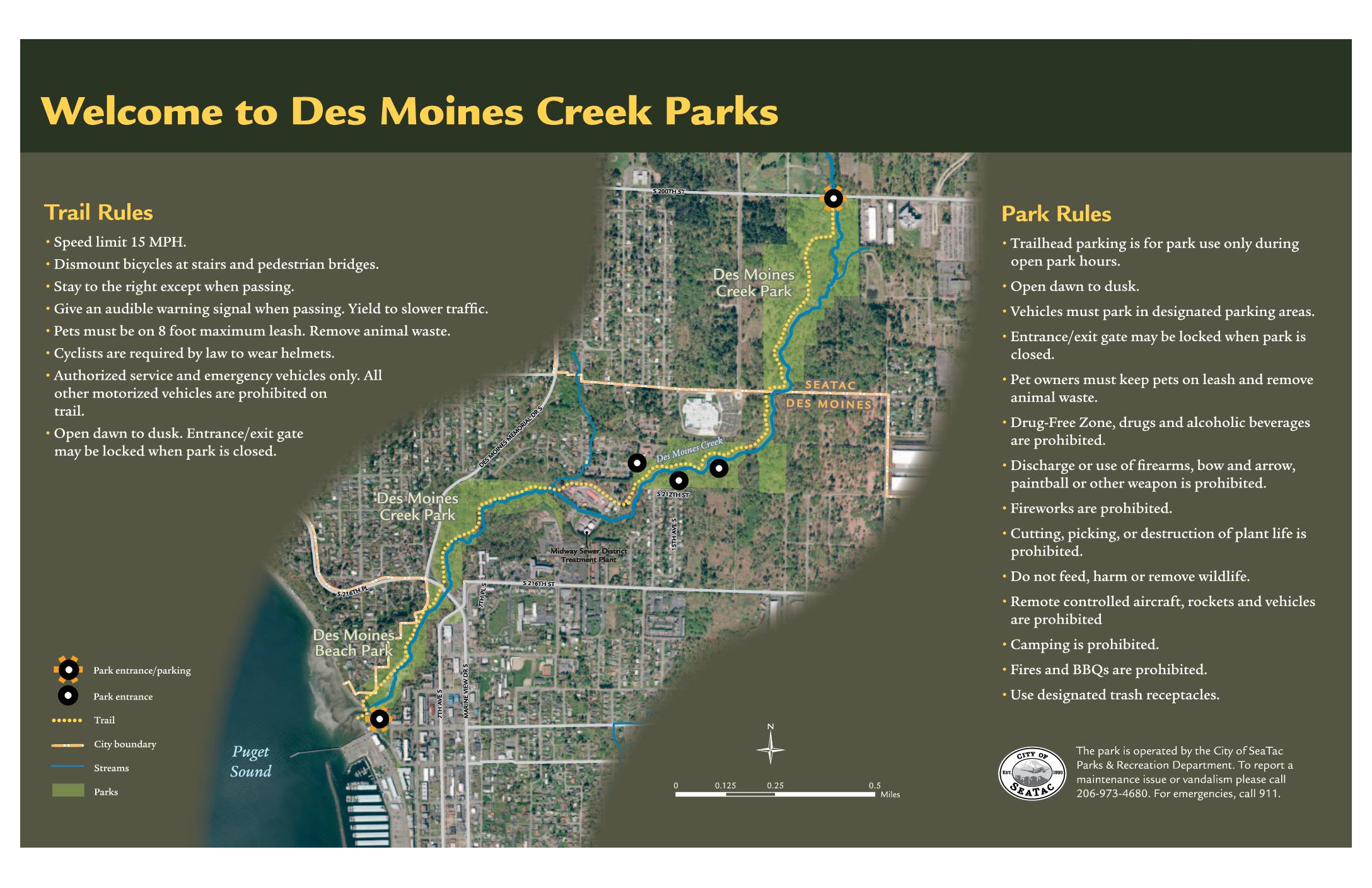
Welcome to Des Moines Creek Parks: Trail Rules, Park Rules, and Ecological Enhancements Map
Des Moines Creek Parks, located near Sea-Tac Airport in the cities of SeaTac and Des Moines, Washington, offers a multi-use trail system with a 15 MPH speed limit, helmet requirements for cyclists, and a dawn-to-dusk schedule. The park prohibits alcohol, firearms, camping, fires, and motorized vehicles, while requiring pets to remain on leash. A regional partnership between the Cities of SeaTac and Des Moines, Port of Seattle, King County, and the Washington State Department of Transportation has led to ecological restoration efforts along Des Moines Creek, including stormwater detention facilities, high-flow bypass pipes, fish passage improvements, and native plant restoration to support salmon and other wildlife. -
 2013-04-25
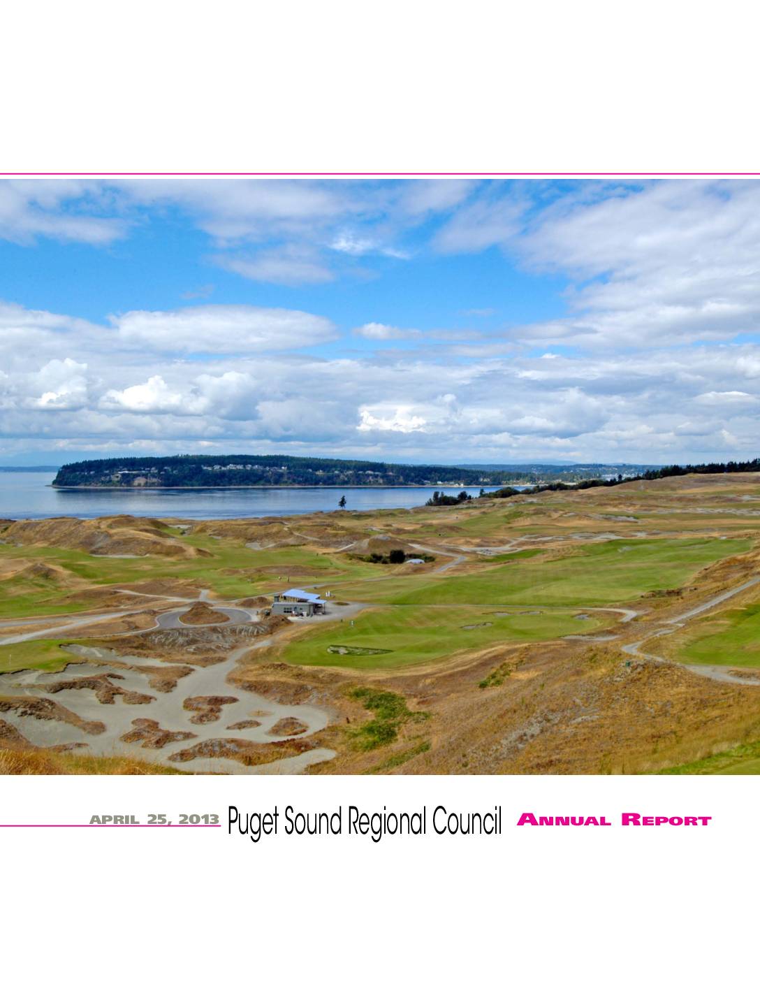
Puget Sound Regional Council Annual Report, April 25, 2013
This is the April 25, 2013 Annual Report of the Puget Sound Regional Council (PSRC), a regional planning organization serving the greater Seattle-Tacoma area. The report is funded by member jurisdictions and federal transportation agencies including the Federal Transit Administration and Federal Highway Administration. It covers regional planning activities and highlights local landmarks such as Chambers Bay Golf Course in University Place, Pierce County, which was announced as the host of the 2015 U.S. Open. -
 2012-06-07
Puget Sound Regional Council Annual Report 2011
This is the 2012 Annual Report of the Puget Sound Regional Council (PSRC), covering regional planning, transportation, and economic development priorities for the central Puget Sound area. It highlights partnerships supporting economic growth, the long-range VISION 2040 strategy, and efforts to coordinate transit and land use planning from Tacoma to Everett. The report does not contain specific content related to Sea-Tac Airport noise policy. -
 2012-05-23
North Flow and South Flow Noise Abatement Procedures: Sea-Tac Airport
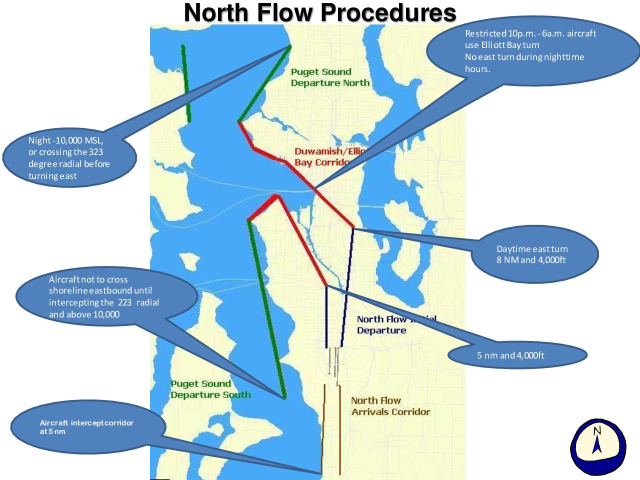
This document outlines flight procedures for Seattle-Tacoma International Airport (Sea-Tac) designed to reduce noise impacts on surrounding communities, covering both North Flow and South Flow operations. Key rules include restrictions on eastbound turns during nighttime hours (10 p.m.–6 a.m.), minimum altitude and distance requirements before turning, and designated corridors for arrivals and departures over Puget Sound and Elliott Bay. Compliance data from March 2012 shows that 89 out of 2,431 daytime South Flow eastbound arrivals turned south of the 520 Bridge early, violating the preferred procedure, with Alaska Airlines (ASA) and Southwest Airlines (SWA) accounting for the largest shares of non-compliant flights. -
 2012-01-01
A Case Study of Climate Change Impacts on Wetlands: Des Moines Creek Regional Detention Facility
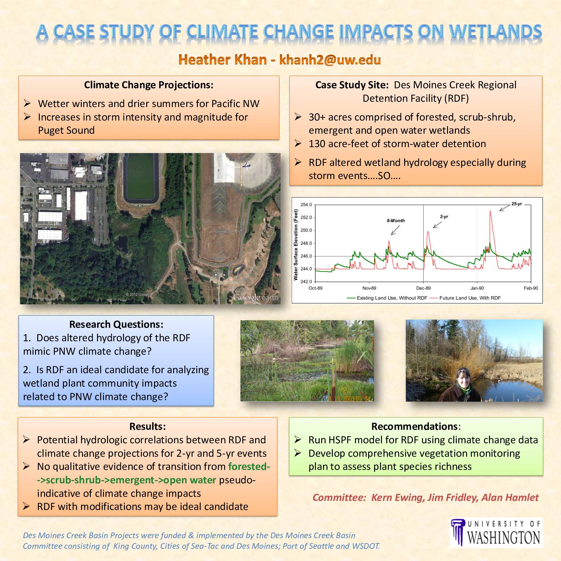
A University of Washington case study examines whether the Des Moines Creek Regional Detention Facility (RDF), a 30+ acre stormwater management site near Sea-Tac Airport, can serve as a model for understanding how projected Pacific Northwest climate changes—wetter winters, drier summers, and stronger storms—may affect local wetland ecosystems. Researchers found potential hydrologic similarities between the RDF's altered water patterns and regional climate change projections, though no clear vegetation shifts were observed. The study recommends further hydrologic modeling and a comprehensive plant monitoring program to better assess long-term wetland impacts. -
 2009-07-01
Washington Aviation System Plan: Chapter 1 — Study Overview
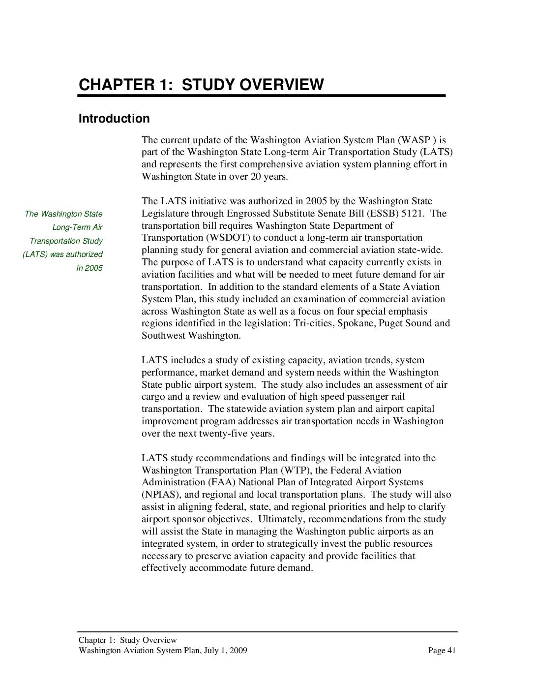
The Washington State Long-Term Air Transportation Study (LATS), authorized in 2005, is a comprehensive statewide aviation planning effort examining current airport capacity and future air transportation needs across Washington's 138 public-use airports, including Seattle-Tacoma International Airport. The study addresses key challenges such as population growth, limited funding, and land use conflicts over a 25-year planning horizon. Its findings are intended to guide long-term investment decisions and shape aviation policy at federal, state, and regional levels. -
 2009-07-01
Washington Aviation System Plan, Chapter 4: Regional Activity
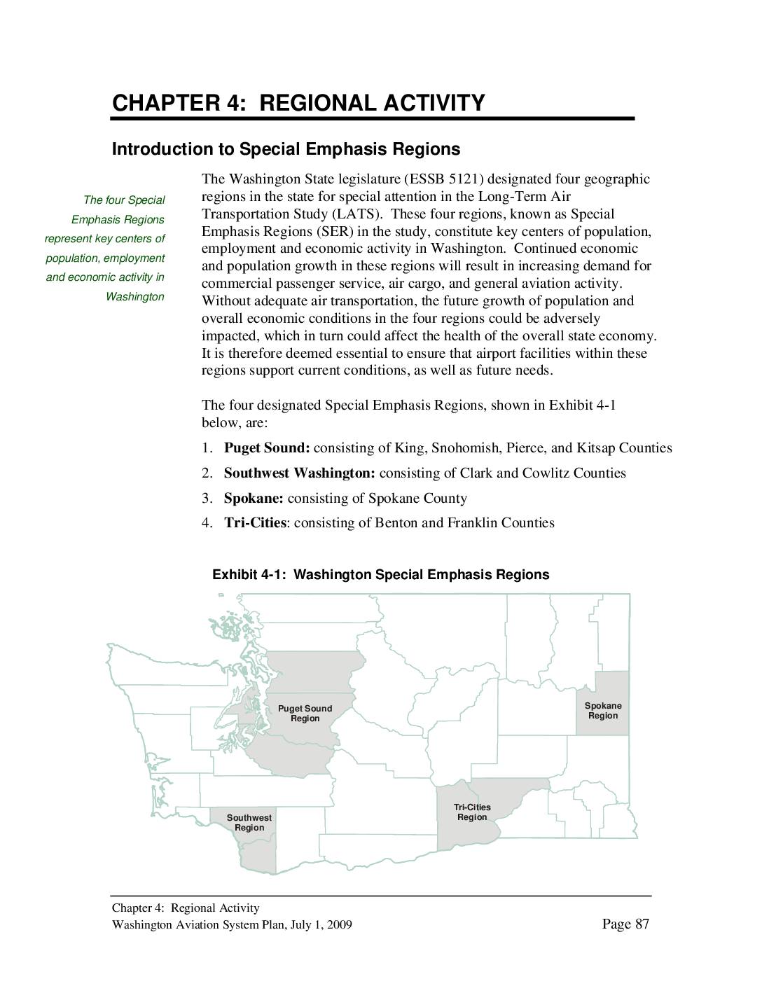
The Washington Aviation System Plan identifies four Special Emphasis Regions in the state, with the Puget Sound region — encompassing King, Snohomish, Pierce, and Kitsap Counties — standing out as the busiest aviation area. The region is home to Seattle-Tacoma International Airport, the state's primary commercial airport, along with 27 other public-use airports serving commercial, general aviation, and seaplane operations. As of 2005, the Puget Sound region housed approximately 55 percent of Washington's total population, driving significant demand for air service and making adequate airport capacity a key economic priority. -
 2007-09-10
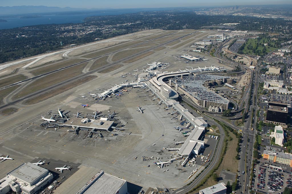
Aerials of Sea-Tac Airport, 10 September 2007.
Aerial photograph of Seattle-Tacoma International Airport (SEA/KSEA) showing the main terminal complex, satellite concourses, airfield runways, taxiways, and surrounding parking structures. Puget Sound and the Seattle skyline are visible in the background, confirming the geographic location in the south King County area.