TagMiller Creek(252)
-
 2025-11-21
Miller Creek Restoration Project Completed, Enhancing Contiguous Ecosystem and Community Access
$3.5 million interlocal partnership delivers critical salmon habitat and restores public access near Miller Creek Trail November 21, 2025 The Port of Seattle, the City of Burien, and the City of SeaTac celebrated the completion of a significant Miller Creek Restoration project on Thursday. The project replaced two critical fish passage barriers, created 450 feet -
2025-11-21
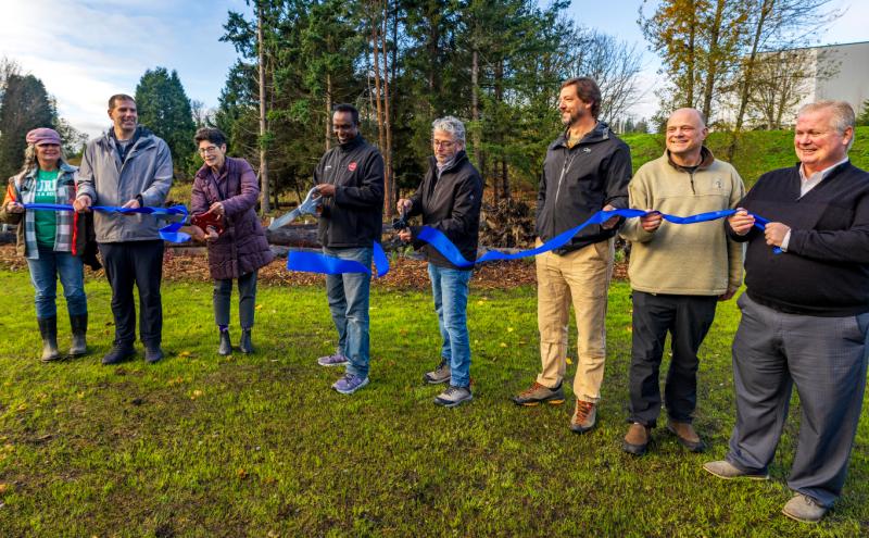
Miller Creek Ribbon-Cutting Ceremony, November 20, 2025
Ribbon-cutting ceremony holding a blue ribbon outdoors near a wooded area, marking the completion or dedication of a Miller Creek-related project. Burien Mayor Sarah Moore, SeaTac Mayor Mohamed Egal, Fred Felleman, Port of Seattle Chipper Maney. https://seatacnoise.info/miller-creek-culvert-replacement-fish-passage-and-stream-restoration/ -
 2025-11-20
Miller Creek Restoration Project Flight Corridor Safety Project Logs
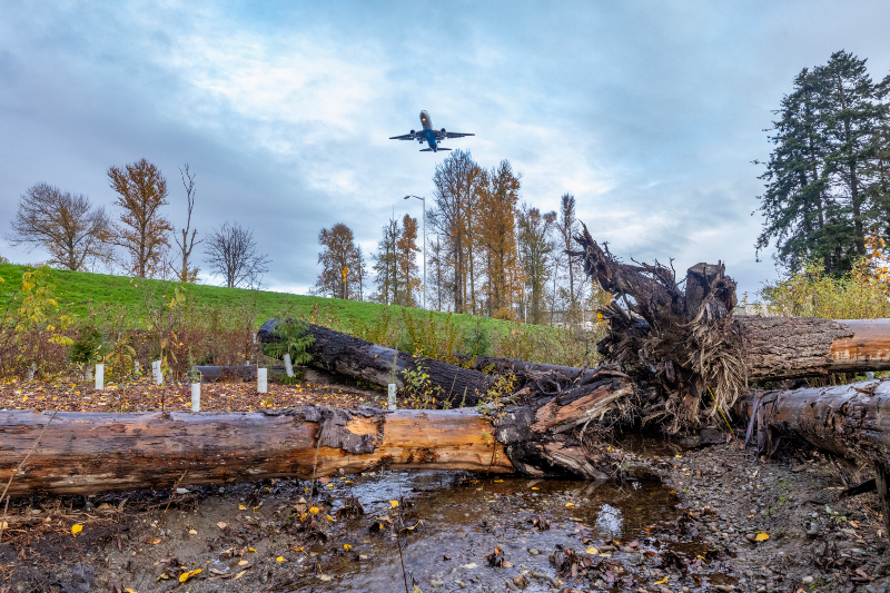
A commercial jet aircraft is captured on low final approach over a naturalized area featuring fallen logs, a small stream, young planted vegetation with protective tubes, and autumn deciduous trees. The green berm and tall conifers in the background are consistent with airport-adjacent mitigation or habitat restoration landscaping. -
 2024-08-15
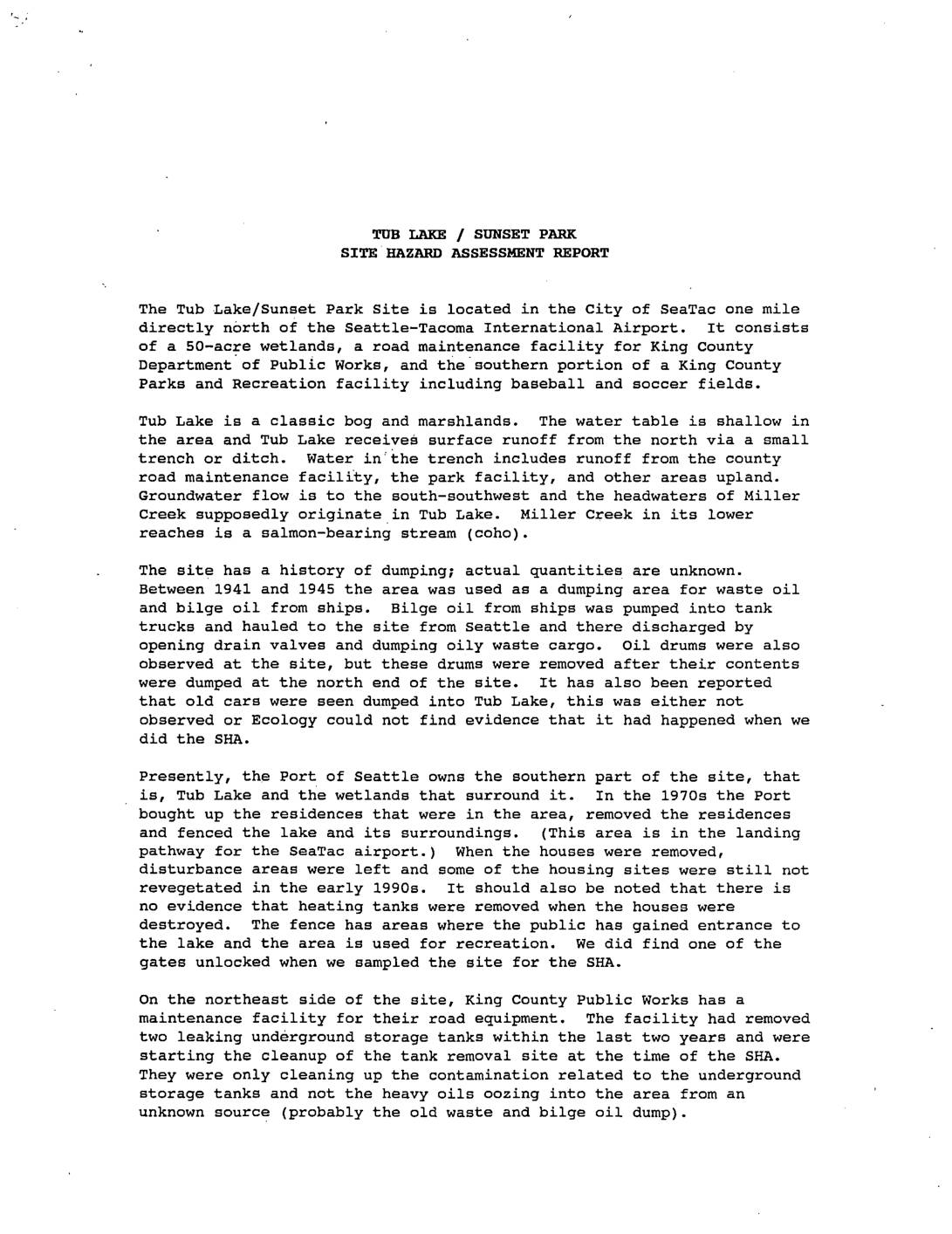
Tub Lake / Sunset Park site hazard assessment report
The Tub Lake/Sunset Park site in SeaTac, located one mile north of Seattle-Tacoma International Airport, was contaminated by decades of illegal dumping of waste oil and bilge oil from ships between 1941 and 1945, as well as leaking underground storage tanks at a King County road maintenance facility. Environmental sampling conducted in 1990 detected petroleum hydrocarbons, benzene, and other chemicals exceeding cleanup standards in soil, sediment, and water, with contamination estimated to cover 2-3 acres up to 12 feet deep beneath nearby playing fields. The Port of Seattle, which owns the southern wetlands portion of the site including Tub Lake, fenced the area in the 1970s after demolishing residences in the airport's landing pathway, though public access and ongoing contamination remained concerns at the time of the assessment. -
 2024-02-01
Seattle-Tacoma International Airport SAMP Near Term Projects: Wetlands and Streams Report — Appendix A Background Information
This February 2024 technical report from the Port of Seattle documents the wetlands and streams located at and around Seattle-Tacoma International Airport as part of the Sustainable Airport Master Plan (SAMP). It includes mapped locations of wetlands surveyed across multiple years (2006, 2014, and 2017) along with stream corridors such as Miller Creek, Des Moines Creek, and Walker Creek. Field hydrology monitoring data from 2020 is also provided, recording groundwater depth and soil saturation measurements to assess wetland conditions across the airport property. -
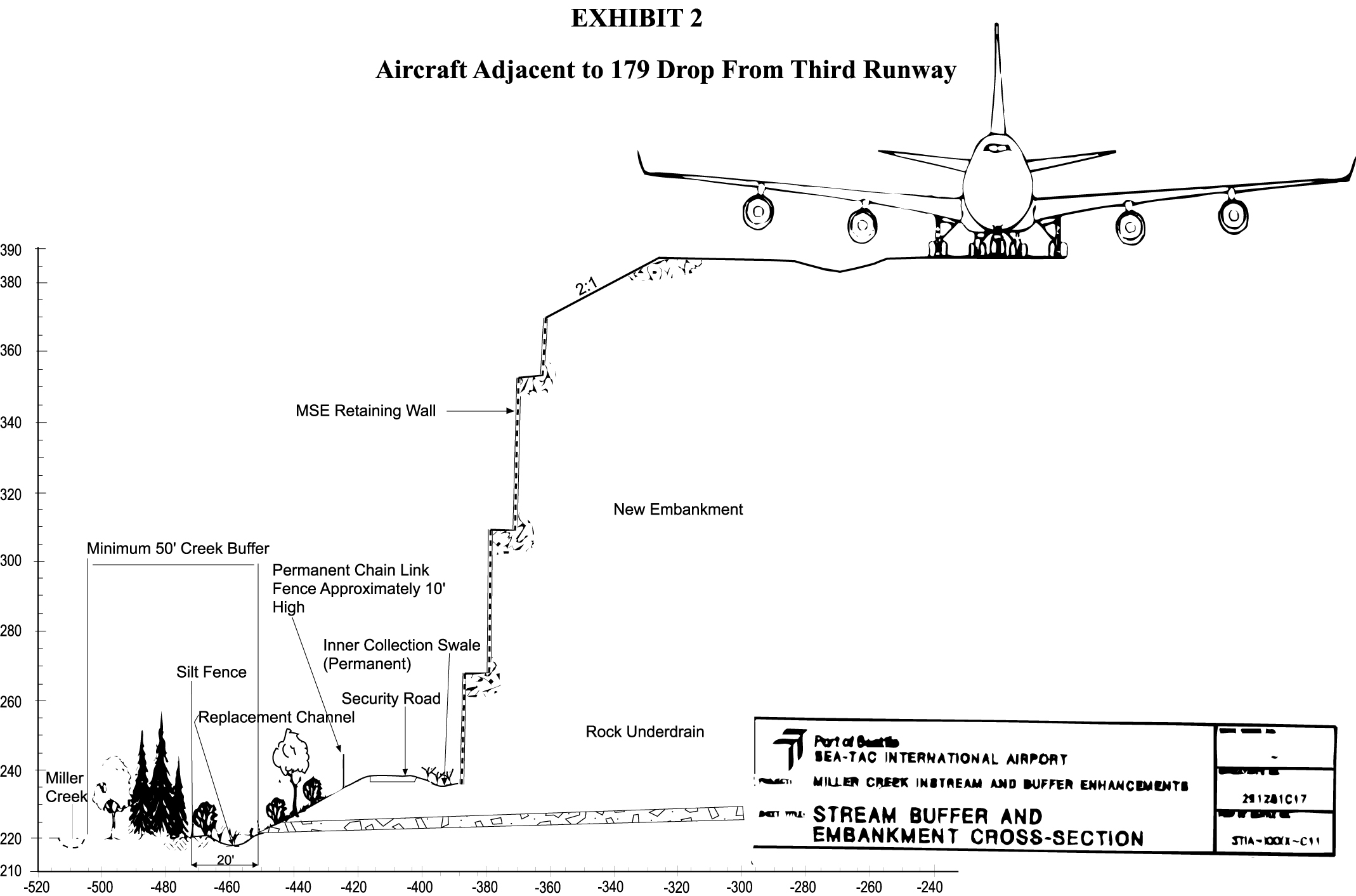
MSE wall cross-section, Miller Creek buffer — Third Runway embankment
Engineering cross-section drawing labeled 'Exhibit 2: Aircraft Adjacent to 179 Drop From Third Runway,' produced by the Port of Seattle / Sea-Tac International Airport for the Miller Creek Instream and Buffer Enhancements project. The drawing (sheet 291Z81C17, detail S11A-XXXI-C11) shows the embankment profile with an MSE retaining wall, replacement channel, silt fence, security road, rock underdrain, and a minimum 50-foot creek buffer for Miller Creek, with elevation and horizontal scales and a wide-body aircraft silhouette for scale reference. -
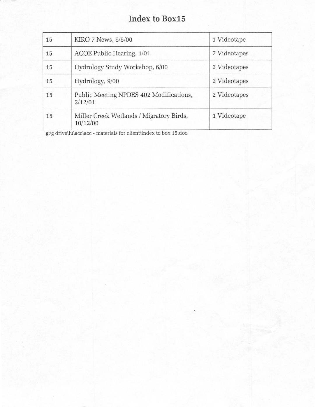
Index to Box15
Box 15 is an archival collection of videotapes documenting environmental and regulatory proceedings related to the Sea-Tac Airport area, recorded between 2000 and 2001. The collection includes footage of a KIRO 7 news segment, an Army Corps of Engineers public hearing, hydrology study workshops, and a public meeting on NPDES 402 stormwater permit modifications. Also included is a videotape focused on Miller Creek Wetlands and migratory birds, totaling 15 videotapes across six subject categories. -
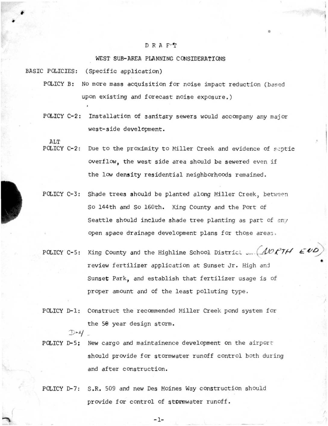 2022-11-29
West sub-area planning considerations
This draft planning document outlines west sub-area policies near Sea-Tac Airport, addressing noise impact reduction, environmental concerns, and land use transitions. Key provisions include halting mass property acquisition for noise mitigation, installing sanitary sewers near Miller Creek, controlling stormwater runoff from new airport development, and planting shade trees along local waterways. The document also proposes orderly conversion of single-family residential areas to higher-intensity uses, coordinated with the construction of S.R. 509 as a western boundary for redevelopment. -
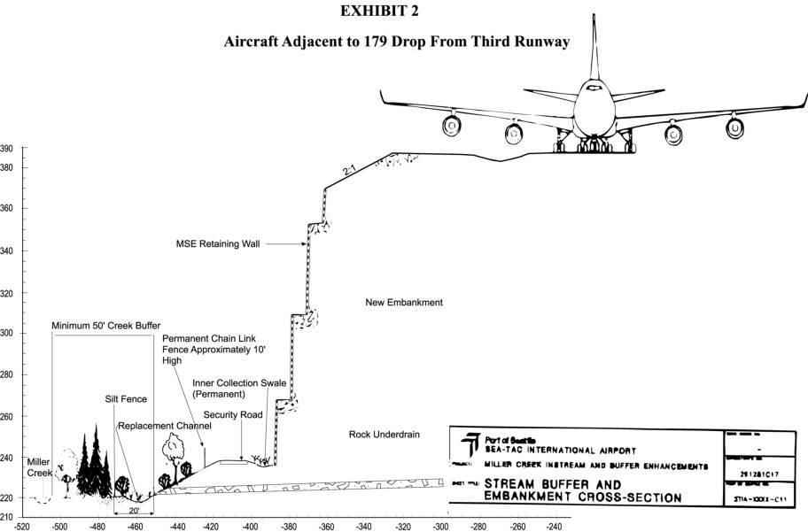 2022-09-12
Aircraft adjacent to 179 drop from third runway
This engineering cross-section diagram from Sea-Tac International Airport illustrates the dramatic 179-foot elevation drop adjacent to the proposed Third Runway, showing how a massive retaining wall and new embankment would be constructed alongside Miller Creek. The exhibit depicts key infrastructure features including a permanent chain-link security fence, rock underdrain, silt fence, inner collection swale, and a minimum 50-foot creek buffer zone designed to protect the existing waterway. The drawing is part of the Miller Creek Instream and Buffer Enhancements project documentation associated with the Third Runway expansion. -
 2022-09-12
Discharge Monitoring Reports (DMR’s) and water pollution historical documents
This archive documents a long history of water pollution discharged from Seattle-Tacoma (Sea-Tac) Airport into nearby waterways, dating back to 1948. It includes Discharge Monitoring Reports filed by the Port of Seattle showing high concentrations of glycol and other chemicals flowing into local stormwater systems and ultimately Puget Sound, as well as historical letters from the 1950s describing fish kills in Miller Creek and Des Moines Creek caused by airport runoff. The records reveal decades of regulatory correspondence between the Port of Seattle and Washington State pollution authorities over inadequate waste disposal practices.