TagMap(375)
-
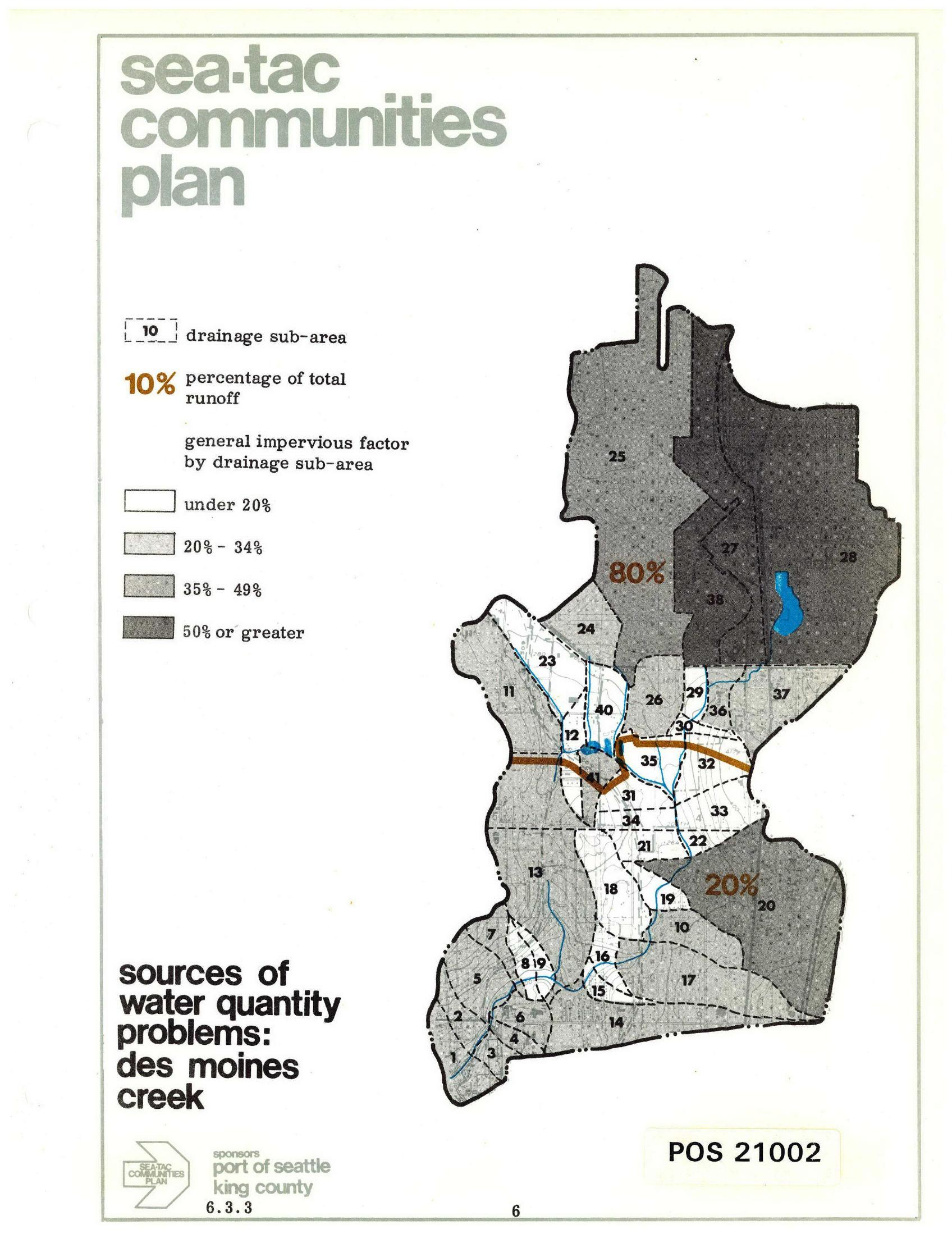
Sea-Tac Communities Plan: Des Moines Creek Drainage Sub-Areas and Runoff Sources
A planning map from the Sea-Tac Communities Plan (document POS 21002, section 6.3.3) showing drainage sub-areas for Des Moines Creek, with impervious surface factors ranging from under 20% to 50% or greater, and annotating that 80% of total runoff originates from the northern sub-areas and 20% from the southern sub-areas. Sponsored by the Port of Seattle and King County. -
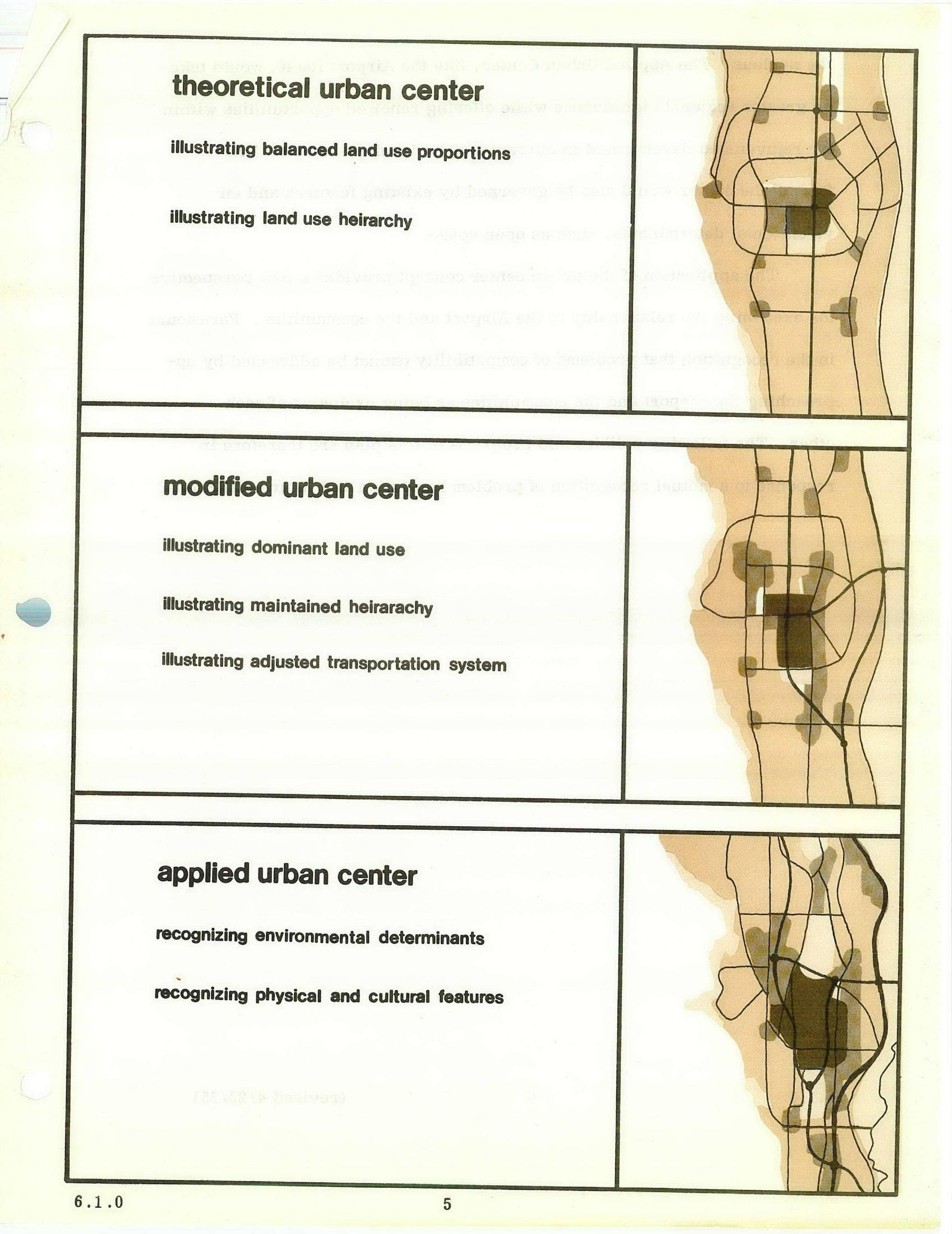
STCP Chapter 6 Urban Center Diagrams: Theoretical, Modified, and Applied Models
A planning document page comparing three urban center models — theoretical, modified, and applied — each with accompanying schematic maps illustrating land use proportions, hierarchy, transportation systems, and environmental determinants. The diagrams appear to be from an urban planning study, possibly related to land use and transportation analysis near an airport or metropolitan area, numbered page 5 under section 6.1.0. -
 2026-07-04
SAMP NTP: 31 projects by the numbers
It’s all about construction permits The Sustainable Airport Master Plan Near Term Projects Draft Environmental Impact Statement is a description of the effects of the largest expansion in airport history. But at bottom, it consists of thirty-one construction projects. What we find striking is the absence of detail on most of those projects. In most -
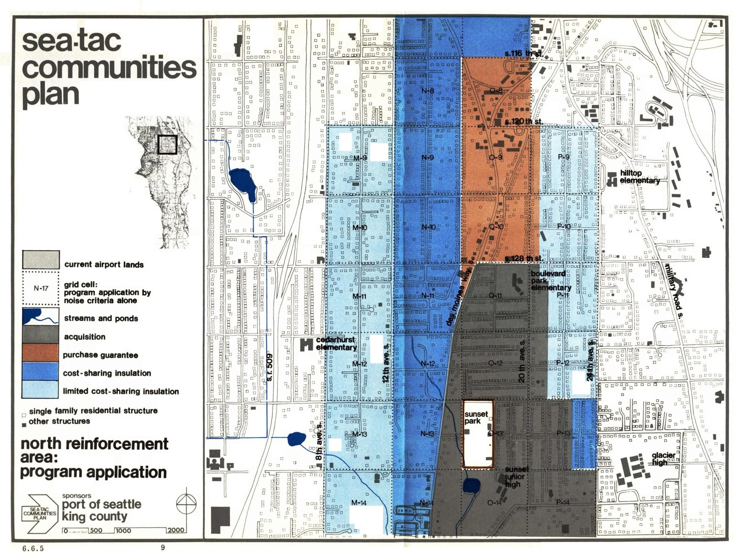
Sea-Tac Communities Plan: North Reinforcement Area Program Application
This planning map, document number 6.6.5, is from the Sea-Tac Communities Plan sponsored by the Port of Seattle and King County. It depicts the North Reinforcement Area program application, showing grid-cell zones color-coded by noise mitigation category—including acquisition, purchase guarantee, cost-sharing insulation, and limited cost-sharing insulation—for the residential area surrounding Seattle-Tacoma International Airport, with landmarks such as Cedarhurst Elementary, Boulevard Park Elementary, Hilltop Elementary, Glacier High, and Sunset Junior High visible. -
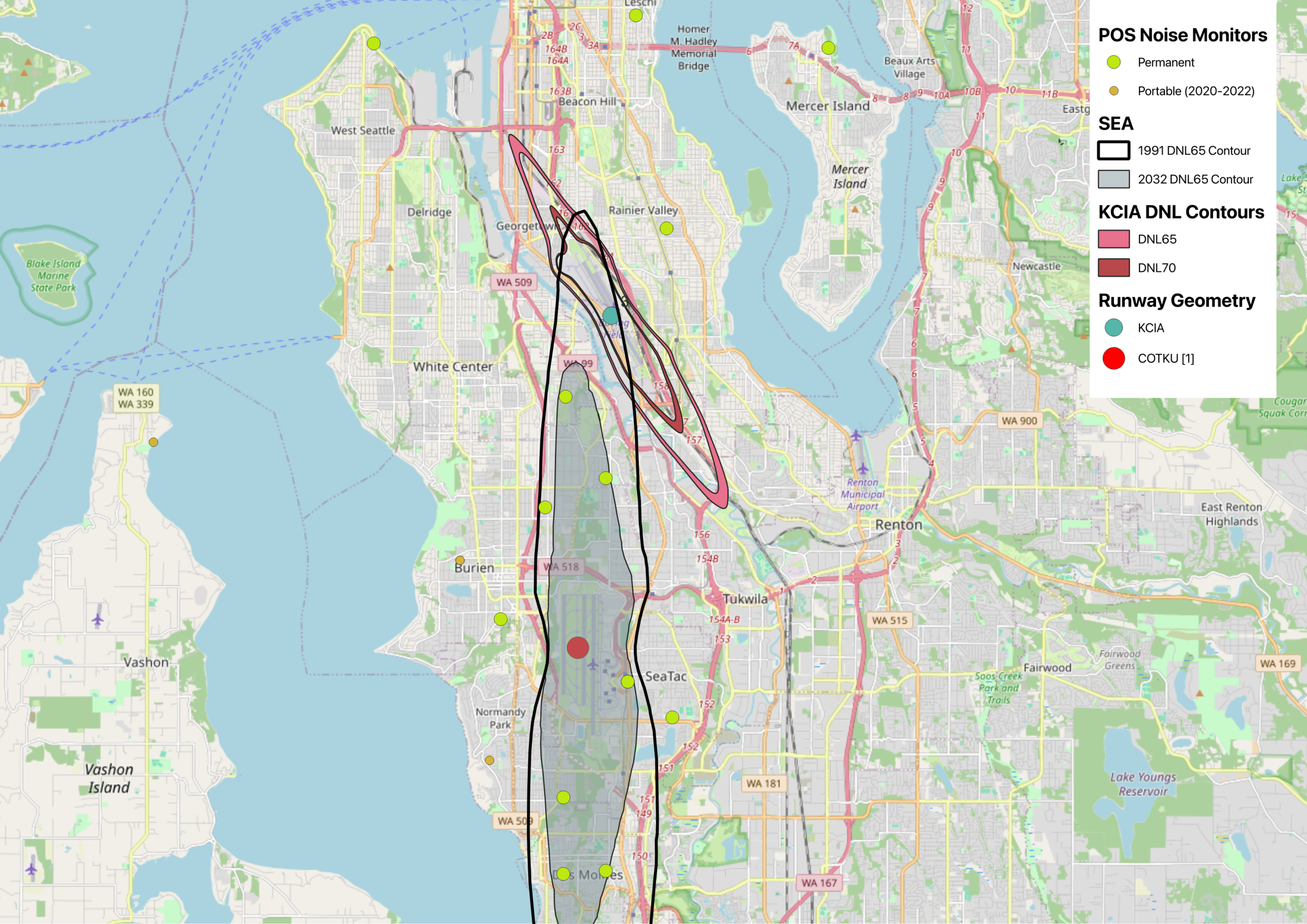
Map of Sea-Tac and KCIA DNL contours with Port of Seattle Noise Monitors
This map displays noise exposure contours for Seattle-Tacoma International Airport (SEA) comparing the 1991 and 2032 DNL65 projections, alongside KCIA DNL65 and DNL70 contours near Georgetown/South Seattle. It also shows POS (Port of Seattle) permanent and portable noise monitor locations (2020–2022) across the South Seattle, Burien, SeaTac, Tukwila, and Renton areas, with runway geometry markers for KCIA and COTKU [1]. -
 2026-04-23
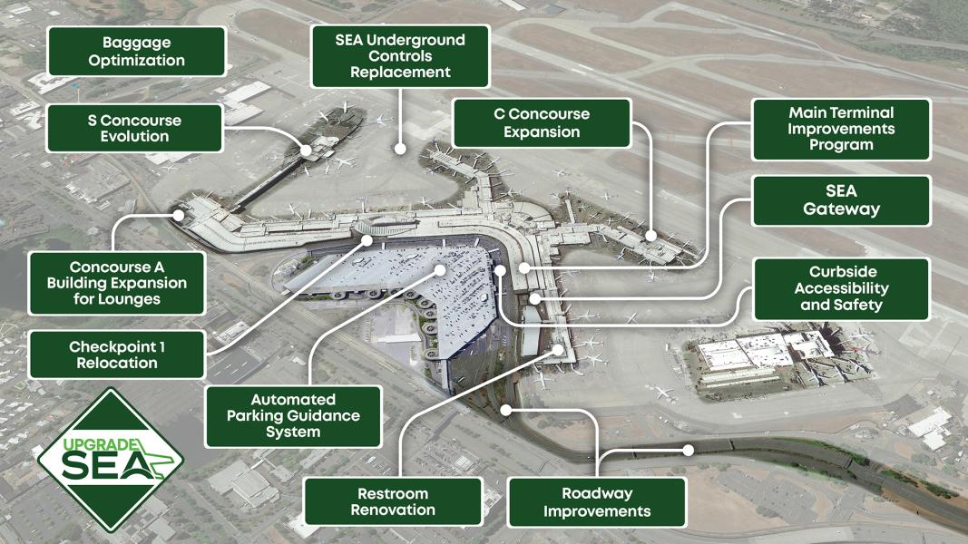
Upgrade SEA Airport Improvement Map
An aerial overview of Seattle-Tacoma International Airport annotated with labeled capital improvement projects under the 'Upgrade SEA' program, including C Concourse Expansion, S Concourse Evolution, Concourse A Building Expansion for Lounges, SEA Gateway, Main Terminal Improvements Program, Baggage Optimization, Checkpoint 1 Relocation, Automated Parking Guidance System, Restroom Renovation, Roadway Improvements, Curbside Accessibility and Safety, and SEA Underground Controls Replacement. The Upgrade SEA diamond logo is visible in the lower left corner. -
Everything you ever wanted to know about Flight Paths
You can think of any major airport as the most extravagant short-term parking lot imaginable, with an equally extravagant quickie-mart. Both are connected to a 1super-highway. But instead of one on and off ramp, there are many known as Standard Instrument Departures (SIDs) and Standard Terminal Arrival Routes (STARs). SIDs are the flight procedures that -
 2026-02-19
When Federal environmental maps go dark
The benefits and consequences for airport communities In January 2025, the Trump administration began removing content from federal websites following Executive Order 14151. The order directed all government agencies to terminate DEI and environmental justice–related programs. These include environmental justice and climate mapping using a nationally consistent dataset for evaluating the socioeconomic impacts of airports. -
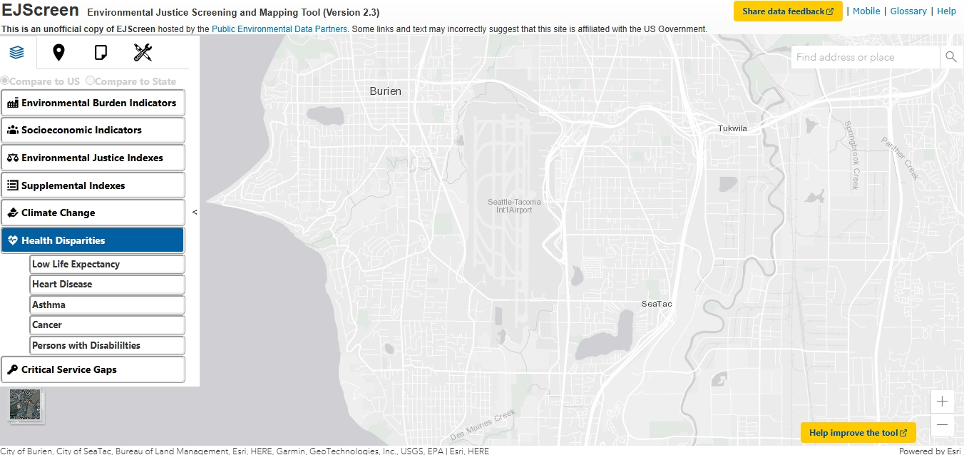
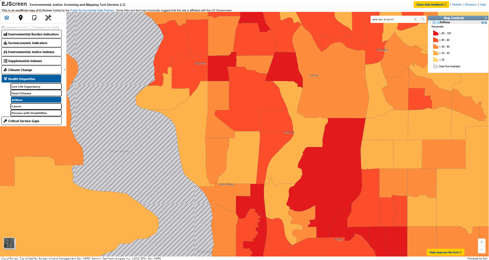
EJScreen Environmental Justice Screening and Mapping Tool (Version 2.3)
This is an 1unofficial copy of EJScreen hosted by the Public Environmental Data Partners. Some links and text may incorrectly suggest that this site is affiliated with the US Government. The EJScreen Tool was an EPA web application taken down in January of 2025 as part of Executive Order 14151. It was described as “an -
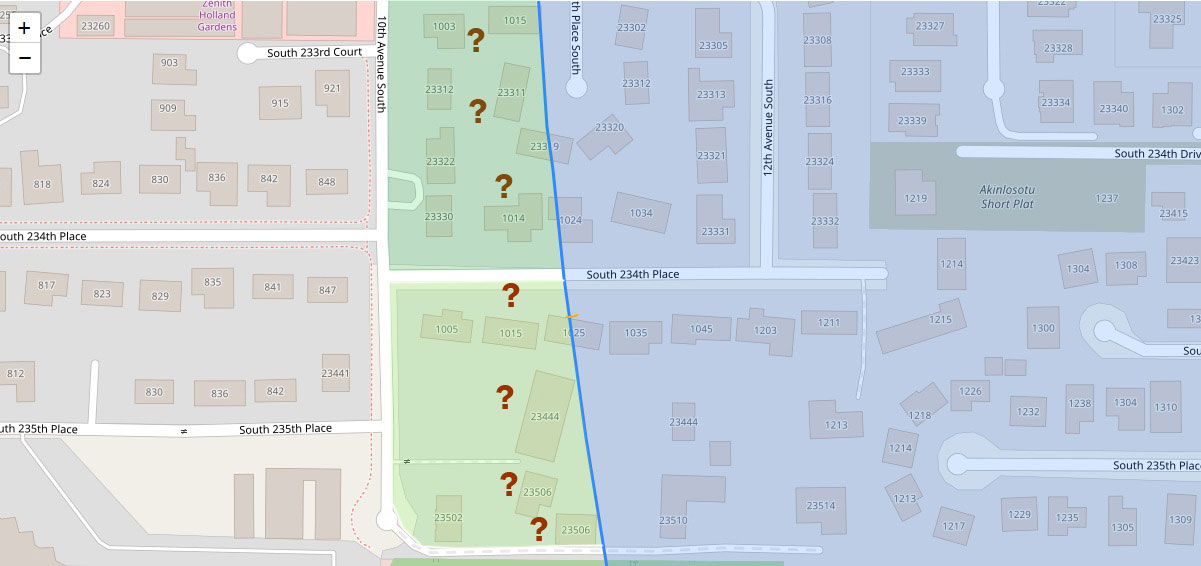
GIS Parcel Map — Akinlosotu Short Plat Area Near 10th and 12th Avenue South, Sea-Tac Airport Noise Review
A GIS map showing residential parcels in the Sea-Tac Airport vicinity, centered on 10th and 12th Avenue South between South 233rd Court and South 235th Place. Green-shaded zones with question mark markers appear to indicate properties under noise impact review or acquisition consideration, bisected by a blue diagonal line likely representing a noise contour or jurisdictional boundary; street addresses and the 'Akinlosotu Short Plat' label are visible.