TagMap(375)
-
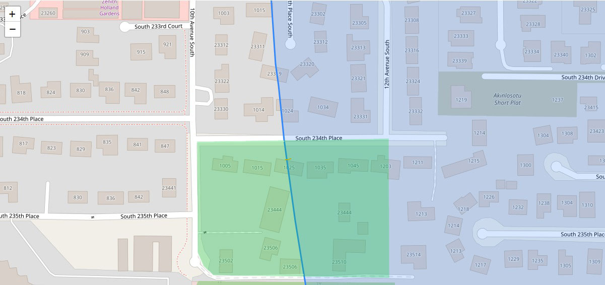
GIS Parcel Map with Noise Contour Boundary Near South 234th Place, Sea-Tac/Des Moines Area
A GIS map showing residential parcels near South 234th Place in the SeaTac/Des Moines area, with a blue diagonal line indicating a noise contour or flight path boundary related to Sea-Tac Airport. Street addresses and parcel numbers are visible, including properties along 10th Avenue South, 12th Avenue South, and South 234th–235th Places, with overlapping green and blue shaded zones likely representing different noise exposure levels. The 'Akinlosotu Short Plat' subdivision is labeled in the upper right area. -
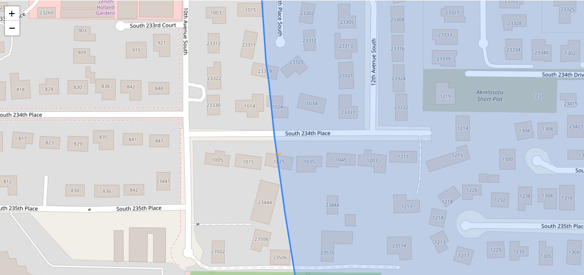
End of Block example from 2032 Part 150
A GIS map showing residential parcels in the South 234th Place corridor near 10th and 12th Avenue South in Des Moines/SeaTac, Washington, with a blue diagonal line indicating a noise contour or flight path boundary overlaid on the street grid. The shaded (blue) zone to the right of the line likely represents an airport noise impact area associated with Seattle-Tacoma International Airport policy mapping. -
 2025-10-28
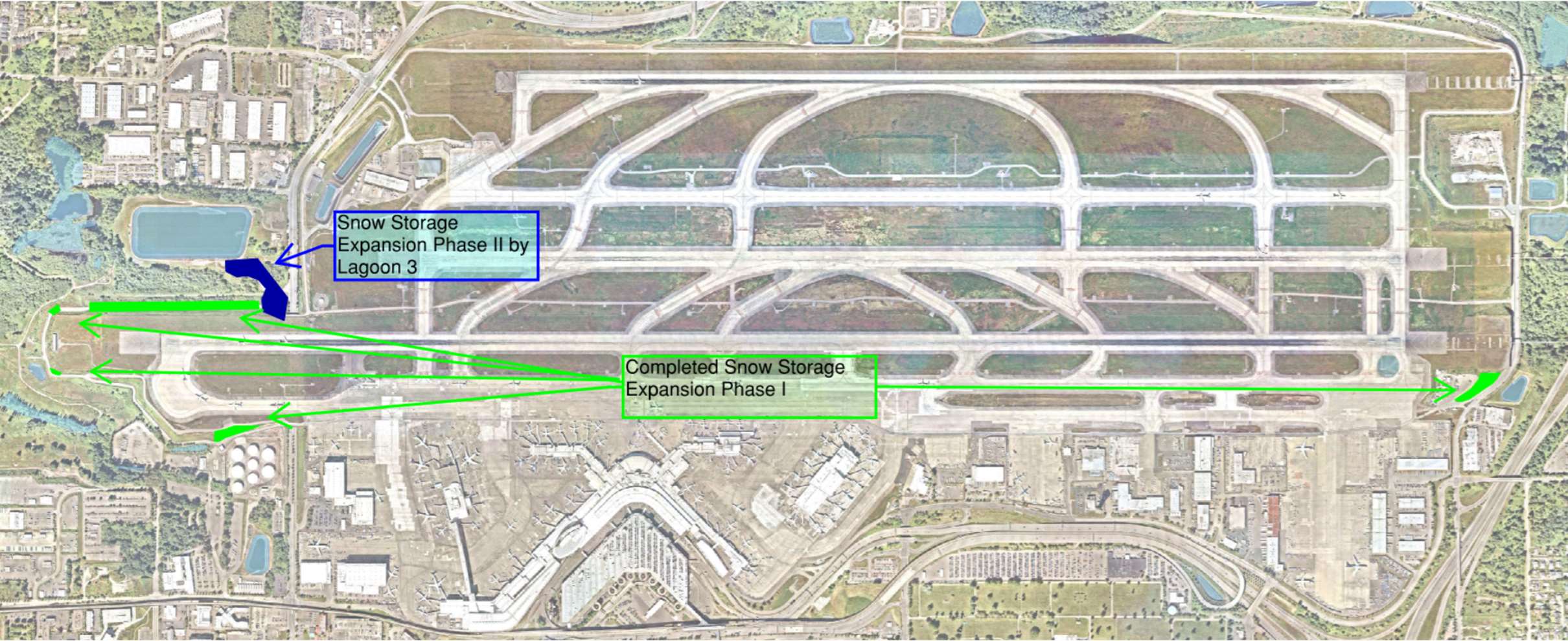
Sea-Tac Airport Airport Snow Storage Expansion Diagram
★Aerial satellite map of showing two annotated snow storage areas: 'Completed Snow Storage Expansion Phase I' along the south airfield and 'Snow Storage Expansion Phase II by Lagoon 3' on the west side, with green arrows indicating access routes between locations. -
 2025-09-30
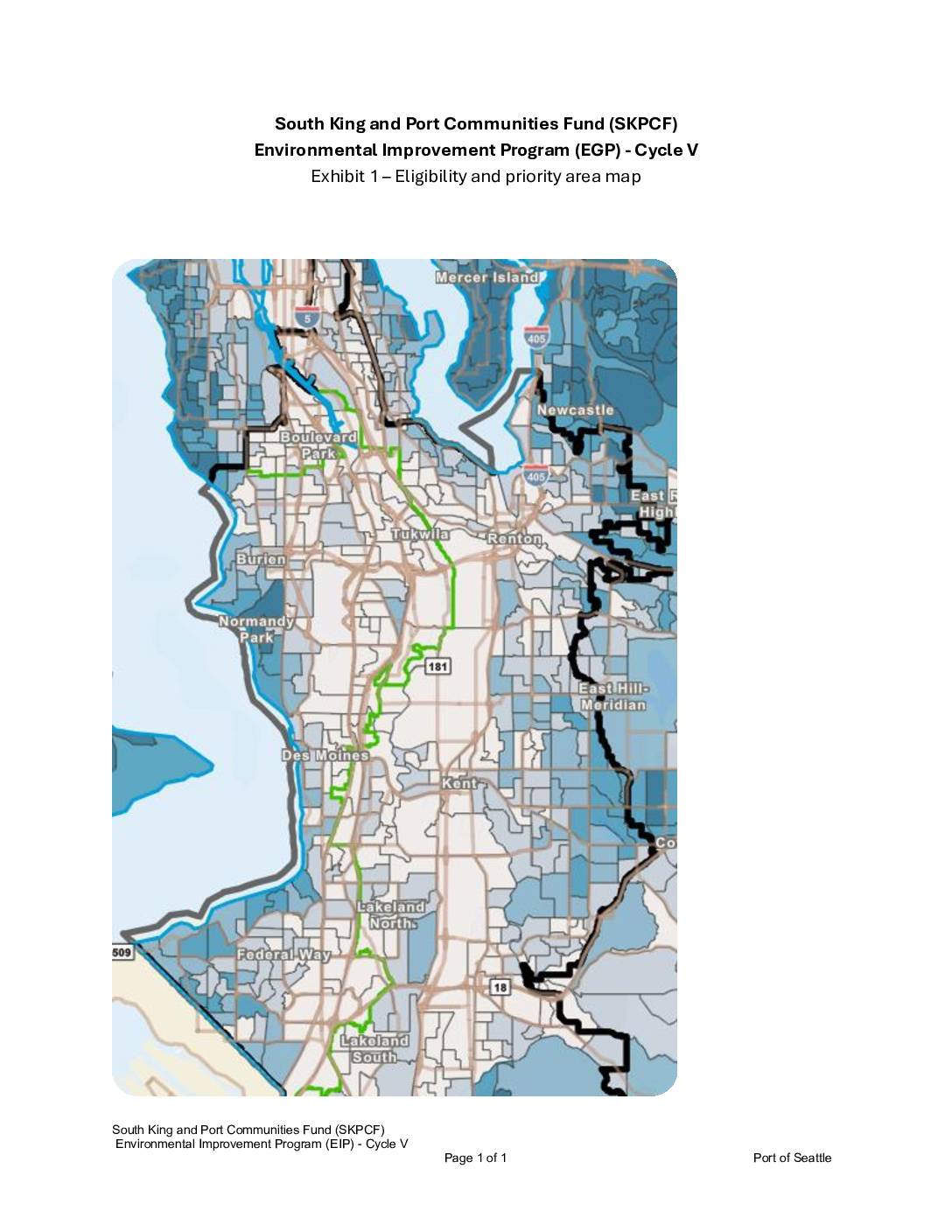
South King and Port Communities Fund (SKPCF) Environmental Improvement Program (EGP) – Cycle V: Exhibit 1 – Eligibility and Priority Area Map
This document presents the eligibility and priority area map for Cycle V of the South King and Port Communities Fund (SKPCF) Environmental Improvement Program (EGP), administered by the Port of Seattle. The map outlines the geographic boundaries of communities in South King County — including areas such as Burien, Tukwila, Renton, Des Moines, Kent, and Federal Way — that are eligible for environmental improvement funding, likely related to noise and pollution impacts from Sea-Tac Airport and port operations. Priority zones are visually highlighted to help direct resources toward the most affected neighborhoods within the program's service area. -
Port Properties and Trees mapped
Properties, trees and the environment around the airport As the icon indicates, this is a beta project, one of a series of visual representations on community impacts. This indicates Port-owned properties around the airport, most purchased with FAA grants. It also displays the status of trees that are subject to removal and/or replacement via the -
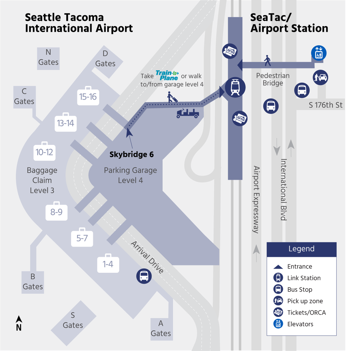
Sound Transit Airport Station Map
Official transit access map for Seattle-Tacoma International Airport showing the SeaTac/Airport Station connection via Skybridge 6 at Parking Garage Level 4. The map depicts the pedestrian route along S 176th Street and International Blvd, with marked locations for Link Station, bus stops, pick-up zones, ORCA ticket machines, and elevators. -
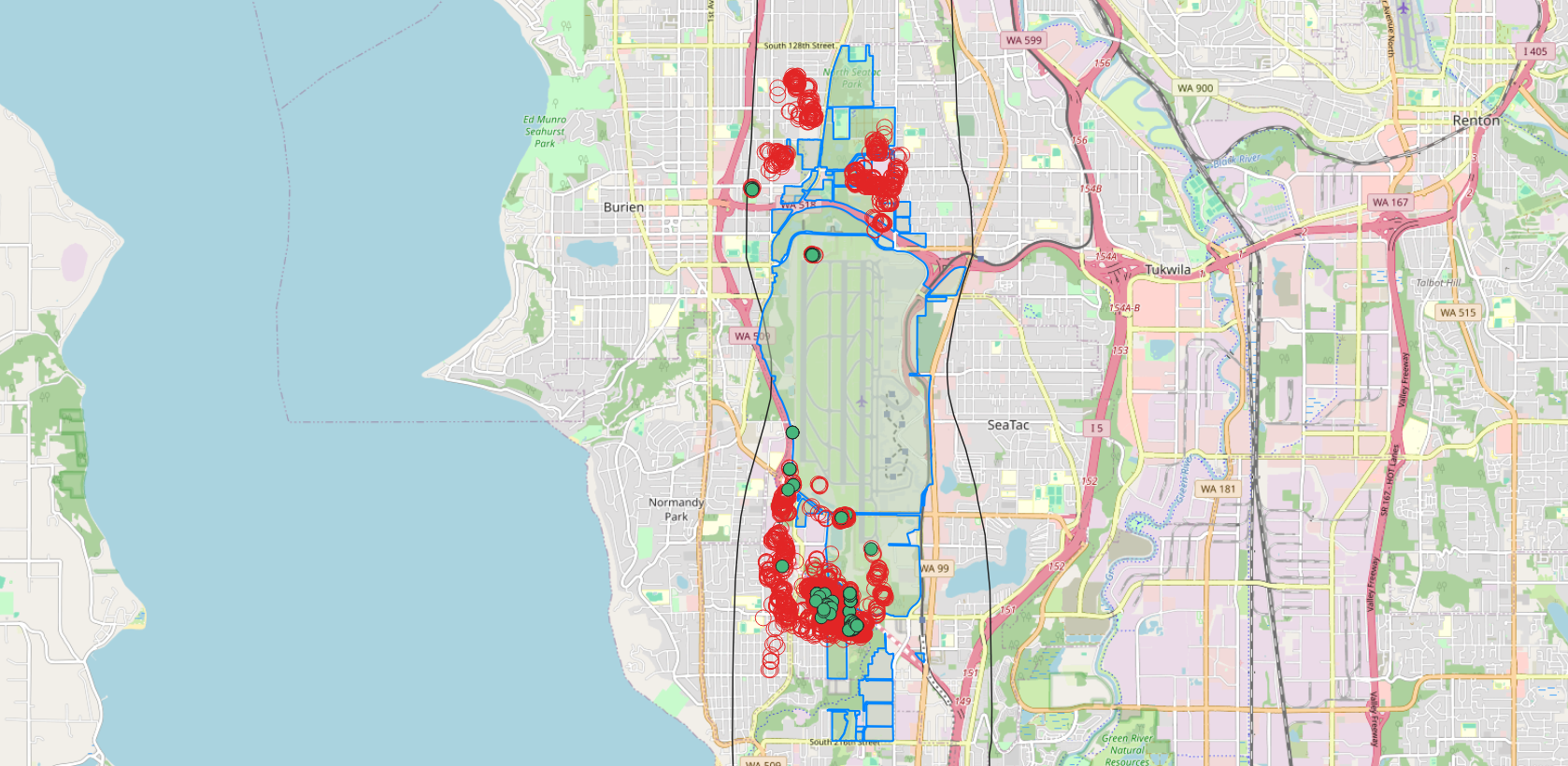
Port Properties and Trees GIS
A map centered on Seattle-Tacoma International Airport (Sea-Tac) showing clusters of red circles and green dots overlaid on the airport and surrounding communities including Burien, SeaTac, Tukwila, and Normandy Park. The blue outlined polygon appears to delineate a municipal or study boundary, and the red/green markers likely represent noise complaint locations or flight track data points used in airport noise policy analysis. -
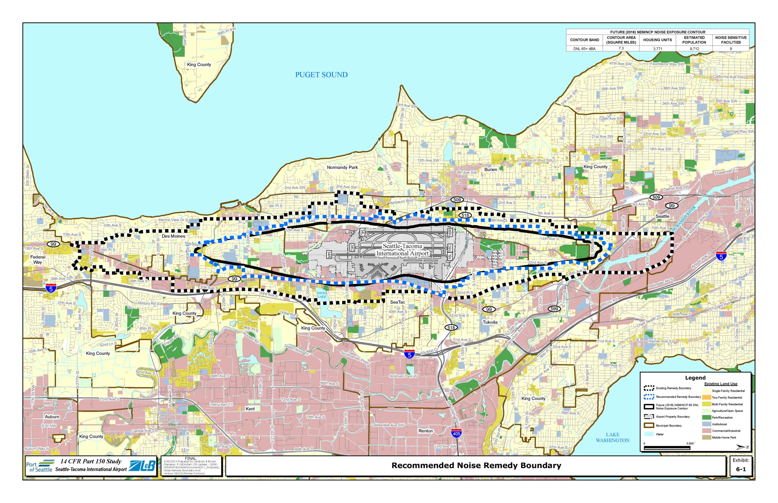
Recommended Noise Remedy Boundary Map — Sea-Tac Airport Part 150 Study
This map, prepared by Landrum & Brown for the Port of Seattle's 14 CFR Part 150 Study at Seattle-Tacoma International Airport, shows the Recommended Noise Remedy Boundary (blue dashed line) alongside the Existing Remedy Boundary (black dashed line) and the Future (2018) NEM/NCP 65 DNL Noise Exposure Contour. The future noise contour covers 7.3 square miles, encompassing an estimated 3,771 housing units, 9,712 residents, and 9 noise-sensitive facilities in communities including Des Moines, Burien, SeaTac, Normandy Park, and Tukwila. -
Noise Events mapped
Visualizing flights over the 24 Permanent Noise Monitors The 2032 boundary is not finalized and subject to frequent change! Based on a presentation of the possible 2032 boundary by the Technical Review Committee of the current Part 150 -
Port Packages mapped
Structures with Port of Seattle avigation easements Background When the Port of Seattle conducted their initial Part 150 Study in 1985, there were at least 11,000 structures inside the eligible boundary area. Since then, it has conducted four more, including the current one. Since then, the boundary, and the structures included within those boundaries, have