Tagseatac(36)
-
 2014-12-31
Flying Food Fare lease and property information
Flying Food Fare operates a flight kitchen and office facility at 2300 S. 154th Street in SeaTac, WA, under a non-aeronautical ground lease (#000086) covering approximately 90,114 square feet at the north end of Sea-Tac Airfield. The lease, which expired in March 2018, included two renewal options extending until 2028, each lasting five years. The tenant-owned building spans roughly 34,199 square feet, with space divided between office and warehouse functions, and any modifications to the property's use require review of bond and Airport Improvement Project (AIP) funding restrictions. -
 2014-12-31
Cargo 1 (AMB/AFCO Cargo Sea, LLC) lease property profile
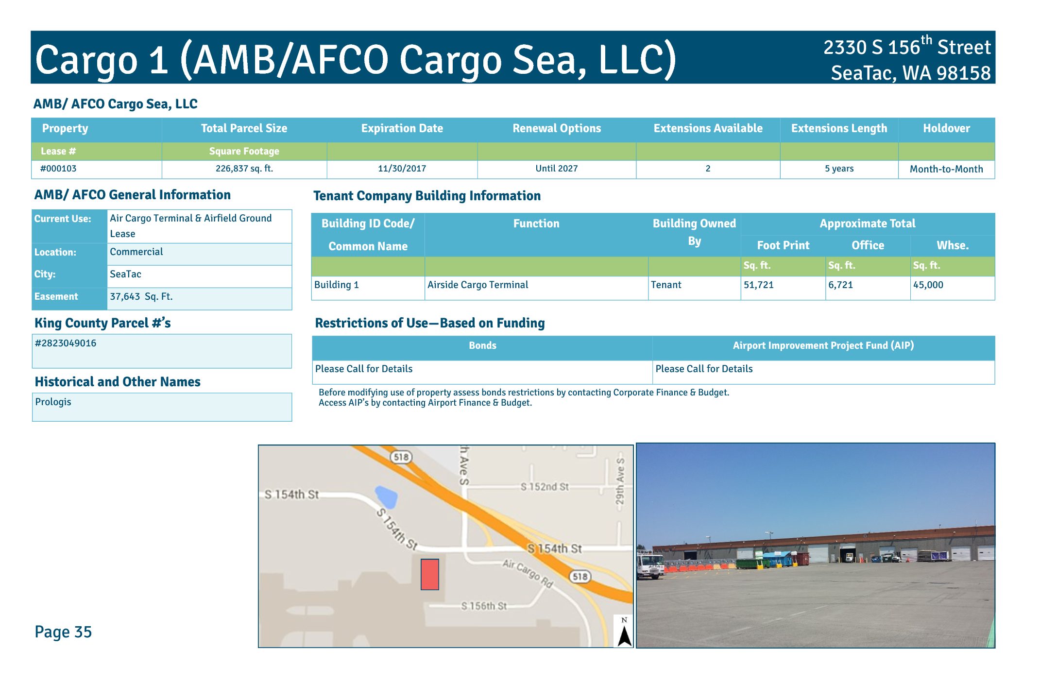
This document details Lease #000103 for Cargo 1, an air cargo terminal and airfield ground lease operated by AMB/AFCO Cargo Sea, LLC (historically known as Prologis) at 2330 S 156th Street, SeaTac, WA 98158. The property covers approximately 226,837 square feet, with Building 1 serving as an airside cargo terminal totaling 51,721 square feet, including 6,721 square feet of office space and 45,000 square feet of warehouse space. The lease, which expired November 30, 2017, includes renewal options extending until 2027, with two available five-year extensions and a month-to-month holdover provision. -
 2014-12-31
Cargo 4E (AMB/AFCO Cargo Sea II, LLC) lease information
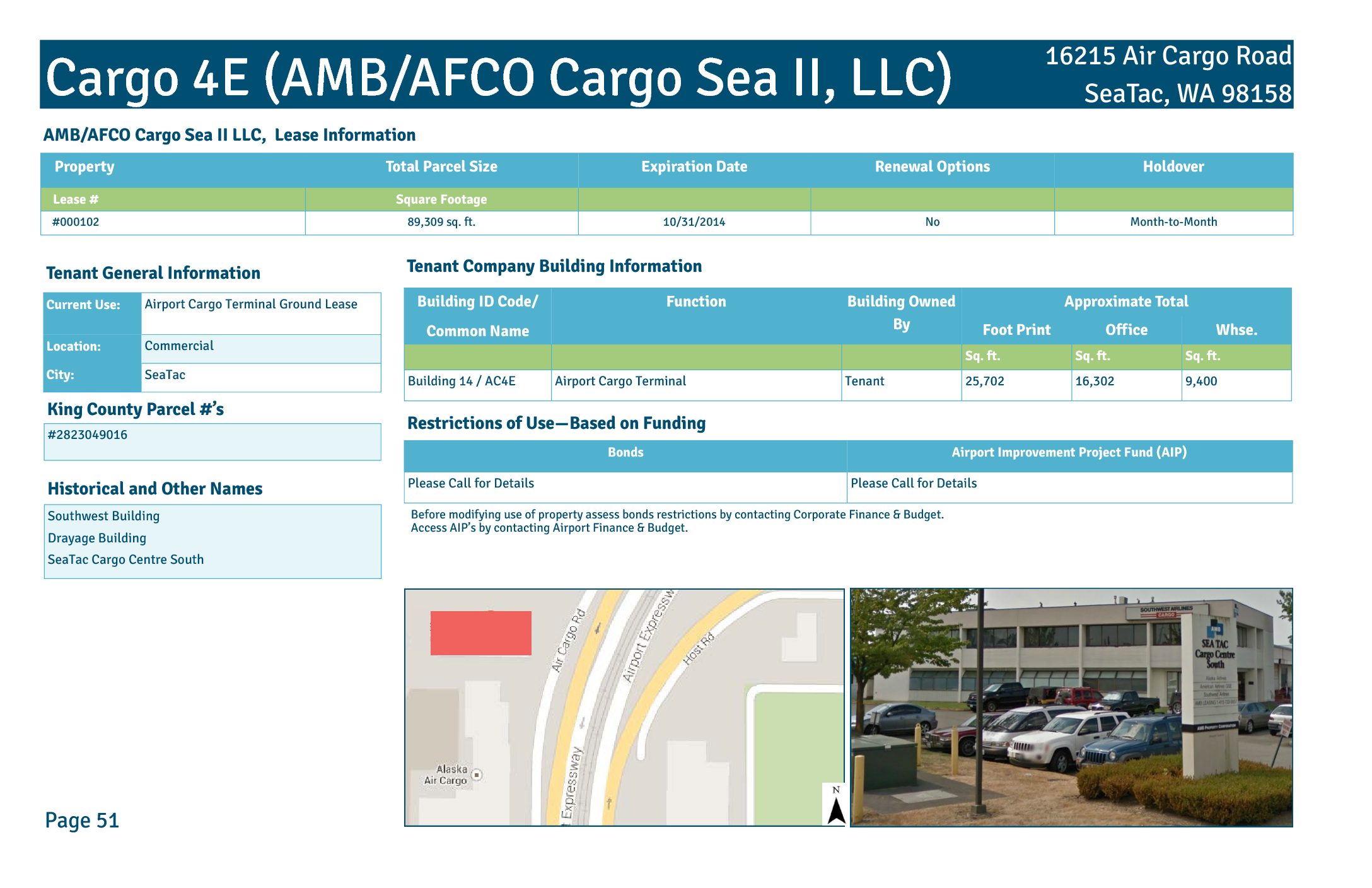
Cargo 4E is an airport cargo terminal facility located at 16215 Air Cargo Road in SeaTac, WA, leased by AMB/AFCO Cargo Sea II, LLC under Lease #000102. The property covers a total parcel of 89,309 square feet and includes Building 14, which has approximately 25,702 square feet of footprint with 16,302 square feet of office space and 9,400 square feet of warehouse space. The lease expired on October 31, 2014, with no renewal options, transitioning to a month-to-month holdover arrangement. -
 2014-06-15
Airport Key Map: Sea-Tac Airport Property Zones
★ 32This Airport Key Map, published by the Port of Seattle on June 15, 2014, provides a general reference overview of property zones surrounding Seattle-Tacoma International Airport. It identifies distinct areas including the Airfield, Terminal, Commercial, South of Airfield, South of 200th, and North of Airfield zones, and distinguishes between Port of Seattle property, lease boundaries, non-Port property, land available for redevelopment, and the proposed SR 509 corridor. The aerial photo, taken in Spring 2012, is intended for general reference only and is not approved for navigation use. -
 1984-07-19
Letter to Port Of Seattle Commissioners supporting acquisition on 26th Ave. South
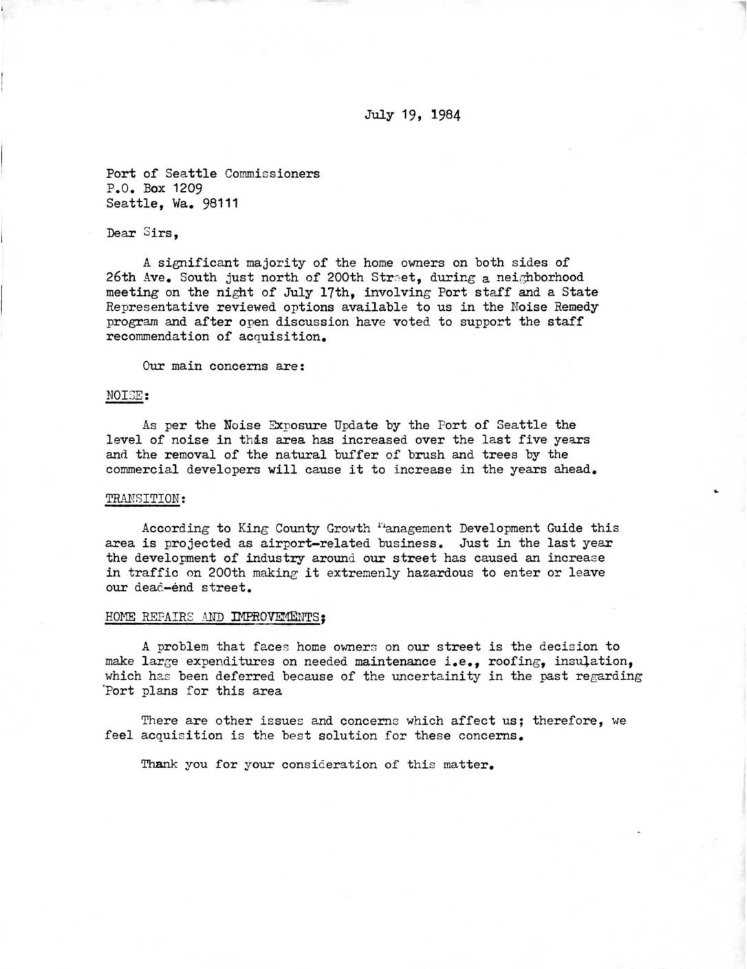
In July 1984, homeowners on 26th Ave. South near Seattle-Tacoma International Airport wrote to Port of Seattle Commissioners supporting the acquisition of their properties under the Noise Remedy program, citing increasing aircraft noise, growing industrial traffic hazards, and uncertainty that had delayed home maintenance. A separate letter from the Port's Director of Aviation to an airline captain acknowledged that non-compliance with existing noise abatement procedures — such as aircraft flying lower or turning sooner than prescribed — was a significant community concern, and noted that the Port was developing computer software using FAA radar data to automatically detect and report such violations. -
 1984-06-22
Letter from United Airlines to Mr. Vernon L. Ljungren, Seattle-Tacoma Int’l Airport, Regarding Noise Abatement Procedures Survey
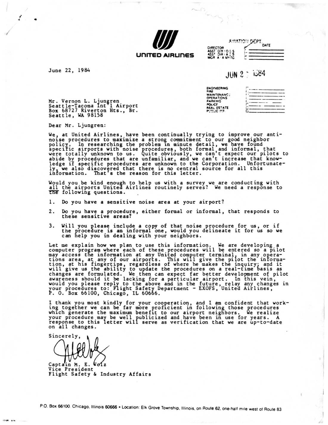
In a June 22, 1984 letter to Seattle-Tacoma International Airport, United Airlines Vice President Captain M. E. Volz requested information about the airport's noise-sensitive areas and any formal or informal noise abatement procedures in place. The airline was conducting a survey of all airports it served in order to build a computer database of noise procedures accessible to pilots at any United Airlines terminal. United Airlines asked Sea-Tac to provide copies or descriptions of its noise procedures and to send future updates to the Flight Safety Department in Chicago.