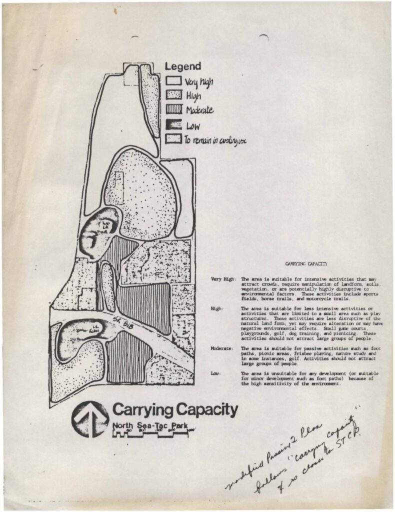
This document presents a Carrying Capacity map for North Sea-Tac Park, classifying land areas into four categories—Very High, High, Moderate, and Low—based on their suitability for various recreational activities. Very High areas can support intensive uses like sports fields and horse trails, while Low areas are too environmentally sensitive for most development. The map appears to be part of a passive recreational planning study examining how different zones of the park can be used without causing significant environmental harm.Open full document
Notes
A carrying capacity map for North Sea-Tac Park showing zones rated Very High, High, Moderate, and Low for recreational activity suitability. The legend defines each capacity level, ranging from Very High (suitable for intensive activities like sports fields and motorcycle trails) to Low (unsuitable for development due to high environmental sensitivity). A handwritten note references a ‘modified passive plan’ and ‘carrying capacity’ in relation to the Sea-Tac Communities Plan (STCP).