TagSea-Tac Communities Plan(215)
-
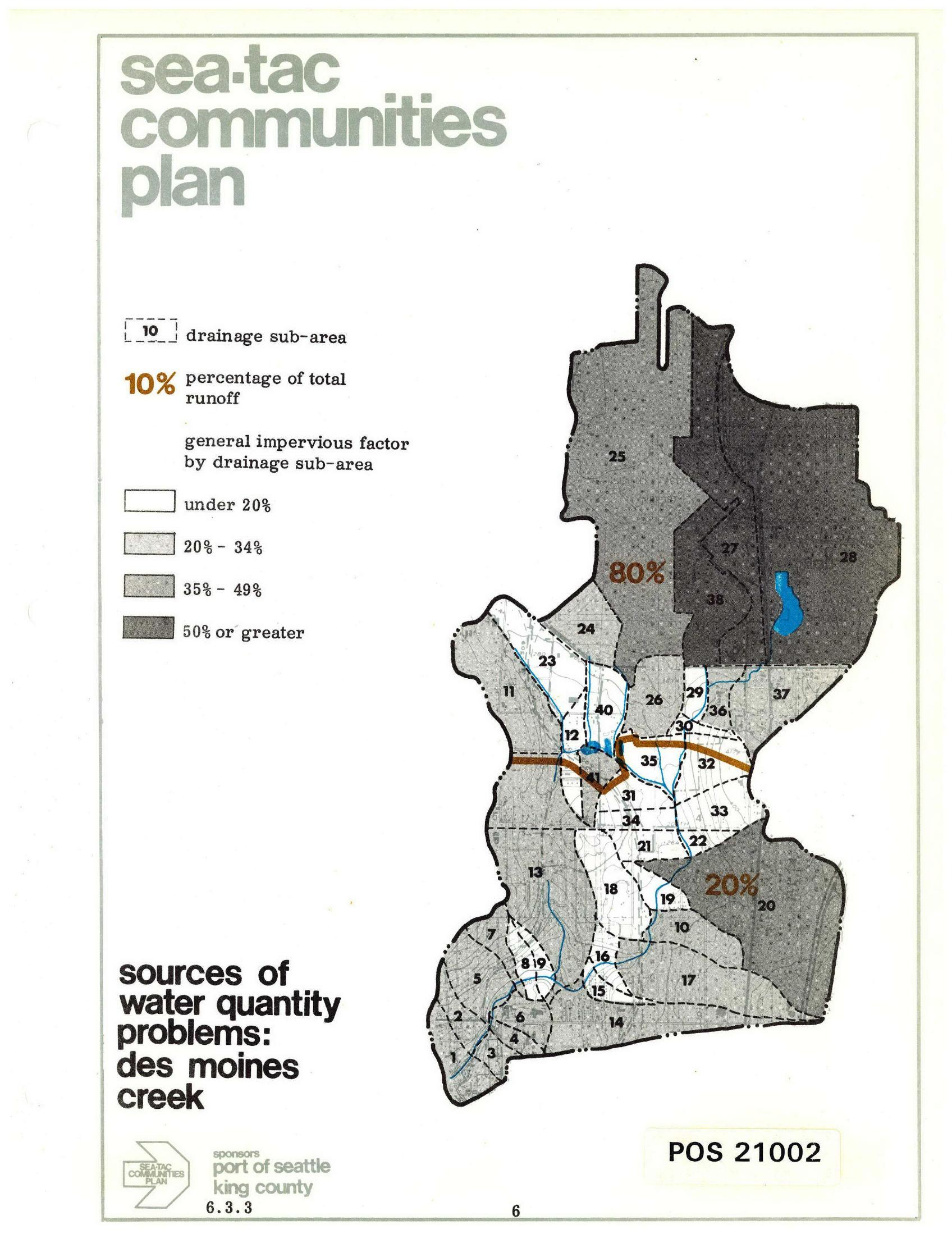
Sea-Tac Communities Plan: Des Moines Creek Drainage Sub-Areas and Runoff Sources
A planning map from the Sea-Tac Communities Plan (document POS 21002, section 6.3.3) showing drainage sub-areas for Des Moines Creek, with impervious surface factors ranging from under 20% to 50% or greater, and annotating that 80% of total runoff originates from the northern sub-areas and 20% from the southern sub-areas. Sponsored by the Port of Seattle and King County. -
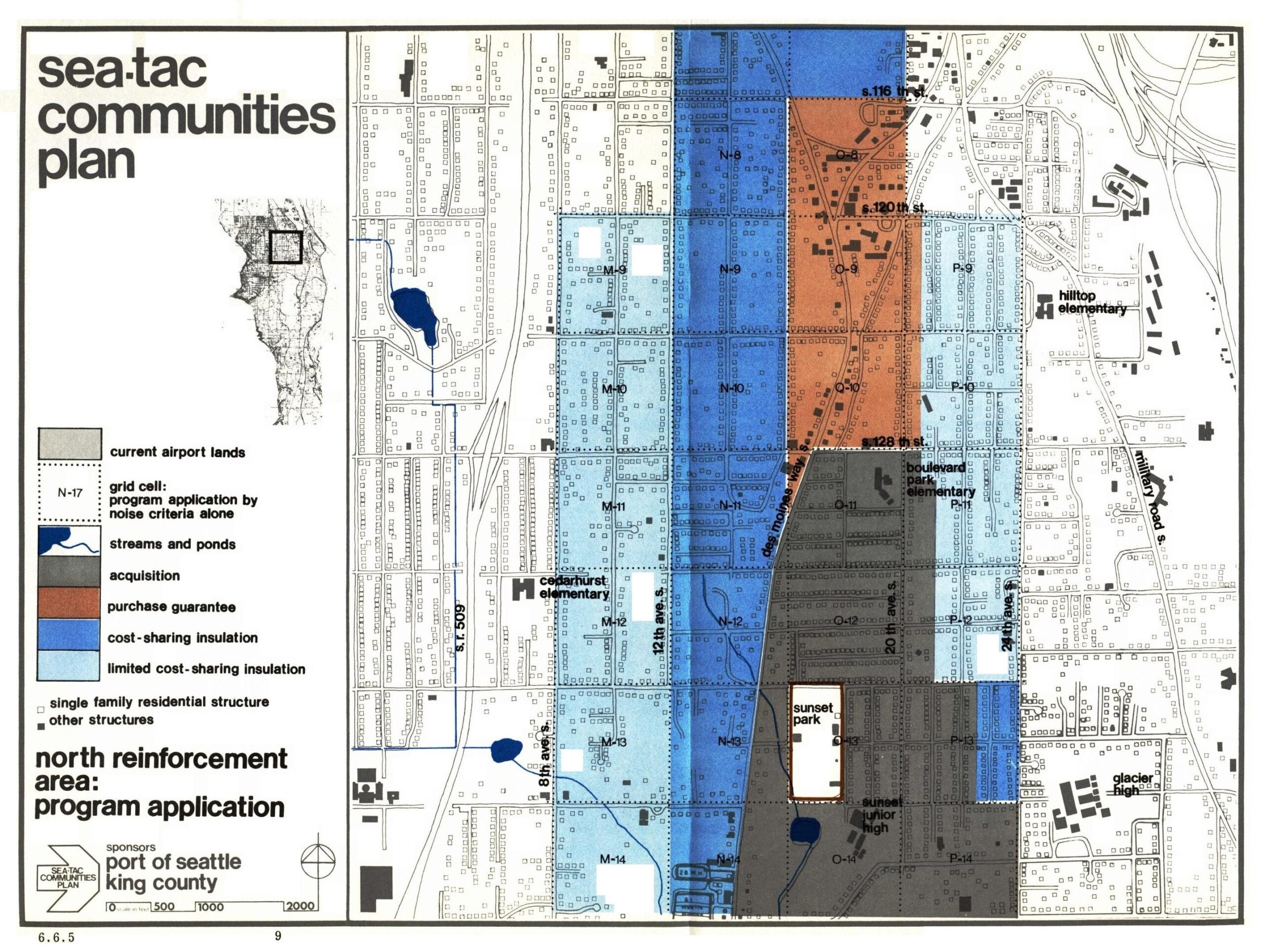
Sea-Tac Communities Plan: North Reinforcement Area Program Application
This planning map, document number 6.6.5, is from the Sea-Tac Communities Plan sponsored by the Port of Seattle and King County. It depicts the North Reinforcement Area program application, showing grid-cell zones color-coded by noise mitigation category—including acquisition, purchase guarantee, cost-sharing insulation, and limited cost-sharing insulation—for the residential area surrounding Seattle-Tacoma International Airport, with landmarks such as Cedarhurst Elementary, Boulevard Park Elementary, Hilltop Elementary, Glacier High, and Sunset Junior High visible. -
 2026-01-06
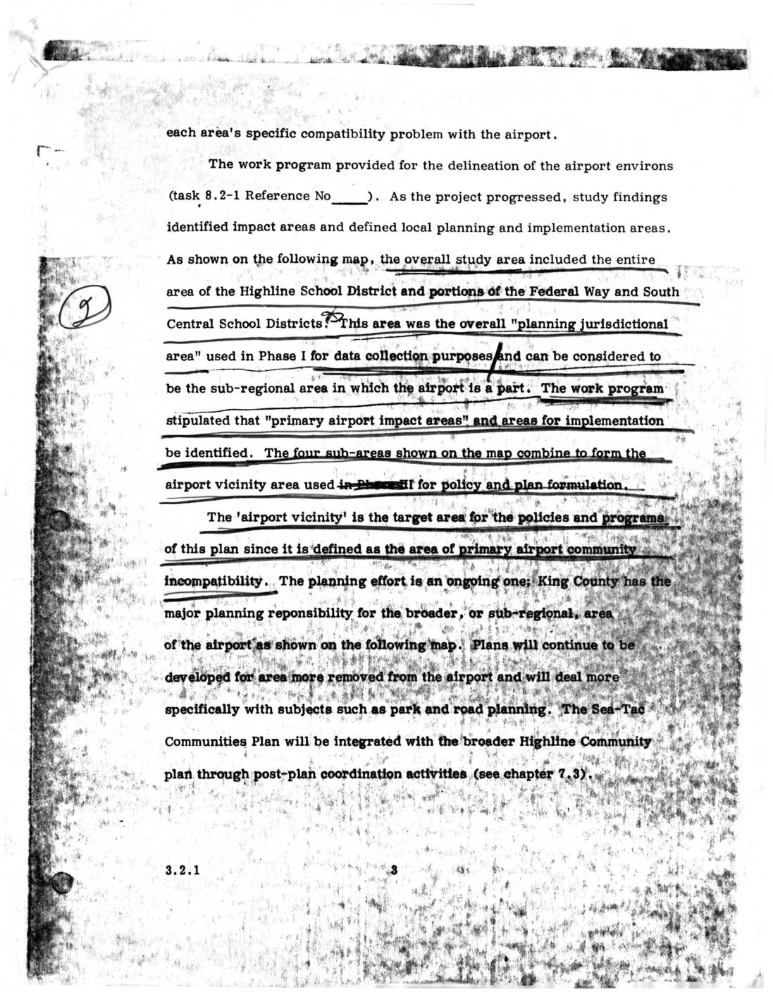
Sea-Tac Communities Plan: Airport Vicinity Area and Planning Jurisdictional Area (Section 3.2.1)
This document describes the planning study area surrounding Seattle-Tacoma (Sea-Tac) Airport, which encompassed the entire Highline School District and portions of the Federal Way and South Central School Districts. The study identified four sub-areas forming an 'airport vicinity' zone — defined as the area of primary airport-community incompatibility — to guide policy and land-use planning. King County holds major planning responsibility for the broader sub-regional area, with the Sea-Tac Communities Plan intended to integrate with the wider Highline Community Plan through post-plan coordination. -
 2023-08-22
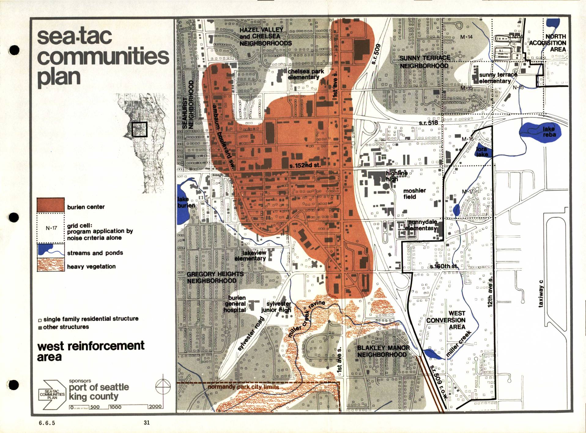
Sea-Tac Communities Plan: West Reinforcement Area Map (Section 6.6.5)
The Sea-Tac Communities Plan, sponsored by the Port of Seattle and King County, maps the West Reinforcement Area surrounding Seattle-Tacoma International Airport, identifying neighborhoods such as Hazel Valley, Chelsea, Sunny Terrace, Gregory Heights, and Blakley Manor that are affected by aircraft noise. The map uses color coding to highlight the Burien Center commercial core, grid cells where program eligibility is determined by noise criteria alone, streams and ponds, and areas of heavy vegetation. It distinguishes between single-family residential structures and other building types to guide noise mitigation and land-use planning decisions in communities near the airport. -
 2023-08-22
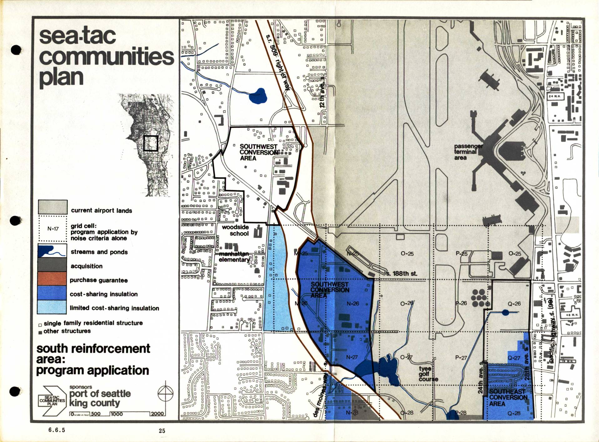
Sea-Tac Communities Plan: South Reinforcement Area Program Application (Section 6.6.5)
The Sea-Tac Communities Plan, sponsored by the Port of Seattle and King County, maps out noise mitigation programs for residential and other structures in communities surrounding Seattle-Tacoma International Airport. The plan designates specific zones for different types of assistance, including property acquisition, purchase guarantees, cost-sharing insulation, and limited cost-sharing insulation, with a focus on the South Reinforcement Area. Grid cells are identified by noise criteria to determine which program applies to each affected neighborhood, covering areas such as the Southwest and Southeast Conversion Areas near the airport's passenger terminal. -
 2023-08-22
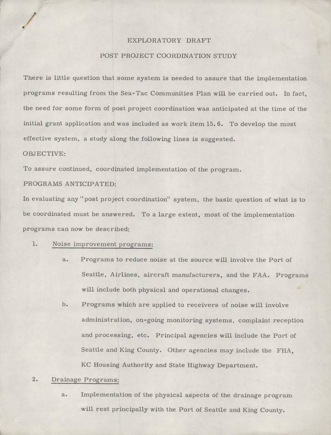
Exploratory draft: Post project coordination study
This exploratory draft outlines a proposed Post Project Coordination Study for the Sea-Tac Communities Plan, designed to ensure that implementation programs are carried out effectively. It identifies seven key program areas requiring coordination, including noise reduction, drainage improvements, community action, zoning guidelines, capital improvements, and legislative advocacy. The document calls for a methodical study to analyze coordination needs, define responsibilities, and assign authorities across agencies such as the Port of Seattle, King County, and the FAA. -
 2023-08-22
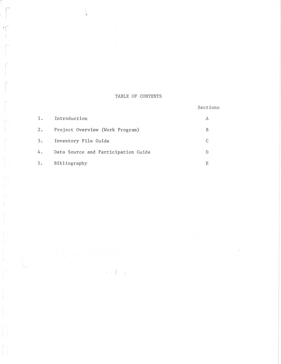
Sea-Tac/Communities Plan work program: Project overview and inventory
This document outlines the Sea-Tac/Communities Plan, a collaborative airport master planning study conducted by the Port of Seattle and King County with FAA funding, covering environmental, demographic, economic, and land-use impacts of Seattle-Tacoma International Airport on surrounding communities. The $642,000 study, two-thirds funded by a $427,978 FAA planning grant, hired multiple consultants to examine issues including noise exposure, air quality, water quality, and public opinion. The inventory phase aimed to compile comprehensive existing-conditions data within the first six months of the project, starting March 19, 1972. -
 2023-04-24
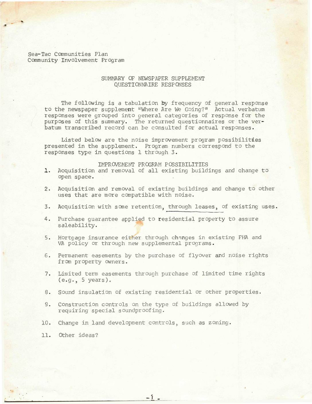
Summary of newspaper supplement questionnaire responses
This document summarizes community questionnaire responses collected as part of the Sea-Tac Communities Plan, asking residents which noise improvement programs—such as property acquisition, sound insulation, easements, and zoning changes—would best meet their personal and neighborhood needs. Results show that acquisition and removal of buildings (Program 2) and purchase guarantees (Program 4) were among the most favored options, while a majority of respondents (60) supported more governmental controls to protect the environment. Open space near the north and south of the airport was most frequently cited as a potential solution to neighborhood problems. -
 2023-04-24
East sub-area planning considerations
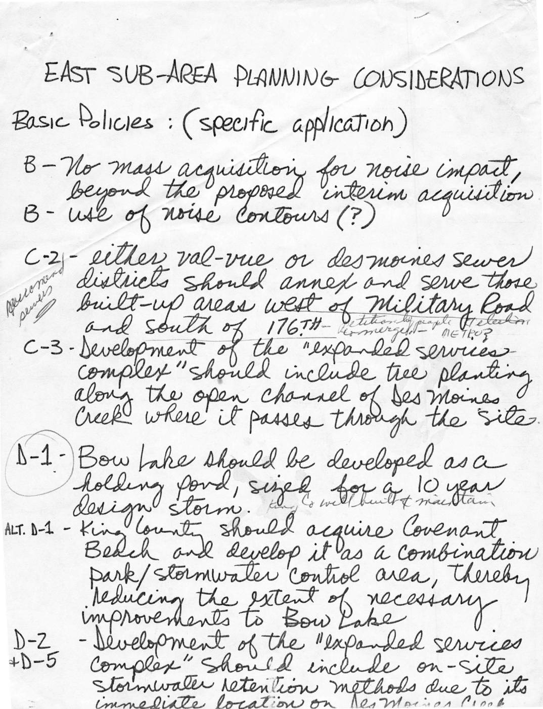
This handwritten document outlines East Sub-Area Planning Considerations for the area surrounding Sea-Tac Airport, covering policies on noise impact, land use, stormwater management, and community development. Key proposals include limiting mass property acquisition for noise mitigation, expanding Angle Lake Park to protect the surrounding neighborhood from airport encroachment, and developing Bow Lake as a stormwater holding pond. Additional recommendations address bicycle and pedestrian paths along Military Road, setback and landscaping requirements near airport development districts, and preserving natural areas and residential views around McMicken Heights. -
 2022-11-29
Your 2¢ Worth Meeting #4: Community Planning — A Game?
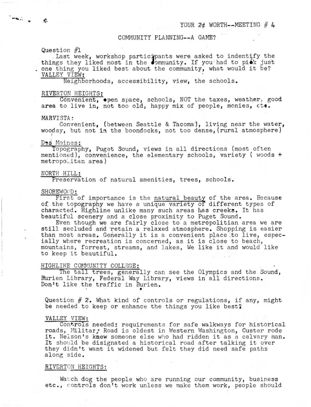
Minutes from a community planning workshop (Meeting #4) in which residents from neighborhoods near Sea-Tac Airport — including Valley View, Riverton Heights, Marvista, Des Moines, North Hill, Shorewood, and Highline College — identified what they valued most about their communities, such as natural scenery, views, schools, and open space. Participants also discussed what regulations might be needed to protect those qualities, including building height controls, green belt preservation, clean-air policies, and safe pedestrian pathways. A comprehensive land use plan was proposed that would balance residential, industrial, recreational, and conservation needs while ensuring local residents have a meaningful voice in decisions affecting their neighborhoods.