TagSea-Tac Communities Plan(215)
-
Sea Tac Communities Plan 1600
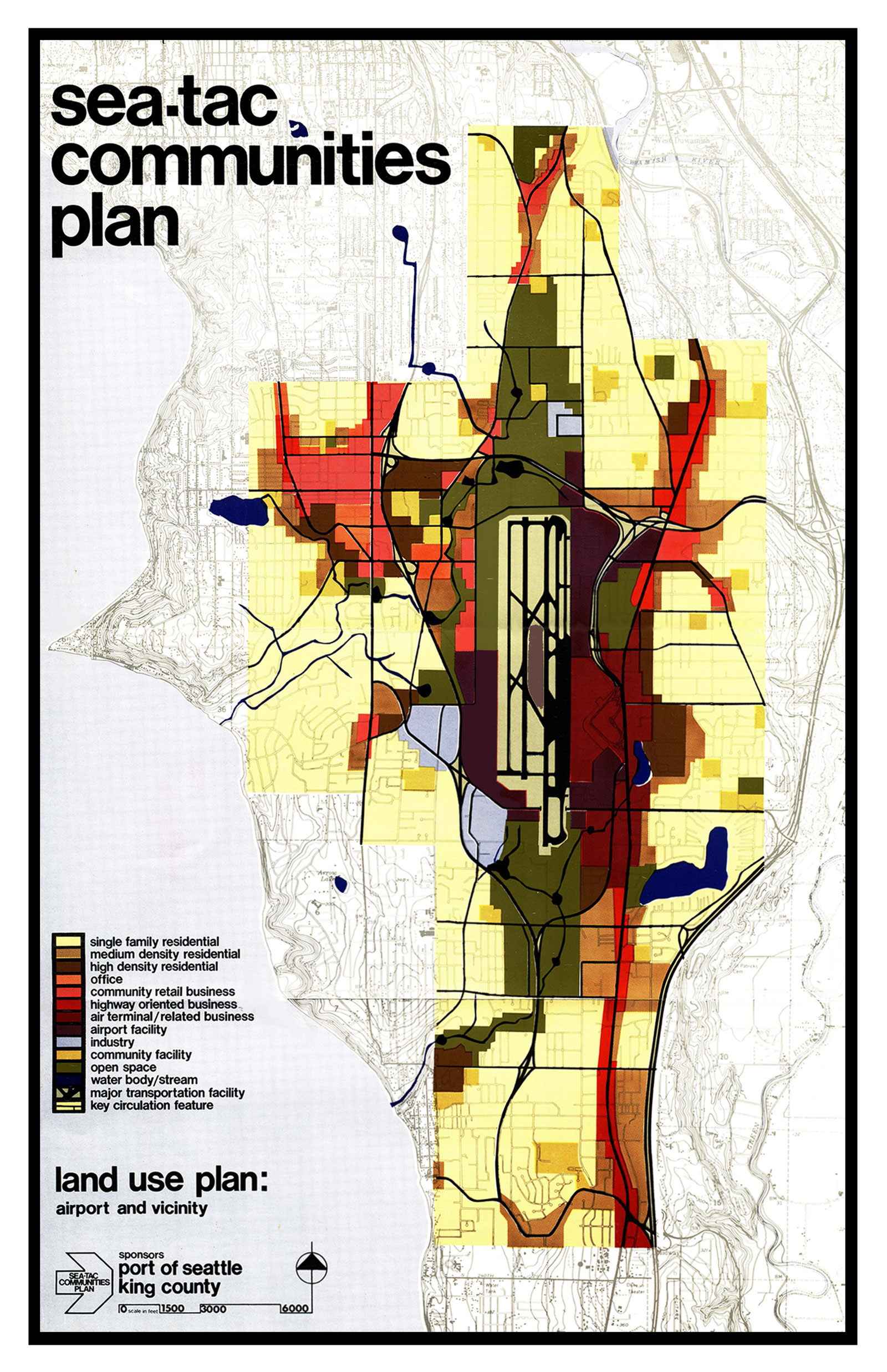
A land use planning map produced under the Sea-Tac Communities Plan, sponsored by the Port of Seattle and King County, showing zoning categories (residential, commercial, office, airport facility, open space, etc.) for the area surrounding Seattle-Tacoma International Airport. The legend identifies uses including air terminal/related business, highway-oriented business, community retail, industry, and key circulation features, with a scale bar indicating coverage at 1:500 to 6,000 feet. -
Sea-Tac Community Plan Land Use Sideways
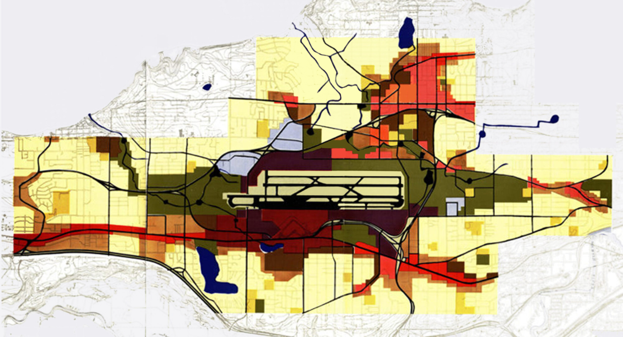
A color-coded GIS-style map overlay showing noise contour zones or land-use impact areas surrounding what appears to be a major airport runway complex at center. Colors ranging from light yellow to deep red and dark olive likely represent varying levels of noise exposure or compatible/incompatible land uses, with road networks shown in black and red lines. -
SCP_sideways
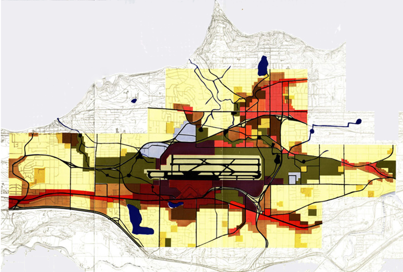
A color-coded planning map showing noise contour zones or land-use impact areas radiating from a central airport runway facility, depicted in shades of yellow, red, brown, and dark olive-green. Blue lines appear to represent waterways or transportation corridors, and bold black lines indicate road or grid infrastructure overlaid on a topographic base map. -
Sea Tac Communities Plan 6.7 Land Use Plan 1600 661×1024
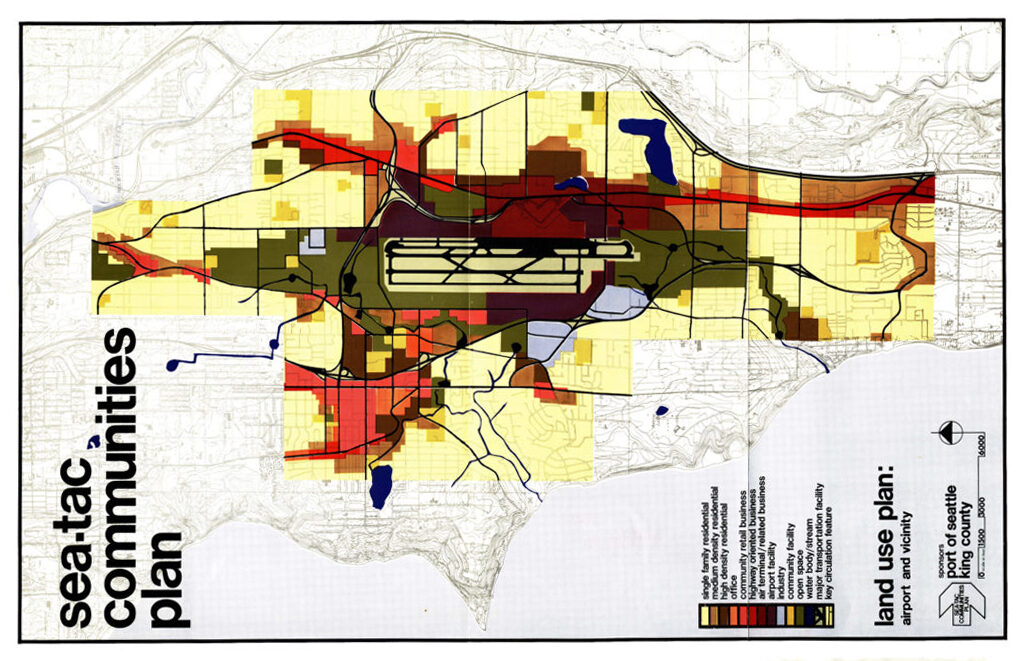
A color-coded land use planning map produced by the Port of Seattle and King County as part of the Sea-Tac Communities Plan, showing zoning categories (residential, commercial, office, airport facility, open space, and circulation features) in the airport vicinity. The legend identifies uses including single-family residential, high-density residential, highway-oriented retail, air terminal/related business, community facility, open body/stream, major transportation facility, and key circulation features. -
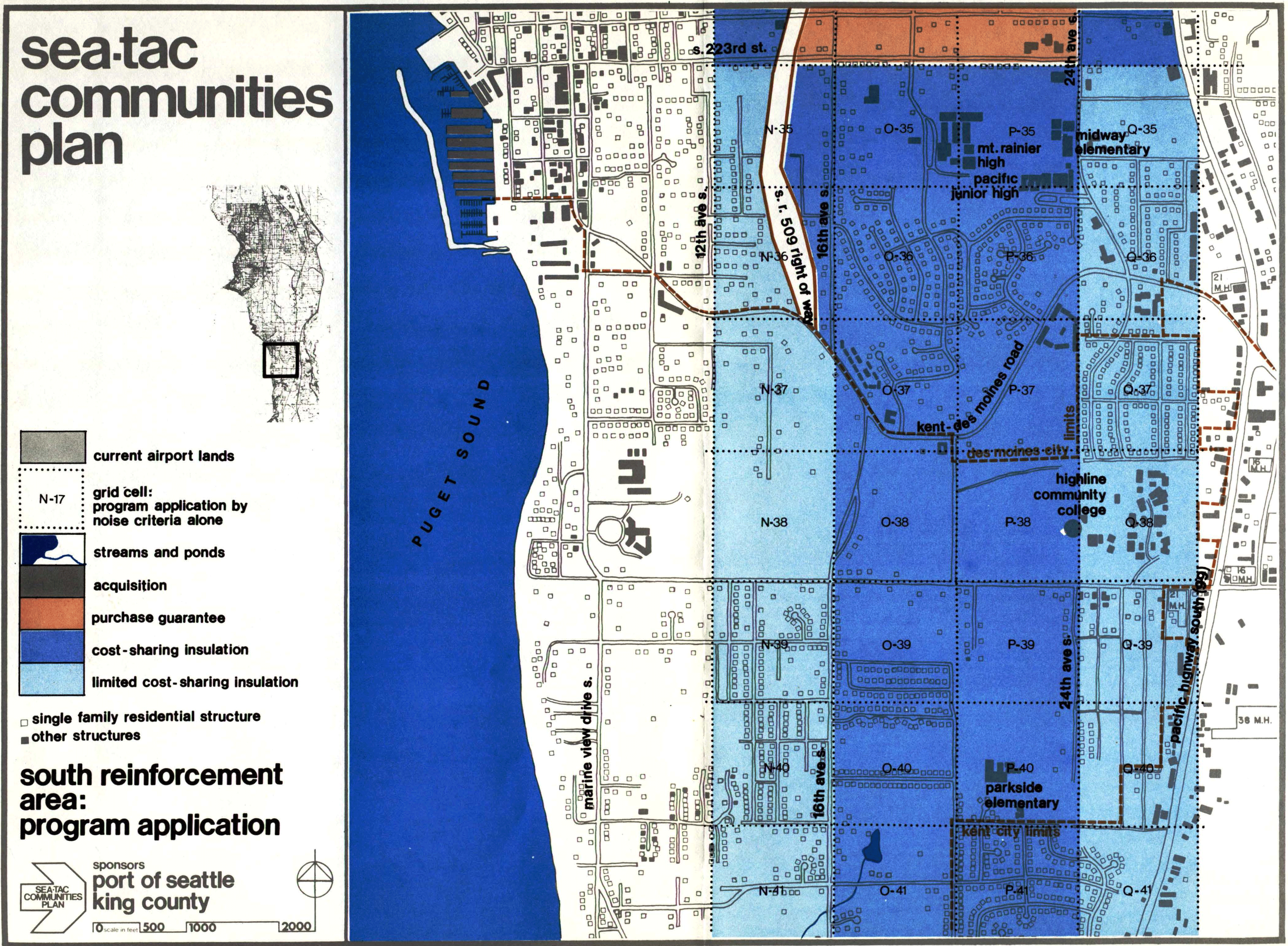
STCP-6.6.5-27-south
A planning map from the Sea-Tac Communities Plan, sponsored by the Port of Seattle and King County, showing the South Reinforcement Area program application with color-coded zones indicating acquisition, purchase guarantee, cost-sharing insulation, and limited cost-sharing insulation relative to airport noise contours. The map covers the area around S. 223rd Street south to Kent city limits, bounded by Puget Sound to the west and Pacific Highway South (SR-99) to the east, with landmarks including Mt. Rainier High School, Highline Community College, and Parkside Elementary labeled. -
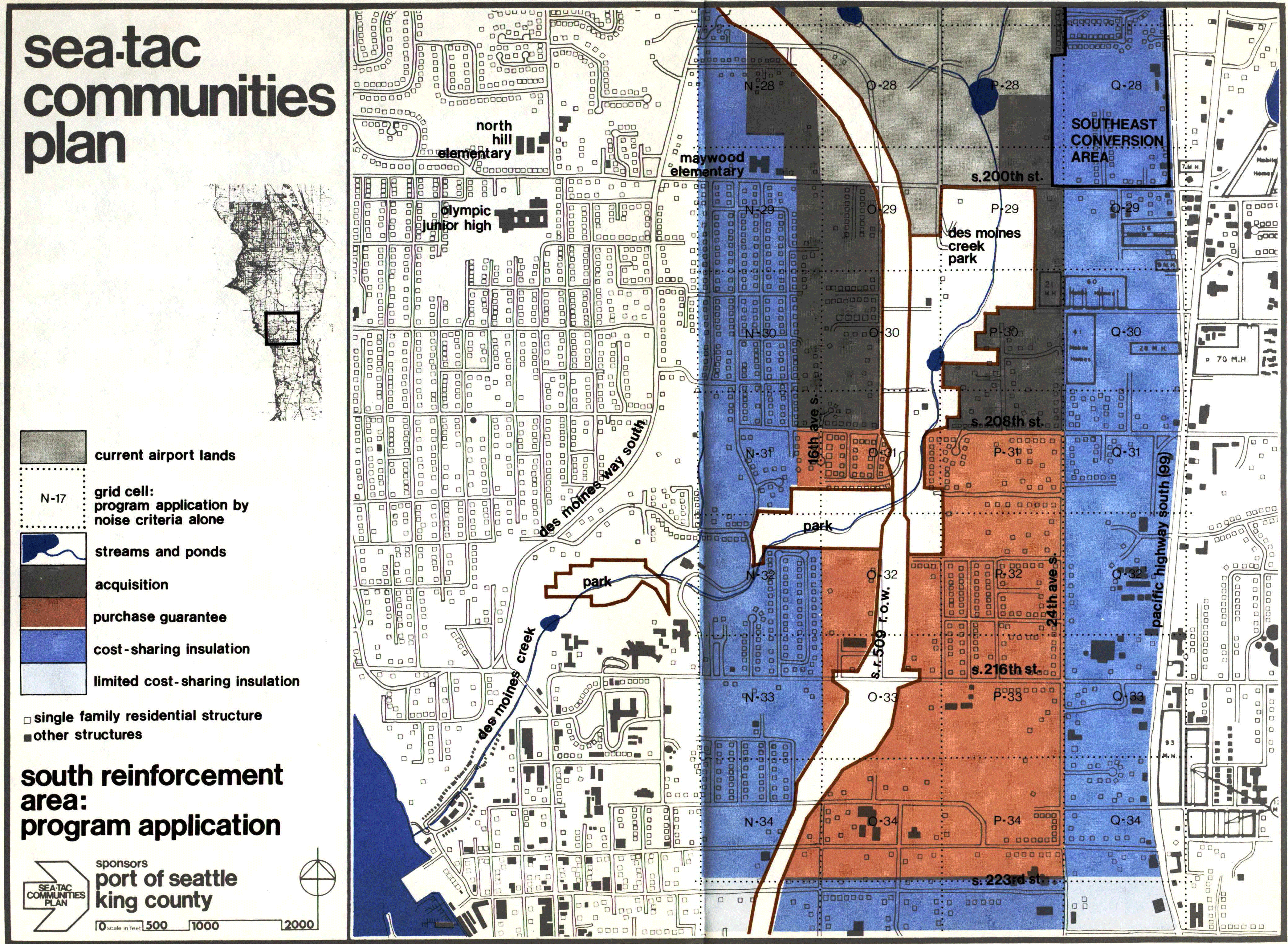
STCP-6.6.5-26-south
A planning map from the Sea-Tac Communities Plan, sponsored by the Port of Seattle and King County, showing the South Reinforcement Area program application. The map uses color coding to designate zones for acquisition, purchase guarantee, cost-sharing insulation, and limited cost-sharing insulation in the area bounded roughly by S. 200th St. to the north and S. 223rd St. to the south, including grid cells along 16th Ave. S., 24th Ave. S., and Pacific Highway South (SR-99), with a Southeast Conversion Area noted in the upper right. -
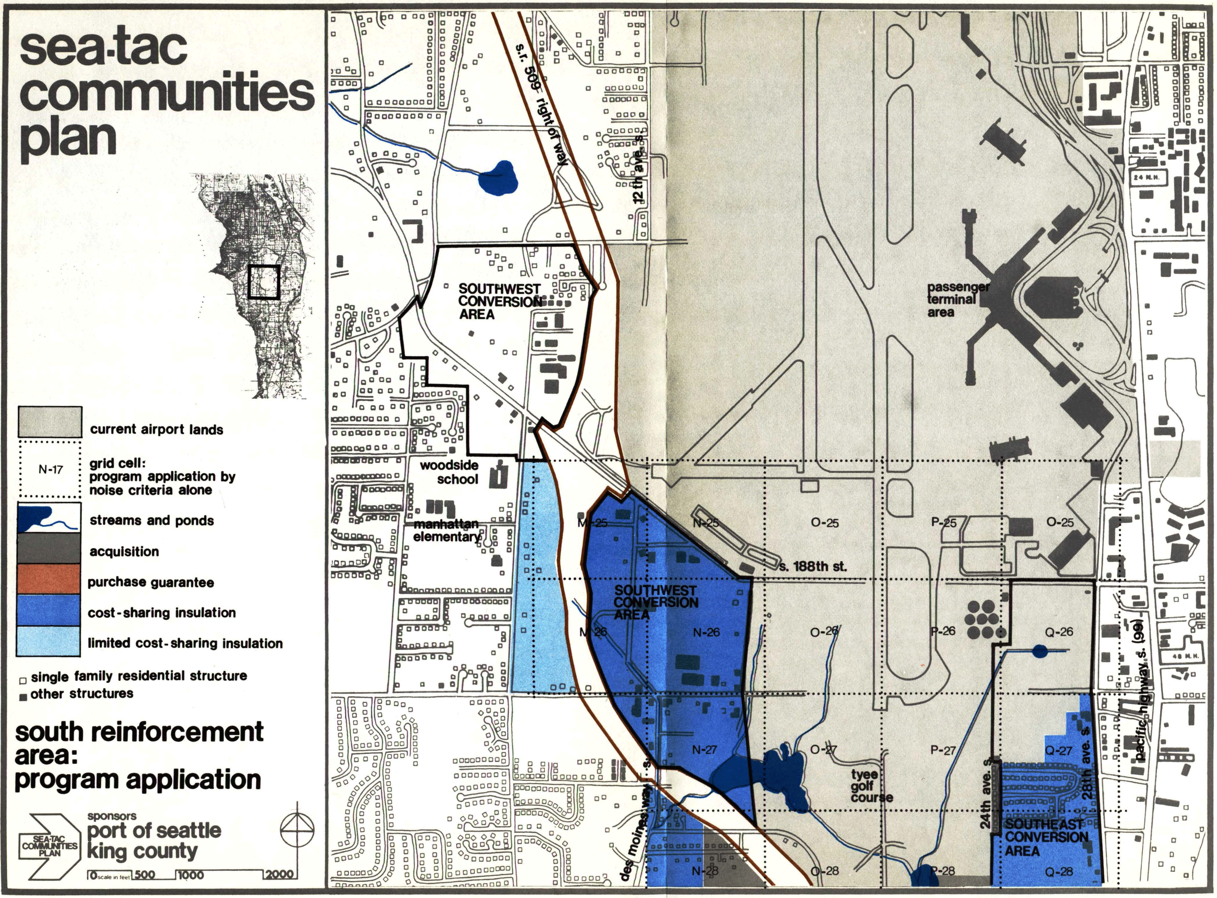
STCP-6.6.5-25-south
A planning map produced under the Sea-Tac Communities Plan, sponsored by the Port of Seattle and King County, depicting the South Reinforcement Area program application near Seattle-Tacoma International Airport. The map identifies land-use zones including the Southwest Conversion Area, Southeast Conversion Area, and color-coded program interventions such as acquisition, purchase guarantee, cost-sharing insulation, and limited cost-sharing insulation, with grid cells referenced by noise criteria (e.g., N-25 through Q-28) and landmarks including Woodside School, Manhattan Elementary, and Tyee Golf Course. -
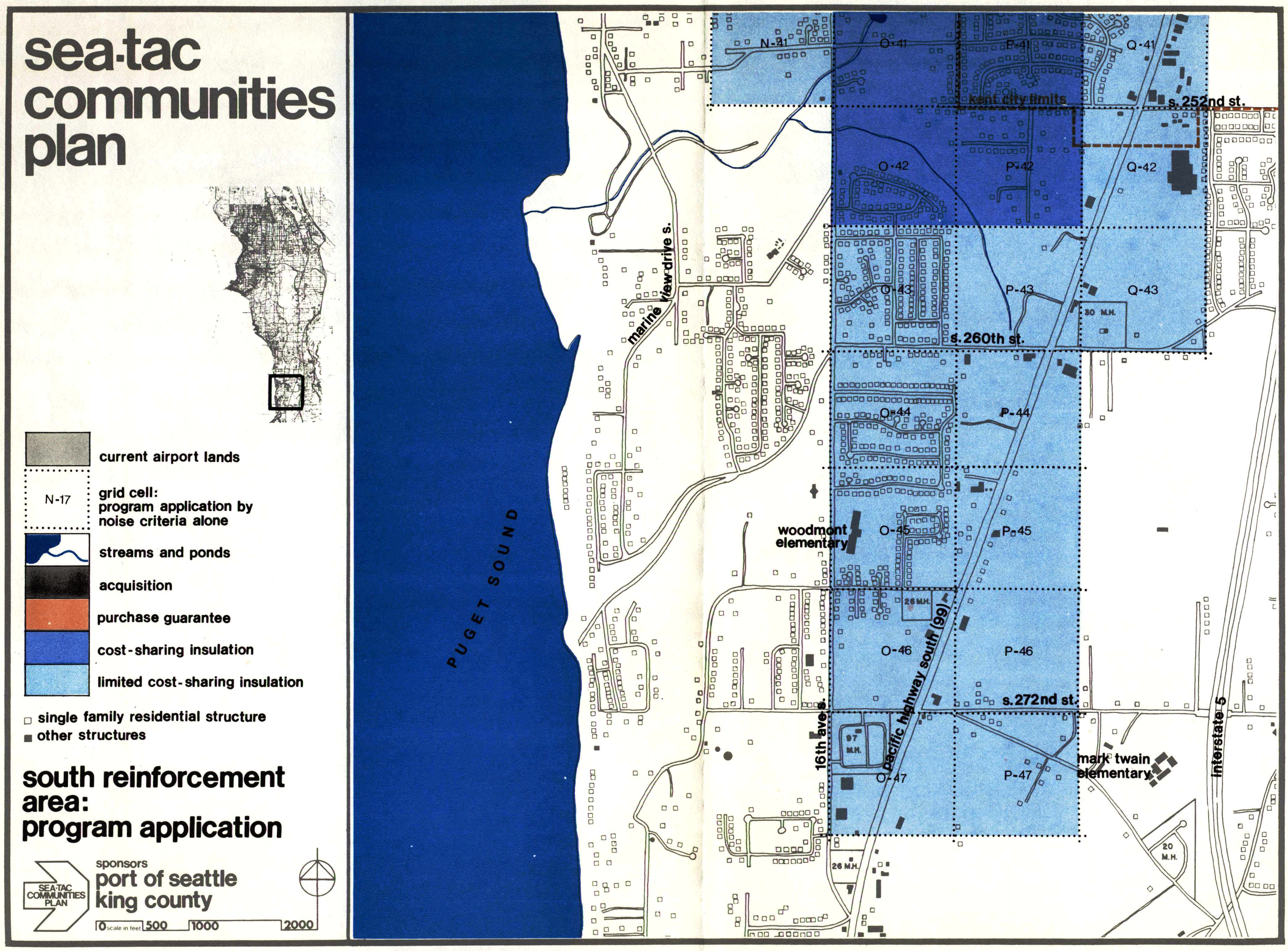
STCP-6.6.5-28-south
A planning map from the Sea-Tac Communities Plan, sponsored by the Port of Seattle and King County, showing the South Reinforcement Area program application. The map uses color-coded grid cells (labeled N-41 through P-47) to designate zones for acquisition, purchase guarantee, cost-sharing insulation, and limited cost-sharing insulation relative to airport noise impacts, covering the area between approximately S. 252nd St. and S. 272nd St. along Puget Sound, including landmarks such as Woodmont Elementary and Mark Twain Elementary schools. -
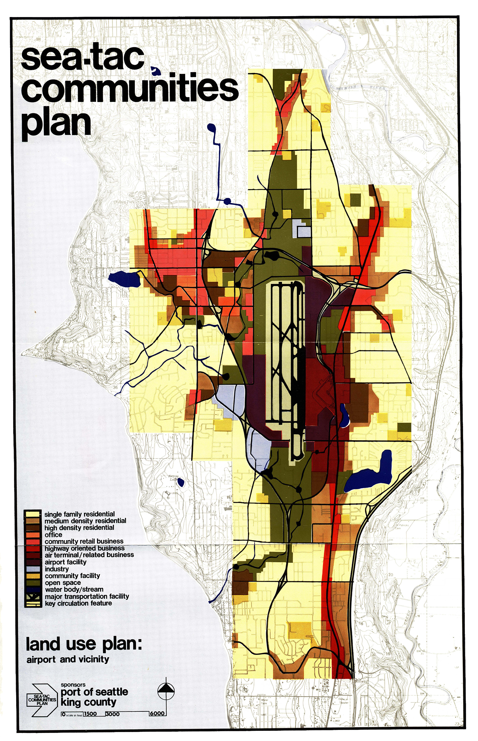
Sea-Tac Communities Plan 6.7 Land Use Plan-1600
A color-coded land use planning map produced under the Sea-Tac Communities Plan, sponsored by the Port of Seattle and King County, showing proposed zoning categories (residential, commercial, industrial, airport facility, open space, etc.) for the area surrounding Seattle-Tacoma International Airport. The map includes a full legend and scale bar, with key circulation features and water bodies marked. -
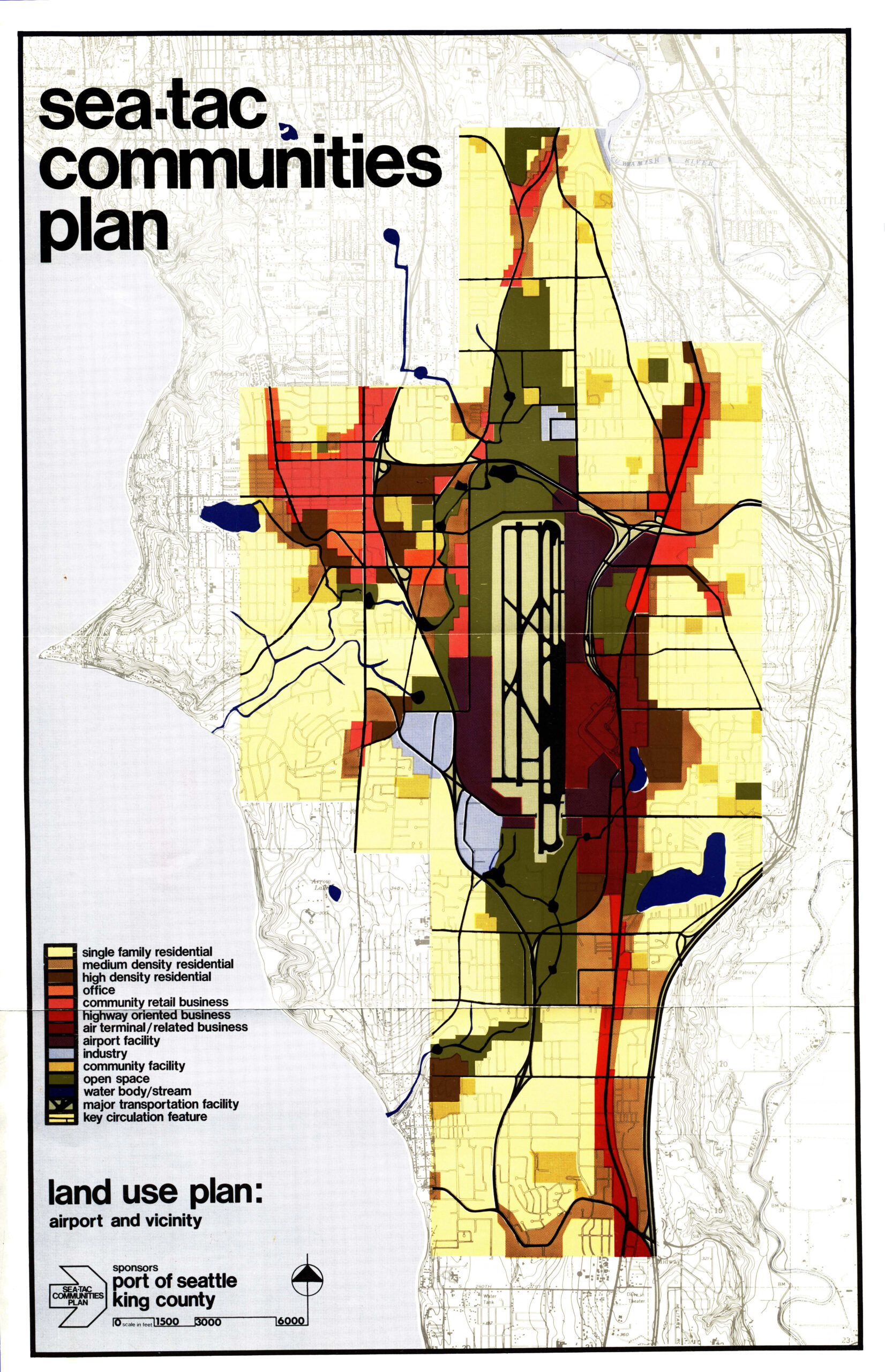
Sea-Tac Communities Plan 6.7 Land Use Plan
A color-coded land use planning map produced under the Sea-Tac Communities Plan, sponsored by the Port of Seattle and King County, depicting zoning categories (single-family residential, commercial, industrial, airport facility, open space, etc.) and circulation features in the area surrounding Seattle-Tacoma International Airport. The map's legend, title text, sponsor logos, and scale bar are all clearly legible.