TagSea-Tac Communities Plan(215)
-
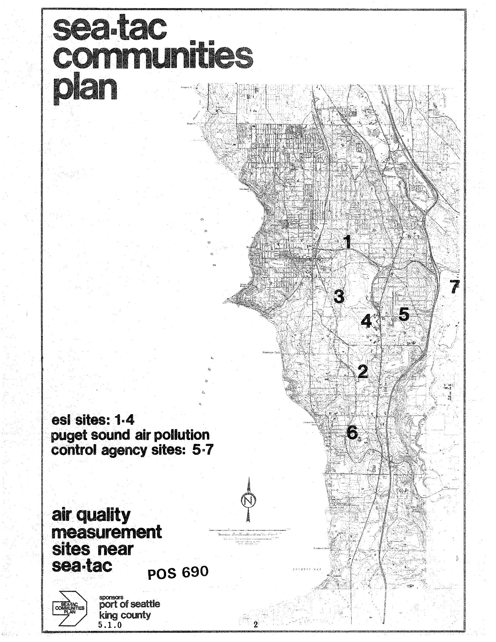
STCP Air Quality Measurement Sites Near Sea-Tac Airport
A map from the Sea-Tac Communities Plan (document reference POS 690, page 5.1.0) showing seven air quality measurement sites near Seattle-Tacoma International Airport. Sites 1–4 are ESL sites and sites 5–7 are Puget Sound Air Pollution Control Agency sites; the plan was sponsored by the Port of Seattle and King County. -
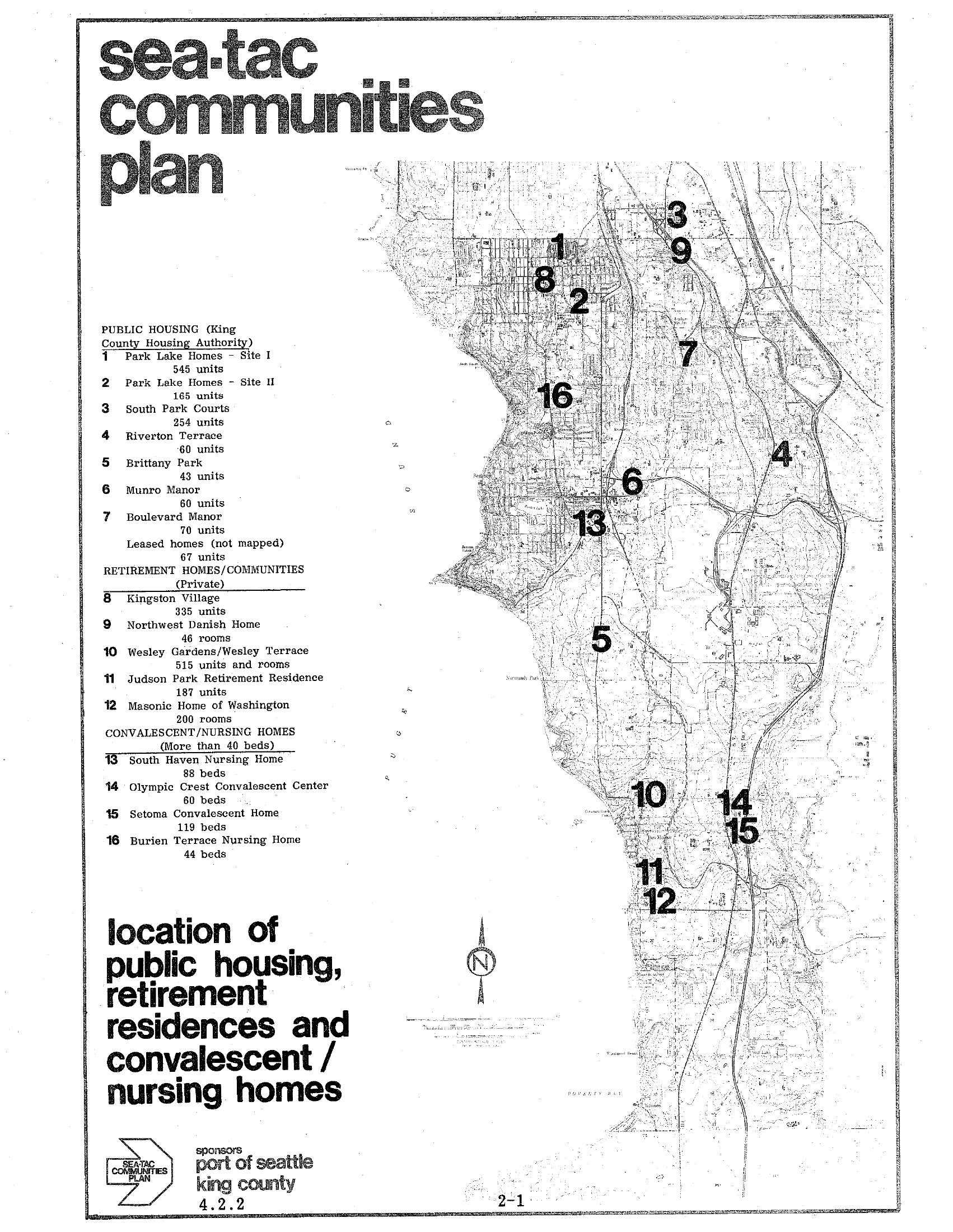
STCP Map: Locations of Public Housing, Retirement Residences, and Convalescent Nursing Homes in the Sea-Tac Area
A map from the Sea-Tac Communities Plan (document reference 4.2.2), sponsored by the Port of Seattle and King County, showing numbered locations of 16 public housing, retirement, and convalescent/nursing home facilities in the Sea-Tac area, including King County Housing Authority properties such as Park Lake Homes (545 and 165 units) and private retirement communities such as Kingston Village (335 units) and Wesley Gardens/Wesley Terrace (515 units and rooms). -
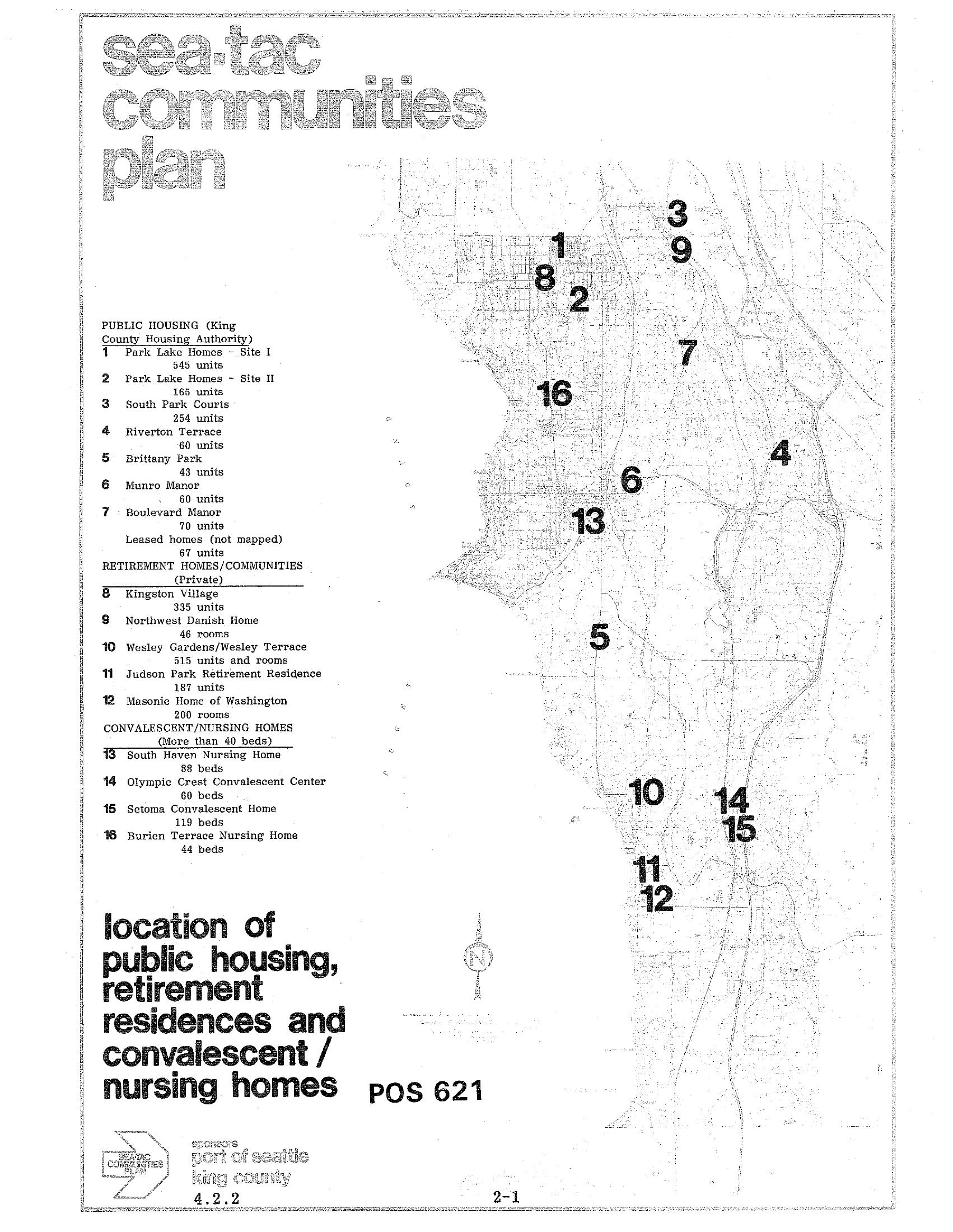
STCP Map: Locations of Public Housing, Retirement Residences, and Convalescent Nursing Homes in the Sea-Tac Area
This map from the Sea-Tac Communities Plan (document reference 4.2.2, page 2-1) plots 16 numbered locations of public housing sites administered by the King County Housing Authority, private retirement homes/communities, and convalescent/nursing homes with more than 40 beds in the Sea-Tac area. Sponsors listed are the Port of Seattle and King County. -
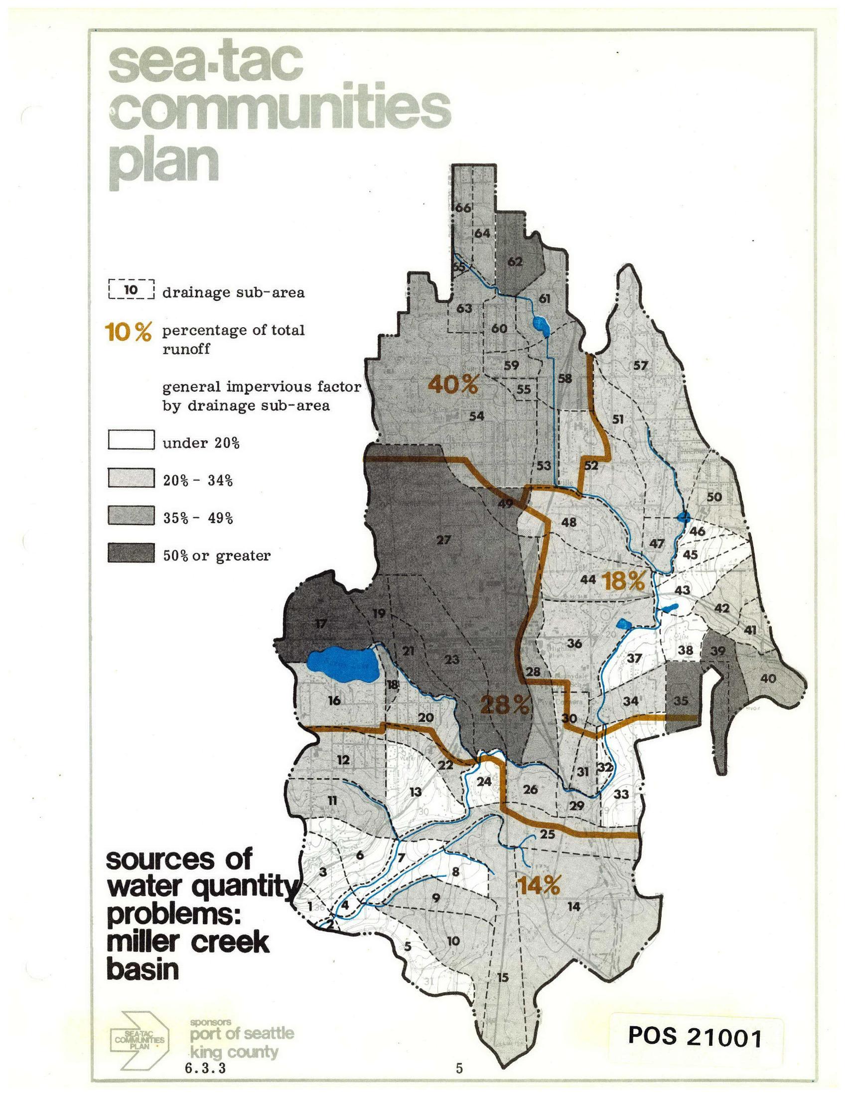
Miller Creek Basin Drainage Sub-Areas Map — Sea-Tac Communities Plan (STCP Section 6.3.3)
A drainage map from the Sea-Tac Communities Plan, sponsored by the Port of Seattle and King County (document reference 6.3.3, POS 21001), showing the Miller Creek Basin divided into numbered drainage sub-areas with general impervious surface factors (under 20% to 50% or greater) and percentage of total runoff contributions (40%, 28%, 18%, and 14%) for each major zone. -
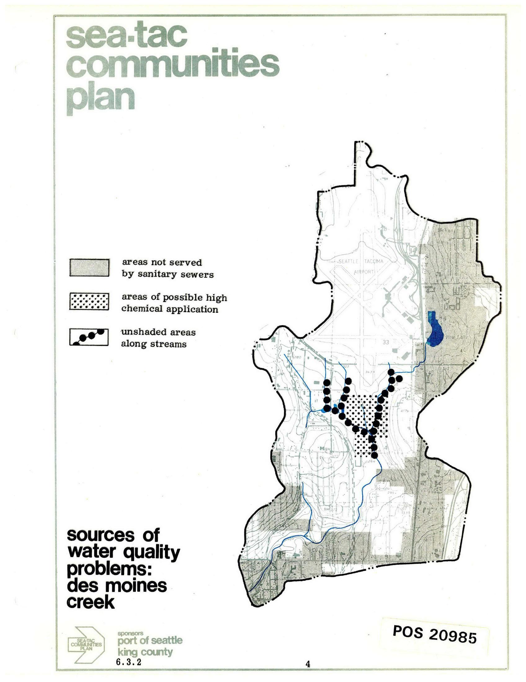
Sea-Tac Communities Plan — Sources of Water Quality Problems in Des Moines Creek
A planning map from the Sea-Tac Communities Plan (document number POS 20985, section 6.3.2), sponsored by the Port of Seattle and King County, identifying sources of water quality problems in Des Moines Creek. The map legend distinguishes areas not served by sanitary sewers, areas of possible high chemical application, and unshaded areas along streams, with the Seattle-Tacoma Airport prominently shown. -
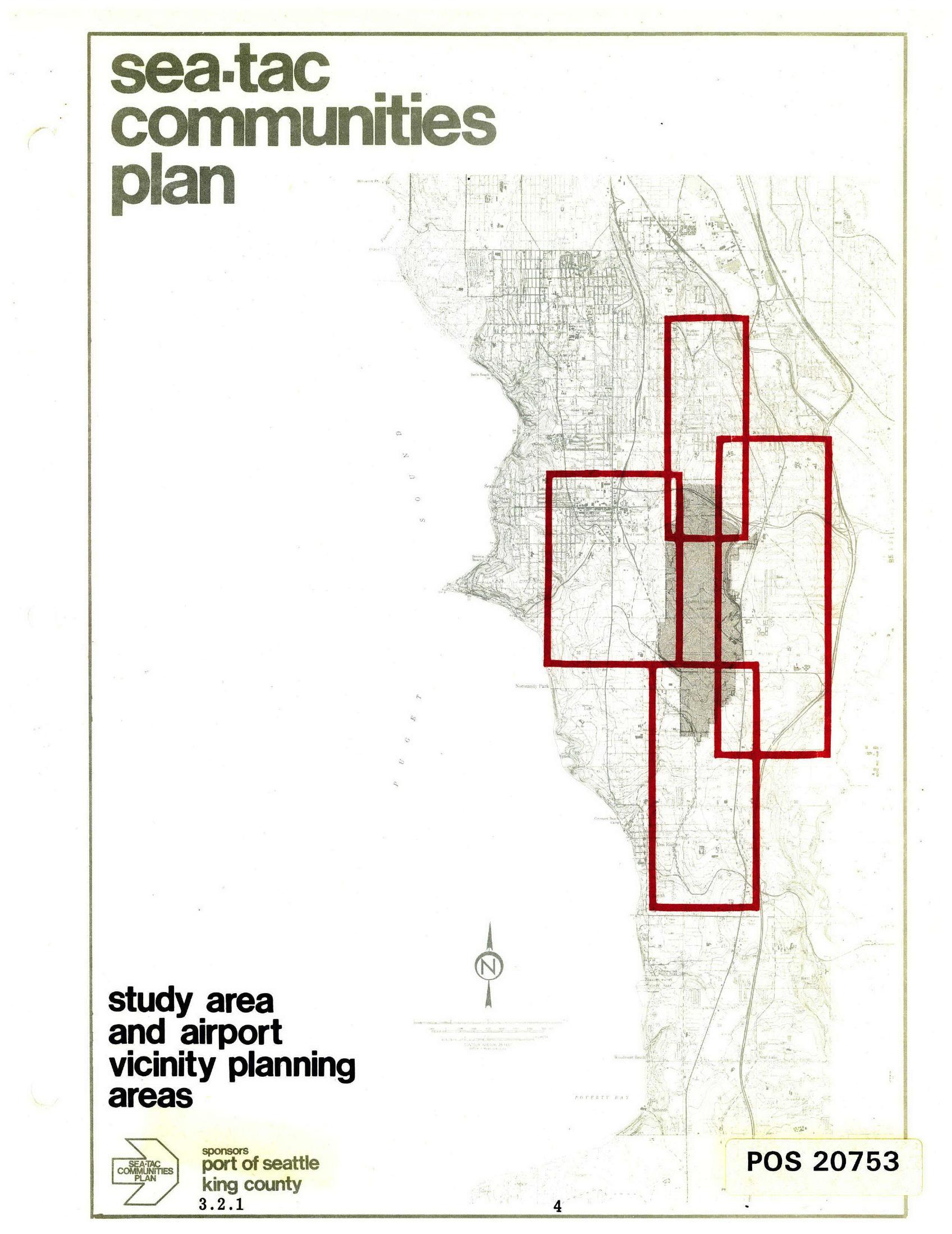
Sea-Tac Communities Plan Study Area and Airport Vicinity Planning Areas Map
Cover page of the Sea-Tac Communities Plan document (map sheet 3.2.1, page 4), jointly sponsored by the Port of Seattle and King County, showing a topographic base map of the Sea-Tac area with red-outlined rectangles delineating the study area and airport vicinity planning zones around Seattle-Tacoma International Airport. The document is catalogued as POS 20753. -
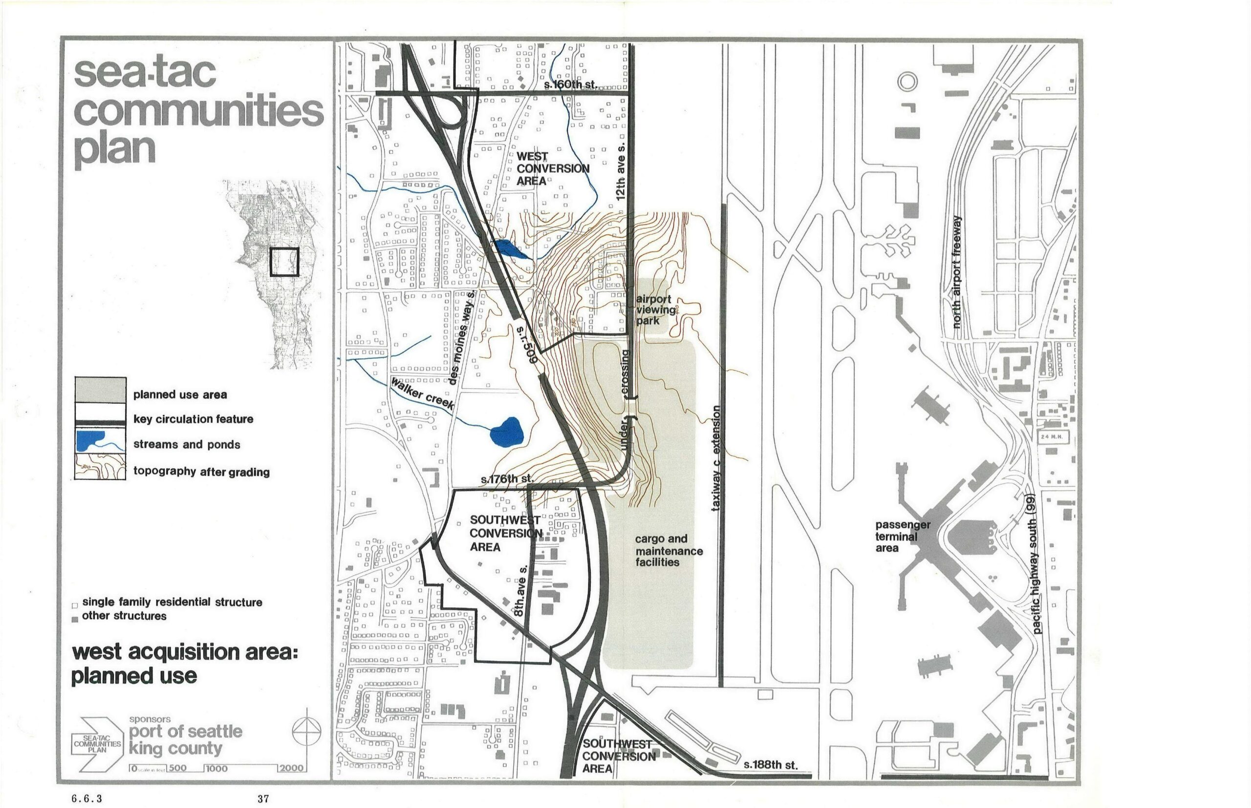
Sea-Tac Communities Plan West Acquisition Area Planned Land Use Map
This planning map, sponsored by the Port of Seattle and King County, depicts the West Acquisition Area planned land uses near Seattle-Tacoma International Airport, showing the West Conversion Area, Southwest Conversion Area, cargo and maintenance facilities, airport viewing park, taxiway C extension, and key circulation features including SR-509 and Des Moines Way S. The map is labeled as page 37, section 6.6.3 of the Sea-Tac Communities Plan. -
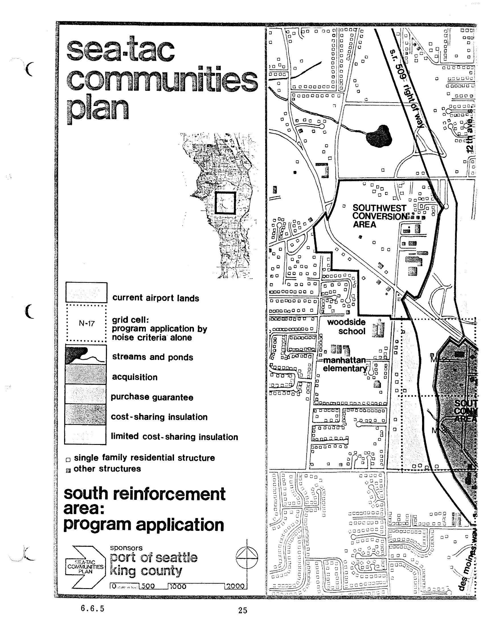
Sea-Tac Communities Plan Chapter 6 — South Reinforcement Area Program Application Map
A planning map from the Sea-Tac Communities Plan, sponsored by the Port of Seattle and King County, depicting the South Reinforcement Area program application including the Southwest Conversion Area, Woodside School, and Manhattan Elementary. The legend identifies land-use and noise-mitigation categories including current airport lands, acquisition zones, purchase guarantee areas, cost-sharing insulation, and grid cells defined by noise criteria (e.g., N-17). -
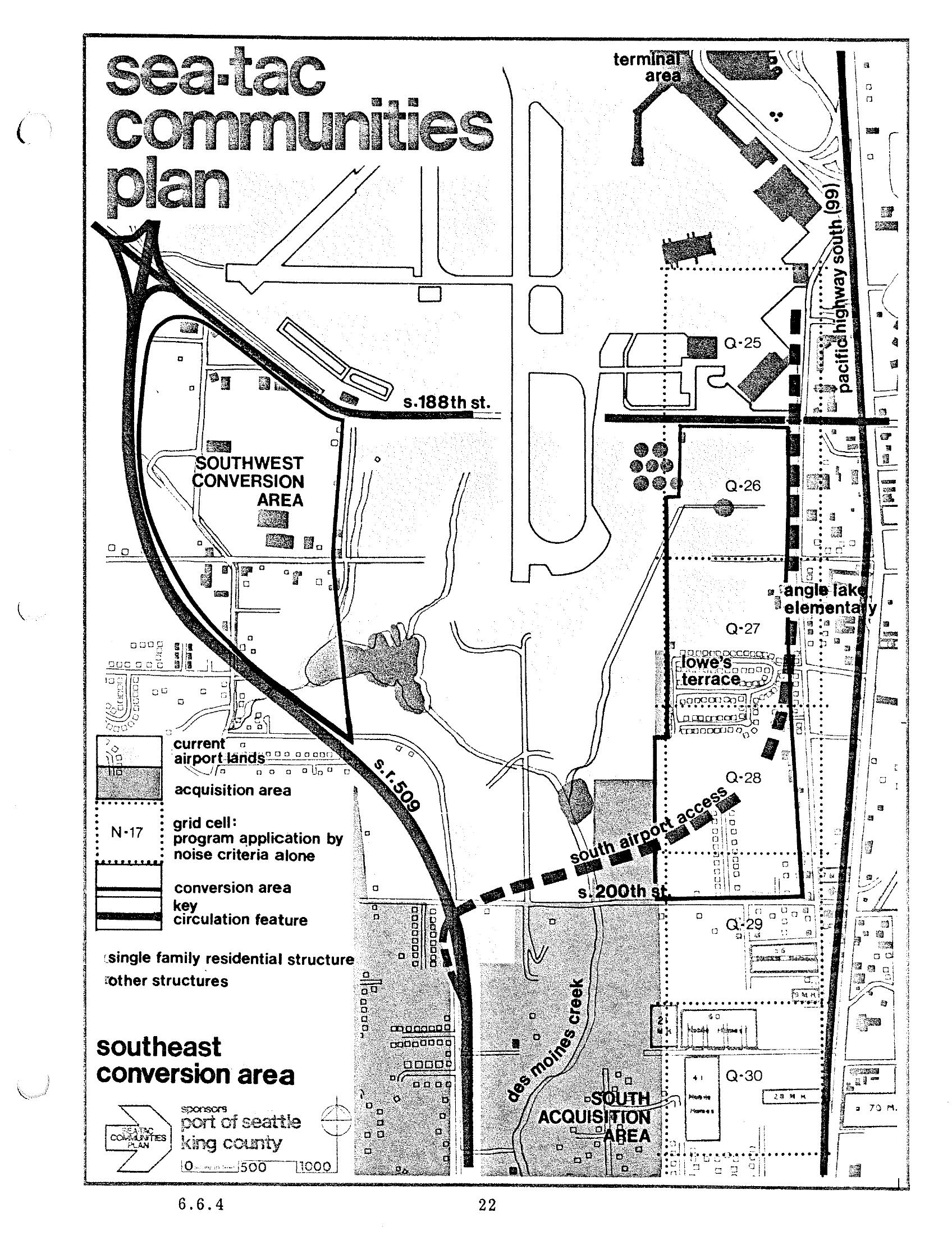
Sea-Tac Communities Plan Chapter 6 Page 22 — Southeast Conversion Area Map
This is page 22 (section 6.6.4) of the Sea-Tac Communities Plan, sponsored by the Port of Seattle and King County. The map depicts the Southeast Conversion Area near Seattle-Tacoma International Airport, showing grid cells, acquisition areas, current airport lands, key circulation features including S.R. 509 and South Airport Access road, and named landmarks such as Angle Lake Elementary, Lowe's Terrace, Des Moines Creek, and street references including S. 188th St. and S. 200th St. -
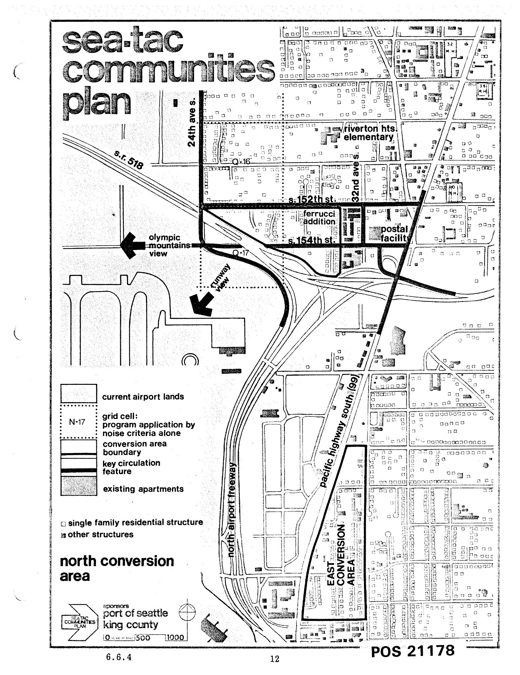
Sea-Tac Communities Plan Chapter 6 Page 12 — North Conversion Area Map
This is page 12 (document reference 6.6.4, POS 21178) of the Sea-Tac Communities Plan, co-sponsored by the Port of Seattle and King County. The map depicts the North Conversion Area near Seattle-Tacoma International Airport, showing current airport lands, grid cells subject to noise-criteria program application, conversion area boundaries, key circulation features, the Ferrucci Addition, a postal facility, Riverton Heights Elementary, S. 152nd and S. 154th Streets, 24th Ave S., 32nd Ave S., Pacific Highway South (SR 99), the North Airport Freeway, and SR 518.