TagSea-Tac Airport(1835)
-
 2019-11-30
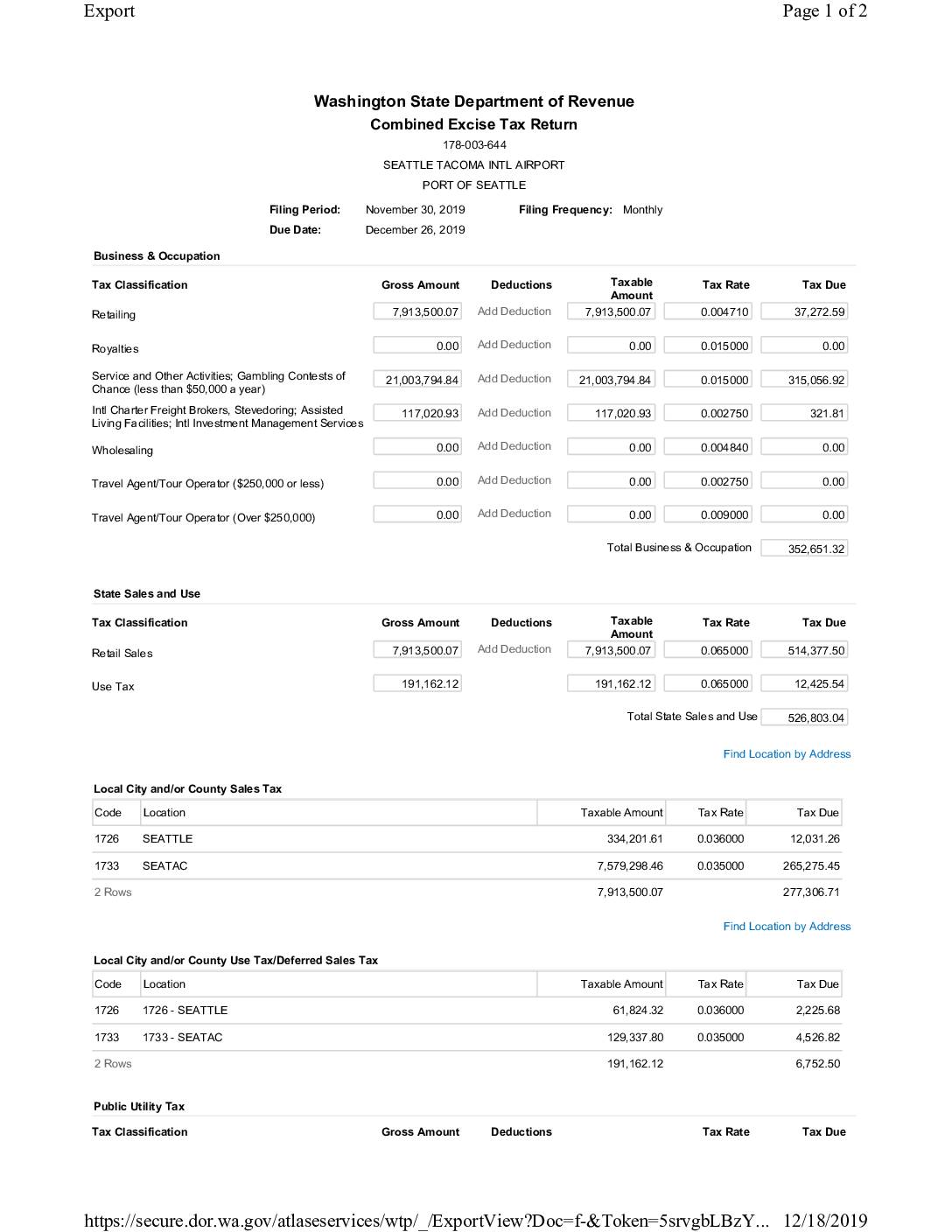
Combined Excise Tax Return: Seattle Tacoma Intl Airport, Port Of Seattle — November 2019
This document is a Washington State Combined Excise Tax Return filed by the Port of Seattle for Seattle-Tacoma International Airport, covering the period ending November 30, 2019. It details Business & Occupation taxes, state and local sales and use taxes, and public utility taxes across multiple classifications, resulting in a total tax liability of $1,194,557.63. The return was submitted on December 18, 2019, by Bonnie McArthur and paid via ACH debit with an effective date of December 26, 2019. -
 2019-11-27
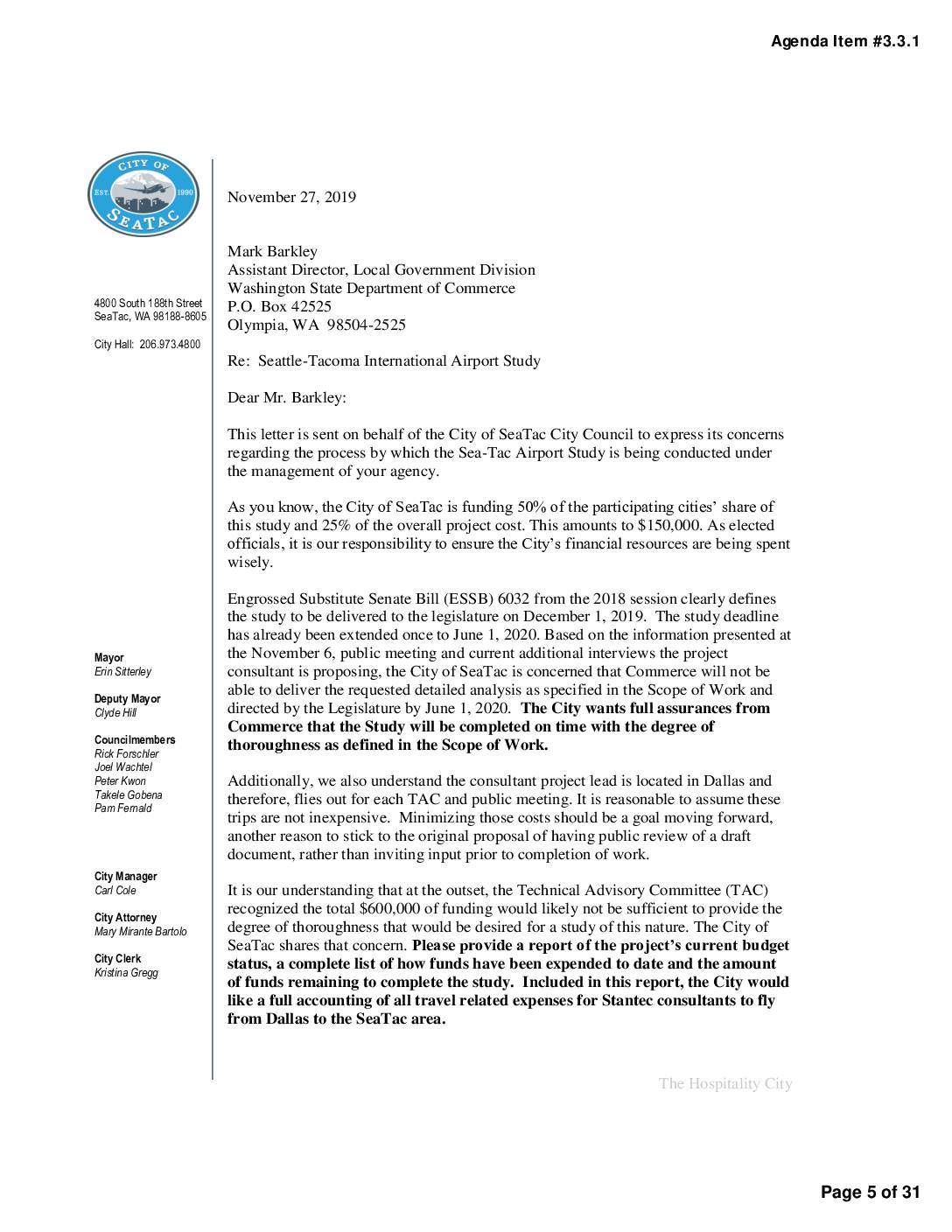
Letter to Washington State Department of Commerce regarding Seattle-Tacoma International Airport Study
In a November 2019 letter to the Washington State Department of Commerce, SeaTac Mayor Erin Sitterley raised concerns about the management of the Seattle-Tacoma International Airport Study, which SeaTac is funding to the tune of $150,000. The city questioned whether consultant Stantec had strayed from the study's original technical scope, flagged potentially wasteful spending on travel from Dallas, and expressed doubt that the study would be completed on time and thoroughly by the June 2020 deadline. The city demanded a full budget accounting and requested that public input be limited until after a draft report was completed and reviewed by the Technical Advisory Committee. -
 2019-11-07
EPA Region 10 response to Debi Wagner regarding Sea-Tac Airport environmental impacts and SAMP Near-Term Projects
These two letters from 2019 address community concerns about noise and environmental impacts from Seattle-Tacoma International Airport (Sea-Tac). The EPA's Region 10 Regional Administrator responds to a Burien resident, explaining the agency's limited role in the NEPA review process and directing her to engage with the FAA regarding the Sustainable Airport Master Plan (SAMP) Environmental Assessment. Separately, the Port of Seattle's Executive Director responds to Burien's mayor, acknowledging community concerns about aircraft noise and emphasizing the Port's commitment to collaboration through forums such as the Sea-Tac Stakeholder Advisory Round Table (StART). -
 2019-10-31
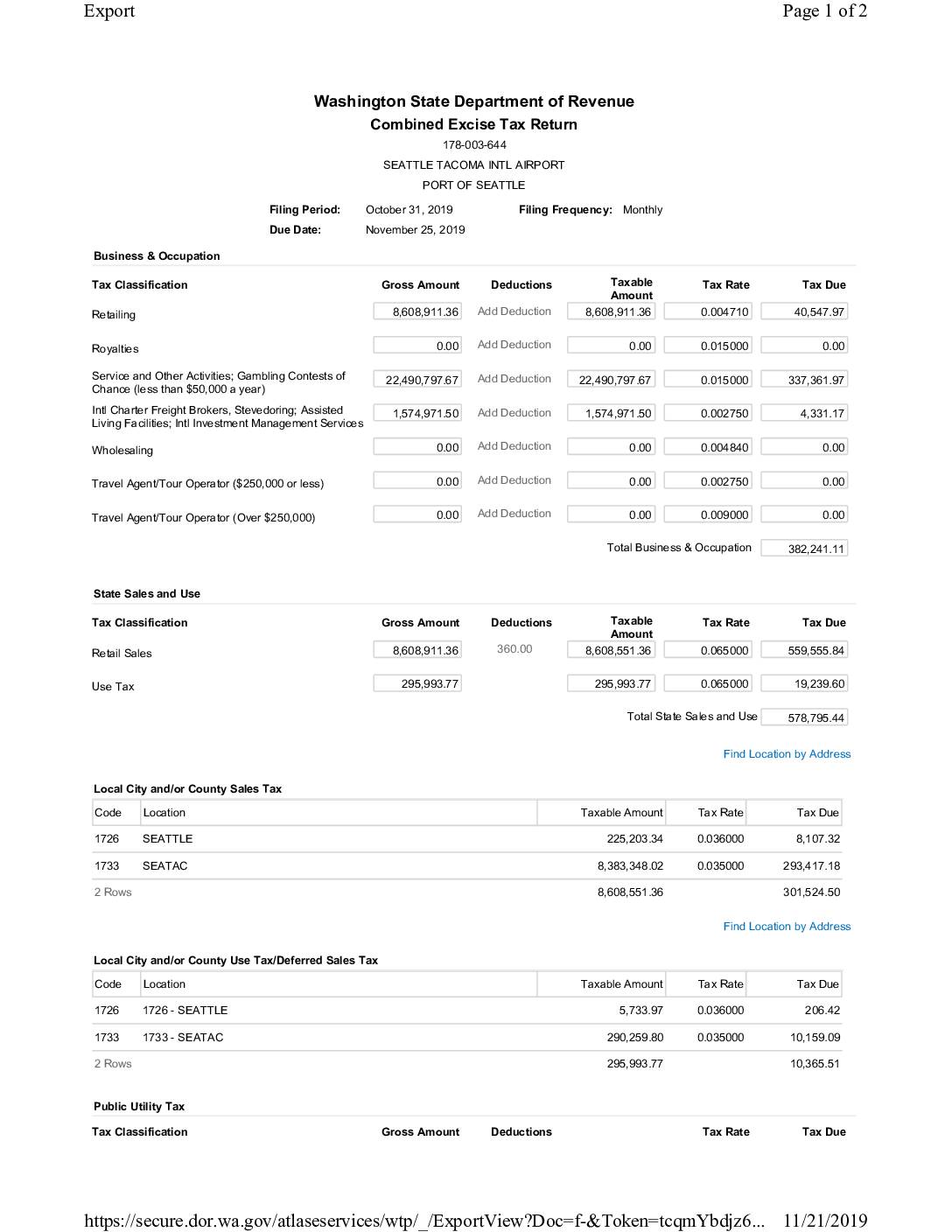
Combined Excise Tax Return: Seattle Tacoma International Airport, Port Of Seattle — October 2019
This document is a Washington State Combined Excise Tax Return filed by the Port of Seattle for Seattle-Tacoma International Airport, covering the period ending October 31, 2019. It details Business & Occupation taxes, state and local sales and use taxes, and Public Utility taxes across categories such as retailing, services, power, water distribution, and sewer collection. The total tax amount of $1,304,787.71 was submitted on November 21, 2019, with payment scheduled via ACH debit on November 25, 2019. -
 2019-10-27
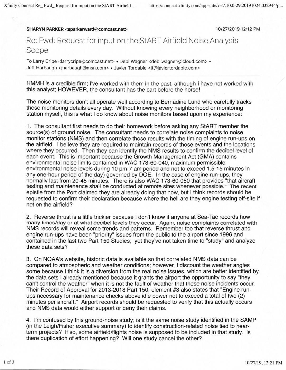
Re: Fwd: Request for input on the StART Airfield Noise Analysis Scope
In October 2019, community advocate Sharyn Parker responded to a request for public input on a Sea-Tac Airport airfield ground noise study being conducted by consulting firm HMMH. Parker argued that the consultant should first analyze existing noise monitor station data, correlate it with engine run-up records and resident complaints, and review compliance with Washington State noise regulations (WAC 173-60) before seeking community feedback. She also raised concerns about non-functioning noise monitors, the airport's unverified claims about off-site engine testing, and potential overlap with a separate noise study tied to the airport's master planning process. -
 2019-10-25
Request for input on the StART airfield noise analysis scope
These emails, dated October–November 2019, relate to a study of ground-level noise at Seattle-Tacoma International Airport initiated by the StART Aviation Noise Working Group. Noise consultant Brad Nicholas of HMMH sought input from surrounding cities, including Burien (which had suspended its StART membership), on which noise sources to analyze and where to place monitoring equipment. Community advocate Sharyn Parker responded with detailed recommendations, arguing the consultant should first correlate existing noise complaints and monitor records with engine run-up events before soliciting public input, and identifying engine run-ups and reverse thrust as the two primary sources of airfield ground noise. -
 2019-10-22
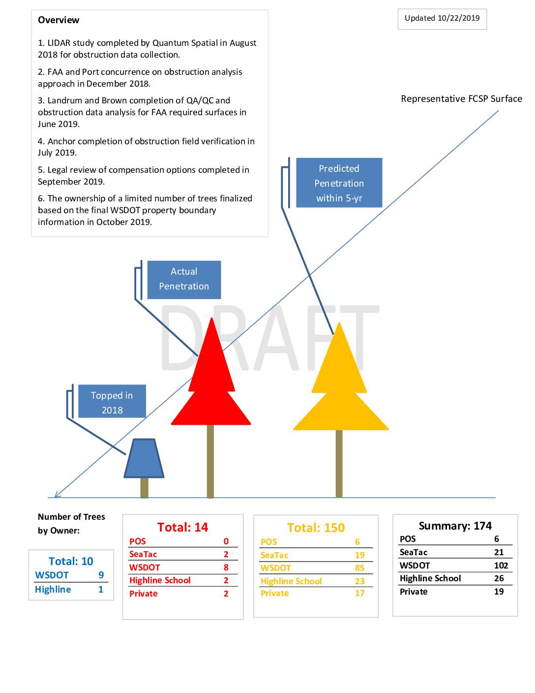
Flight Corridor Safety Program: Tree Obstruction Analysis Overview and Removal Summary
This draft document, updated October 2019, summarizes an obstruction removal study conducted near Seattle-Tacoma International Airport, identifying 174 trees that penetrate or are predicted to penetrate FAA-required airspace surfaces. The trees are distributed across multiple property owners, with WSDOT holding the largest share (102), followed by Highline School District (26), private owners (19), SeaTac (21), and the Port (6). The study, which involved LIDAR scanning, FAA-approved analysis, and field verification, classifies the obstructions as topped, existing, or potential future penetrations, with conifers making up the vast majority of affected trees. -
 2019-10-22
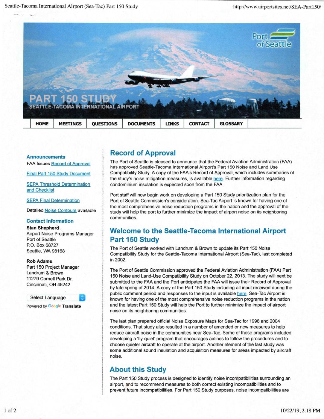
Seattle-Tacoma International Airport (Sea-Tac) Part 150 Study
The Port of Seattle completed an updated Part 150 Noise and Land Use Compatibility Study for Seattle-Tacoma International Airport (Sea-Tac), which was approved by the Port of Seattle Commission in October 2013 and subsequently received a Record of Approval from the Federal Aviation Administration (FAA). The study identifies noise incompatibilities in communities surrounding Sea-Tac and recommends measures to reduce aircraft noise, building on earlier programs such as a 'fly-quiet' initiative and sound insulation efforts. Sea-Tac is recognized as having one of the most comprehensive airport noise reduction programs in the nation, and this updated study is intended to further minimize the impact of aircraft noise on neighboring communities. -
 2019-10-17
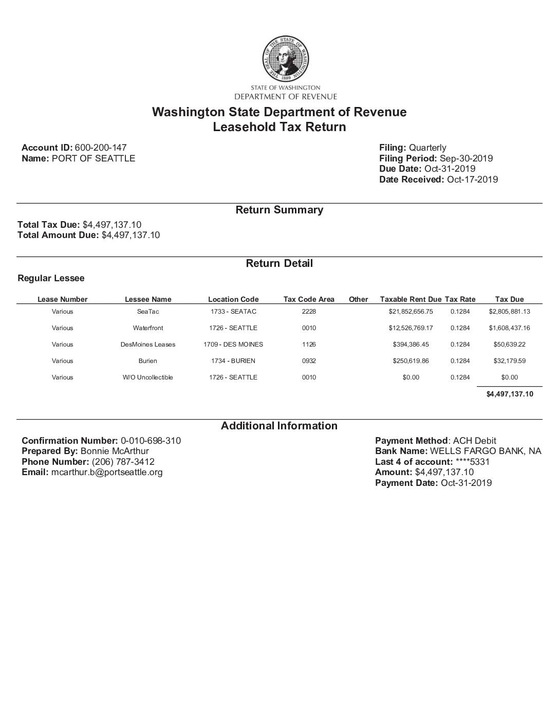
Washington State Department of Revenue Leasehold Tax Return: Port Of Seattle, Q3 2019
The Port of Seattle filed a quarterly Leasehold Tax Return with the Washington State Department of Revenue for the period ending September 30, 2019, reporting a total tax due of $4,497,137.10. The largest portion of taxable rent—$21,852,656.75—was attributed to SeaTac leases (Location Code 1733), generating $2,805,881.13 in tax at a rate of 12.84%. Payment was made via ACH debit from a Wells Fargo account on October 31, 2019. -
 2019-09-30
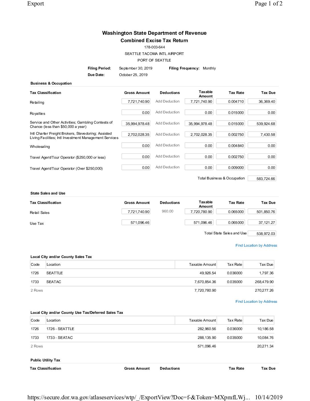
Combined Excise Tax Return: Seattle Tacoma Intl Airport, Port Of Seattle — September 2019
This document is a Washington State Combined Excise Tax Return filed by the Port of Seattle for Seattle-Tacoma International Airport, covering the period ending September 30, 2019. It details Business & Occupation taxes, state and local sales and use taxes, and public utility taxes across multiple classifications, resulting in a total tax liability of $1,439,820.52. The return was prepared by Bonnie McArthur and submitted on October 14, 2019, with payment scheduled via ACH debit on October 25, 2019.