Notes
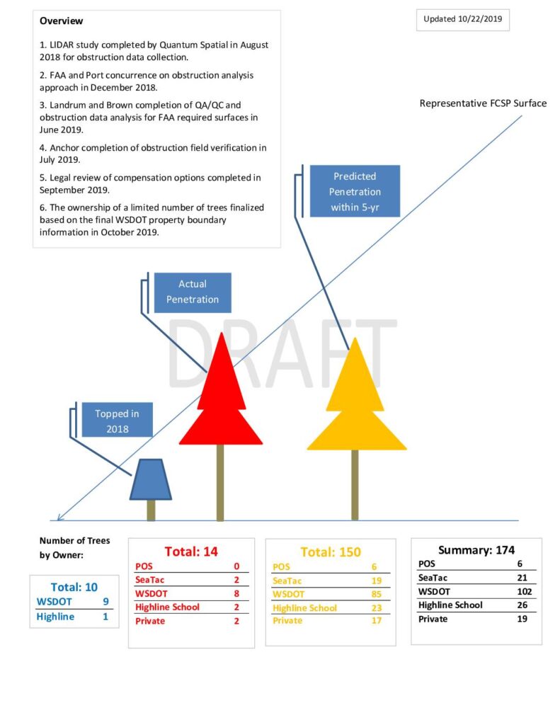
Draft presentation dated October 22, 2019, summarizing the Sea-Tac Airport Flight Corridor Safety Program (FCSP) tree obstruction analysis. Documents 174 total obstructions by owner: WSDOT (102), Highline School District (26), SeaTac (21), Private (19), Port of Seattle/POS (6). Categorizes trees as topped (10), existing penetrations (14), and predicted penetrations within 5 years (150). Species breakdown: 157 conifers, 17 hardwoods. Obstruction removal summary by jurisdiction: WSDOT ROW for SR 509 extension (104), City of SeaTac public including Highline School District property (46), City of SeaTac private including Hillgrove Cemetery (10), City of Burien private residential (7), City of Des Moines (1), Port of Seattle including wetland and wetland buffer (6). LIDAR study by Quantum Spatial (August 2018), QA/QC by Landrum and Brown (June 2019), field verification by Anchor (July 2019), legal review of compensation options (September 2019), WSDOT property boundary finalized (October 2019).