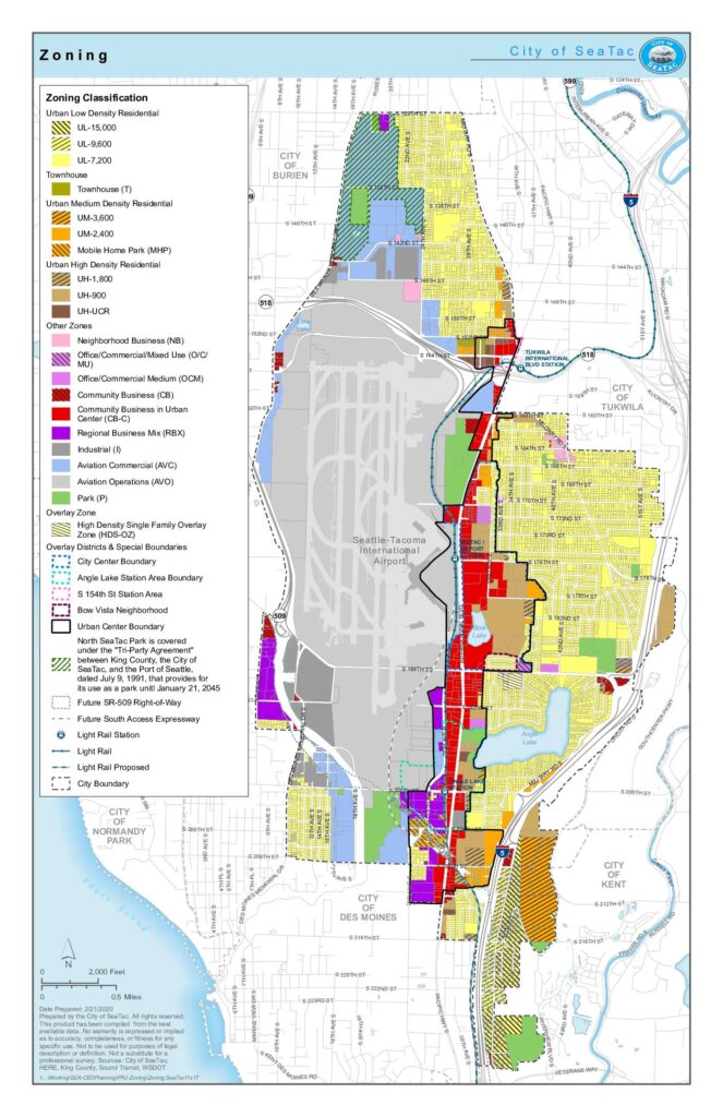
This is the official zoning map for the City of SeaTac, Washington, prepared in February 2020, showing land-use classifications across the city. It covers a range of zones including low-, medium-, and high-density residential areas, commercial and industrial districts, aviation-related zones, and parks, alongside overlay districts and special boundaries such as the Urban Center and Angle Lake Station Area. The map also depicts infrastructure features including light rail stations, the Seattle-Tacoma International Airport footprint, and planned future rights-of-way for SR-509.Open full document
Notes
Official zoning map of the City of SeaTac, Washington, prepared on February 21, 2020. The map displays all zoning classifications including residential, commercial, industrial, aviation, and park zones, as well as overlay districts and special boundaries such as the City Center, Angle Lake Station Area, and Urban Center. It also shows light rail stations, future SR-509 right-of-way, and surrounding city boundaries.