TagSea-Tac Airport(1835)
-
Topographic Map.com (King County)
Topographic Map is a free Internet site that aggregates content from ESRI and OpenStreetMaps to create heat maps for given areas. This particular image shows the plateau (partially man-made) on which the airport sits. -
 2021-07-28
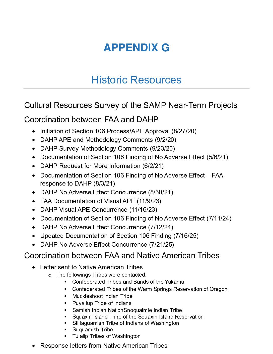
Cultural Resources Survey of the Seattle-Tacoma International Airport Sustainable Airport Master Plan Near-Term Projects, King County
This appendix documents the historic and cultural resources review conducted for near-term construction projects at Seattle-Tacoma International Airport, as part of the Sustainable Airport Master Plan (SAMP). It includes a timeline of coordination between the FAA and Washington's Department of Archaeology and Historic Preservation (DAHP), which ultimately concurred that the projects would have no adverse effect on historic properties. The appendix also records outreach to ten Native American tribes in the region, including the Muckleshoot, Puyallup, Tulalip, and Suquamish, as required under the federal Section 106 review process. -
 2021-07-28
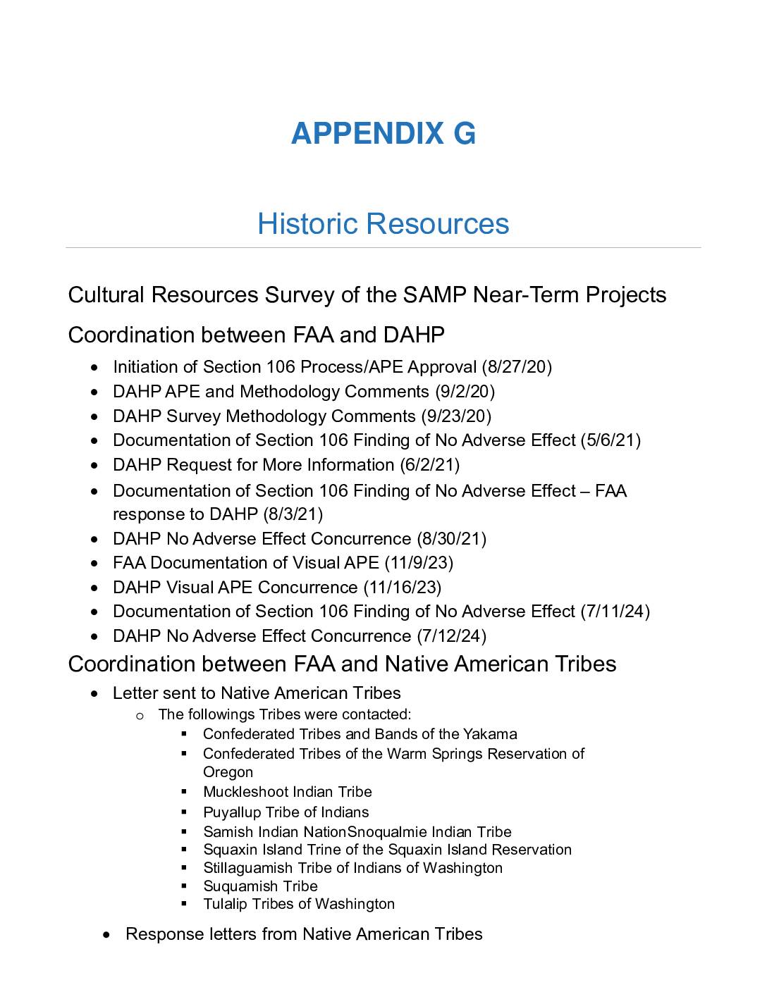
Appendix G: Historic Resources Cultural Resources Survey
This document is Appendix G of the Seattle-Tacoma International Airport Sustainable Airport Master Plan (SAMP), covering a cultural resources survey of near-term airport projects in King County. It outlines coordination between the FAA and the Washington State Department of Archaeology and Historic Preservation (DAHP), which ultimately concurred with findings of No Adverse Effect on historic resources. The appendix also documents outreach to ten Native American tribes as part of the federally required Section 106 review process. -
 2021-07-21
Activity update & outlook: Highline Forum
A July 2021 presentation to the Highline Forum reported that Seattle-Tacoma International Airport (SEA) was steadily recovering from pandemic-related declines, with passenger traffic reaching 71% and scheduled seat capacity reaching 83% of 2019 levels as of June 2021. By August 2021, the flight schedule had climbed to 85% of pre-pandemic capacity, with Alaska Airlines leading the recovery at 97% of its 2019 schedule, while United Airlines lagged at 66%. The document highlights that airlines had largely restored operations to meet rebounding traveler demand. -
 2021-07-21
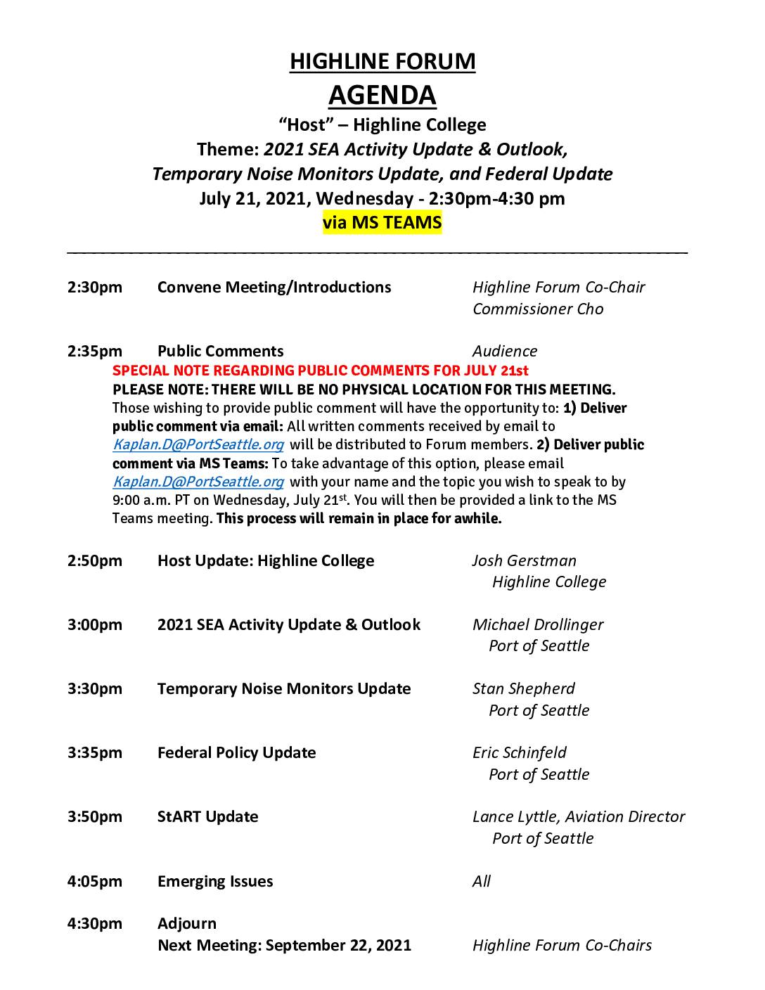
Highline Forum agenda, July 21, 2021
The Highline Forum held a virtual meeting on July 21, 2021, hosted by Highline College, covering updates on 2021 Seattle-Tacoma International Airport (SEA) flight activity, temporary noise monitor installations, and federal aviation policy. The meeting, conducted via Microsoft Teams, featured presentations by Port of Seattle staff and Aviation Director Lance Lyttle, with public comments accepted by email or live video link. The document also lists all six Highline Forum meeting dates for 2021, with hosts rotating among local entities including the cities of Burien, Federal Way, Tukwila, and SeaTac. -
2021-07-20
The Green Guide to Sustainable Travel
Purcell, Arlyn July 20, 2021 The Port of Seattle’s goal is to be the greenest and most energy-efficient airport and seaport in North America. Despite the impact of the pandemic on budgets around the world, we are continuing to move toward that goal, prioritizing our sustainability investments and programs at Seattle-Tacoma International Airport (SEA). And -
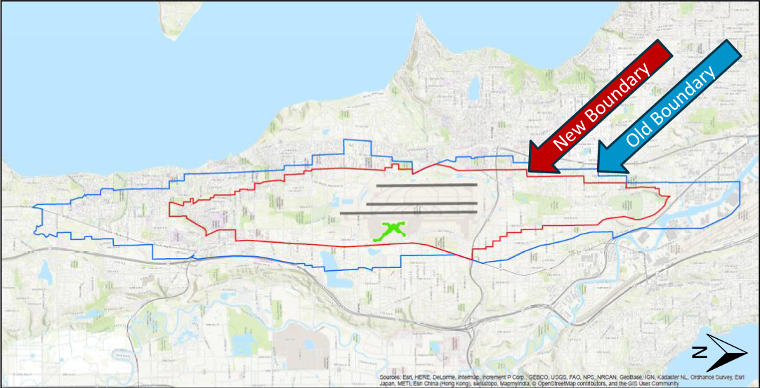
2021 Projected Noise Boundary Map
A GIS map comparing the old noise boundary (blue line) and new noise boundary (red line) around Seattle-Tacoma International Airport, with runway layout and airport symbol visible at center. Map data credited to Esri, HERE, DeLorme, Intermap, GEBCO, USGS, NPS, NRCAN, and other contributors. -
 2021-05-13
Environmental checklist: Seattle-Tacoma International Airport (SEA) Widen Arrivals Drive
The Port of Seattle filed an environmental checklist in May 2021 for a project to widen Arrivals Drive at Seattle-Tacoma International Airport (SEA) from two lanes to four lanes, aiming to reduce congestion and improve safety for passengers and ground transportation vehicles. Construction was planned to begin in mid-2023 and last approximately 18 months, involving road realignments, updated stormwater drainage, new LED lighting, and utility relocations. The project was designed as a standalone improvement but coordinated with broader airport master plan efforts to accommodate potential future infrastructure expansions at SEA. -
 2021-04-20
Community health and airport operations-related noise and air pollution
A 2021 presentation by Public Health Seattle and King County examines how noise and air pollution from Seattle-Tacoma International Airport (SeaTac) affect nearby communities. It covers community health profiles, the current strength of scientific evidence, a University of Washington study on ultrafine particles (UFP), and recommendations for addressing health impacts. The affected communities are notably diverse, with people of color — particularly Native Hawaiian/Pacific Islander and Black/African American residents — making up a disproportionately large share of the airport-area population compared to King County as a whole. -
 2021-03-24
Capital improvement projects update
This March 2021 Capital Improvement Projects update from Seattle-Tacoma International Airport (SEA) outlines a series of major construction and renovation projects planned across the airport campus. Key projects include the International Arrivals Facility and NorthSTAR program opening in 2021, along with longer-term developments such as the North Main Terminal Renovation (2025), C-1 Building (2027), and South Satellite Renovation (2029). The presentation was delivered at the Highline Forum, a community engagement venue relevant to airport neighbors and noise policy stakeholders.