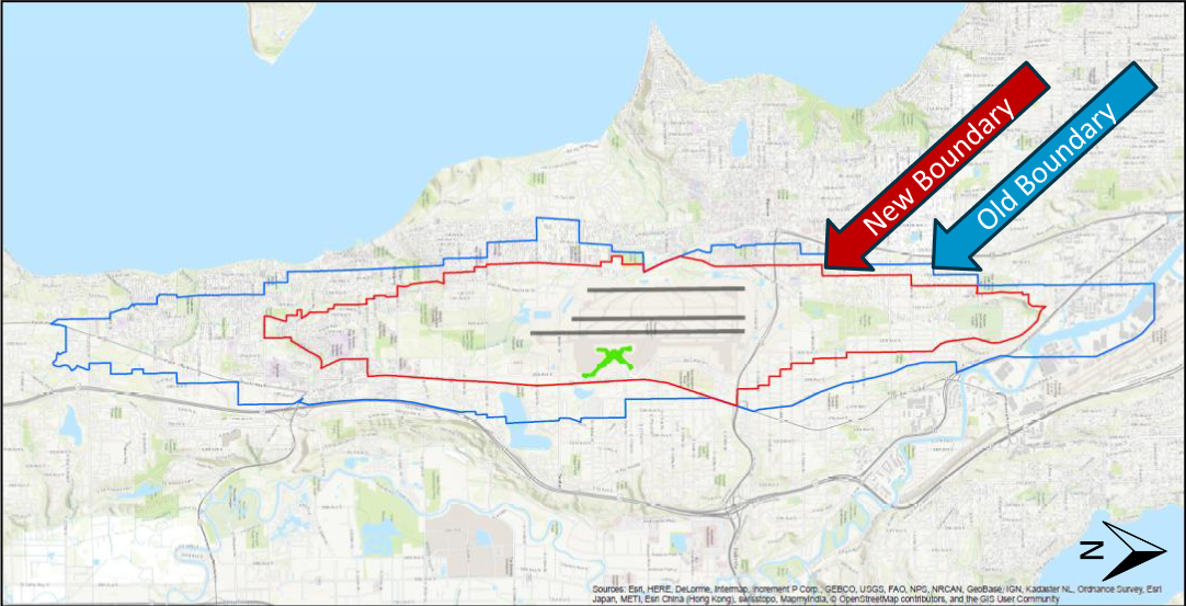
A GIS map comparing the old noise boundary (blue line) and new noise boundary (red line) around Seattle-Tacoma International Airport, with runway layout and airport symbol visible at center. Map data credited to Esri, HERE, DeLorme, Intermap, GEBCO, USGS, NPS, NRCAN, and other contributors.Open full document
Notes
A GIS map comparing the old noise boundary (blue line) and new noise boundary (red line) around Seattle-Tacoma International Airport, with runway layout and airport symbol visible at center. Map data credited to Esri, HERE, DeLorme, Intermap, GEBCO, USGS, NPS, NRCAN, and other contributors.