TagSea-Tac Airport(1835)
-
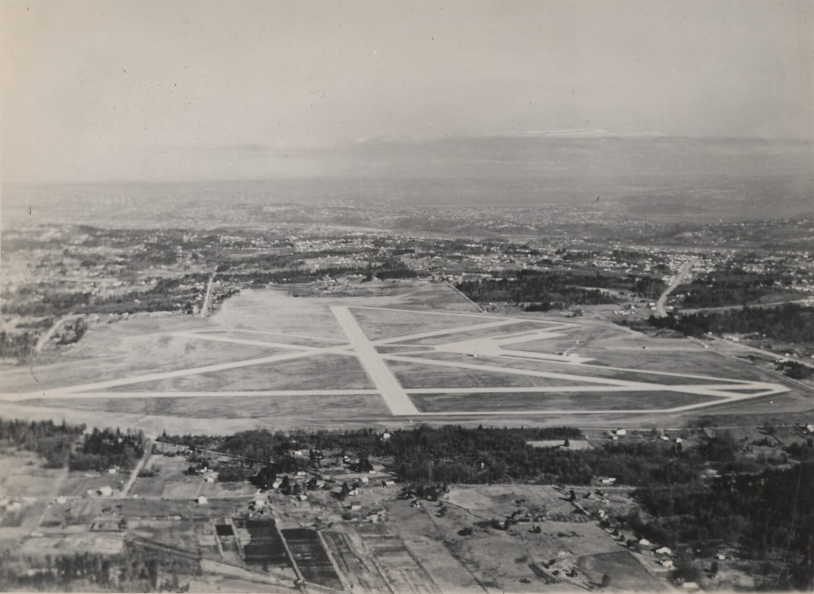
Bow Lake Airport Aerial View
Black-and-white aerial photograph showing a small to mid-sized airport with a triangular or star-pattern runway configuration and multiple taxiways. The surrounding area shows suburban residential development, wooded tracts, and agricultural parcels extending toward a distant urban area and mountains on the horizon. -
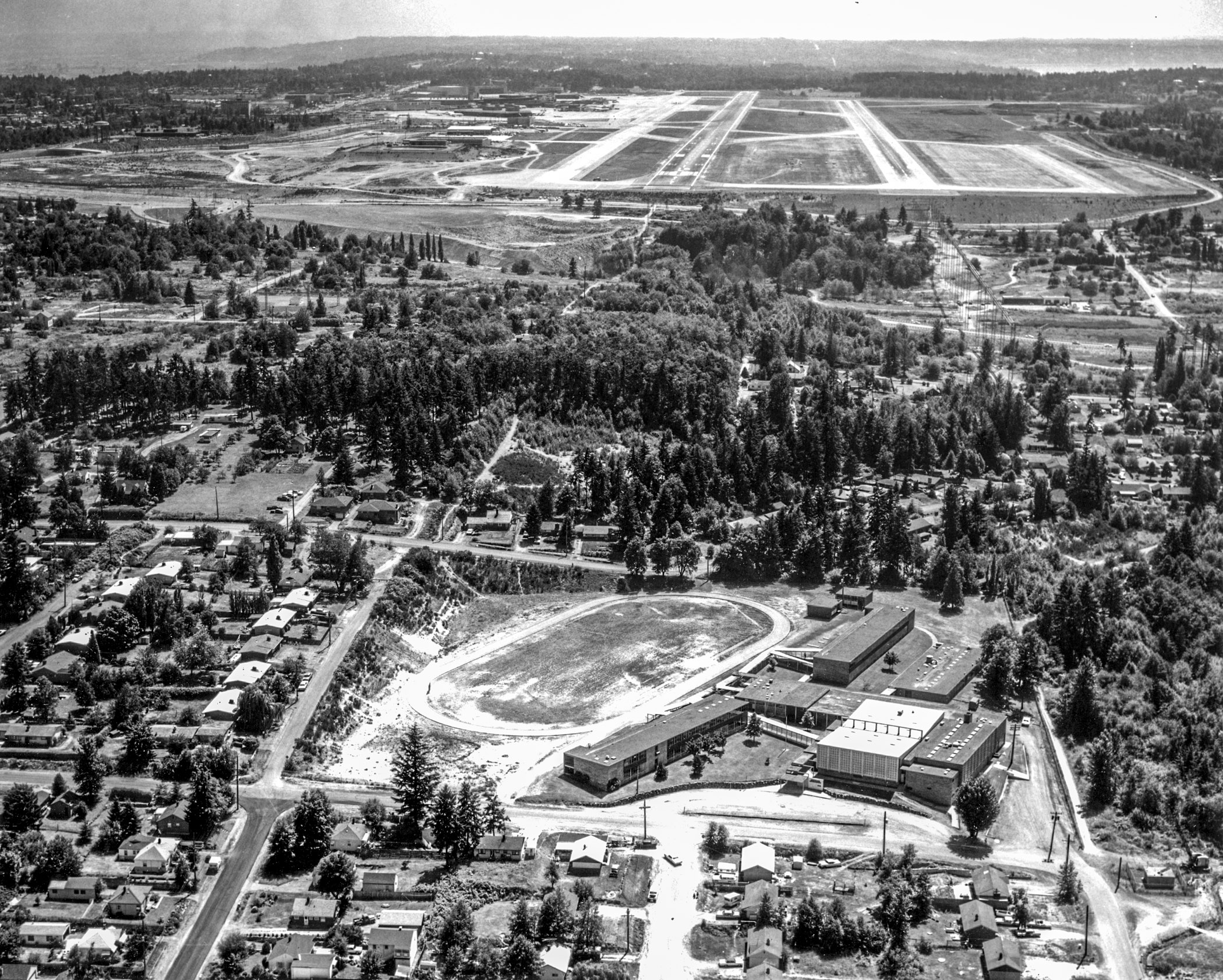
Aerial View of Sea-Tac Airport Runways and Adjacent Residential Neighborhood
Black-and-white aerial photograph showing a mid-20th century airport with multiple runways and taxiways in the background, and a residential neighborhood with a large oval water reservoir or sports track and modernist institutional buildings in the foreground. No visible text, captions, or watermarks are present in the image. -
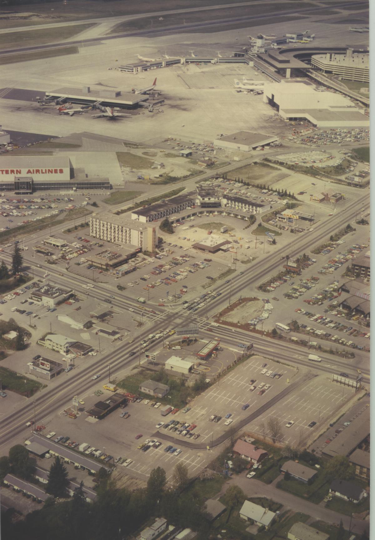
STIA historical south east aerial
Aerial photograph looking north toward Sea-Tac Airport showing terminal buildings, aircraft at gates, and a Western Airlines facility (visible signage on left). The foreground shows the International Boulevard/Pacific Highway South commercial corridor with motels, parking lots, and retail businesses adjacent to the airport. -
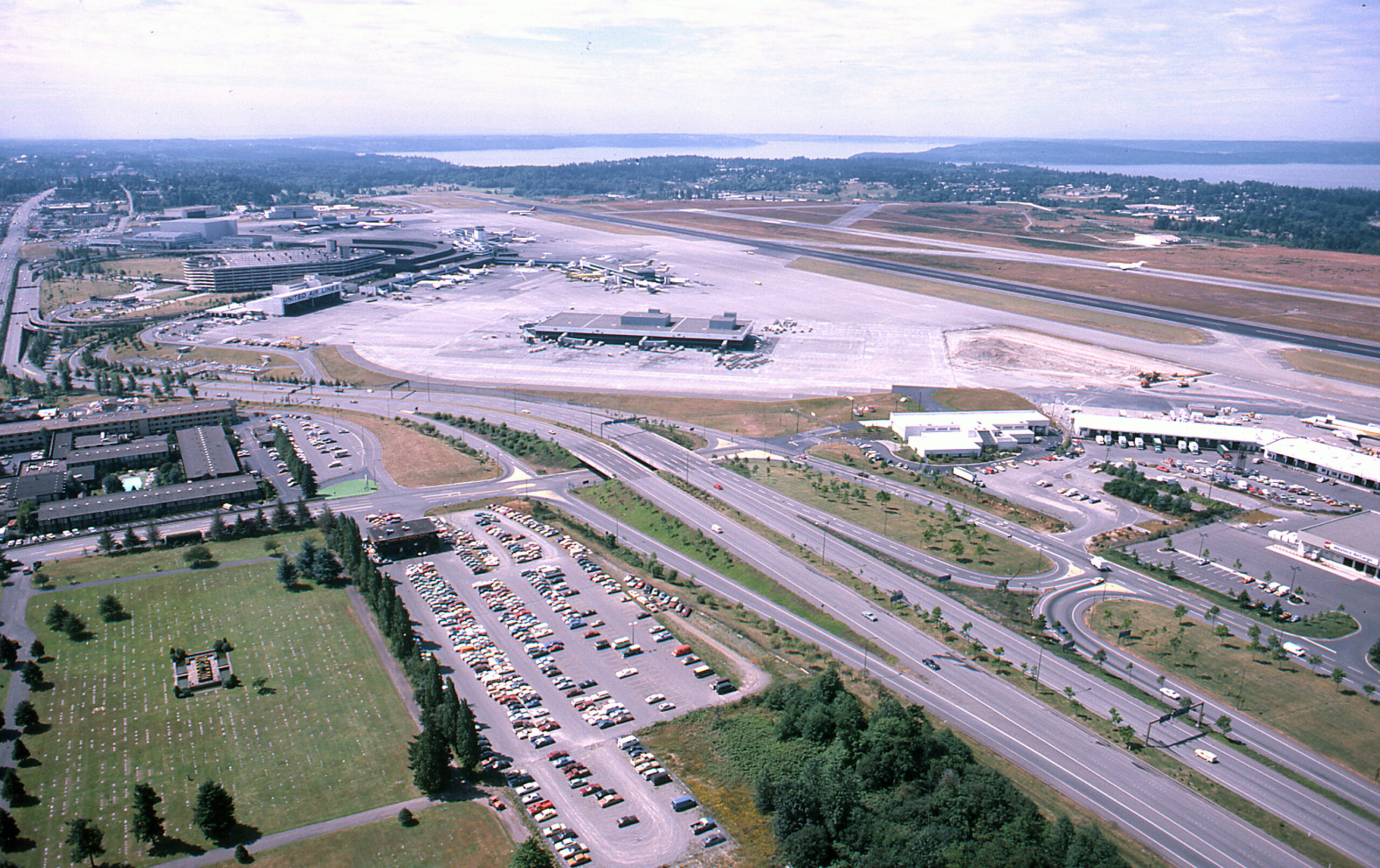
SEA-TAC Aerial w cargo 1981
Aerial photograph looking northward over Sea-Tac Airport showing the main terminal complex, satellite concourses, apron areas, runways, and Puget Sound visible in the background. A large surface parking lot, access roads, and adjacent commercial/hotel buildings are visible in the foreground; vehicle styles and airport layout suggest the photograph dates from the early-to-mid 1970s. -
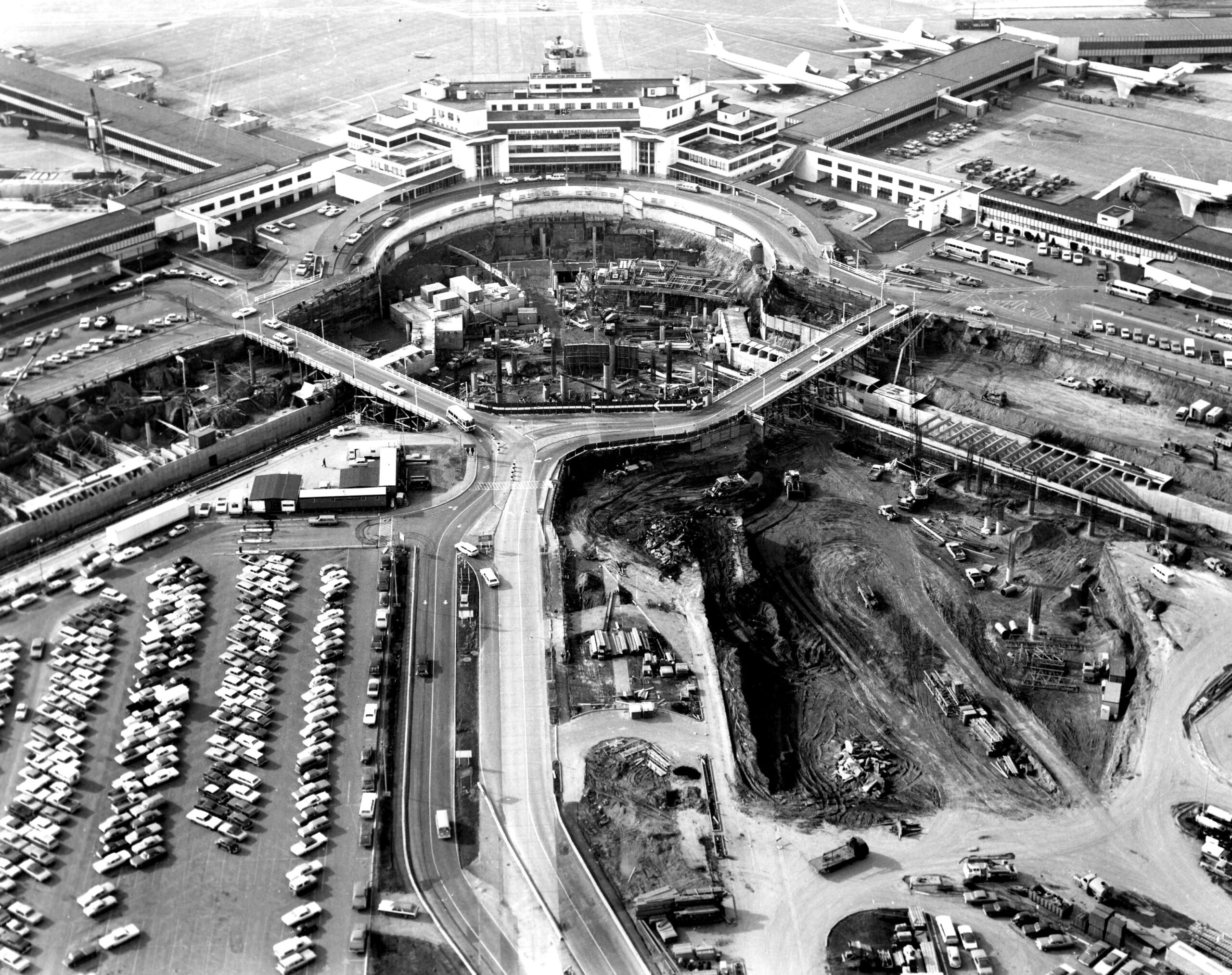
Sea-Tac Airport Aerial View During Terminal Expansion Construction
Black-and-white aerial photograph showing a large airport terminal complex with a distinctive circular roadway/structure under active construction in the foreground. Jet aircraft are visible at gates in the background, and large parking lots and excavation work are visible, suggesting a significant expansion or renovation project. -
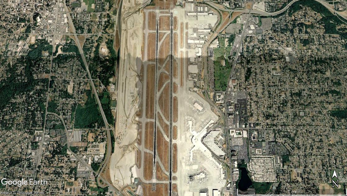
Sea-Tac Airport Satellite View Showing Parallel Runways and Terminal Complex
Google Earth satellite image of Seattle-Tacoma International Airport (Sea-Tac), showing its parallel runway configuration, terminal complex on the east side, and surrounding suburban neighborhoods in King County, Washington. The image is credited to Google Earth and the U.S. Geological Survey, with a scale bar indicating approximately 1 mile. -
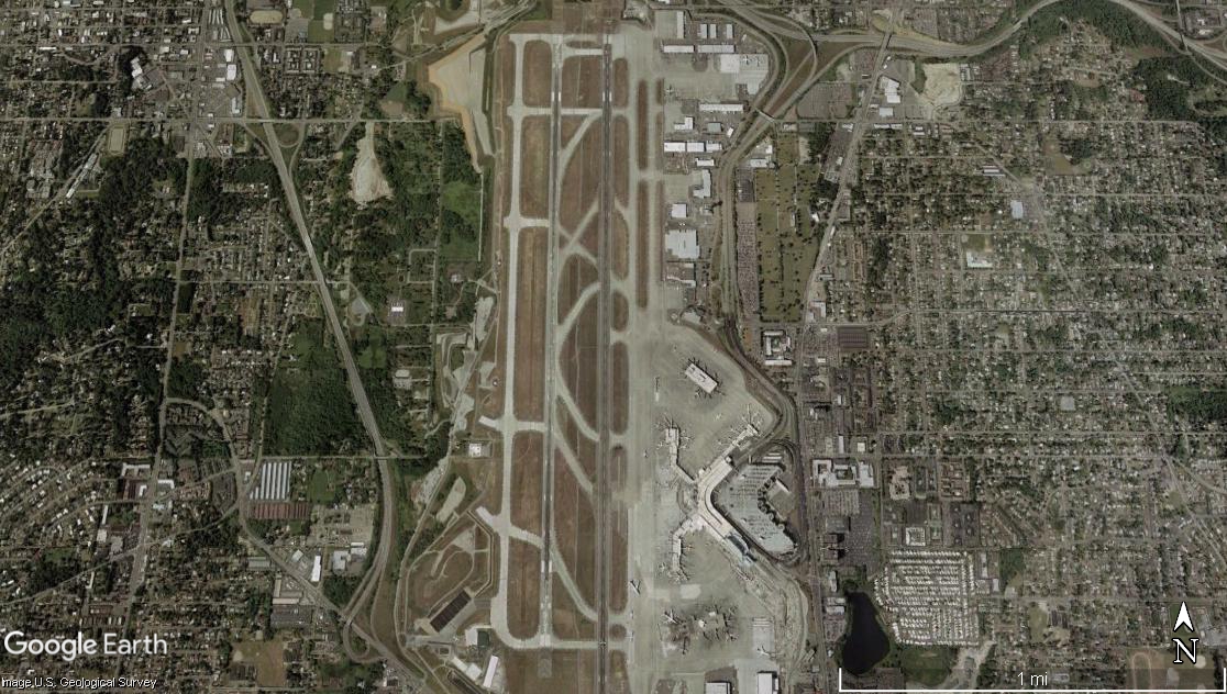
Sea-Tac Airport Two Parallel Runways Satellite View
Google Earth satellite image showing an airport with two parallel runways oriented roughly north-south, surrounded by dense residential and commercial development on all sides. The terminal complex and taxiways are visible on the east side of the runways; a scale bar indicates approximately 1 mile across the image. -
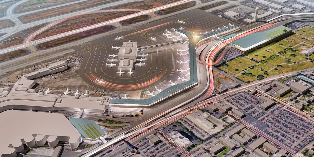
Alaska Airlines North Terminal Expansion Rendering at Sea-Tac Airport
An architectural rendering of a proposed terminal expansion at Seattle-Tacoma International Airport, attributed to Alaska Airlines as indicated by the watermark 'Image: Alaska Airlines' visible in the lower right corner. The aerial view depicts a new satellite concourse with aircraft gates, taxiways, and ground transportation connections. -
 2022-09-12
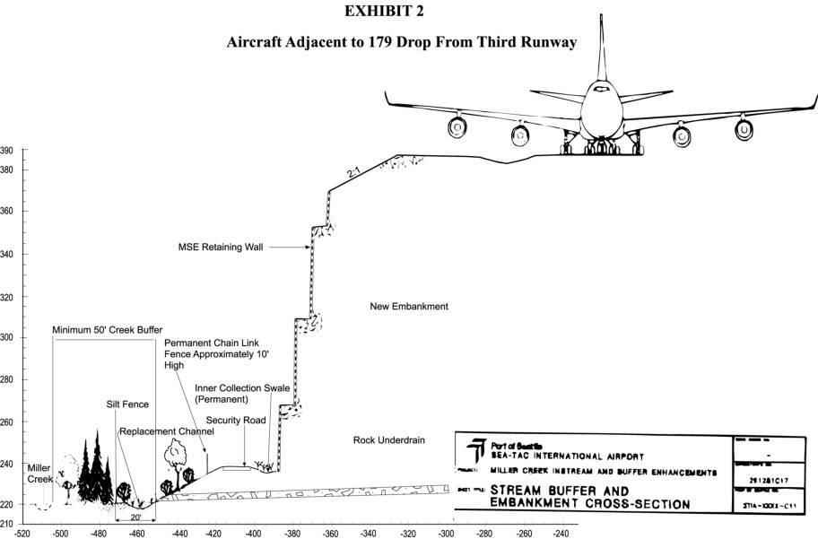
Aircraft adjacent to 179 drop from third runway
This engineering cross-section diagram from Sea-Tac International Airport illustrates the dramatic 179-foot elevation drop adjacent to the proposed Third Runway, showing how a massive retaining wall and new embankment would be constructed alongside Miller Creek. The exhibit depicts key infrastructure features including a permanent chain-link security fence, rock underdrain, silt fence, inner collection swale, and a minimum 50-foot creek buffer zone designed to protect the existing waterway. The drawing is part of the Miller Creek Instream and Buffer Enhancements project documentation associated with the Third Runway expansion. -
 2022-09-12
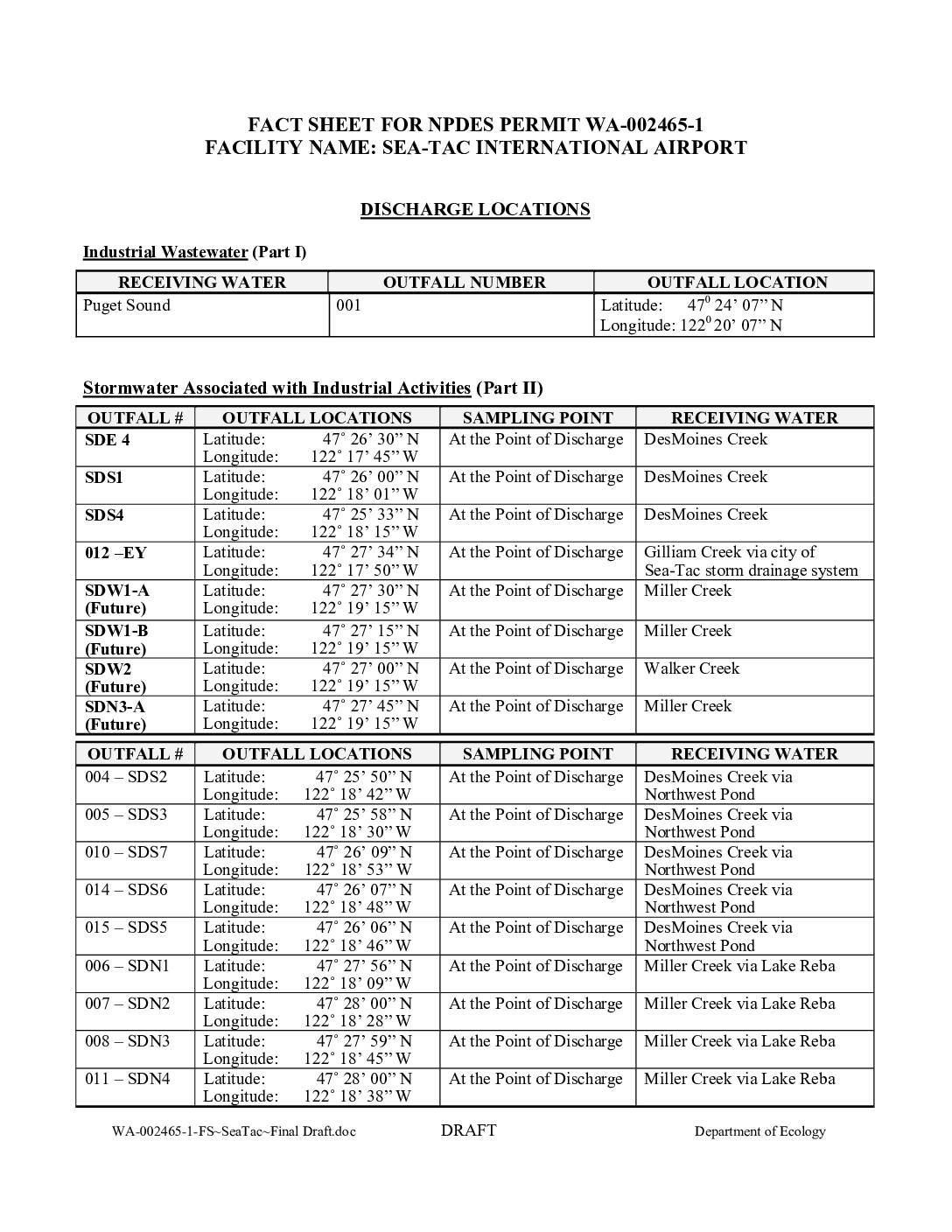
Fact sheet for NPDES permit WA-002465-1, Sea-Tac International Airport
This document is an NPDES (National Pollutant Discharge Elimination System) permit fact sheet for Sea-Tac International Airport, issued by the Washington State Department of Ecology. It details the locations of numerous water discharge outfalls across the airport property, covering industrial wastewater, stormwater from industrial activities, and stormwater from construction activities. The discharges flow into several local waterways including Des Moines Creek, Miller Creek, Walker Creek, Gilliam Creek, and Puget Sound.