TagSea-Tac Airport(1835)
-
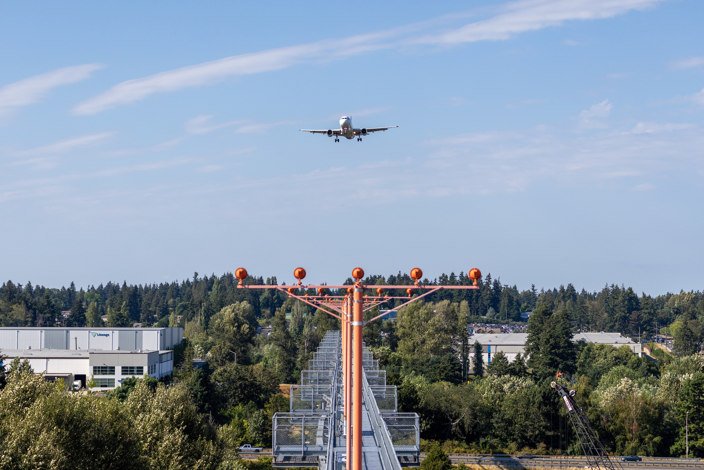
Twin-Engine Commercial Jet on Final Approach to Sea-Tac Airport with ALS Lighting
A twin-engine commercial jet aircraft on final approach is aligned with an Approach Lighting System (ALS) featuring orange crossbar structures and sequenced flasher lights. A 'Lineage' logistics facility is visible in the background left, consistent with the industrial corridor adjacent to Seattle-Tacoma International Airport. -
 2022-09-16
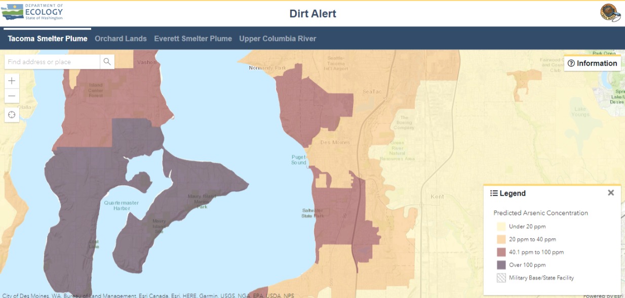
Washington State Ecology Dirt Alert Map: Tacoma Smelter Plume Arsenic Concentrations Near Sea-Tac Airport
A screenshot of the Washington State Department of Ecology's 'Dirt Alert' web mapping application showing the Tacoma Smelter Plume tab, displaying predicted arsenic soil concentrations across the south King County / Pierce County area including SeaTac, Des Moines, Vashon Island, and Maury Island. The legend indicates concentration zones ranging from under 20 ppm (light yellow) to over 100 ppm (dark purple), with SeaTac Airport and surrounding communities falling within the 40.1–100 ppm range. -
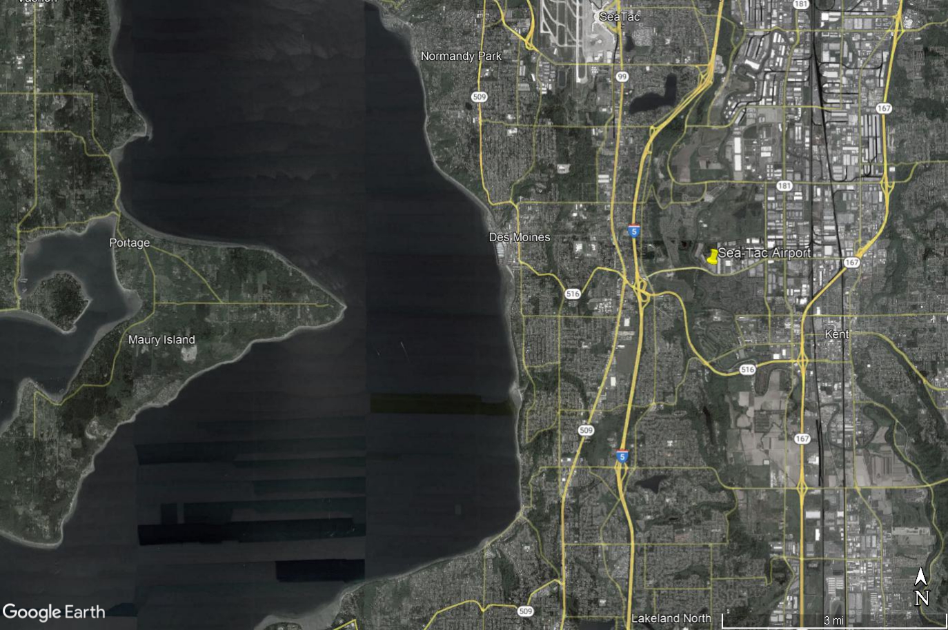
Google Earth Aerial View: Sea-Tac Airport to Maury Island and Des Moines Beach Noise-Impact Study Area
Google Earth aerial/satellite image showing Seattle-Tacoma International Airport (Sea-Tac) and surrounding communities including Des Moines, Normandy Park, Kent, Maury Island, and Portage, with Interstate 5, SR-509, SR-516, and SR-167 visible. The image includes a yellow pin marker at Sea-Tac Airport and covers the broader noise-impact study area west of Puget Sound to east of the airport corridor. -
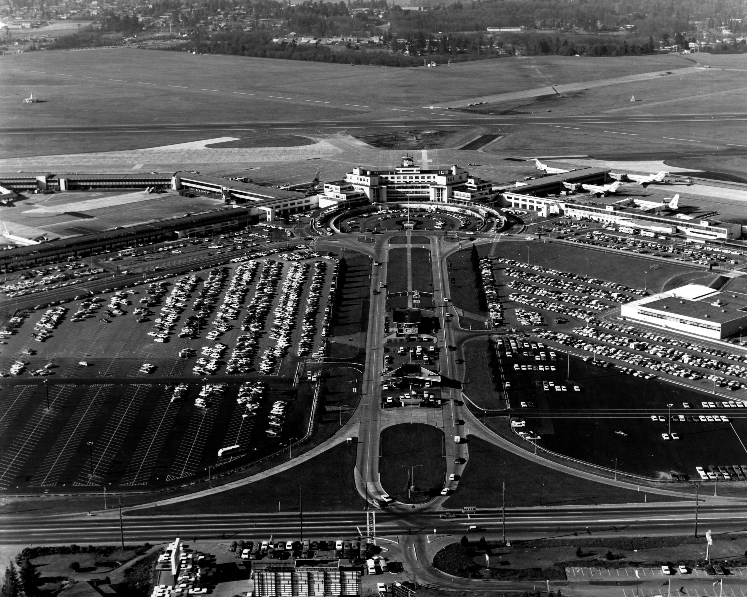
Sea-Tac Airport Aerial View, Mid-Century Layout
Aerial photograph of Seattle-Tacoma International Airport (Sea-Tac) showing the original terminal building with control tower, surrounding parking lots, access roads, and aircraft gates. The image captures the airport's mid-century layout prior to major expansions, consistent with the period shortly after its 1949 opening through the early jet age, with propeller and early jet aircraft visible at the gates. -
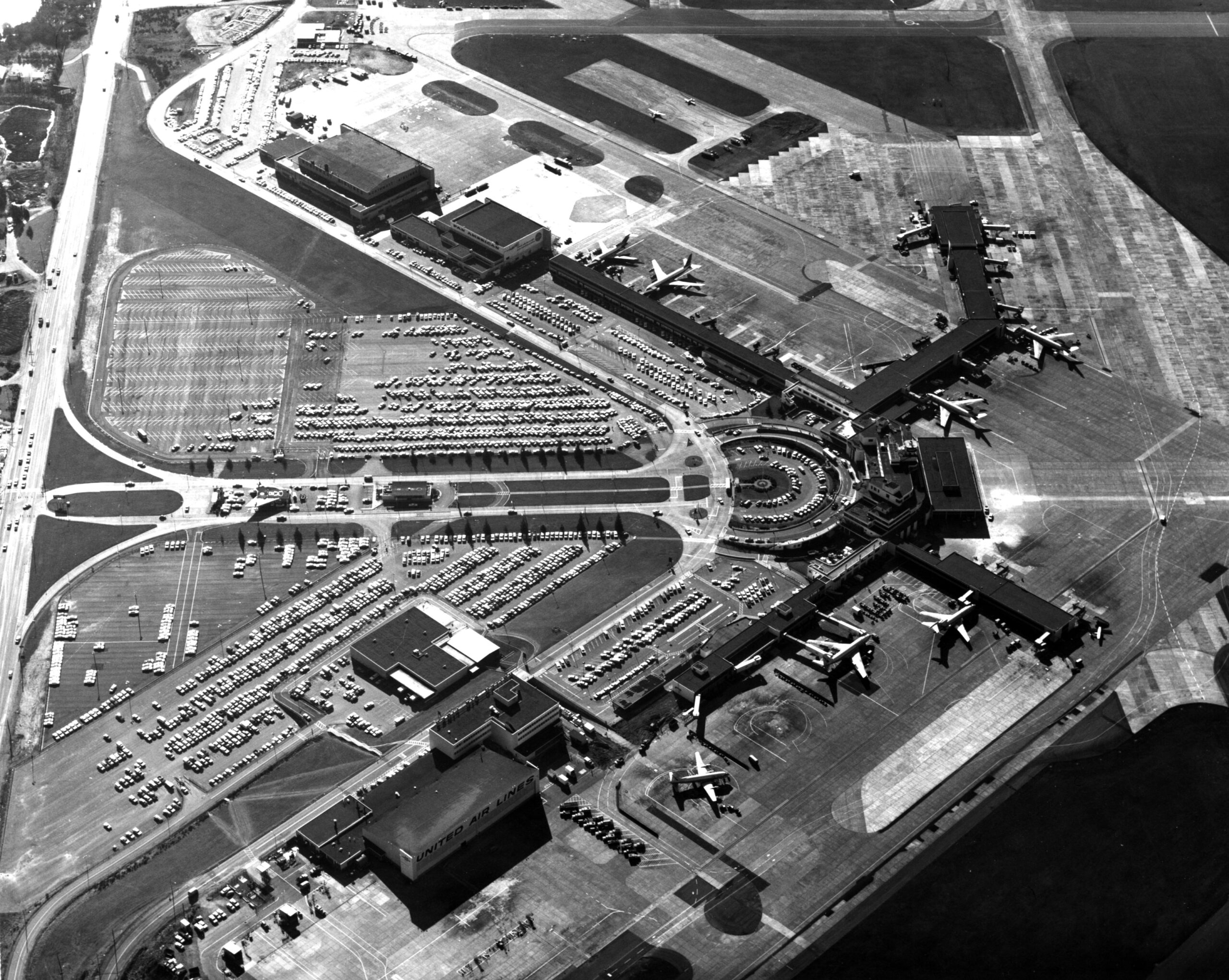
Sea-Tac Airport Aerial View Showing United Air Lines Terminal, circa 1960s
Aerial photograph of Seattle-Tacoma International Airport showing the terminal complex, parking areas, taxiways, and aircraft on the apron. A building in the lower portion of the image is clearly labeled 'United Air Lines,' indicating this photo dates from the jet era of airport operations, likely the 1960s based on the aircraft types and terminal configuration visible. -
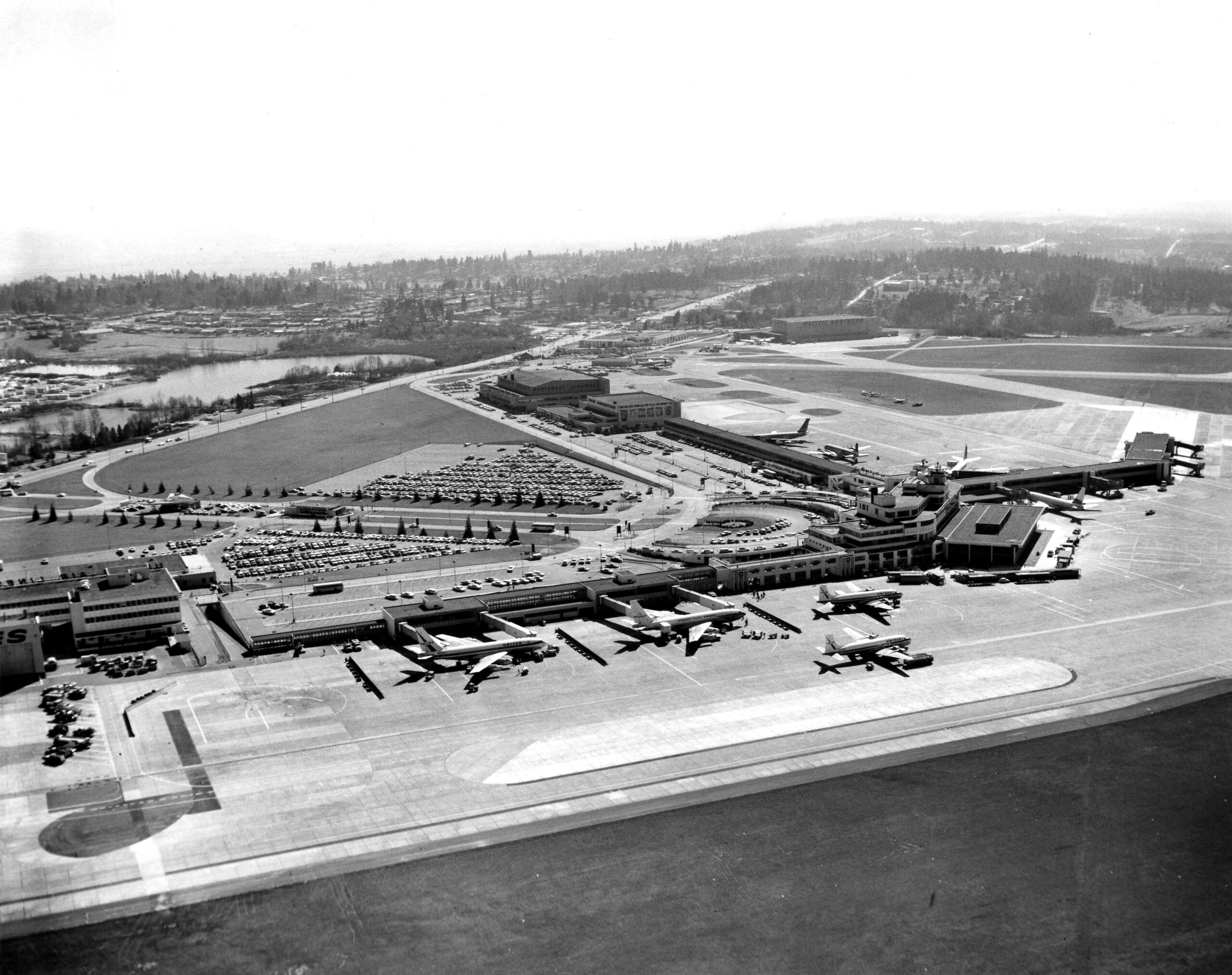
Sea-Tac Airport Aerial View, circa Late 1950s–Early 1960s
Black-and-white aerial photograph showing a commercial airport terminal complex with multiple propeller and early jet aircraft at gates, large surface parking lots, and suburban landscape visible in the background. The layout, runway configuration, and architectural style are consistent with a mid-century Pacific Northwest regional airport, likely dating to the late 1950s or early 1960s. -
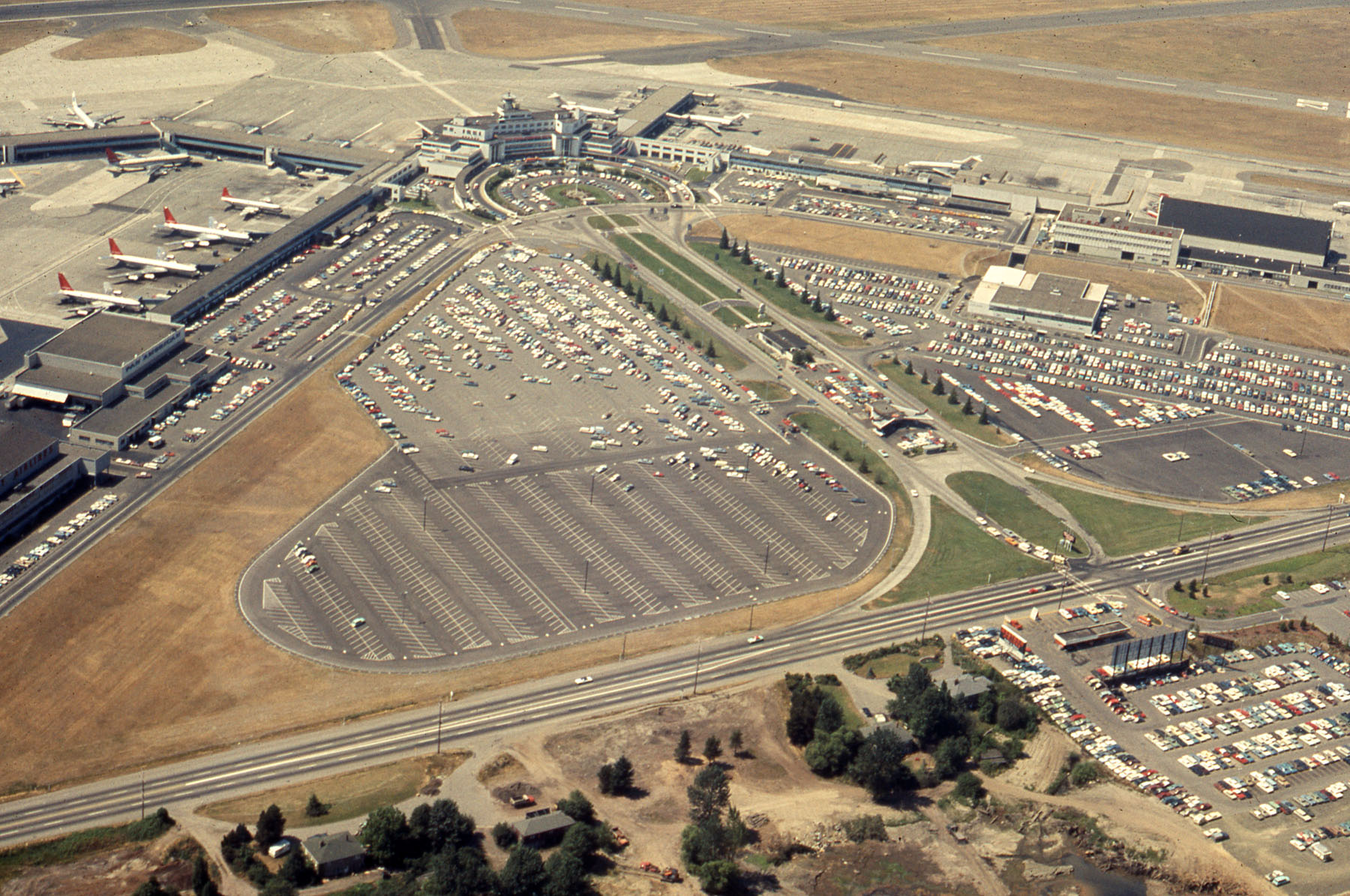
Sea-Tac Airport Aerial View, 1960s–1970s
Aerial photograph showing a large airport terminal complex with multiple aircraft bearing red tail livery consistent with Northwest Airlines, extensive surface parking lots, and runway infrastructure visible in the background. The dry summer conditions, vehicle styles, and airport layout are consistent with a Pacific Northwest hub airport from the 1960s–1970s era, possibly Sea-Tac or Portland International. -
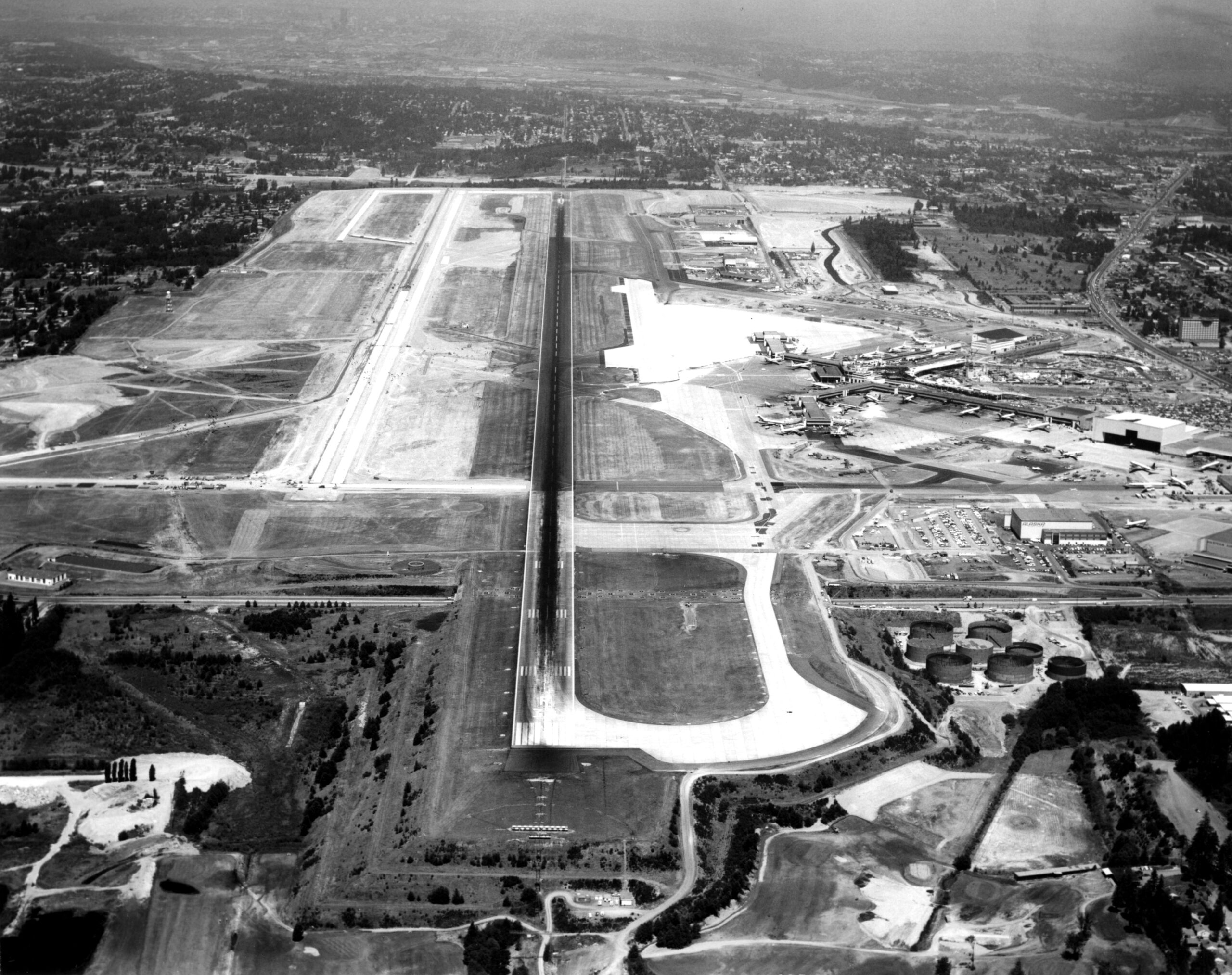
Sea-Tac Airport Aerial View During Expansion Construction
Black-and-white aerial photograph showing a major commercial airport with a central runway, terminal complex with jet aircraft at gates visible on the right side, and extensive grading and construction activity suggesting a significant expansion project underway. Fuel storage tanks and support facilities are visible in the lower right quadrant. -
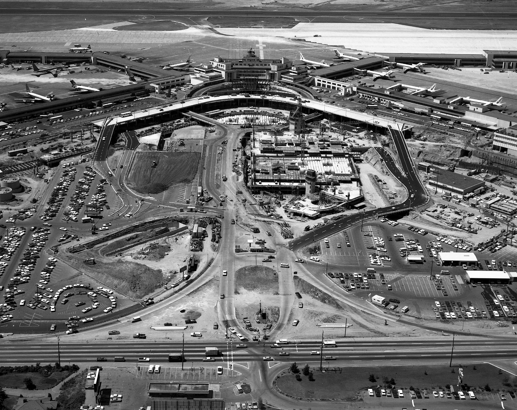
Sea-Tac Airport Aerial View During Terminal Expansion Construction
Aerial photograph showing Seattle-Tacoma International Airport (Sea-Tac) during a major construction/expansion phase, with the existing terminal complex and aircraft gates visible in the background and large-scale earthwork and new terminal foundation construction underway in the foreground. Multiple commercial jet aircraft are visible at gates, and the surrounding roadway infrastructure and parking areas are partially complete, consistent with Sea-Tac's expansion construction in the late 1960s to early 1970s. -
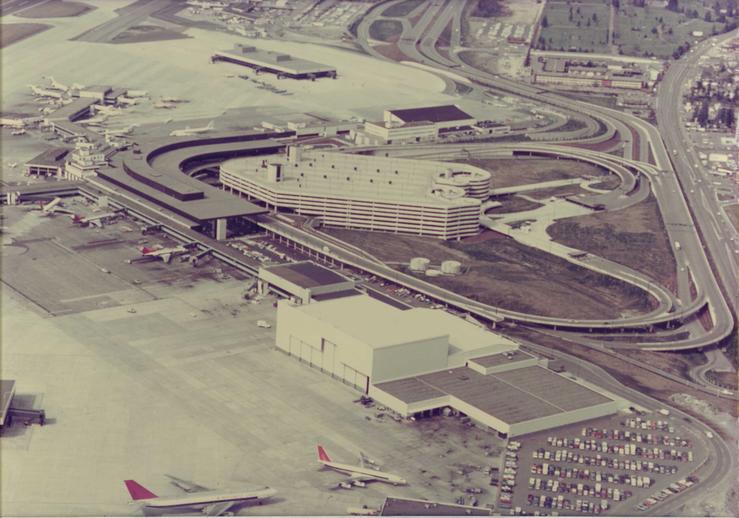
Sea-Tac Airport Aerial View, circa 1970s
Aerial photograph showing a large airport terminal with a curved concourse design, a multi-story parking garage with a circular ramp system, and numerous aircraft at gates. The image appears to date from the 1970s based on aircraft types, vehicle styles, and construction era of the facilities visible, consistent with Sea-Tac Airport's terminal expansion period.