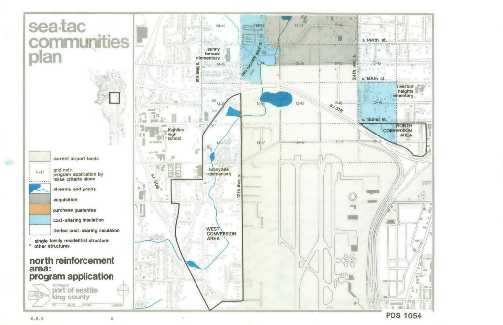
This planning map, document number POS 1054 (page 6.6.5, sheet 8), was produced under the Sea-Tac Communities Plan sponsored by the Port of Seattle and King County. It depicts the North Reinforcement Area program application, showing land-use designations including acquisition zones (gray), cost-sharing insulation areas (blue), conversion areas (West and North), streams and ponds, current airport lands, and key landmarks such as Highline High School, Sunny Terrace Elementary, Sunnydale Elementary, and Riverton Heights Elementary, within the grid bounded roughly by S. 144th St. to S. 152nd St. and SR-509/SR-518.Open full document
Notes
This planning map, document number POS 1054 (page 6.6.5, sheet 8), was produced under the Sea-Tac Communities Plan sponsored by the Port of Seattle and King County. It depicts the North Reinforcement Area program application, showing land-use designations including acquisition zones (gray), cost-sharing insulation areas (blue), conversion areas (West and North), streams and ponds, current airport lands, and key landmarks such as Highline High School, Sunny Terrace Elementary, Sunnydale Elementary, and Riverton Heights Elementary, within the grid bounded roughly by S. 144th St. to S. 152nd St. and SR-509/SR-518.
