Notes
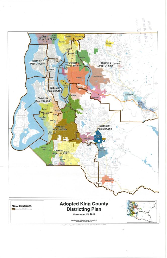
Adopted King County Districting Plan map dated November 15, 2011, based on U.S. Census Bureau Census 2010 Redistricting Data (PL 94-171). Shows nine King County Council districts with population figures: District 1 (Pop: 214,883), District 2 (Pop: 214,106), District 3 (Pop: 214,325), District 4 (Pop: 214,216), District 5 (Pop: 215,099), District 6 (Pop: 214,567), District 7 (Pop: 214,735), District 8 (Pop: 214,455), District 9 (Pop: 214,863). Geographic coverage includes cities such as Seattle, Bellevue, Kirkland, Redmond, Bothell, Woodinville, Auburn, Federal Way, Enumclaw, Snoqualmie, North Bend, Sammamish, Issaquah, Renton, Tukwila, SeaTac, Des Moines, Burien, and Normandy Park. Map produced by Schlösser Geographic Systems, Inc. (SGS) for Metropolitan King County, Washington.