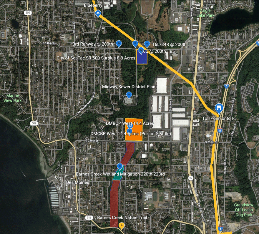
Aerial map of the SeaTac/Des Moines, Washington area showing labeled land parcels relevant to Sea-Tac Airport planning, including the City of SeaTac SR-509 Surplus 8.8 Acres, DMCBP West 14.4 Acres (Port of Seattle), Barnes Creek Wetland Mitigation 220th–223rd, and runway reference points (3rd Runway @ 200th, 16L/34R @ 200th, 16C @ 200th). The map also identifies the Midway Sewer District Plant, Barnes Creek Nature Trail, and major roadways including SR-509 and I-5.Open full document
Notes
Aerial map of the SeaTac/Des Moines, Washington area showing labeled land parcels relevant to Sea-Tac Airport planning, including the City of SeaTac SR-509 Surplus 8.8 Acres, DMCBP West 14.4 Acres (Port of Seattle), Barnes Creek Wetland Mitigation 220th–223rd, and runway reference points (3rd Runway @ 200th, 16L/34R @ 200th, 16C @ 200th). The map also identifies the Midway Sewer District Plant, Barnes Creek Nature Trail, and major roadways including SR-509 and I-5.