TagHistory(127)
-
 1980-08-01
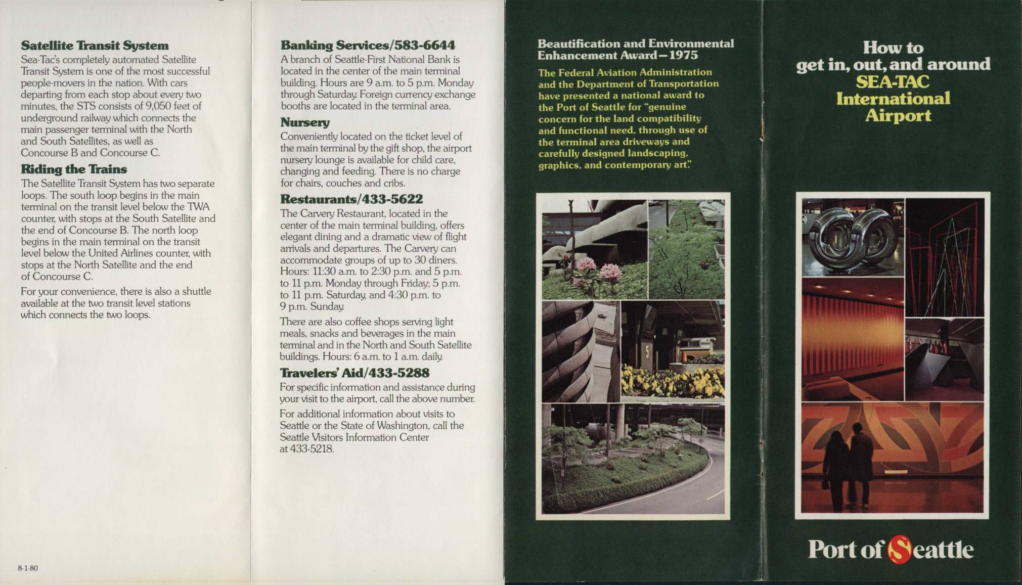
How to Get In, Out, and Around Sea-Tac International Airport
This circa-1980 visitor guide for Seattle-Tacoma (Sea-Tac) International Airport describes the layout and services available to travelers, including the automated Satellite Transit System—an underground railway connecting the main terminal to the North and South Satellites and Concourses B and C. The brochure covers amenities such as banking, dining, a nursery lounge, and Travelers' Aid, and includes a terminal map showing airline gate assignments and ground transportation options. It also notes that the Port of Seattle received a 1975 Federal Aviation Administration award for its attention to land compatibility, landscaping, and contemporary art throughout the airport. -
 1980-02-20
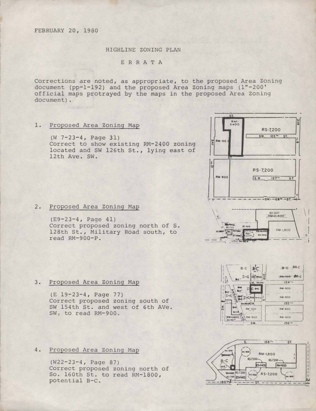
Highline Zoning Plan Errata
This February 20, 1980 errata document lists official corrections to the Highline Zoning Plan, a proposed area zoning document and accompanying maps covering communities in the Highline area near Seattle. The corrections update specific zoning designations on several map sections, such as changing certain parcels to residential multi-family (RM) or business-commercial (B-C) classifications, and fix a text sequencing error in the zoning document. These adjustments reflect policy decisions aimed at guiding land use—including residential density and commercial development—in neighborhoods in the vicinity of what is now Sea-Tac Airport. -
 1979-08-11
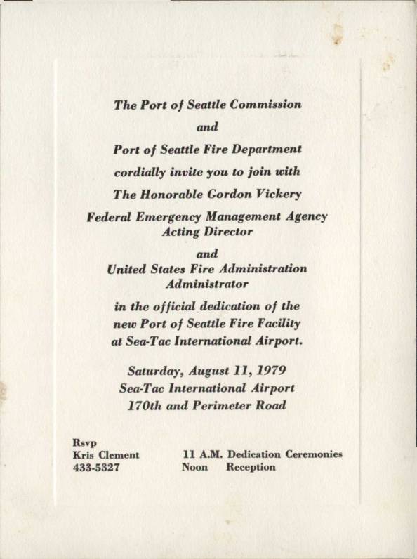
Invitation: Dedication of New Port Of Seattle Fire Facility at Sea-Tac International Airport
This is a formal invitation from the Port of Seattle Commission and Port of Seattle Fire Department to the official dedication of a new fire facility at Sea-Tac International Airport, held on Saturday, August 11, 1979. The event featured Gordon Vickery, Acting Director of the Federal Emergency Management Agency and Administrator of the United States Fire Administration, as a distinguished guest. Dedication ceremonies were scheduled for 11 A.M., followed by a noon reception at the airport's 170th and Perimeter Road location. -
 1979-01-26
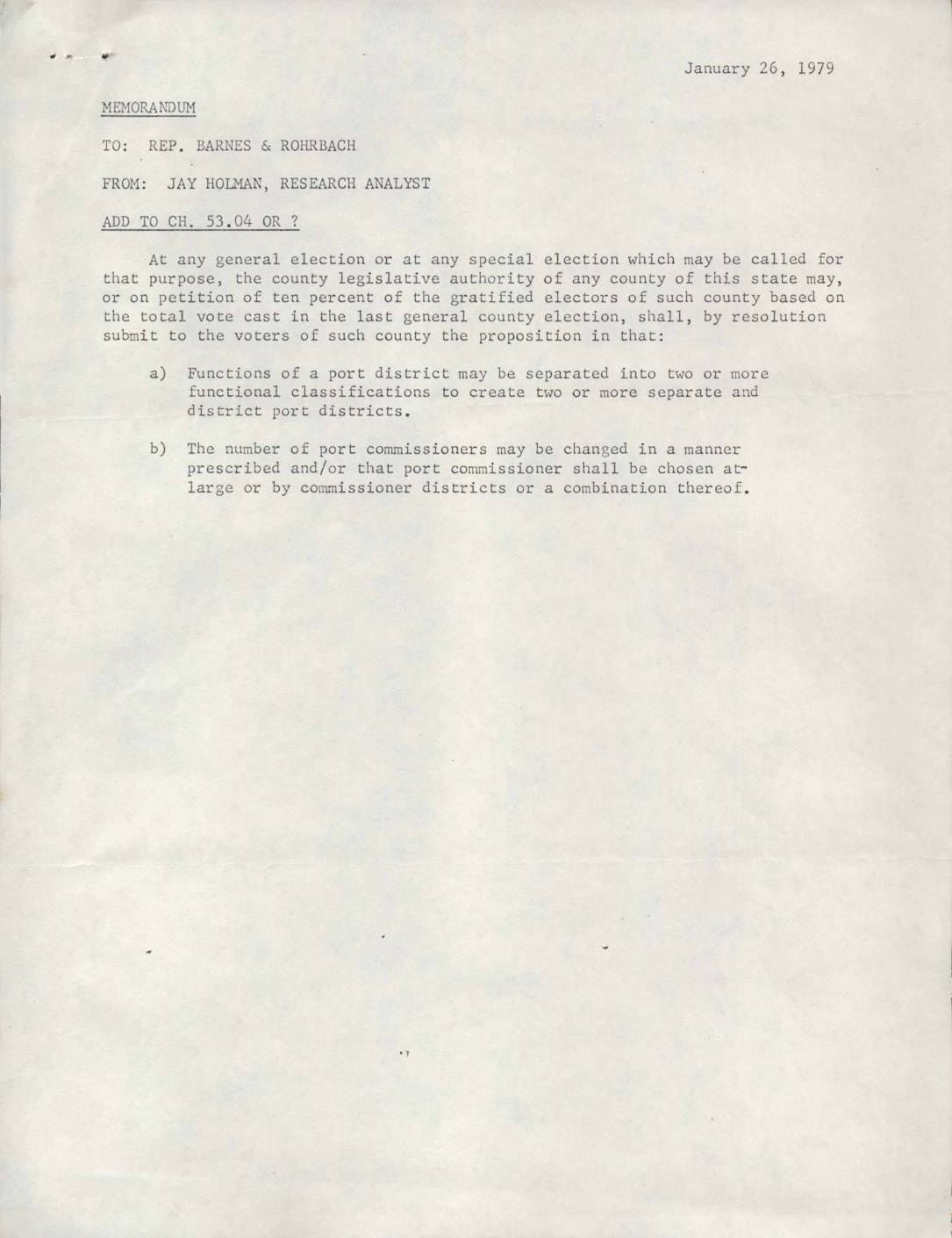
Memorandum to Rep. Barnes & Rohrbach: Port District Restructuring Proposals
A January 1979 legislative memorandum from research analyst Jay Holman to Washington state representatives proposes amendments to port district governance laws, including allowing voters to split port districts into separate functional entities and modify how port commissioners are elected. A follow-up note from January 31, 1979 refines the proposal, suggesting that five port commissioners be retained but that three be elected from newly formed sub-districts and two chosen at-large, with changes to take effect at the November 1979 general election. -
 1978-10-12
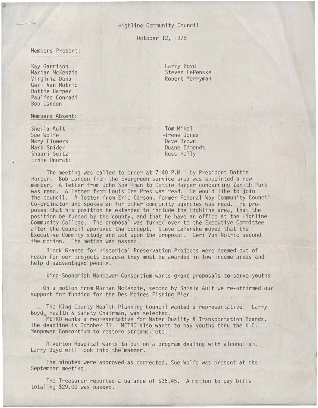
Highline Community Council Minutes, October 12, 1978
Minutes from the Highline Community Council meeting held on October 12, 1978, covering new member appointments, correspondence regarding Zenith Park, and proposals for community coordination and funding. The council discussed topics including block grants for historical preservation, youth employment through the King-Snohomish Manpower Consortium, and representation on regional boards such as the King County Health Planning Council and METRO's Water Quality and Transportation Boards. Financial business included approval of bills totaling $29.00 against a treasury balance of $36.45. -
 1978-08-13
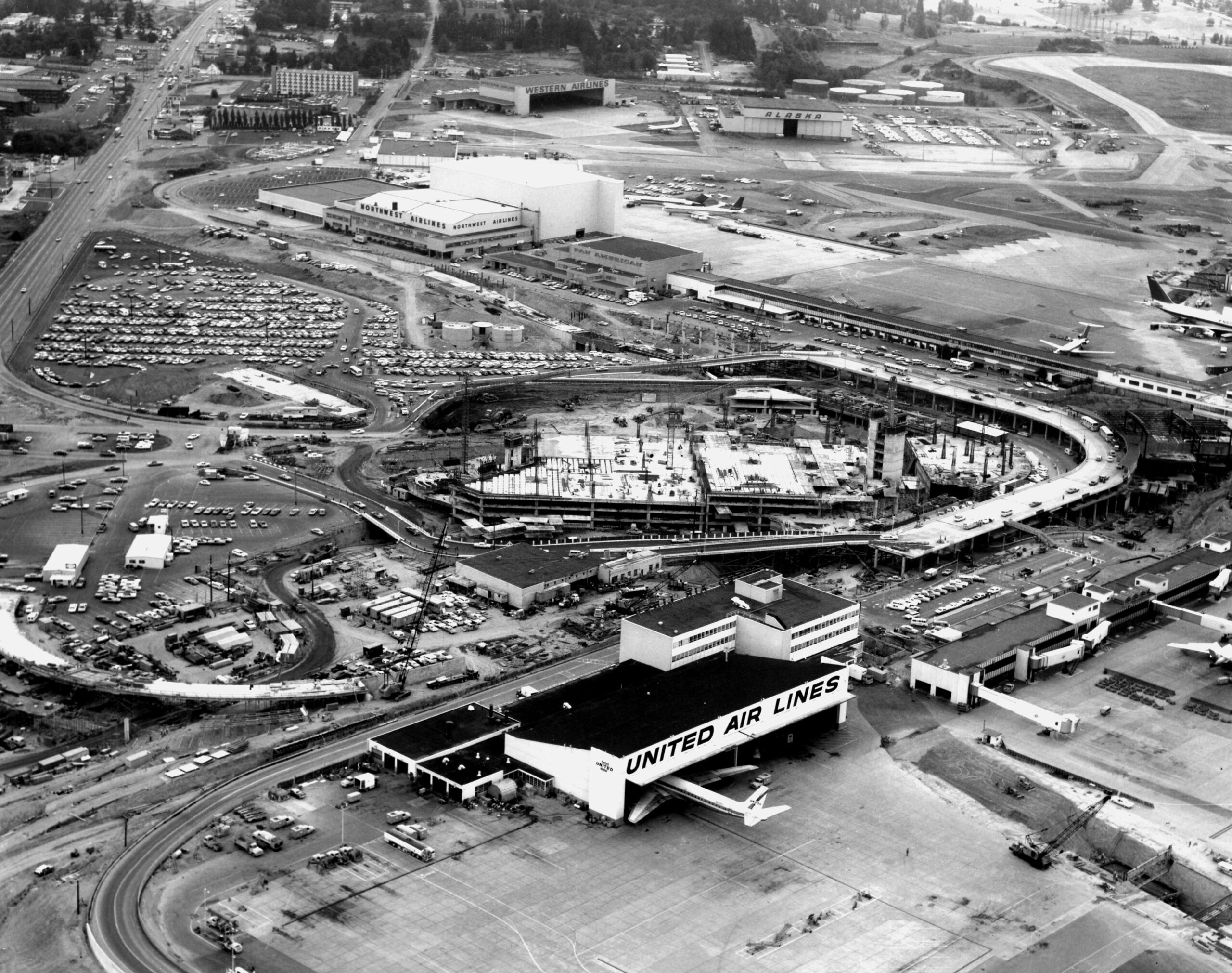
Sea-Tac Airport Aerial View During Central Terminal Construction
Aerial photograph of Seattle-Tacoma International Airport during a major construction phase, showing the new central terminal under construction (circular/horseshoe structure). Visible airline facilities include United Air Lines (foreground), Northwest Airlines, Western Airlines, and Alaska Airlines hangars, along with extensive parking areas and tarmac operations. -
 1978-01-01
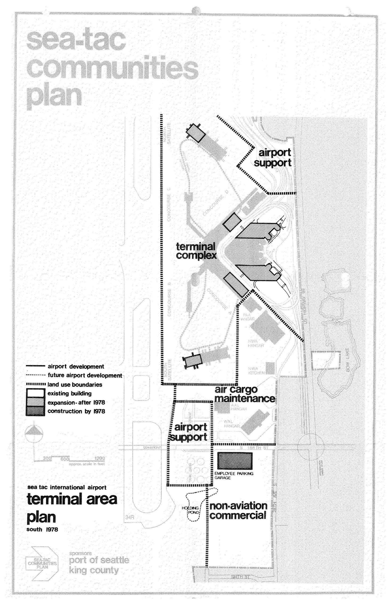
Sea-Tac International Airport Terminal Area Plan South — STCP, 1978
A planning map from the Sea-Tac Communities Plan, sponsored by the Port of Seattle and King County, depicting the Sea-Tac International Airport terminal area as of 1978. The map identifies land use zones including the terminal complex, airport support areas, air cargo maintenance, non-aviation commercial, and an employee parking garage, with a legend distinguishing existing buildings, post-1978 expansions, and construction completed by 1978. -
 1975-04-22
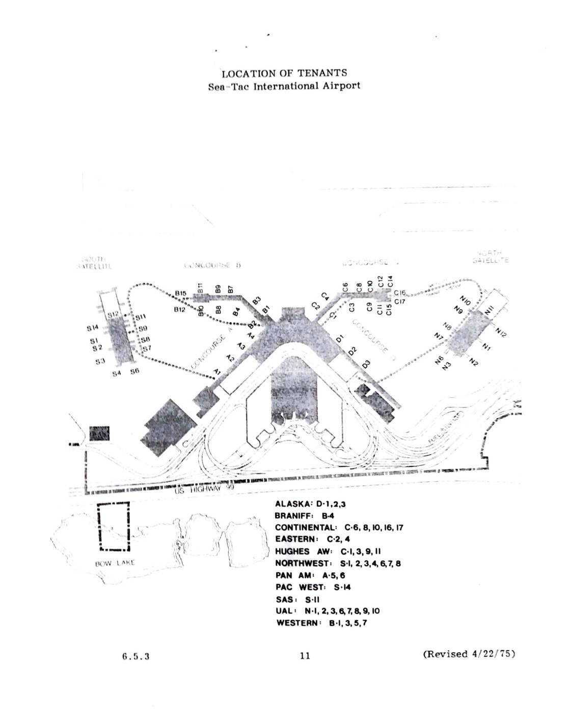
Location of tenants: Sea-Tac International Airport
This 1975 document shows the location of airline tenants at Sea-Tac International Airport, mapping gate assignments across the airport's concourses and satellite terminals. Airlines listed include Alaska, Braniff, Continental, Eastern, Hughes Airwest, Northwest, Pan Am, Pacific West, SAS, United Air Lines, and Western. The map identifies each carrier's specific gate numbers within Concourses B and C, the North and South Satellites, and other terminal areas. -
 1975-02-21
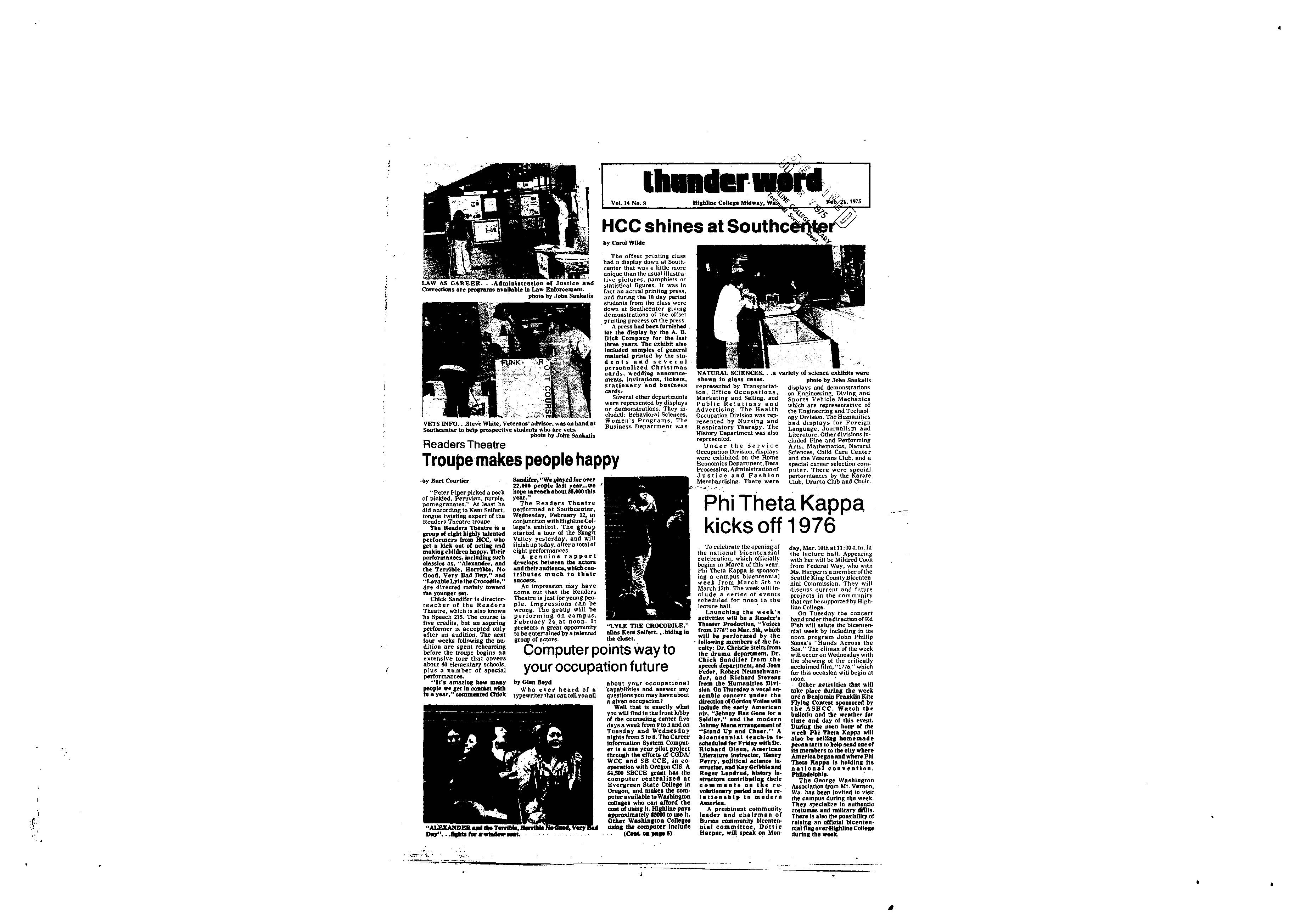
Thunder Word, Vol. 16 No. 8, February 21, 1975 (History of Highline)
Campus newspaper from Highline Community College featuring articles about HCC’s exhibit at Southcenter, the Readers Theatre troupe, Phi Theta Kappa’s bicentennial week plans, and a history of the Highline district. Also includes a humorous review of campus dining options and information about the Business Division’s programs. -
 1974-07-31
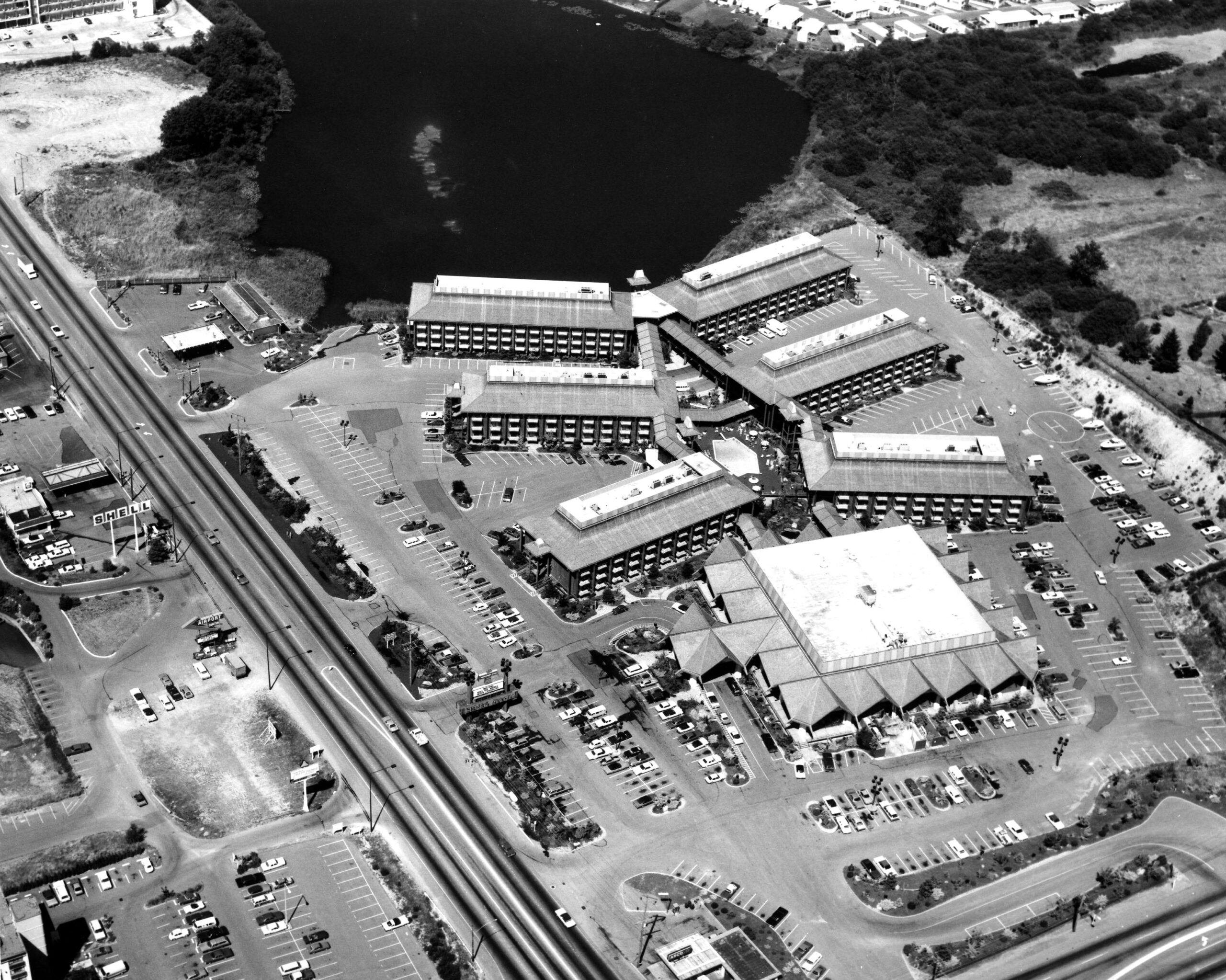
Sea-Tac Motel Aerial
Black-and-white aerial photograph showing a large multi-building hotel or motel complex with extensive parking lots alongside a divided highway. A body of water is visible in the upper portion of the image; a Shell gas station sign is faintly legible on the left side of the road.