TagBurien(59)
-
 2019-03-31
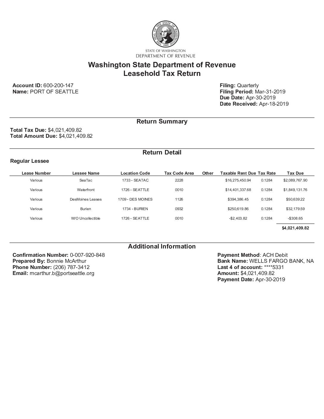
Washington State Department of Revenue Leasehold Tax Return: Port Of Seattle, Q1 2019
The Port of Seattle filed a quarterly Leasehold Tax Return with the Washington State Department of Revenue for the period ending March 31, 2019, reporting a total tax due of $4,021,409.82. The filing covers leased properties across multiple locations, including SeaTac Airport (the largest contributor at over $2 million in tax), Seattle Waterfront, Des Moines, and Burien, all taxed at a rate of 12.84%. Payment of the full amount was submitted via ACH debit from a Wells Fargo account on April 30, 2019. -
A Letter To Mayor Jimmy Matta re. Port Package Problems
I’m often asked why I’m so gung ho about legislative action as opposed to working through issues via the SAMP (Sustainable Airport Master Plan). My flip answer is “If the Port wants me to do it? I’m immediately skeptical.” And the Port wants to drive all community issues through the SAMP. But the substantive reason -
 2018-04-01
Burien Categorical Exclusion April 2018
FAA categorical exclusion document for updating a Letter of Agreement between Seattle-Tacoma International Airport’s Air Traffic Control Tower and Seattle Terminal Radar Approach Control to automate a 250° westerly turn for southbound turboprops during north-flow operations. The automated turn would be suspended between 10 pm and 6 am in response to comments from the City -
 2018-01-01
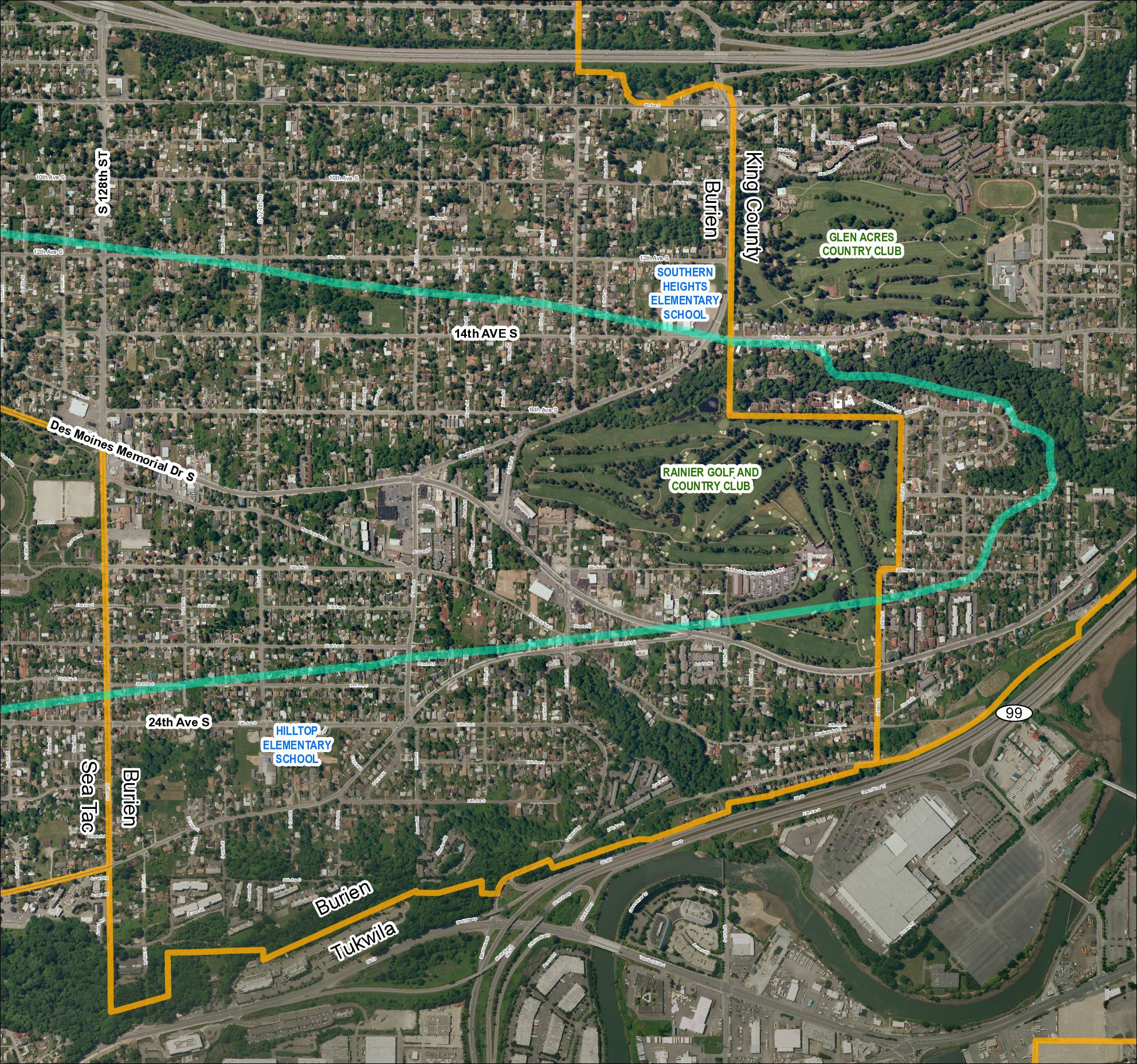
Grid 5: Sea-Tac Airport Area Map (2018)
This aerial map covers the residential and commercial areas surrounding Sea-Tac Airport, spanning portions of Burien, SeaTac, Tukwila, and unincorporated King County. It highlights key landmarks including Southern Heights Elementary School, Hilltop Elementary School, Rainier Golf and Country Club, and Glen Acres Country Club, along with major roadways such as SR 99, SR 599, Des Moines Memorial Drive S, and Military Road S. Turquoise boundary lines appear to delineate specific noise impact or study zones relevant to airport policy planning in the region. -
 2018-01-01
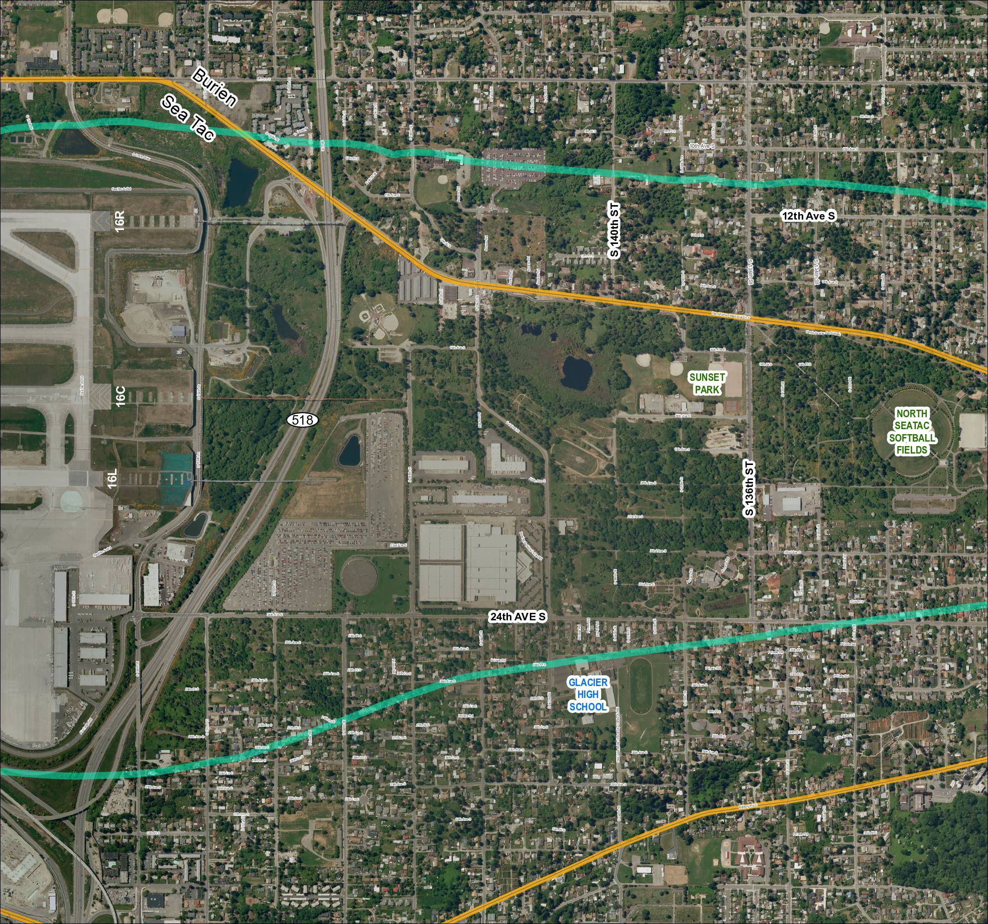
Grid 4 (2018): Aerial Map of Sea-Tac Area Including Glacier High School, Sunset Park, and North Sea-Tac Softball Fields
This map depicts the area surrounding Seattle-Tacoma International Airport, showing the airport's runway layout (including runways 16R, 16C, and 16L) alongside nearby neighborhoods in Burien and SeaTac. Two overlaid flight-path or noise-contour corridors (shown in teal/green and gold) arc across the surrounding residential and parkland areas, illustrating the geographic extent of aircraft noise impact. Notable landmarks within the affected area include Glacier High School, Sunset Park, and the North SeaTac Softball Fields, highlighting the communities exposed to airport-related noise. -
 2018-01-01
Grid 3: Sea-Tac Airport Aerial Map
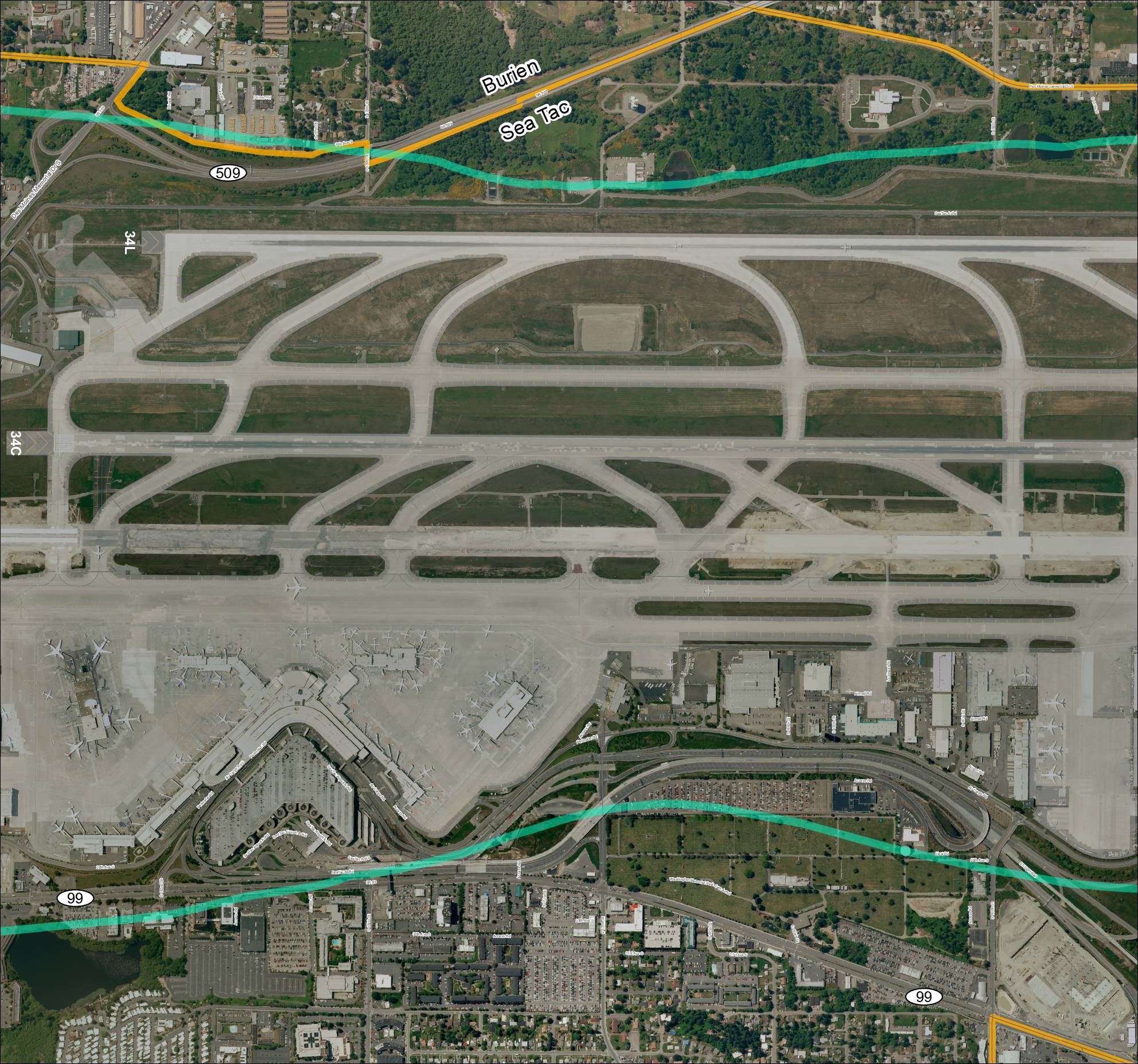
This aerial map depicts Seattle-Tacoma International Airport (Sea-Tac) and its surrounding communities of Burien and SeaTac, showing the airport's runway layout including runways 34L and 34C, along with the local road network and key routes such as SR 99 and SR 509. The map highlights the ST Light Rail corridor and major access roads serving the airport, providing geographic context for understanding flight paths and noise exposure areas in the region. It serves as a reference for analyzing the relationship between airport operations and the residential and commercial areas situated beneath approach and departure corridors. -
 2018-01-01
Quiet Skies Coalition: What Happened to Our Peace and Quiet?
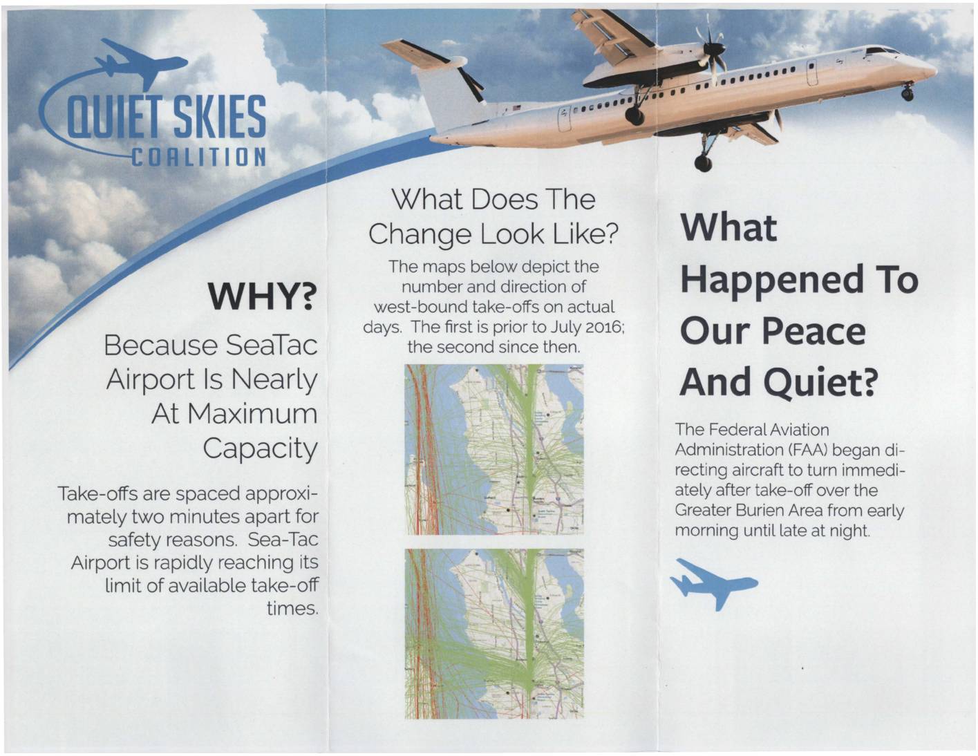
The Quiet Skies Coalition is a community group opposing increased aircraft noise over the Greater Burien area near Seattle-Tacoma (Sea-Tac) Airport. Since July 2016, the FAA began directing westbound flights to turn immediately after takeoff over residential neighborhoods, a change driven by Sea-Tac nearing its maximum capacity with takeoffs spaced roughly two minutes apart. The coalition urges residents to contact the FAA and Port of Seattle to object, and welcomes financial contributions to support their advocacy efforts. -
 2018-01-01
What is the Small Matching Grants Program?
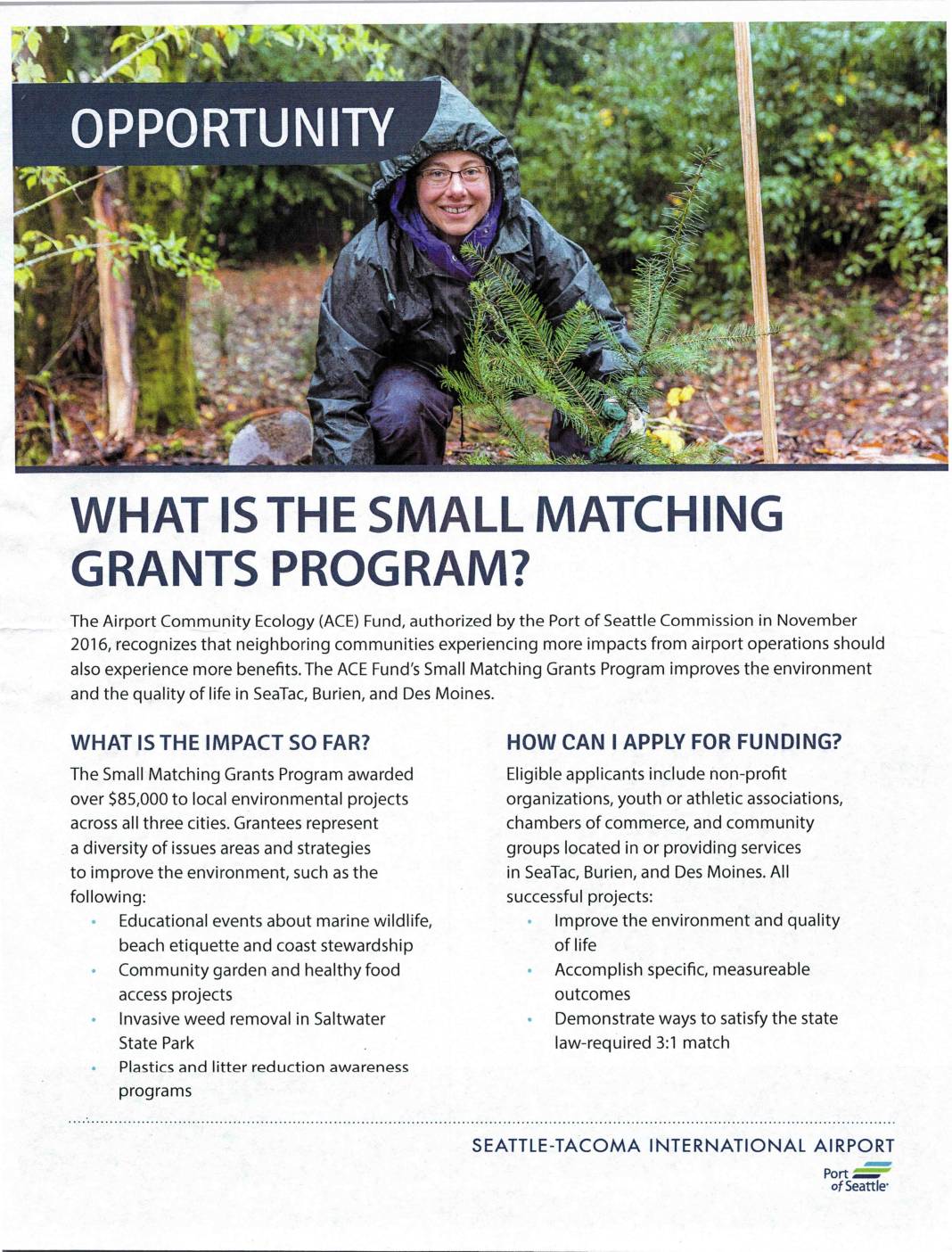
The Port of Seattle's Airport Community Ecology (ACE) Fund offers a Small Matching Grants Program providing funding to non-profit organizations and community groups in SeaTac, Burien, and Des Moines to support local environmental improvement projects. Applicants must demonstrate a 3:1 match for every dollar of Port funding requested, meaning three dollars of community value must be identified for each grant dollar awarded. The program has distributed over $85,000 to projects ranging from invasive weed removal and community gardens to marine wildlife education and plastics reduction awareness. -
 2017-06-01
Airport Community Ecology Fund
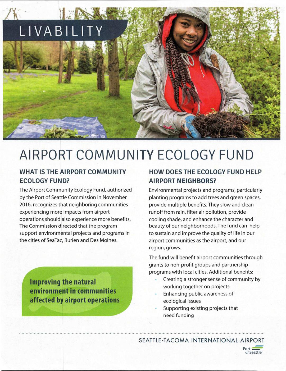
The Airport Community Ecology Fund, authorized by the Port of Seattle Commission in November 2016, provides grants and partnership programs to improve the natural environment in communities affected by Seattle-Tacoma International Airport operations, specifically in SeaTac, Burien, and Des Moines. The fund supports environmental projects such as tree planting and green space development to help offset airport impacts through benefits like cleaner air, reduced runoff, and improved neighborhood character. Local non-profit organizations and community groups in the three eligible cities can apply for grants, provided their projects demonstrate measurable outcomes and a local match of three times the grant value. -
 2015-11-18
City of Burien: Economic Development Presentation
A November 18, 2015 City of Burien presentation outlines five priority economic development actions approved by the city council, including developing a Burien brand identity, conducting a parking and mobility study, attracting a hotel, assessing business impediments, and supporting business retention and recruitment. The presentation also covers projects currently in development within the city.