TagBurien(78)
-
 2018-01-01
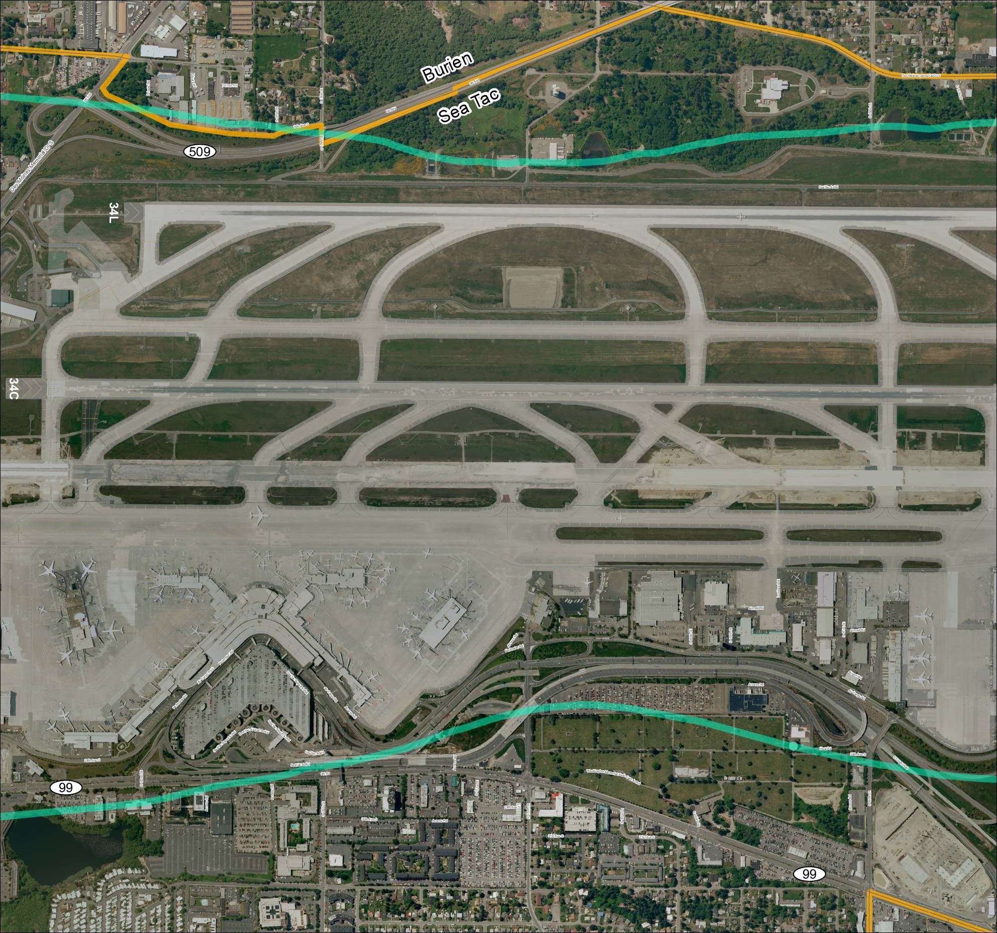
Grid 3: Sea-Tac Airport Aerial Map
This aerial map depicts Seattle-Tacoma International Airport (Sea-Tac) and its surrounding communities of Burien and SeaTac, showing the airport's runway layout including runways 34L and 34C, along with the local road network and key routes such as SR 99 and SR 509. The map highlights the ST Light Rail corridor and major access roads serving the airport, providing geographic context for understanding flight paths and noise exposure areas in the region. It serves as a reference for analyzing the relationship between airport operations and the residential and commercial areas situated beneath approach and departure corridors. -
 2018-01-01
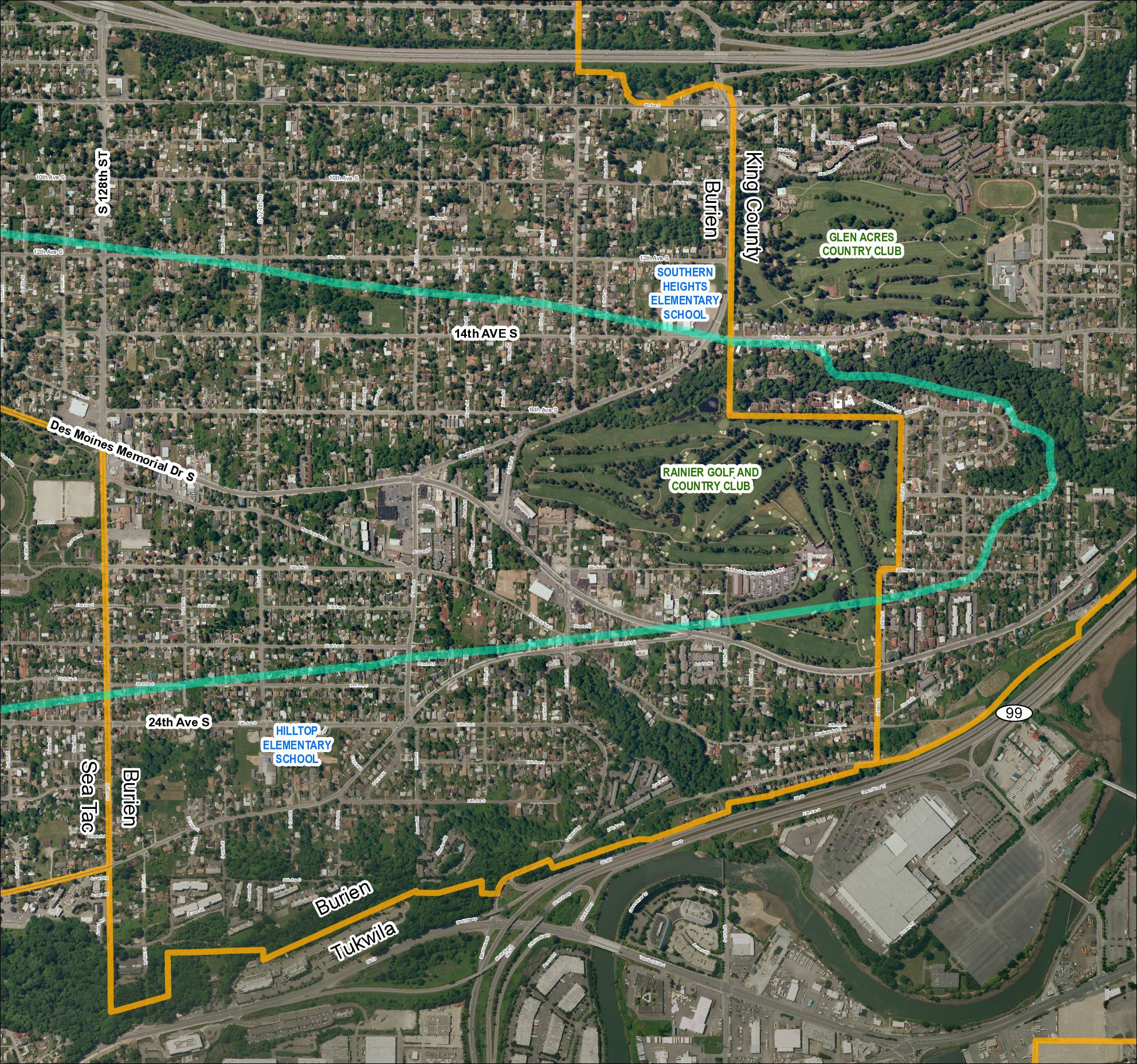
Grid 5: Sea-Tac Airport Area Map (2018)
Aerial satellite map (Grid 5, 2018) of the Sea-Tac Airport surrounding area showing street grid, municipal boundaries, and landmarks in Burien, SeaTac, Tukwila, and King County. Features SR 99, SR 599, Des Moines Memorial Dr S, Military Rd S, and cross streets including S 128th St, S 124th St, S 116th St, S 112th St. -
 2018-01-01
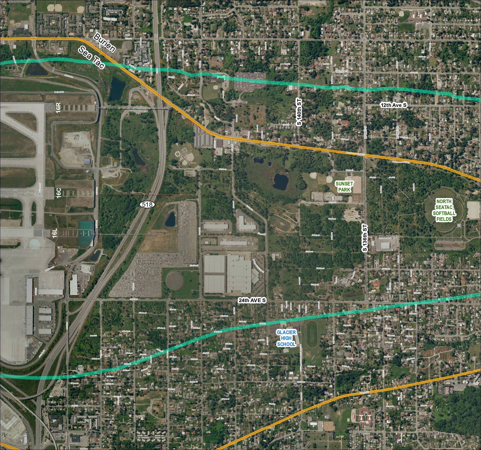
Grid 4 (2018): Aerial Map of Sea-Tac Area Including Glacier High School, Sunset Park, and North Sea-Tac Softball Fields
Aerial satellite map labeled Grid 4 (2018) covering the SeaTac, Burien area near Sea-Tac Airport. Shows SR 518, runways 16R, 16C, and 16L, Glacier High School, Sunset Park, North SeaTac Softball Fields, and the street grid including S 132nd St through S 157th Pl, 24th Ave S, Des Moines Memorial Dr S, and Military Rd -
 2018-01-01
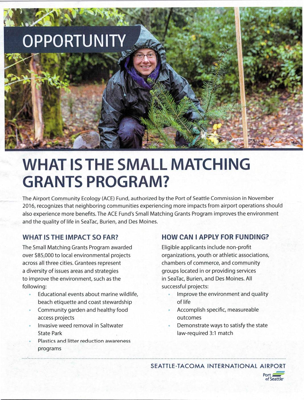
What is the Small Matching Grants Program?
The Port of Seattle's Airport Community Ecology (ACE) Fund offers a Small Matching Grants Program providing funding to non-profit organizations and community groups in SeaTac, Burien, and Des Moines to support local environmental improvement projects. Applicants must demonstrate a 3:1 match for every dollar of Port funding requested, meaning three dollars of community value must be identified for each grant dollar awarded. The program has distributed over $85,000 to projects ranging from invasive weed removal and community gardens to marine wildlife education and plastics reduction awareness. -
 2017-06-01
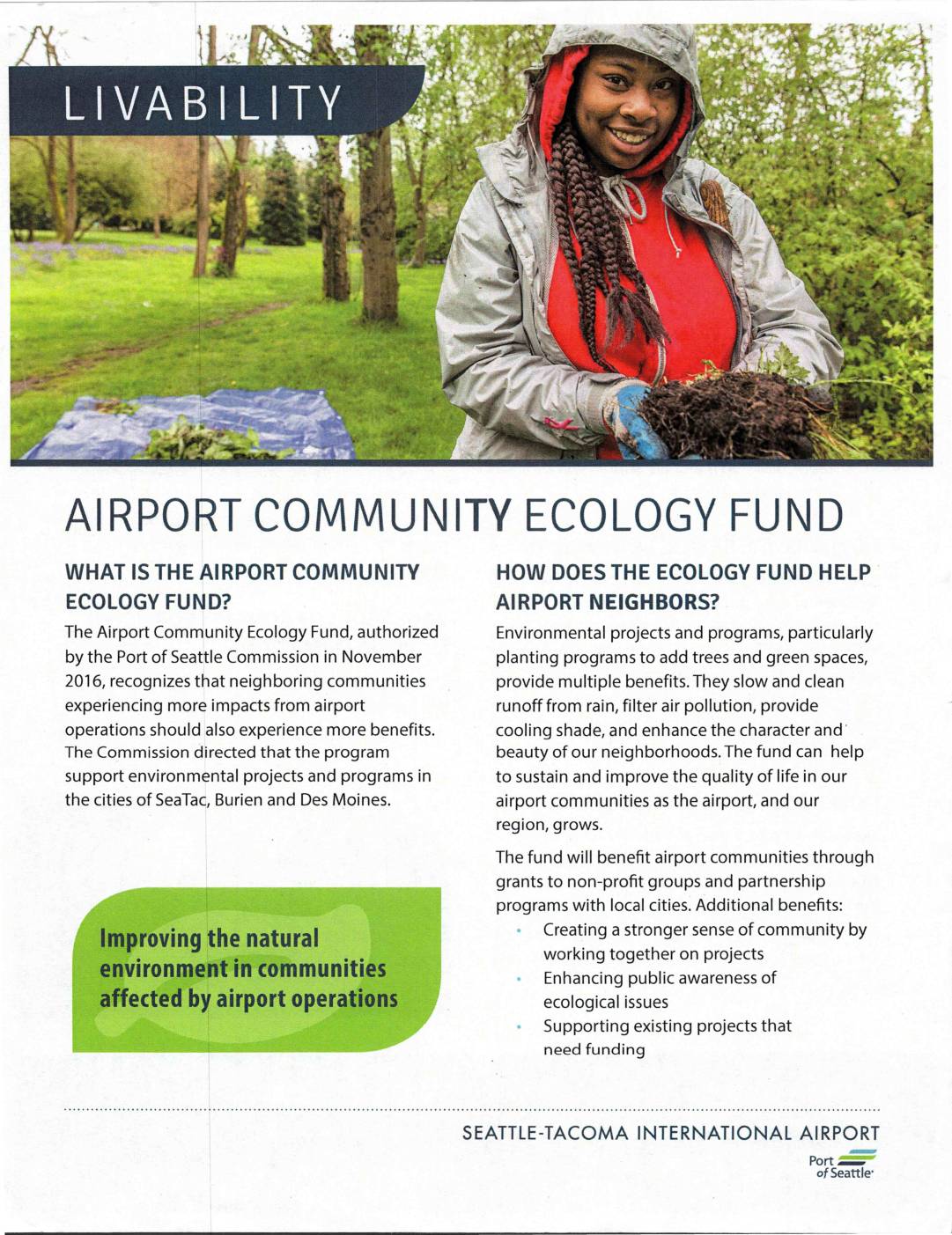
Airport Community Ecology Fund
The Airport Community Ecology Fund, authorized by the Port of Seattle Commission in November 2016, provides grants and partnership programs to improve the natural environment in communities affected by Seattle-Tacoma International Airport operations, specifically in SeaTac, Burien, and Des Moines. The fund supports environmental projects such as tree planting and green space development to help offset airport impacts through benefits like cleaner air, reduced runoff, and improved neighborhood character. Local non-profit organizations and community groups in the three eligible cities can apply for grants, provided their projects demonstrate measurable outcomes and a local match of three times the grant value. -
 2015-11-18
City of Burien: Economic Development Presentation
A November 18, 2015 City of Burien presentation outlines five priority economic development actions approved by the city council, including developing a Burien brand identity, conducting a parking and mobility study, attracting a hotel, assessing business impediments, and supporting business retention and recruitment. The presentation also covers projects currently in development within the city. -
 2013-01-01
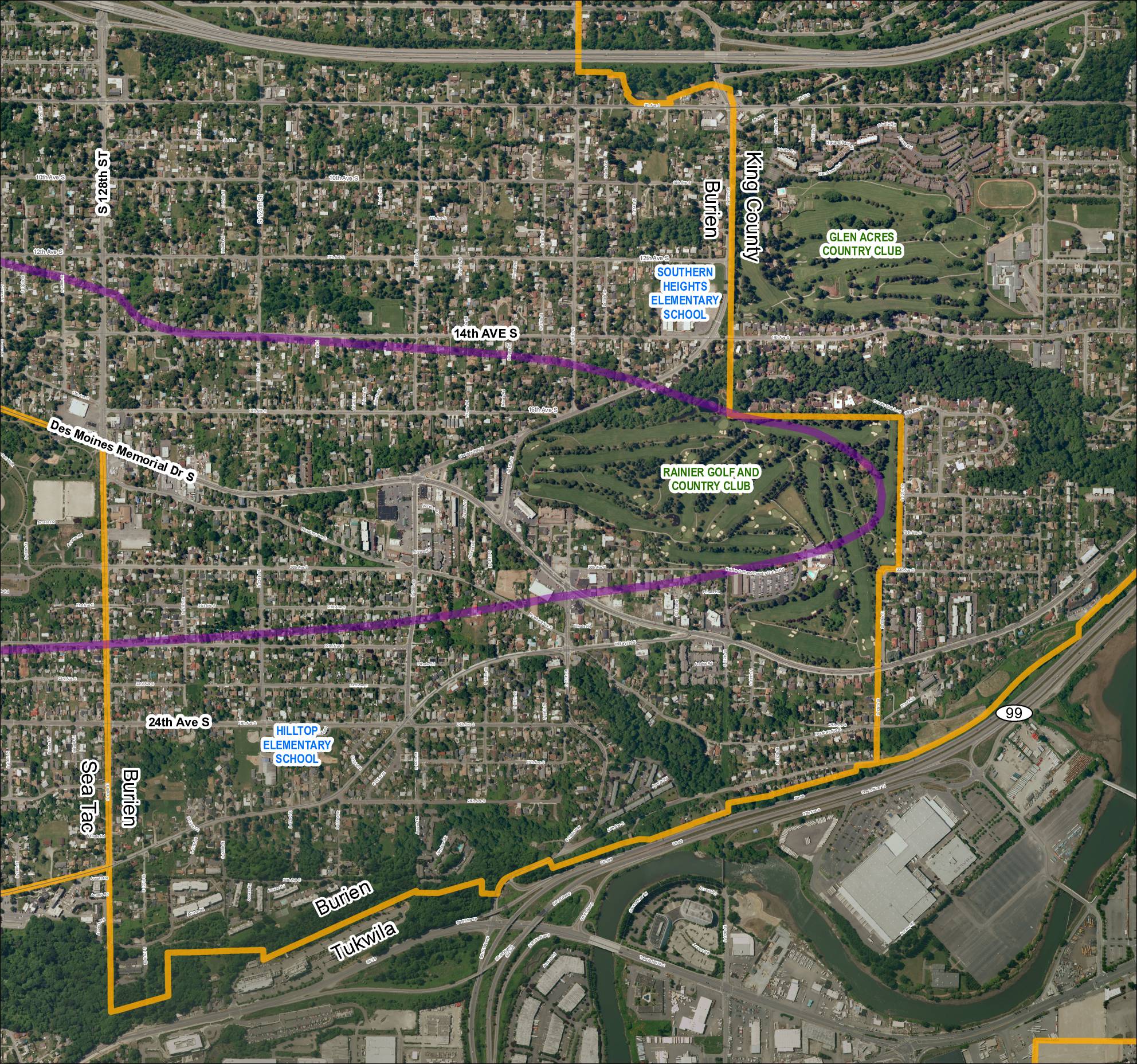
Grid 5: 2013 Baseline Map
This aerial map depicts the area surrounding Sea-Tac Airport, covering portions of Burien, Tukwila, and unincorporated King County in Washington State. It highlights key landmarks including Southern Heights Elementary School, Hilltop Elementary School, Rainier Golf and Country Club, and Glen Acres Country Club, along with major roadways such as SR 99, SR 599, and Des Moines Memorial Drive S. A purple corridor overlay traces what appears to be a noise-impact or flight-path study boundary through residential neighborhoods near the airport. -
 2013-01-01
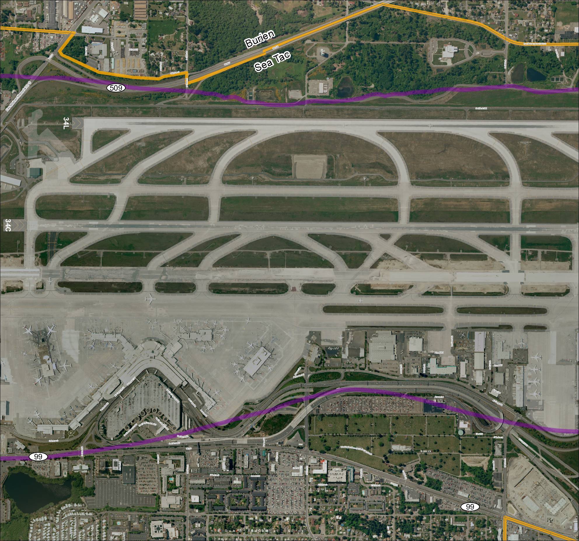
Grid 3 2013 Baseline Map: Sea-Tac Airport Runways and Surrounding Area
This aerial map depicts Seattle-Tacoma International Airport (Sea-Tac) and its surrounding communities of Burien and SeaTac, showing the airport's runway layout including runways 34L and 34C, along with key roadways such as SR 99, SR 509, and various access roads. Highlighted routes in purple and orange appear to mark designated corridors or boundary lines relevant to airport planning or noise study areas. The map provides a geographic reference for understanding the airport's footprint and its relationship to neighboring residential and commercial zones. -
2013-01-01
Grid 3 2013 Baseline Map: Sea-Tac Airport Runways and Surrounding Area
Aerial satellite map labeled ‘Grid3_2013Baseline’ showing Sea-Tac Airport (KSEA) runways 34L and 34C, terminal area, cargo facilities, and surrounding roadways including SR 509, SR 99, Des Moines Memorial Dr S, S 176th St, S 160th St, S 166th St, Airmail Rd, Perimeter Rd, Air Cargo Rd, and Access Rd. Map shows boundary between Burien and