TagSTCP(140)
-
 2022-08-24
Sea-Tac Communities Plan: Map Supplement to Sixth Month Report
The Sea-Tac/Communities Plan is a planning study co-sponsored by the Port of Seattle and King County, funded through a federal grant under the Airport and Airways Development Act of 1970. It serves as a map supplement to a sixth-month report, covering community trends and characteristics, land use, ground transportation and traffic, aesthetic and visual qualities, and natural determinants in the communities surrounding Seattle-Tacoma International Airport. The 1973 report includes demographic data such as median age, the percentage of residents under 20, and the percentage of residents 65 and older, mapped across 1970 census tracts in the Sea-Tac area. -
 2022-07-10
Sea-Tac Communities Plan Part 8: References — Sea-Tac Plan Published Reports (Section 8.0.1)
This document lists the published reports produced as part of the Sea-Tac Airport and Vicinity Master Plan study, a collaborative effort by King County, the Port of Seattle, consultants, and community members. The reports cover a wide range of topics including aviation demand forecasting, air and water quality analysis, solid waste, and noise exposure analysis across multiple volumes. Copies of these references were made available at the King County Land Use Management Division and the Port of Seattle Planning and Research Department. -
 2022-07-10
Part 7, Chapter 7.1: Common Problems and Opportunities — Implementation (Sea-Tac Communities Plan)
This document, Part 7 (Implementation), Chapter 7.1, covers common problems and opportunities related to airport development, with a focus on the financial framework governing the Port of Seattle. It explains that the five-member Port of Seattle Commission is legally authorized to levy taxes on property within King County and to issue general obligation bonds, subject to strict limits—bonds cannot exceed 3/4 of 1% of the actual taxable property value in the district. Voter approval by 60% is required for bond issuances that go beyond the non-voter-authorized debt ceiling. -
 2022-07-10
Part 5: The Environment — Chapter 5.1: Air Quality
This document presents an air quality study conducted by Environmental Systems Laboratories, Inc. for Sea-Tac Airport, examining pollutant levels—including particulates, carbon monoxide, hydrocarbons, nitrogen oxides, and oxidants—at and around the airport. Using monitoring data collected in 1973–1974 from seven sites near the airport and surrounding communities, the study assessed existing conditions and predicted future air quality impacts under various aviation and land use scenarios. -
 2022-07-10
Part 4: Trends and Forecasts — Chapter 4.1, Central Puget Sound Region Population
This document is Part 4 of a Master Plan study for Sea-Tac International Airport, focusing on trends and forecasts for the Central Puget Sound Region. It examines population and economic growth data to project future air traffic demand, noting that the four-county area around Seattle held over 1.9 million people in 1970—56% of Washington State's population. While the region grew rapidly through the 1950s and 1960s, the plan anticipates more modest growth in the 1970s relative to national averages. -
 2022-07-10
Sea-Tac Communities Plan: Chapter 3.1 Background
This document provides historical background on Seattle-Tacoma (Sea-Tac) Airport, tracing its origins to 1942 when the Civil Aeronautics Administration selected a site near Bow Lake and the Port of Seattle acquired the original 906 acres. As the jet age arrived and the airline industry expanded, the surrounding communities experienced rapid urbanization, bringing with it land use conflicts, traffic problems, pollution, and shortsighted commercial development. The Sea-Tac Communities Plan background chapter examines these challenges as context for developing more thoughtful, long-term planning policies for the airport region. -
 2022-07-09
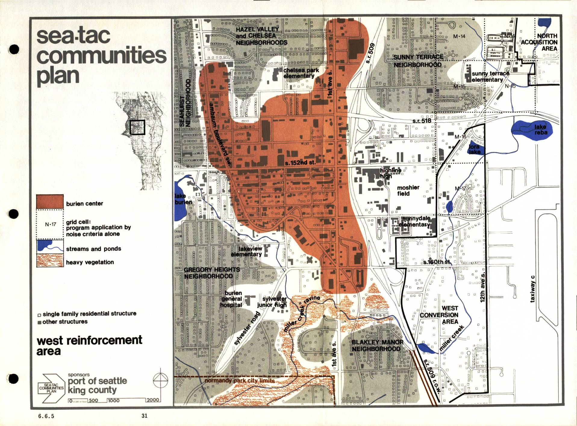
Sea-Tac Communities Plan: West Reinforcement Area Map (Section 6.6.5)
The Sea-Tac Communities Plan, sponsored by the Port of Seattle and King County, maps the West Reinforcement Area surrounding Seattle-Tacoma International Airport, identifying neighborhoods such as Hazel Valley, Chelsea, Seahurst, Gregory Heights, Sunny Terrace, and Blakley Manor that are affected by aircraft noise. The map highlights the Burien Center commercial core, grid cells where program eligibility is determined by noise criteria alone, and features such as streams, ponds, and heavy vegetation. It distinguishes between single-family residential structures and other buildings to guide noise mitigation and land-use planning efforts in the impacted communities. -
 2013-01-01
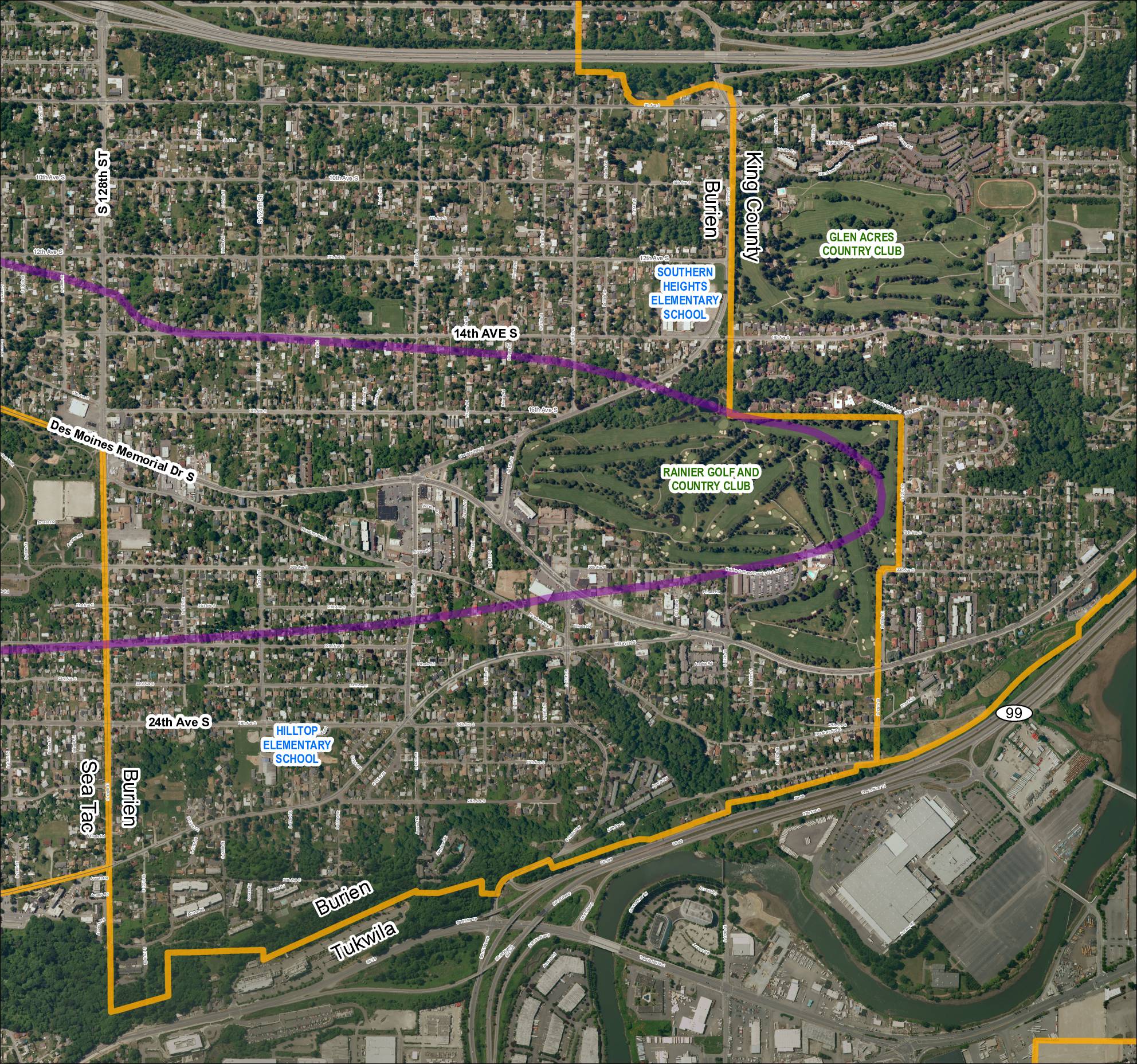
Grid 5: 2013 Baseline Map
This aerial map depicts the area surrounding Sea-Tac Airport, covering portions of Burien, Tukwila, and unincorporated King County in Washington State. It highlights key landmarks including Southern Heights Elementary School, Hilltop Elementary School, Rainier Golf and Country Club, and Glen Acres Country Club, along with major roadways such as SR 99, SR 599, and Des Moines Memorial Drive S. A purple corridor overlay traces what appears to be a noise-impact or flight-path study boundary through residential neighborhoods near the airport. -
 2013-01-01
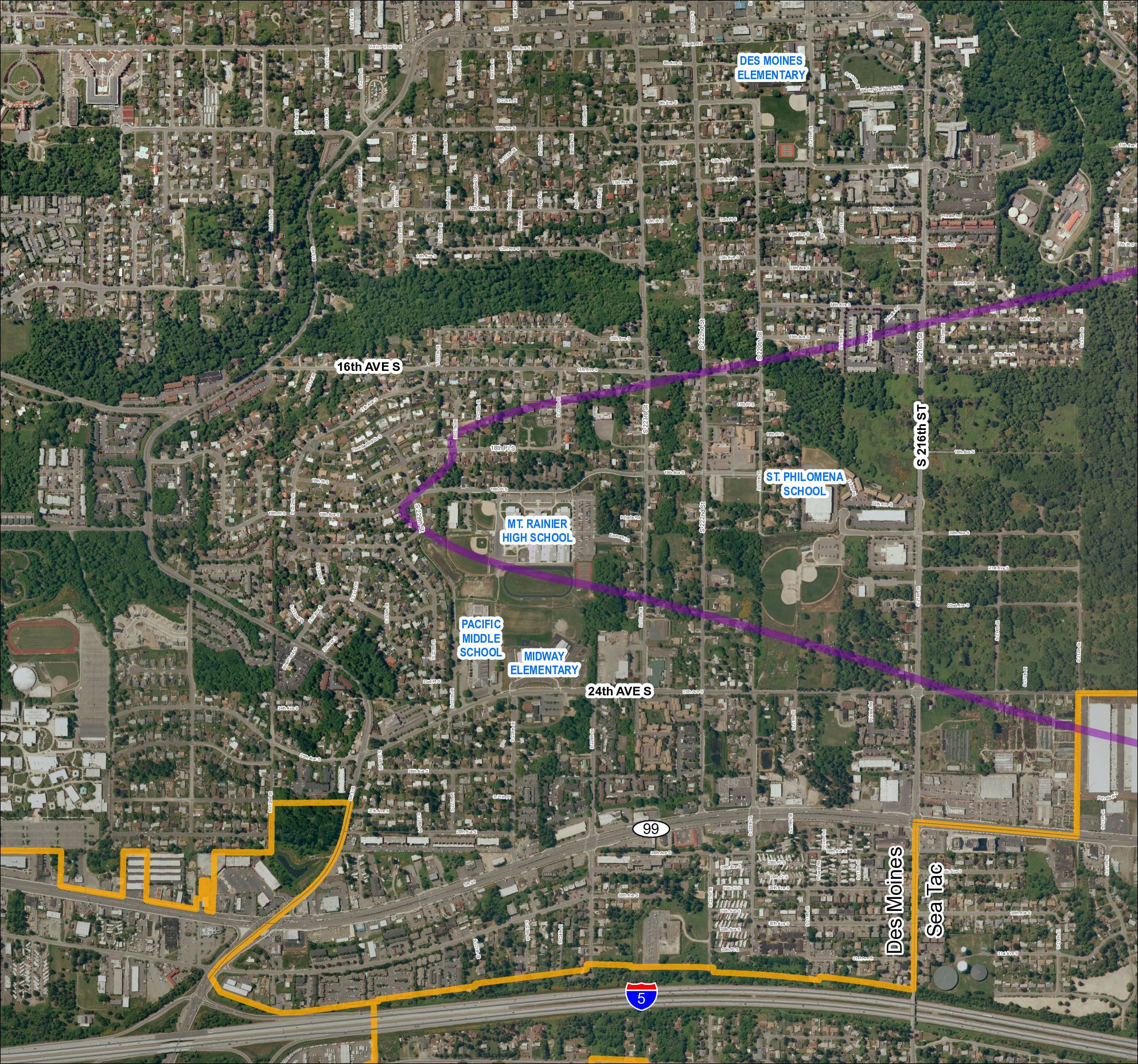
Grid 1: 2013 Baseline Map — Des Moines and Sea-Tac Area Schools
This map covers the Des Moines and SeaTac area in Washington State, showing residential streets, major roads including SR 99, SR 509, SR 516, and Interstate 5, along with several schools such as Mt. Rainier High School, Pacific Middle School, Midway Elementary, Des Moines Elementary, and St. Philomena School. A purple diagonal corridor crosses the map, likely representing a flight path or noise contour zone associated with Seattle-Tacoma International Airport, while an orange boundary outlines a specific study or impact area in the southern portion of the map. The document appears to be part of an airport noise or land-use planning study examining how SeaTac flight operations affect surrounding communities. -
 2002-10-23
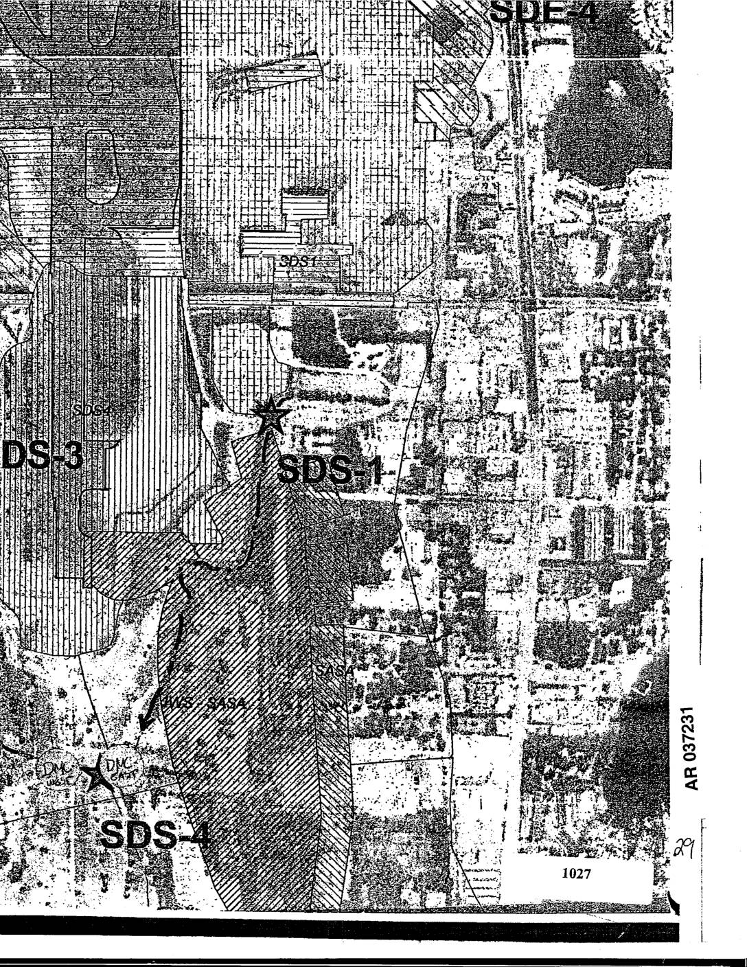
EXH AR037231: Sea-Tac Airport Area Map Showing SDS-1, SDS-3, SDS-4, SDE-4 Site Designations
Aerial map exhibit AR037231 showing site designation zones SDS-1, SDS-3, SDS-4, and SDE-4 in the Sea-Tac Airport vicinity, with DMC markers and parcel 1027 visible. Map includes hatched overlay areas indicating site boundaries and land use zones near Des Moines Creek and surrounding neighborhoods. Filed as exhibit in administrative record.