TagSTCP(140)
-
 1978-01-01
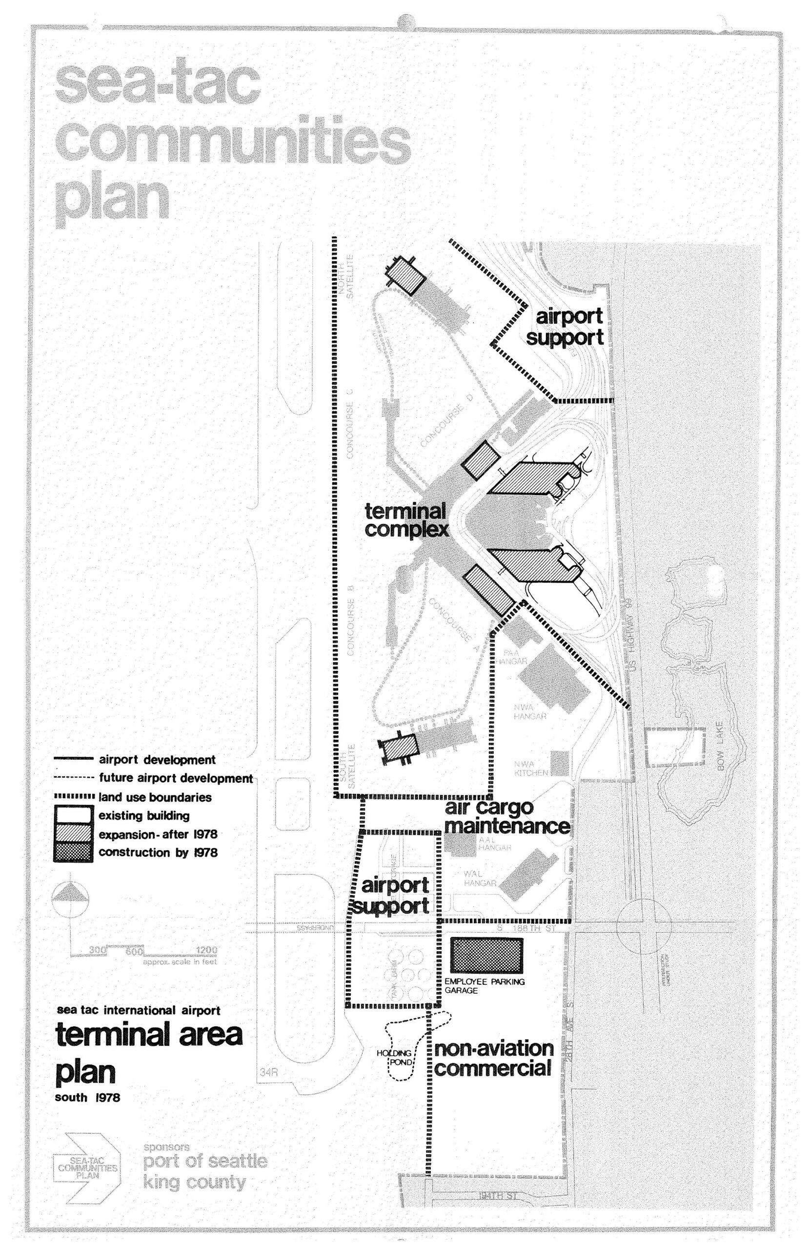
Sea-Tac International Airport Terminal Area Plan South — STCP, 1978
A planning map from the Sea-Tac Communities Plan, sponsored by the Port of Seattle and King County, depicting the Sea-Tac International Airport terminal area as of 1978. The map identifies land use zones including the terminal complex, airport support areas, air cargo maintenance, non-aviation commercial, and an employee parking garage, with a legend distinguishing existing buildings, post-1978 expansions, and construction completed by 1978. -
 1978-01-01
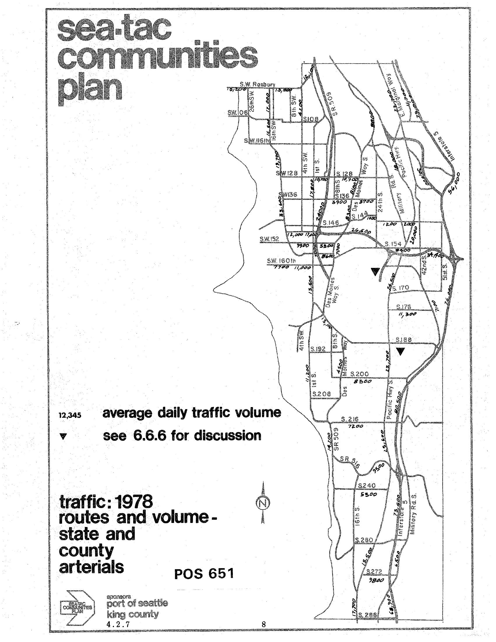
STCP 1978 Traffic Routes and Volumes: State and County Arterials
A traffic map from the Sea-Tac Communities Plan (document reference POS 651, section 4.2.7) showing 1978 average daily traffic volumes on state and county arterials in the Sea-Tac area. The map was sponsored by the Port of Seattle and King County, and displays traffic counts on major roads including SR 509, Pacific Highway S, Military Road, and various numbered streets (SW 128th through S 272nd). -
 1977-09-27
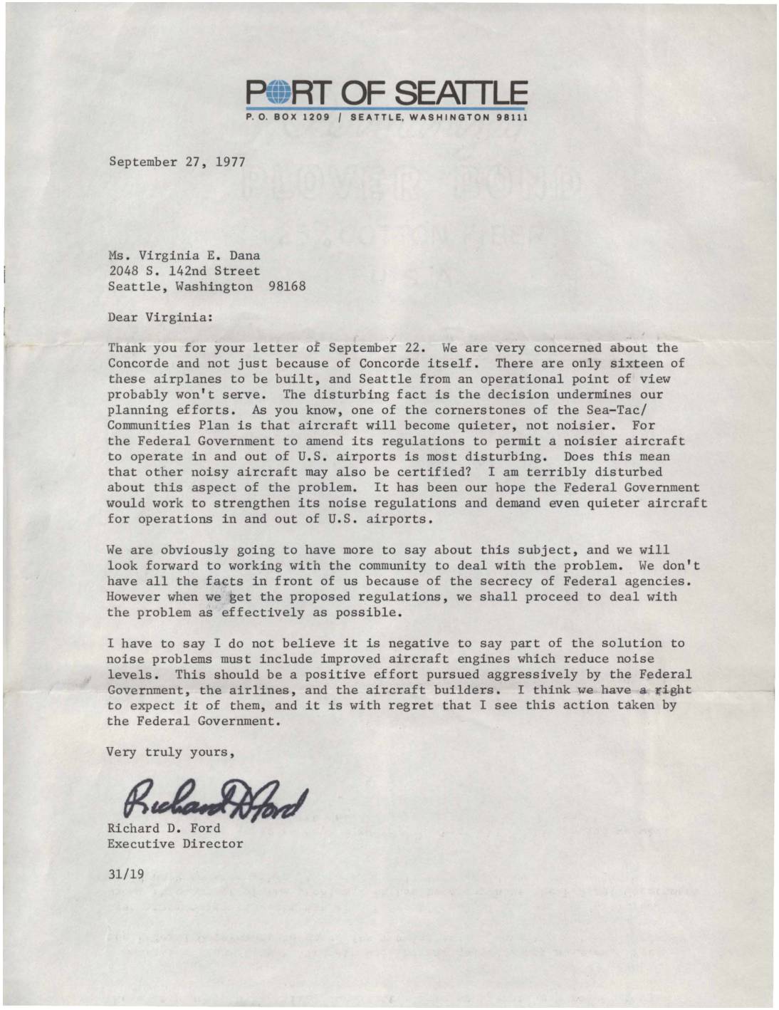
Letter from Port of Seattle Executive Director Richard D. Ford regarding Concorde aircraft noise concerns
In this September 1977 letter, Port of Seattle Executive Director Richard D. Ford responds to a community member's concerns about the Concorde supersonic jet, expressing alarm that the Federal Government amended its noise regulations to allow a noisier aircraft to operate at U.S. airports. Ford warns this decision undermines the Sea-Tac/Communities Plan, which was built on the expectation that aircraft would become progressively quieter over time. He calls on the federal government, airlines, and aircraft manufacturers to aggressively pursue quieter engine technology as a necessary solution to airport noise problems. -
 1977-05-26
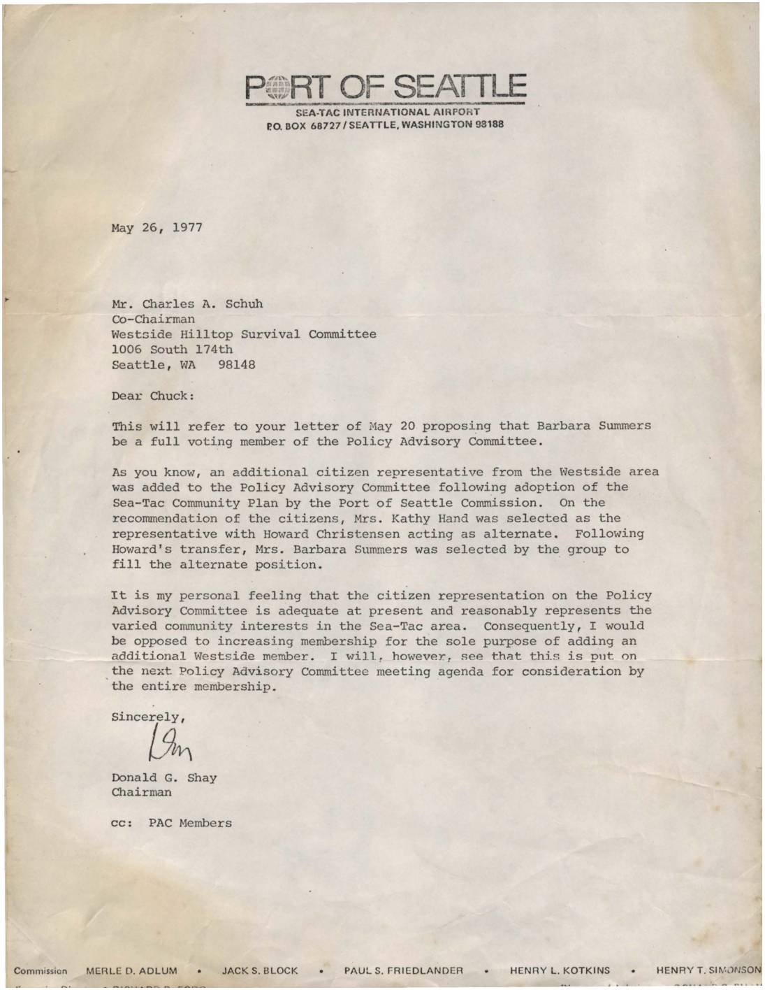
Letter to Charles Schuh regarding Barbara Summers and Policy Advisory Committee membership
In this May 26, 1977 letter, Port of Seattle Chairman Donald G. Shay responds to a request from the Westside Hilltop Survival Committee to make Barbara Summers a full voting member of the Policy Advisory Committee (PAC). Shay explains that Summers currently serves as an alternate representative for the Westside area and expresses his personal opposition to expanding PAC membership solely to add another Westside representative. He agrees, however, to place the matter on the next PAC meeting agenda for consideration by the full membership. -
 1976-07-09
Sea-Tac/communities plan memo: Final plan corrections and additions
A July 9, 1976 internal memo from Ed Parks to holders of the 'Redbook' (Final Sea-Tac Communities Plan), a joint planning effort by the Port of Seattle and King County. The memo instructs recipients to insert enclosed additions and corrections into their copies of the plan, specifying which pages in sections 6.2 through 7.0 should be deleted and replaced. Chapter 7 was included in the packet, and recipients were directed to call 587-4630 for further information. -
 1976-07-01
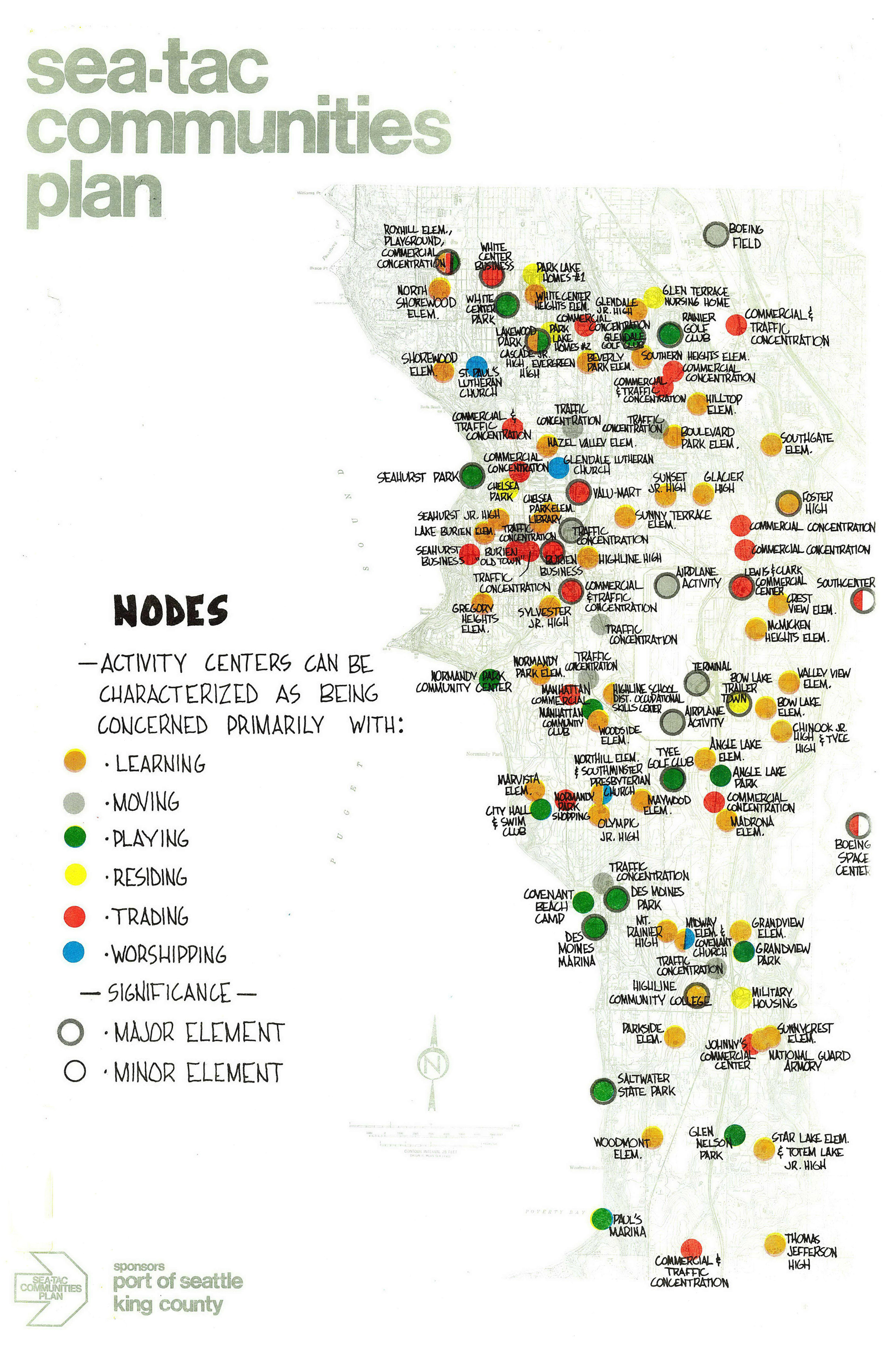
Sea-Tac Communities Plan: Nodes map
A community planning map produced for the Sea-Tac Communities Plan, sponsored by the Port of Seattle and King County, showing activity-center nodes across the Sea-Tac area classified by function (learning, moving, playing, residing, trading, worshipping) and significance (major or minor element). Named locations include schools, parks, commercial concentrations, traffic concentrations, Boeing Field, and Boeing Space Center, among others. -
 1976-06-16
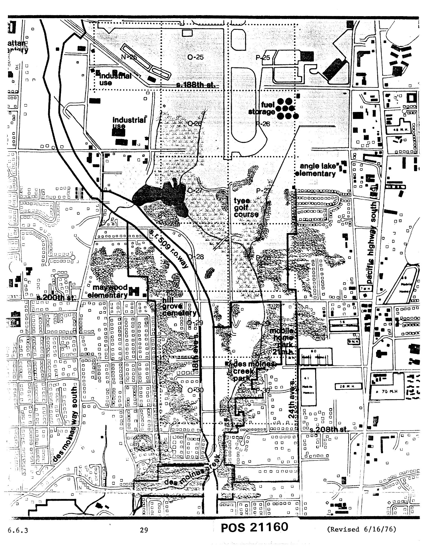
Sea-Tac Comprehensive Plan Land Use Zoning Map — Des Moines Area, Chapter 6, Page 29 (June 1976)
This is document POS 21160, revised June 16, 1976, a detailed land use map (page 29, section 6.6.3) showing the area surrounding Seattle-Tacoma International Airport. Visible features include industrial use zones, fuel storage areas, Tyee Golf Course, Angle Lake Elementary, Maywood Elementary, Hill Grove Cemetery, Des Moines Creek Park, a mobile home park, S. 188th St., S. 200th St., S. 208th St., Pacific Highway South, Des Moines Way South, and the S.R. 509 right-of-way corridor. -
 1976-06-16
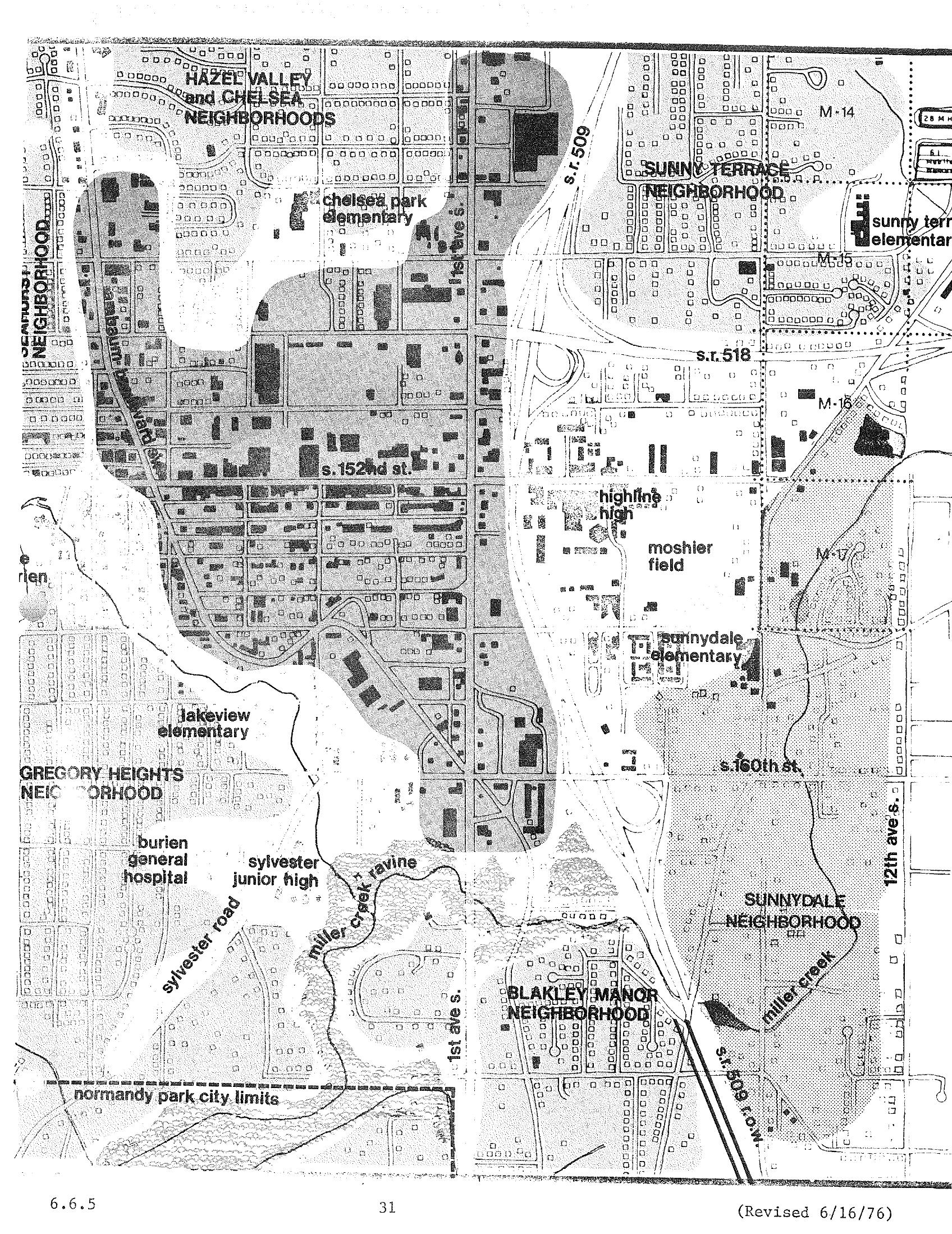
Burien/Sea-Tac Neighborhood Boundaries and Schools Map — STCP Chapter 6, Page 31 (Revised June 1976)
A planning map dated revised 6/16/76 (page 31, section 6.6.5) showing neighborhoods and landmarks in the Burien/Sea-Tac area of Washington State, including Hazel Valley, Chelsea, Sunny Terrace, Gregory Heights, Sunnydale, and Blakley Manor neighborhoods, along with schools (Chelsea Park Elementary, Lakeview Elementary, Highline High, Sunnydale Elementary), Burien General Hospital, Sylvester Junior High, Moshier Field, and major roads including S.R. 509, S.R. 518, and 1st Ave S. The map appears to be part of a noise or land-use study related to Sea-Tac Airport. -
 1976-06-16
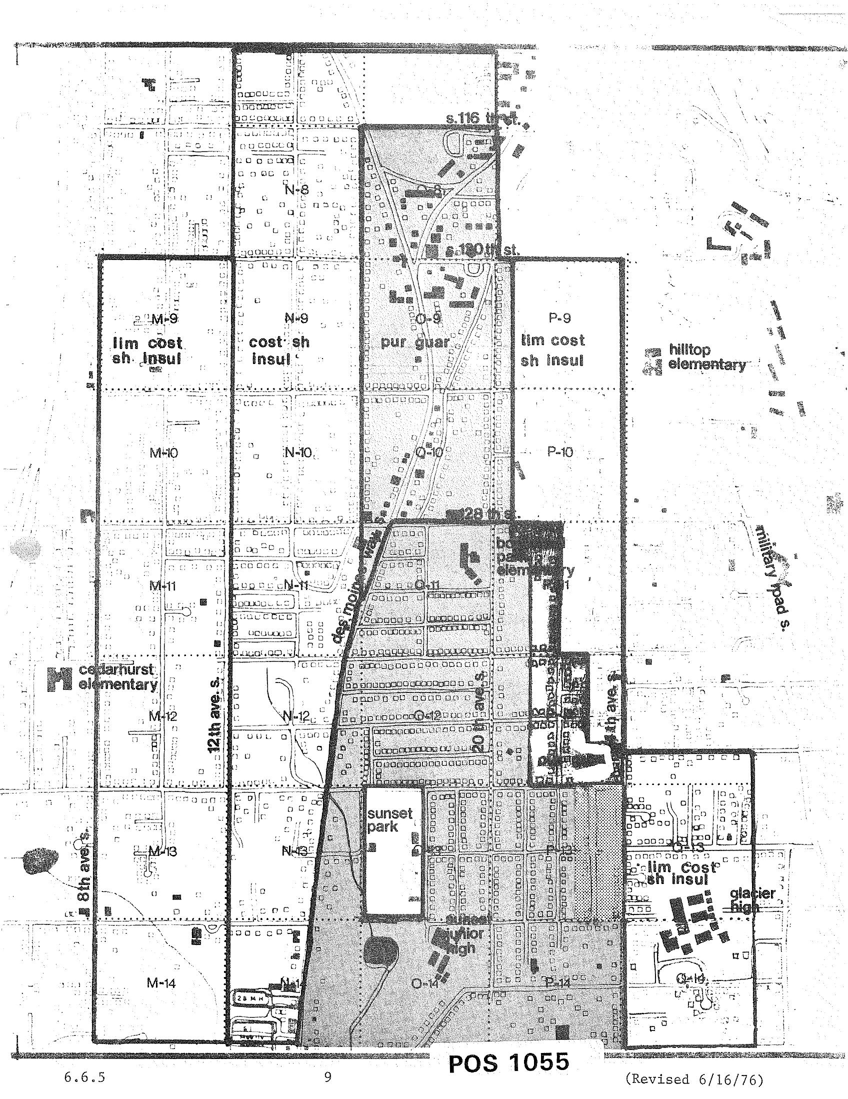
STCP Land Use and Noise Impact Zoning Grid Map, Revised June 16, 1976
A zoning/noise-impact grid map labeled 'POS 1055,' revised June 16, 1976, showing land-use designations (e.g., 'lim cost sh insul,' 'cost sh insul,' 'pur guar') in lettered and numbered grid cells around the Sea-Tac Airport corridor. Named landmarks visible include Cedarhurst Elementary, Hilltop Elementary, Bow Lake Elementary, Glacier High, Sunset Park, Sunset Junior High, 12th Ave S., 8th Ave S., Military Road S., and streets S. 116th, S. 120th, and S. 128th. -
 1976-06-16
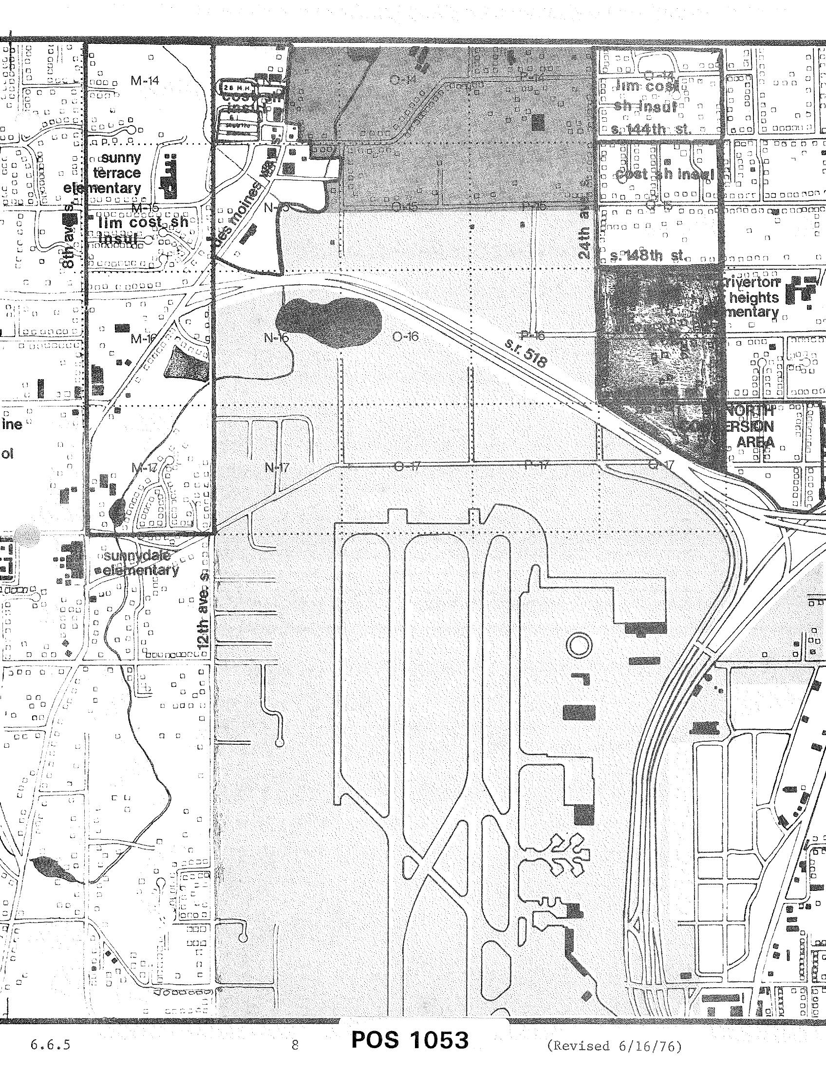
POS 1053 Zoning and Land Use Map — Sea-Tac Airport Area (Revised June 16, 1976)
A planning or zoning map labeled 'POS 1053' (revised June 16, 1976, document section 6.6.5) showing the area surrounding Seattle-Tacoma International Airport, including grid sections M, N, O, and P in rows 14–17, S.R. 518, 24th Avenue, 148th Street, 144th Street, 12th Avenue S., and nearby landmarks such as Sunny Terrace Elementary, Sunnydale Elementary, and Riverton Heights Elementary, with a designated 'North Conversion Area' visible in the upper right.