TagSTCP(140)
-
 1974-03-01
Sea-Tac Communities Plan Element Report 5.8: Community Attitudes Survey
This 1974 study, commissioned by the Port of Seattle and King County, examines the social impact of Seattle-Tacoma International Airport on surrounding neighborhoods. Researchers surveyed residents in high, medium, and low noise zones near Sea-Tac — then the 15th largest airport in the U.S., handling 5.3 million passengers and 375 flights per day in 1973 — and compared their responses with those of residents in comparable areas unaffected by airport noise. The findings were intended to inform the Sea-Tac International Airport Vicinity Master Plan and address community concerns about noise, drainage, and environmental quality. -
 1973-09-01
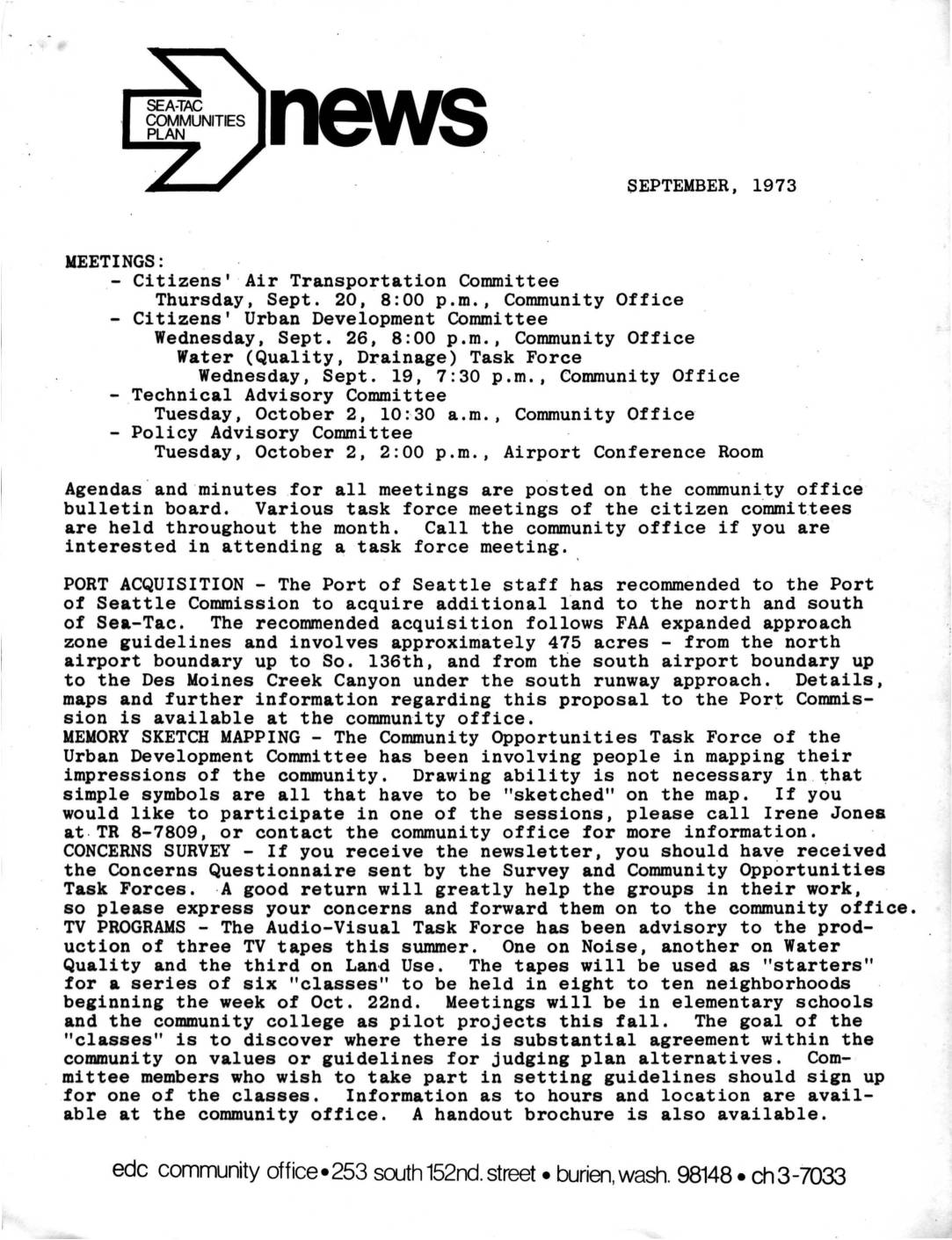
Sea-Tac Communities Plan Newsletter and Air Transportation Committee Minutes, September 1973
This September 1973 newsletter from the Sea-Tac Communities Plan covers community committee meetings, Port of Seattle land acquisition plans, and neighborhood engagement initiatives related to Sea-Tac Airport. The Port of Seattle proposed acquiring approximately 475 acres of land north and south of the airport following FAA approach zone guidelines, while citizen committees worked on noise, water quality, and land use concerns. Community outreach efforts included a memory sketch mapping project, a concerns survey, and a series of TV-based neighborhood classes aimed at building consensus on planning guidelines. -
 1973-07-18
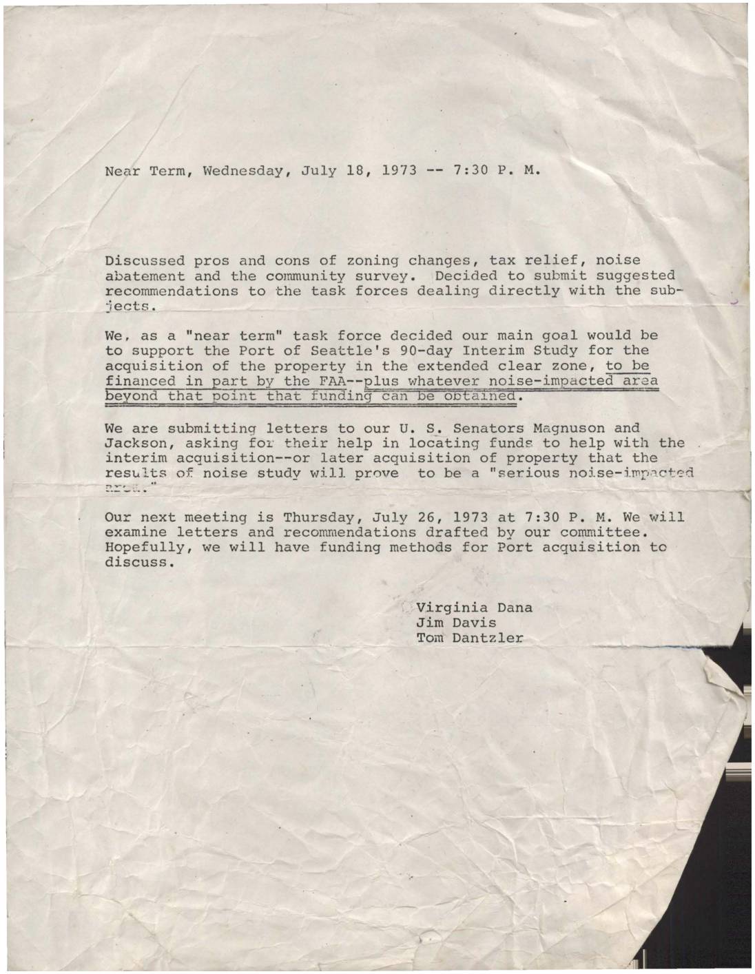
Near Term Task Force Meeting Minutes: July 18, 1973
Minutes from a July 18, 1973 'Near Term' task force meeting focused on Sea-Tac Airport noise issues, in which members agreed to support the Port of Seattle's 90-day Interim Study for acquiring property in the extended clear zone, with partial FAA funding. The group also decided to write to U.S. Senators Magnuson and Jackson to seek additional funds for interim and future property acquisition in serious noise-impacted areas. The next meeting was scheduled for July 26, 1973, to review draft letters and explore funding options. -
 1973-07-01
Community trends and characteristics in the SeaTac Communities Plan Study Area
This 1973 preliminary technical report, prepared by the King County Office of Community and Environmental Development, examines community trends and characteristics in the SeaTac Communities Plan Study Area. It covers population and enrollment, housing, and economy and employment data, with a forecasts section noted as still to be written at the time of publication. The report serves as an early planning document providing baseline demographic and economic context for the communities surrounding Seattle-Tacoma International Airport. -
 1973-06-28
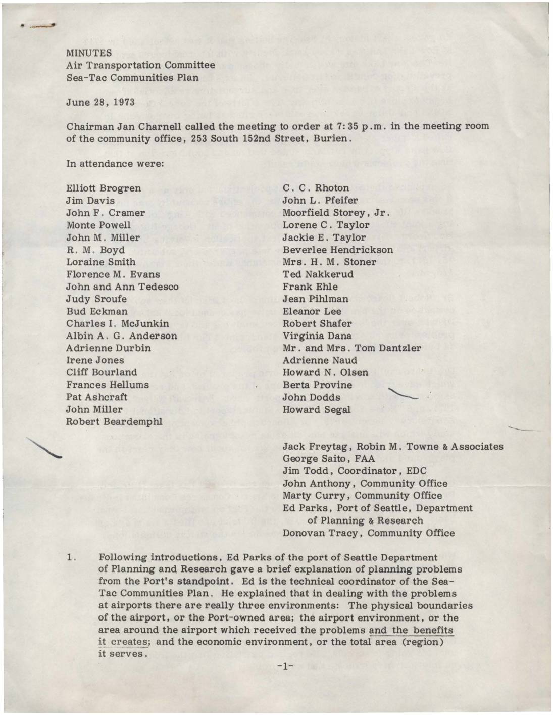
Minutes: Air Transportation Committee, Sea-Tac Communities Plan
Minutes from a June 28, 1973 Air Transportation Committee meeting on the Sea-Tac Communities Plan, held in Burien, Washington. Representatives from the Port of Seattle, FAA, Highline School District, and local community groups discussed the history of Sea-Tac Airport's expansion, the impact of aircraft noise on nearby schools and neighborhoods, and ongoing efforts to measure and reduce noise exposure. Key topics included new comprehensive noise measurement methods, federal agency roles in noise regulation, and strategies for noise abatement such as modified flight procedures and sound-absorbing materials. -
 1973-06-07
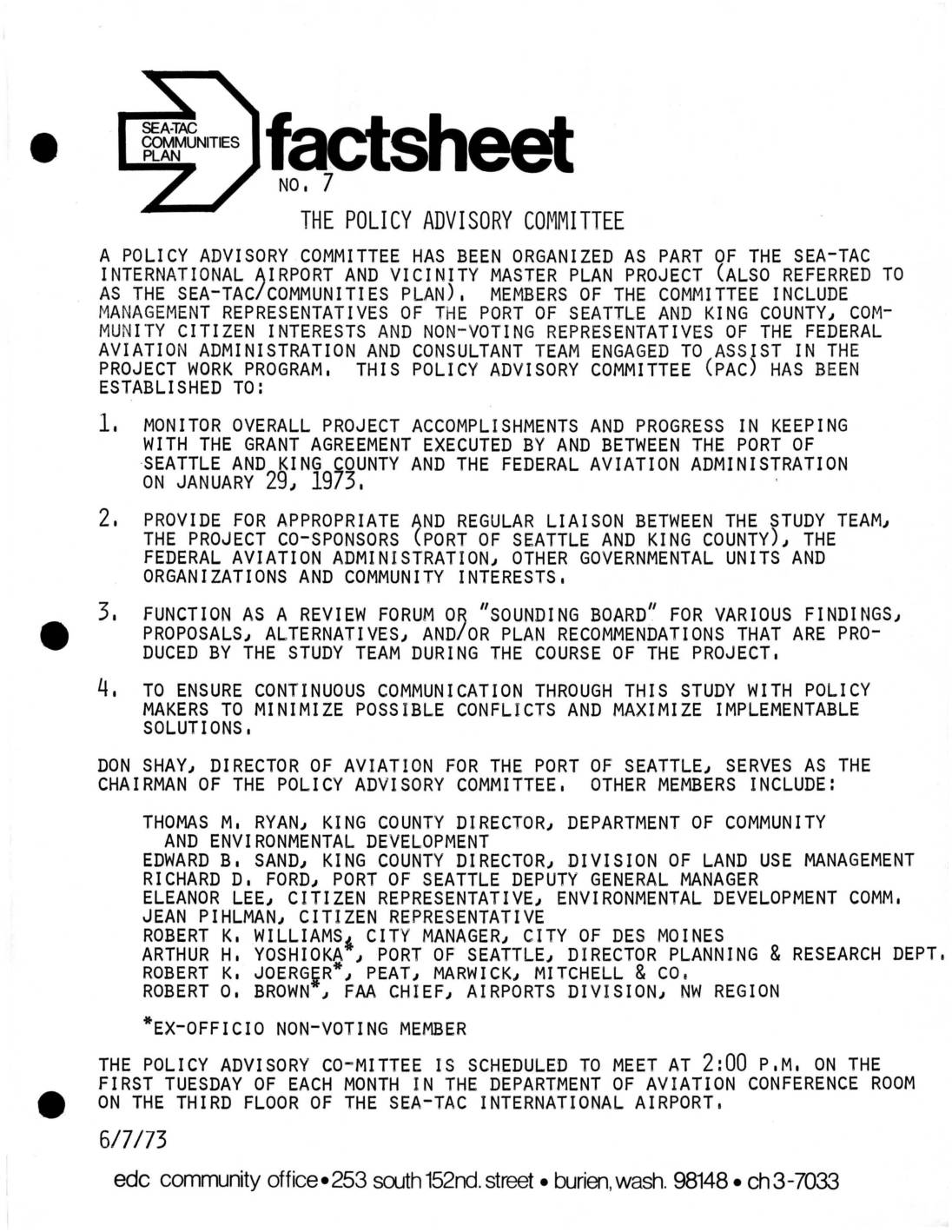
Sea-Tac Communities Plan Fact Sheet No. 7: The Policy Advisory Committee
These documents from 1973 describe the formation and early activities of the Policy Advisory Committee (PAC), established to oversee the Sea-Tac International Airport and Vicinity Master Plan Project. The committee brought together representatives from the Port of Seattle, King County, the FAA, and community citizens to monitor project progress, facilitate communication between stakeholders, and review study findings related to noise, land use, and environmental impacts. Regular monthly meetings and community task forces on topics such as noise abatement and drainage were organized to maximize public involvement in shaping airport policy. -
 1973-05-02
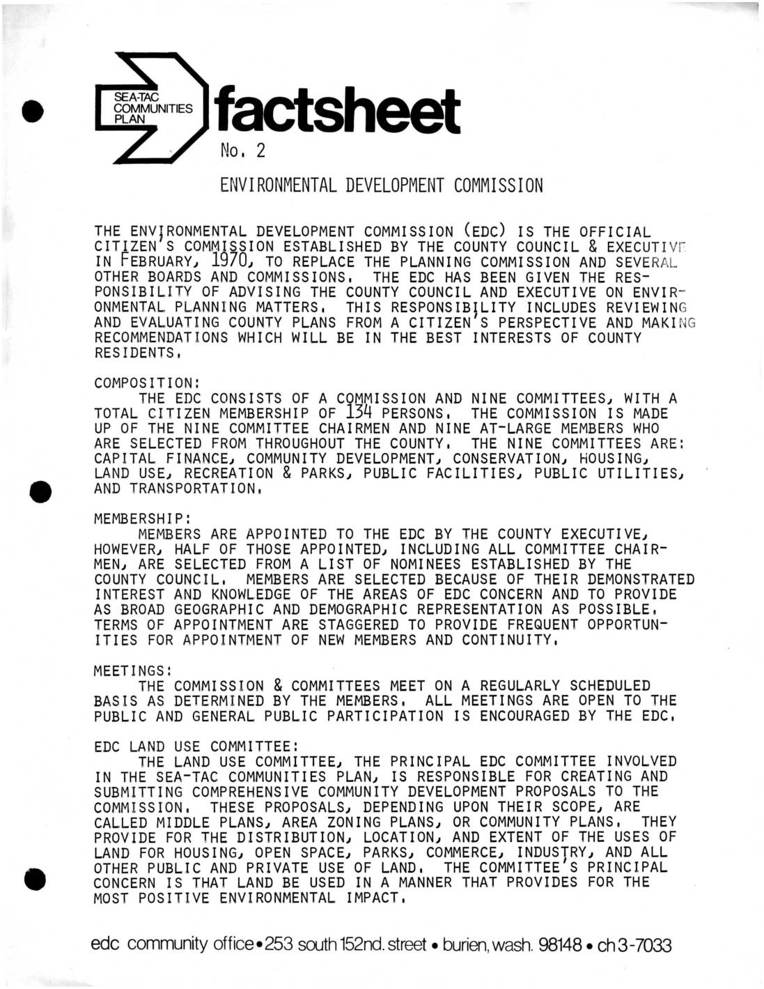
Fact Sheet No. 2: Environmental Development Commission
The Environmental Development Commission (EDC) is an official citizens' advisory body established by King County in February 1970 to replace the Planning Commission and advise the County Council and Executive on environmental planning matters. It consists of 134 citizen members organized into nine committees, including a Land Use Committee that plays a central role in the Sea-Tac Communities Plan by developing proposals governing how land is used for housing, commerce, industry, and open space. All EDC meetings are open to the public, and the commission's overarching goal is to ensure land use decisions provide the most positive environmental impact for county residents. -
 1973-01-01
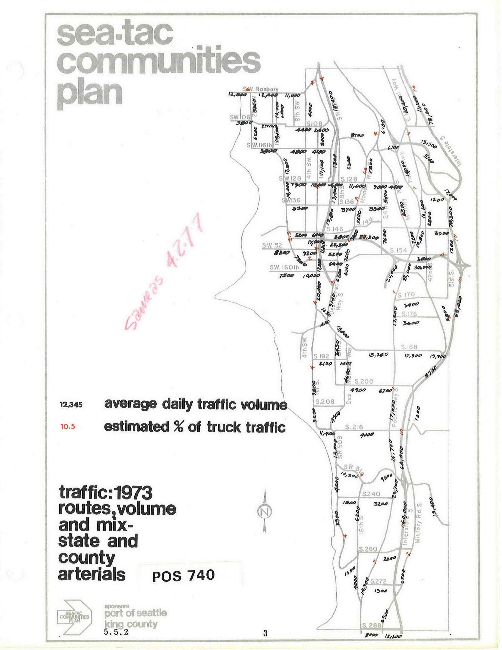
Sea-Tac Communities Plan: 1973 Average Daily Traffic Volumes on State and County Arterials
Map document from the Sea-Tac Communities Plan (document number POS 740, section 5.5.2) showing 1973 average daily traffic volumes and estimated truck traffic percentages on state and county arterials in the Sea-Tac area. Sponsored by the Port of Seattle and King County, the map displays street-level traffic counts across roads including SW 106th through S 288th, with a handwritten notation 'Savings 4,277' in red. -
 1971-01-01
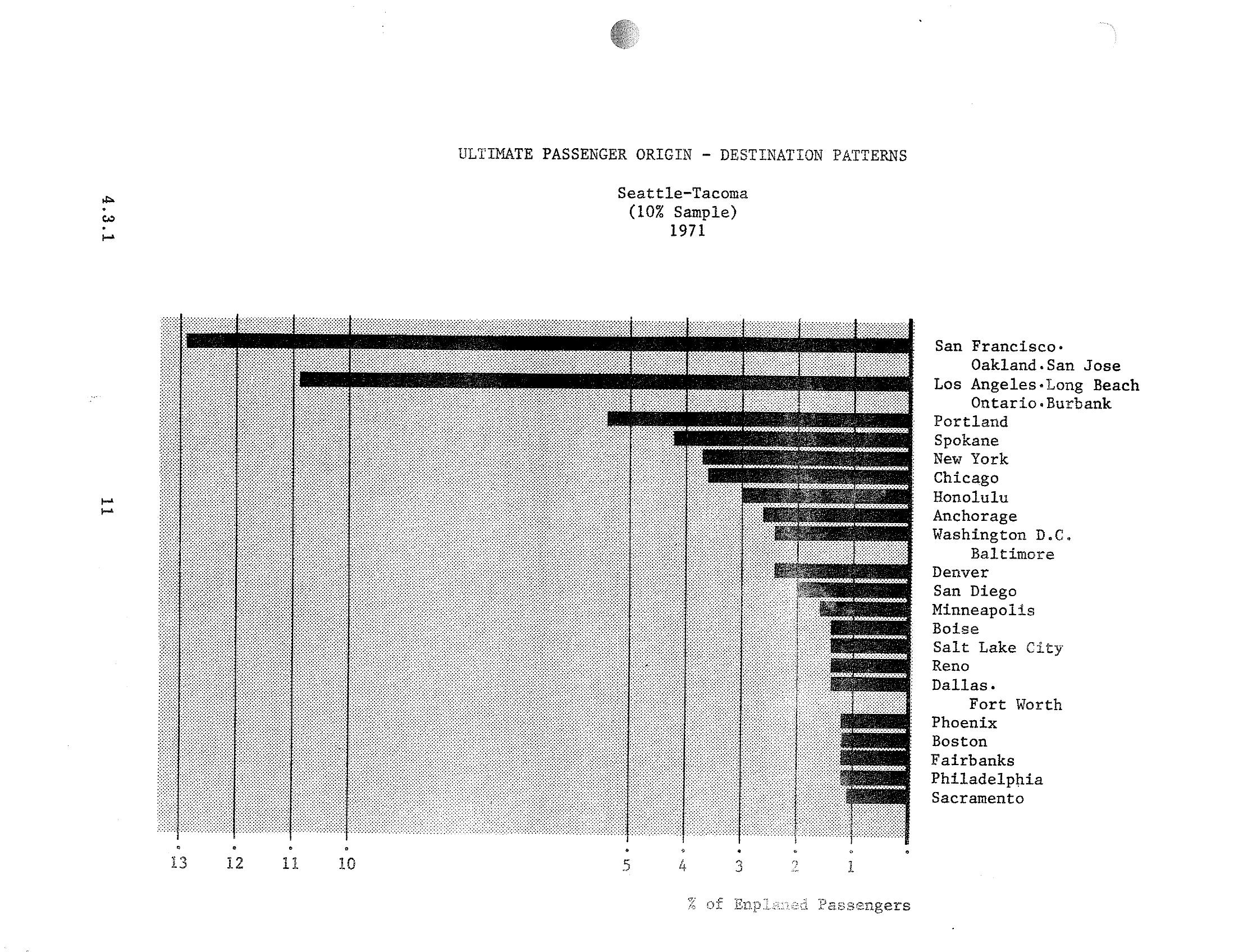
Sea-Tac Airport STCP: Top Passenger Origin-Destination City Pairs by Percentage of Enplaned Passengers, 1971
A horizontal bar chart from a Sea-Tac Airport document (section 4.3.1) showing the top passenger origin-destination city pairs by percentage of enplaned passengers for 1971, based on a 10% sample. San Francisco/Oakland/San Jose and Los Angeles/Long Beach/Ontario/Burbank are the dominant destinations, each exceeding 10% of enplaned passengers, followed by Portland, Spokane, New York, and Chicago. -
 1971-01-01
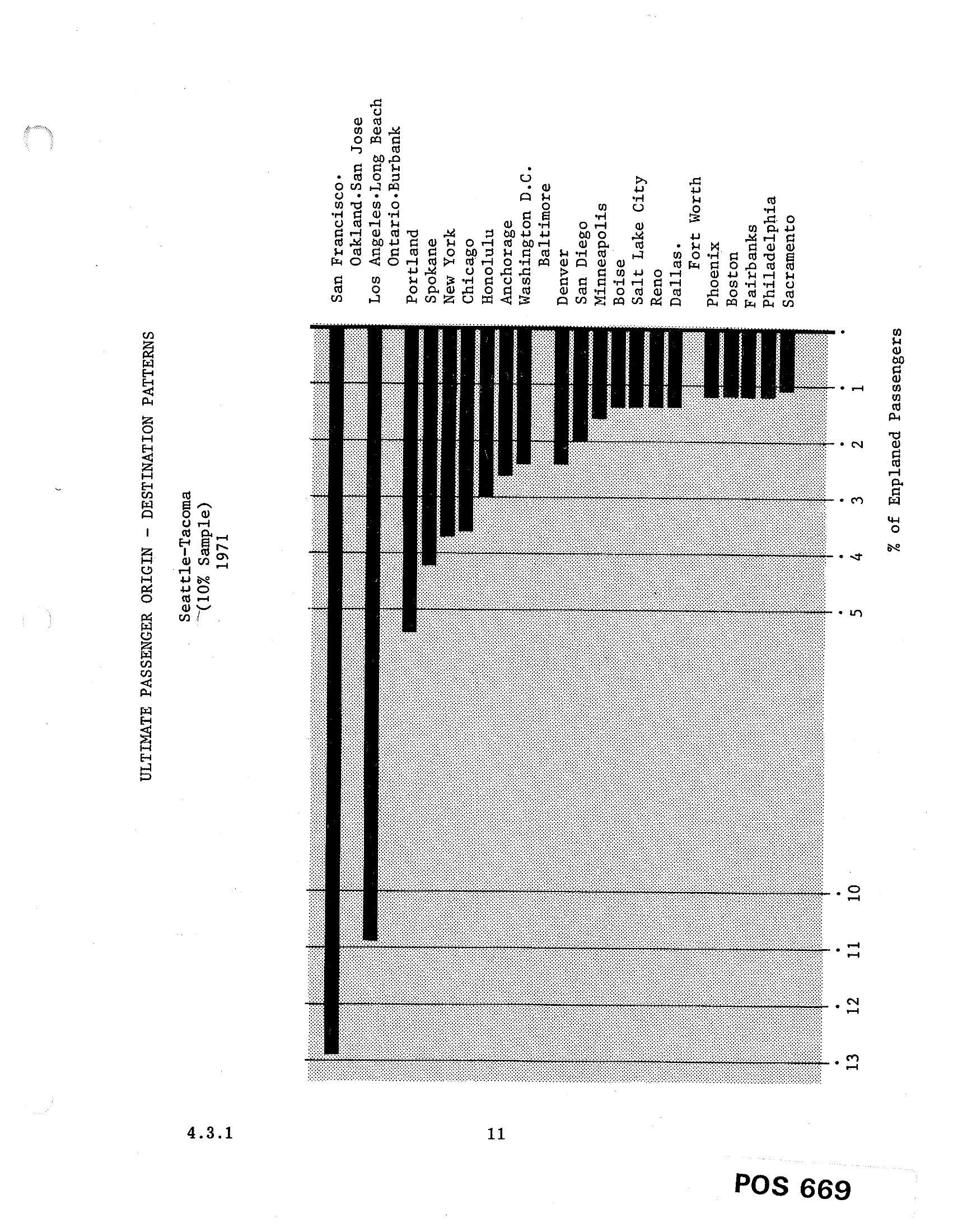
Sea-Tac Airport Passenger Origin-Destination Patterns Bar Chart (1971)
A horizontal bar chart from document POS 669 (section 4.3.1) showing the ultimate passenger origin-destination patterns for Seattle-Tacoma airport based on a 10% sample from 1971. The chart ranks destinations by percentage of enplaned passengers, with San Francisco leading at approximately 13%, followed by Oakland/San Jose, Los Angeles/Long Beach, and other cities including Honolulu, Chicago, New York, and Washington D.C.