TagSea-Tac Airport(1835)
-
 2022-07-14
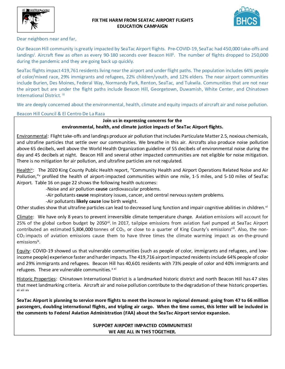
Fix the Harm from Sea-Tac Airport Flights: Education Campaign Fact Sheet
The Beacon Hill Council and El Centro De La Raza are calling on community members to take action against the environmental, health, and equity harms caused by SeaTac Airport flight operations, which affect nearly 420,000 residents — including large proportions of people of color, immigrants, and refugees. Aircraft noise regularly exceeds World Health Organization safe limits, while air pollution from flights contributes to cardiovascular disease, respiratory illness, and developmental harm in children, with no current mitigation available for many impacted neighborhoods. The campaign also warns that SeaTac's planned expansion — from 47 to 66 million passengers, doubled international flights, and tripled air cargo — will worsen these impacts, and pledges to submit community concerns to the FAA during the expansion review process. -
 2022-07-14
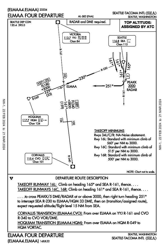
ELMAA Four Departure (ELMAA4.ELMAA) — Seattle-Tacoma International Airport Standard Instrument Departure
The ELMAA Four Departure is a standard instrument departure procedure for Seattle-Tacoma International Airport (SEA) that routes aircraft southward after takeoff on runways 16L, 16C, or 16R. Departing aircraft climb on headings of 161°–165°, cross the PEAKK waypoint at or above 3,000 feet, then turn right to intercept the SEA R-230 radial toward the ELMAA fix, with onward transitions available to Hoquiam (HQM) or Corvallis (CVO). Notably, departures from runways 34L, 34C, and 34R are not authorized due to noise abatement restrictions, and minimum climb gradients of up to 560 feet per nautical mile are required depending on the runway used. -
 2022-07-14
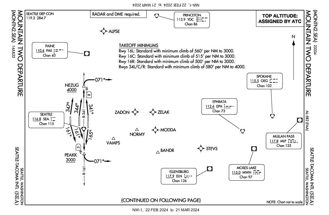
Mountain Two Departure (MONTN2.SEA) — Seattle-Tacoma International Airport Standard Instrument Departure
The Mountain Two Departure (MONTN2.SEA) is an instrument departure procedure for Seattle-Tacoma International Airport (SEA) that provides pilots with specific climb and routing instructions based on which runway they are using. Departing aircraft must meet minimum climb gradients ranging from 500 to 580 feet per nautical mile depending on the runway, and are directed to fly specific headings before turning eastbound on a 071° heading toward fixes like PEAKK or NEZUG. The procedure requires radar and DME equipment, with top altitude assigned by ATC and a lost communications protocol directing pilots to proceed direct to the SEA VORTAC at 4,000 feet. -
 2022-07-10
Sea-Tac Communities Plan Part 8: References — Sea-Tac Plan Published Reports (Section 8.0.1)
This document lists the published reports produced as part of the Sea-Tac Airport and Vicinity Master Plan study, a collaborative effort by King County, the Port of Seattle, consultants, and community members. The reports cover a wide range of topics including aviation demand forecasting, air and water quality analysis, solid waste, and noise exposure analysis across multiple volumes. Copies of these references were made available at the King County Land Use Management Division and the Port of Seattle Planning and Research Department. -
 2022-07-10
Part 5: The Environment — Chapter 5.1: Air Quality
This document presents an air quality study conducted by Environmental Systems Laboratories, Inc. for Sea-Tac Airport, examining pollutant levels—including particulates, carbon monoxide, hydrocarbons, nitrogen oxides, and oxidants—at and around the airport. Using monitoring data collected in 1973–1974 from seven sites near the airport and surrounding communities, the study assessed existing conditions and predicted future air quality impacts under various aviation and land use scenarios. -
 2022-07-10
Part 4: Trends and Forecasts — Chapter 4.1, Central Puget Sound Region Population
This document is Part 4 of a Master Plan study for Sea-Tac International Airport, focusing on trends and forecasts for the Central Puget Sound Region. It examines population and economic growth data to project future air traffic demand, noting that the four-county area around Seattle held over 1.9 million people in 1970—56% of Washington State's population. While the region grew rapidly through the 1950s and 1960s, the plan anticipates more modest growth in the 1970s relative to national averages. -
Sea-Tac Communities Plan Cover
Cover of the 'Sea-Tac Communities Plan,' a planning document jointly produced by the Port of Seattle and King County. The bold graphic design features diagonal typography on a red/pink background with a stylized chevron or flight-path symbol. -
 2022-05-30
Port Package Program Photo — May 30, 2022
-
 2022-05-30
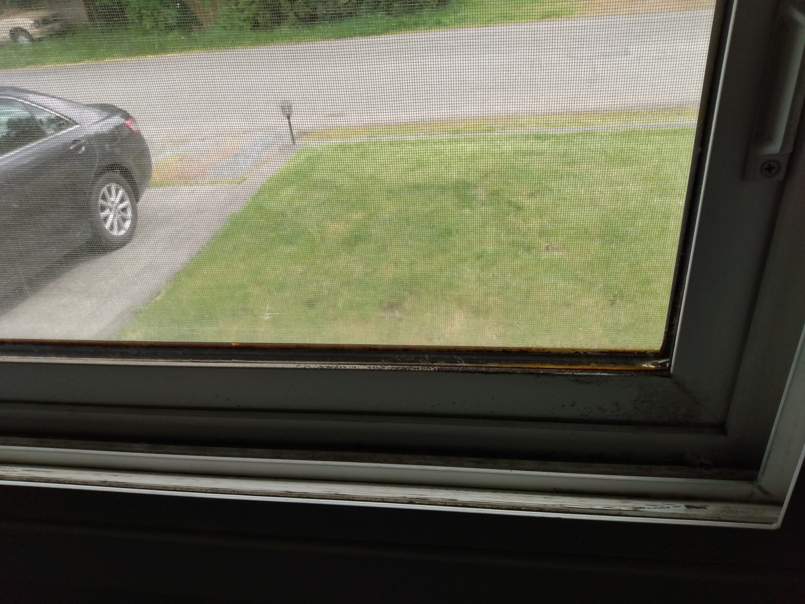
Port Package Program Photo — May 2022
-
 2022-05-26
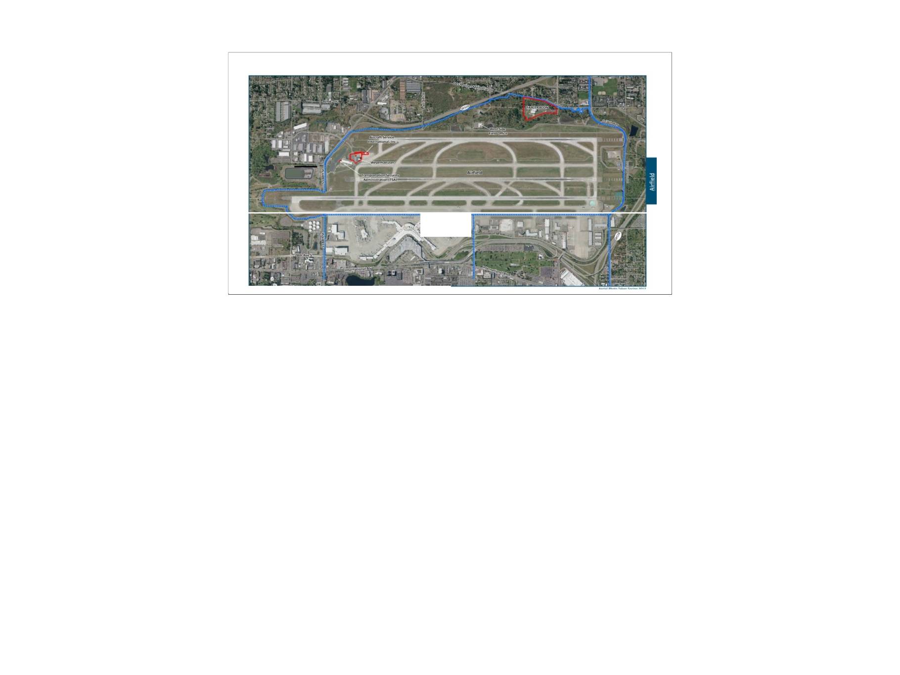
Air Quality Monitoring (AQM) Presentation: Sea-Tac Airport Flight Tracks and Airfield Overview
This document contains airfield mapping and flight-track data related to Seattle-Tacoma International Airport (Sea-Tac), showing Port of Seattle lease boundaries, zone match lines, and recorded aircraft flight paths in the surrounding region. It includes a radar playback capture from August 14, 2019, depicting a FedEx 397 missed approach and an Alaska 807 departure with a non-standard turn at approximately 2,130 feet MSL. The materials appear to be part of an airport noise or operations review archive documenting aircraft movement patterns around Sea-Tac.