TagSea-Tac Airport(1855)
-
 1976-06-16
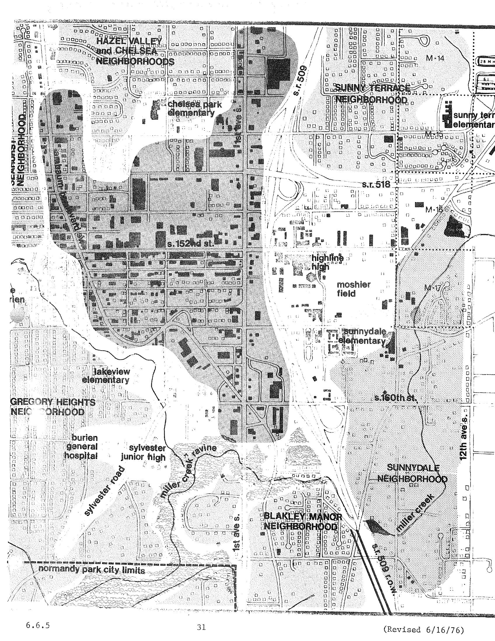
Burien/Sea-Tac Neighborhood Boundaries and Schools Map — STCP Chapter 6, Page 31 (Revised June 1976)
A planning map dated revised 6/16/76 (page 31, section 6.6.5) showing neighborhoods and landmarks in the Burien/Sea-Tac area of Washington State, including Hazel Valley, Chelsea, Sunny Terrace, Gregory Heights, Sunnydale, and Blakley Manor neighborhoods, along with schools (Chelsea Park Elementary, Lakeview Elementary, Highline High, Sunnydale Elementary), Burien General Hospital, Sylvester Junior High, Moshier Field, and major roads including S.R. 509, S.R. 518, and 1st Ave S. The map appears to be part of a noise or land-use study related to Sea-Tac Airport. -
 1976-06-16
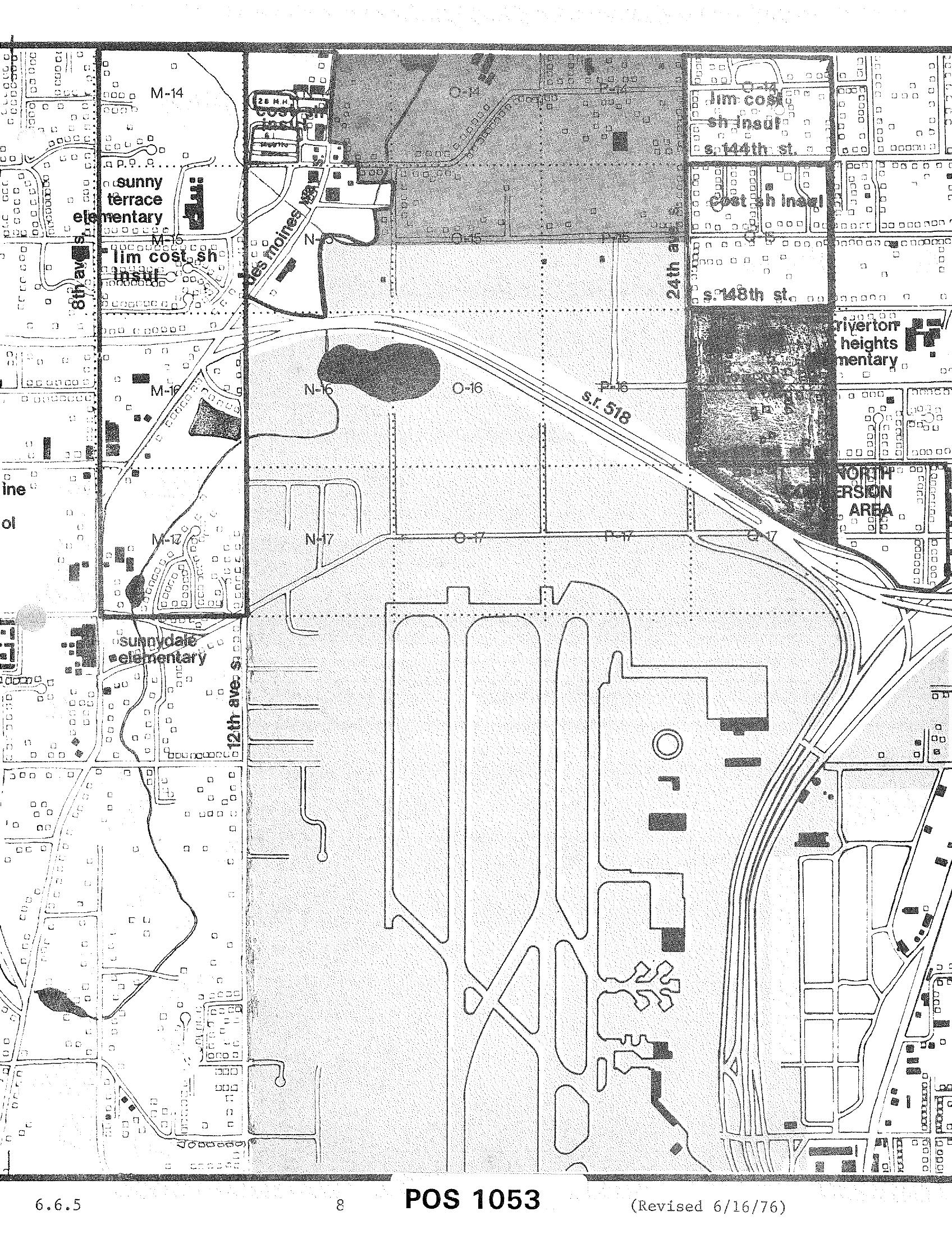
POS 1053 Zoning and Land Use Map — Sea-Tac Airport Area (Revised June 16, 1976)
A planning or zoning map labeled 'POS 1053' (revised June 16, 1976, document section 6.6.5) showing the area surrounding Seattle-Tacoma International Airport, including grid sections M, N, O, and P in rows 14–17, S.R. 518, 24th Avenue, 148th Street, 144th Street, 12th Avenue S., and nearby landmarks such as Sunny Terrace Elementary, Sunnydale Elementary, and Riverton Heights Elementary, with a designated 'North Conversion Area' visible in the upper right. -
 1976-05-11
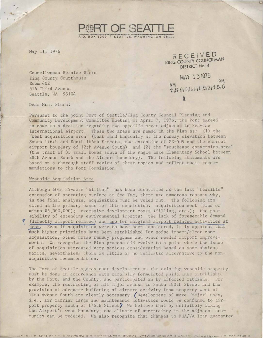
Letter from Port Of Seattle to Councilwoman Bernice Stern regarding Sea-Tac Communities Plan areas
In a May 1976 letter to King County Councilwoman Bernice Stern, Seattle Port Commission President Henry T. Simonson outlined two key decisions regarding land adjacent to Sea-Tac International Airport. The Port ruled out acquiring the 35-acre 'west acquisition area' due to high costs, excessive development expenses, and lack of foreseeable airport-related demand, while agreeing that any existing development there must follow carefully formulated guidelines. For the 'southeast conversion area' — 85 small homes in Lowe's Terrace Subdivision — the Port acknowledged that standard acoustic insulation treatment may not be cost-effective, and flagged the neighborhood as a candidate for a special purchase guarantee program to assist with gradual land-use conversion. -
 1976-02-06
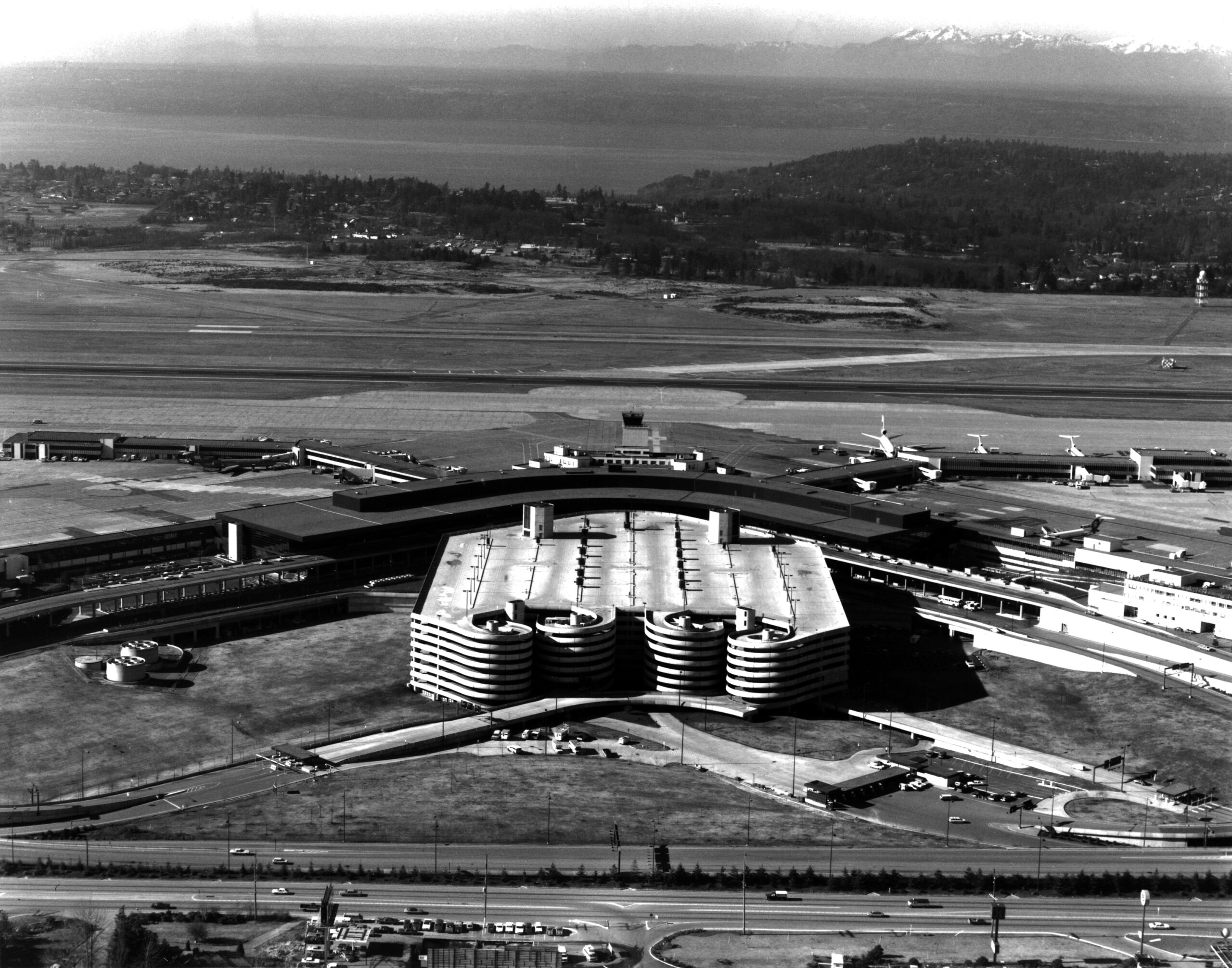
Sea-Tac Aerial
Aerial photograph looking north over Seattle-Tacoma International Airport, showing the main terminal building, satellite concourses with jet aircraft at gates, and the distinctive circular/spiral parking garage structure in the foreground. Puget Sound and the Olympic Mountains are visible in the background, consistent with Sea-Tac's geographic orientation. -
 1975-04-22
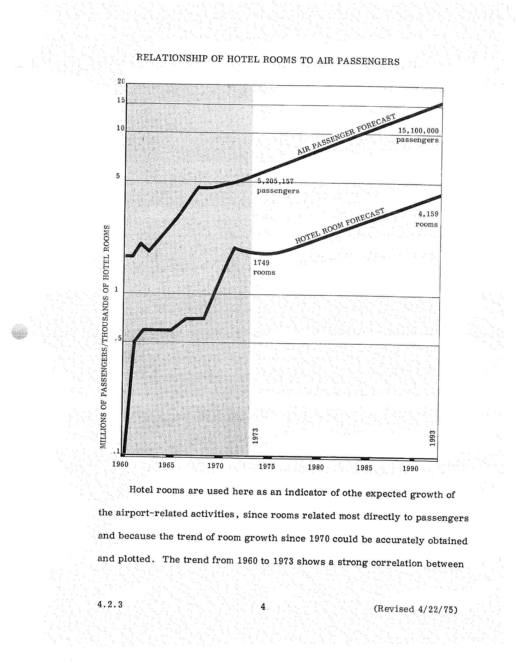
Sea-Tac Airport STCP Section 4.2.3: Air Passengers vs. Hotel Rooms Forecast, 1960–1993
A dual-axis chart from a Sea-Tac Airport planning document (revised April 22, 1975, section 4.2.3) plotting historical and forecast air passenger volumes against hotel room counts from 1960 to 1993. The chart projects growth from 5,205,157 passengers and 1,749 hotel rooms in 1973 to 15,100,000 passengers and 4,159 rooms by 1993, using hotel room growth as an indicator of airport-related activity expansion. -
 1975-04-22
Development concept: the airport and the communities
This document outlines a development concept addressing the relationship between Sea-Tac International Airport and its surrounding communities. While the airport contributes significantly to the regional economy—supporting over 15,200 jobs and $390 million in annual business activity—local residents have long struggled with aircraft noise, uncertainty about airport expansion, and the impact on property values and neighborhood character. The concept seeks to find greater compatibility between the airport's growth and the needs of the communities it affects. -
 1975-04-22
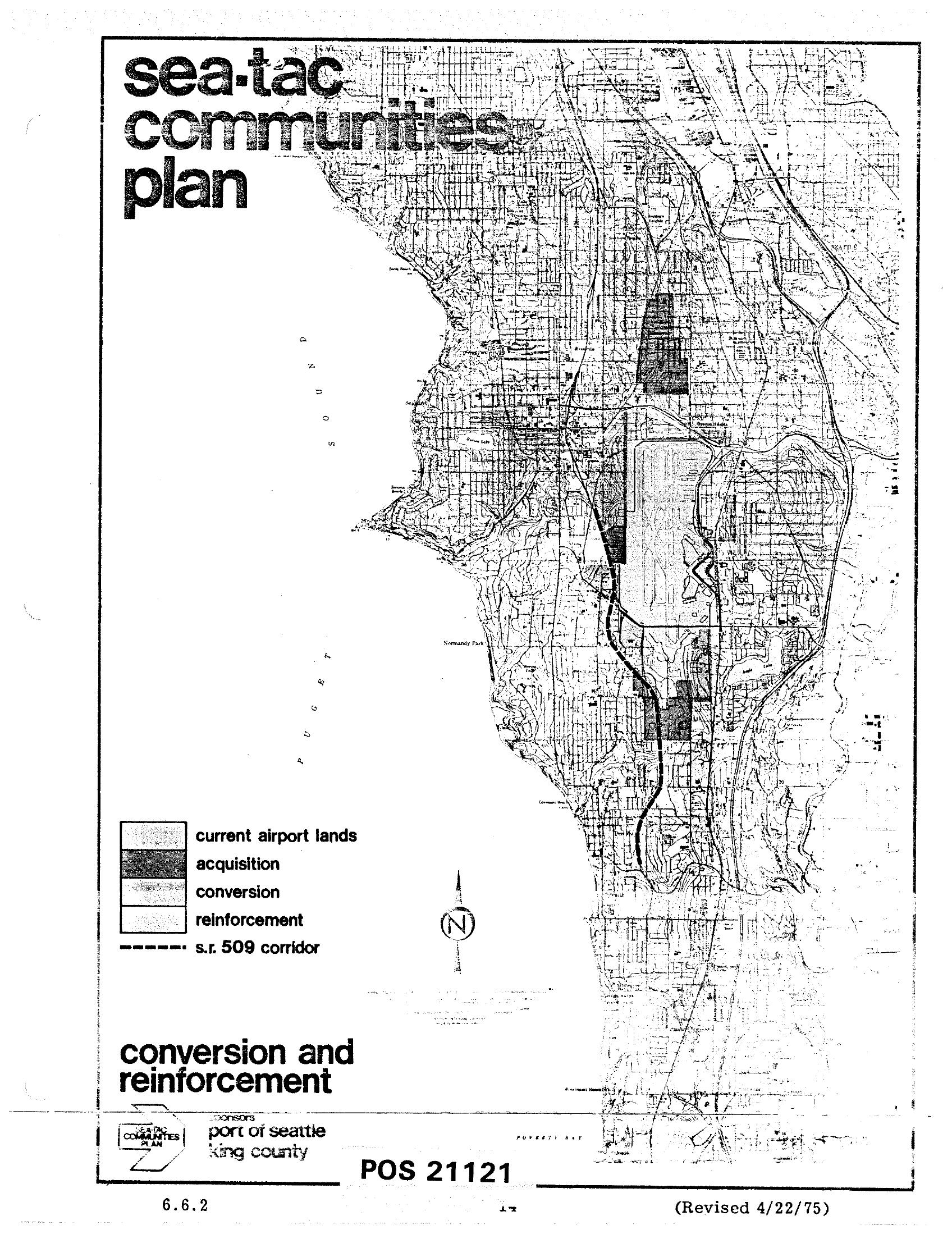
Sea-Tac Communities Plan Map 6.6.2 — Conversion and Reinforcement Areas (April 1975)
This is map sheet 6.6.2 (POS 21121, revised April 22, 1975) from the Sea-Tac Communities Plan, sponsored by the Port of Seattle and King County. It shows the area around Seattle-Tacoma International Airport with land-use designations including current airport lands, acquisition zones, conversion areas, reinforcement areas, and the proposed S.R. 509 corridor, overlaid on a street grid map extending from Puget Sound eastward. -
 1975-04-22
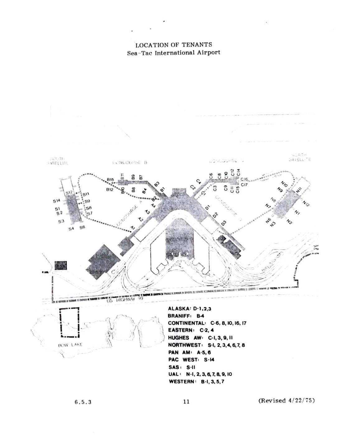
Location of tenants: Sea-Tac International Airport
This 1975 document shows the location of airline tenants at Sea-Tac International Airport, mapping gate assignments across the airport's concourses and satellite terminals. Airlines listed include Alaska, Braniff, Continental, Eastern, Hughes Airwest, Northwest, Pan Am, Pacific West, SAS, United Air Lines, and Western. The map identifies each carrier's specific gate numbers within Concourses B and C, the North and South Satellites, and other terminal areas. -
 1975-04-22
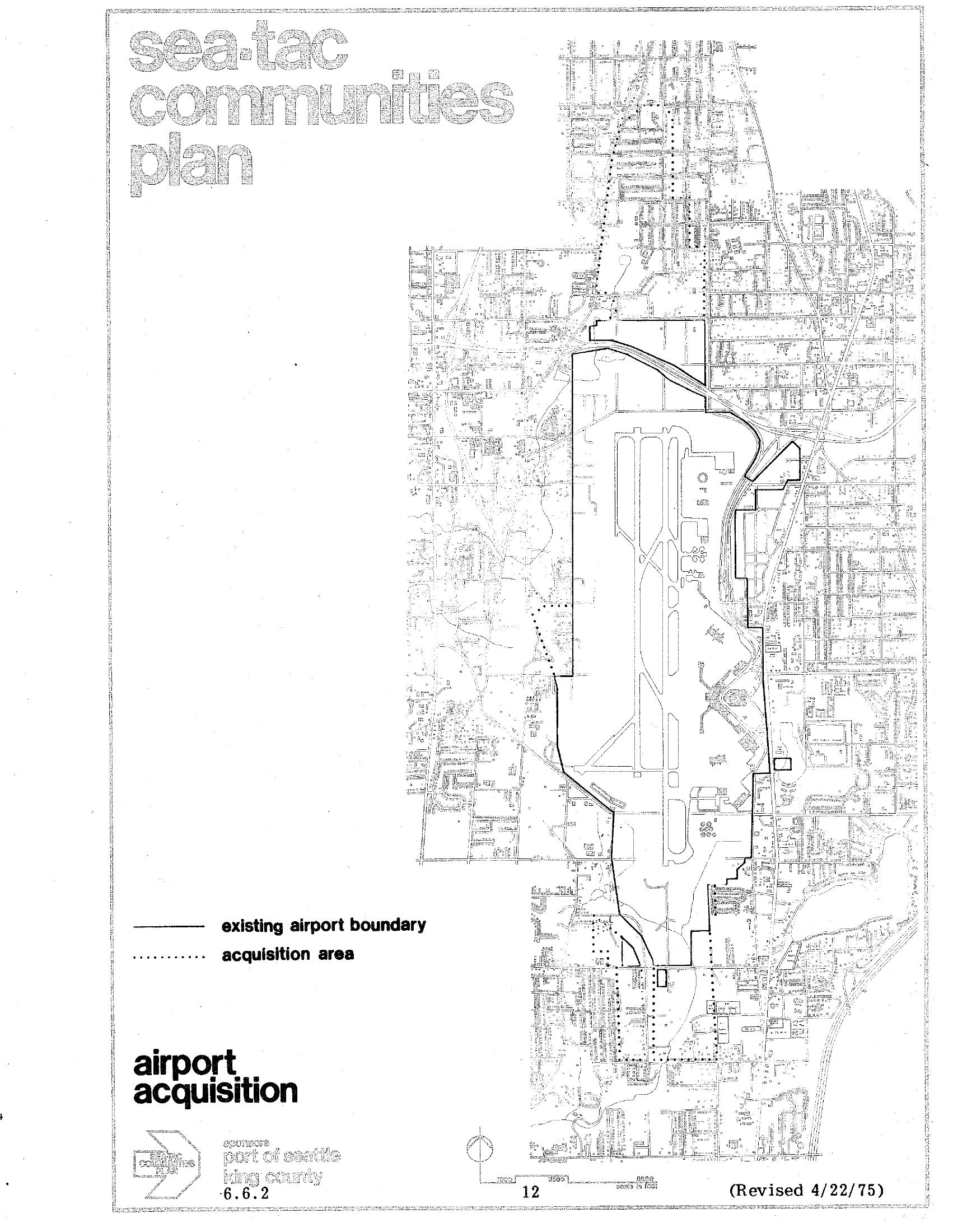
Sea-Tac Communities Plan Airport Acquisition Map (Plate 6.6.2), April 1975
Map plate 6.6.2 from the Sea-Tac Communities Plan, revised April 22, 1975, showing the existing Seattle-Tacoma International Airport boundary (solid line) and the proposed acquisition area (dotted line). The document is sponsored by the Port of Seattle and King County and is labeled 'airport acquisition,' page 12. -
 1974-07-31
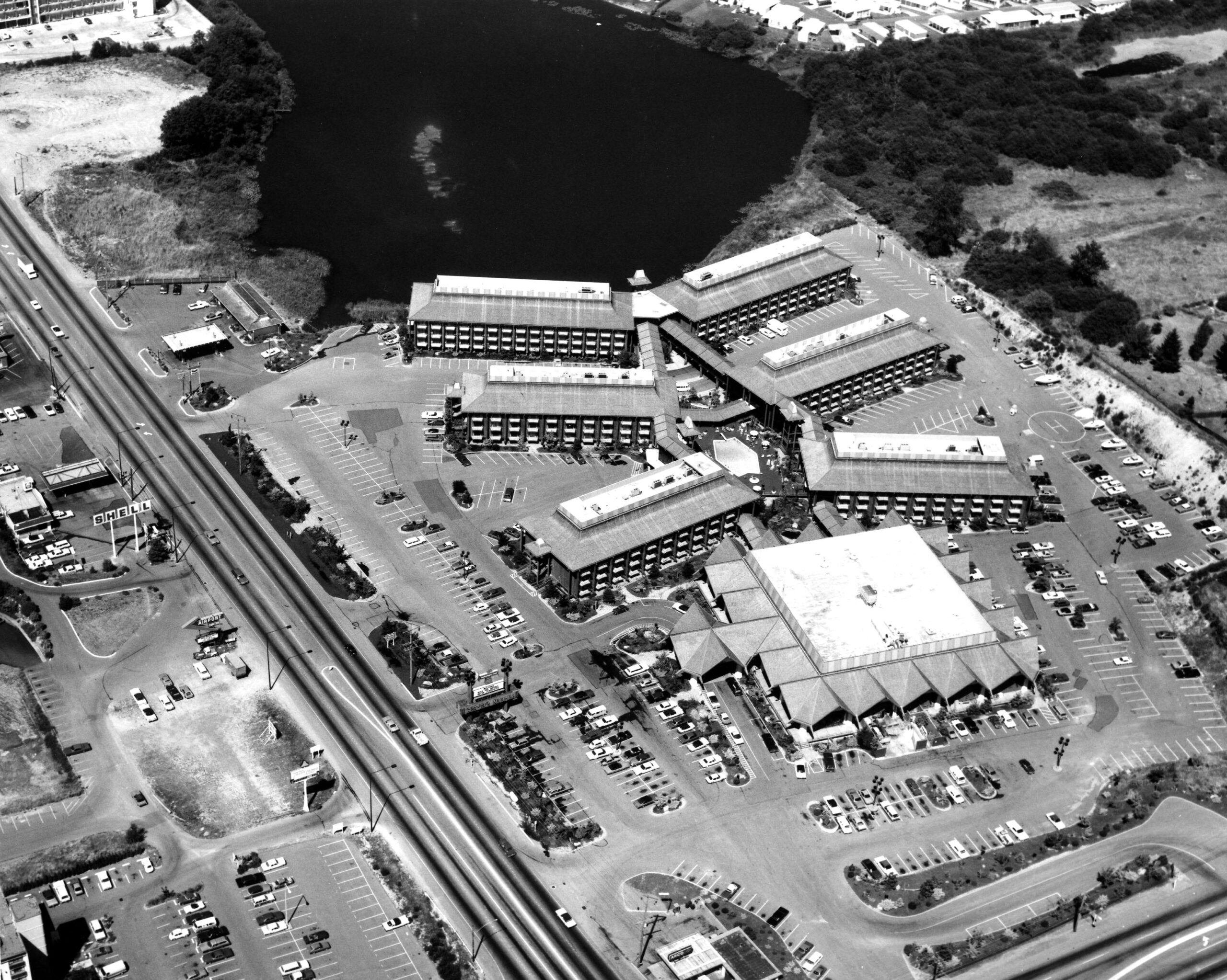
Sea-Tac Motel Aerial
Black-and-white aerial photograph showing a large multi-building hotel or motel complex with extensive parking lots alongside a divided highway. A body of water is visible in the upper portion of the image; a Shell gas station sign is faintly legible on the left side of the road.