TagSea-Tac Airport(1855)
-
 1978-01-01
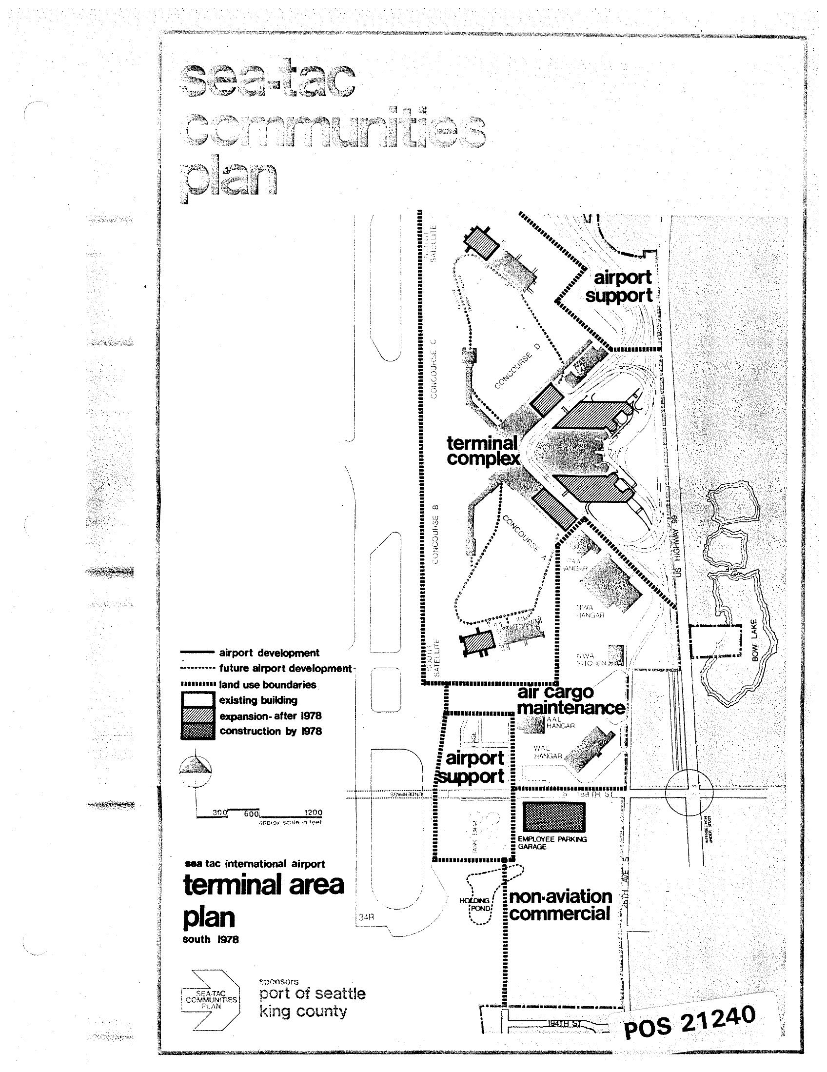
Sea-Tac International Airport Terminal Area Plan — Land-Use Map from the Sea-Tac Communities Plan (1978)
A land-use map from the Sea-Tac Communities Plan showing the Sea-Tac International Airport terminal area as of south 1978, sponsored by the Port of Seattle and King County. The map identifies zones including the terminal complex, airport support, air cargo maintenance, and non-aviation commercial areas, with a legend distinguishing existing buildings, expansions after 1978, and construction by 1978. Document reference number POS 21240. -
 1978-01-01
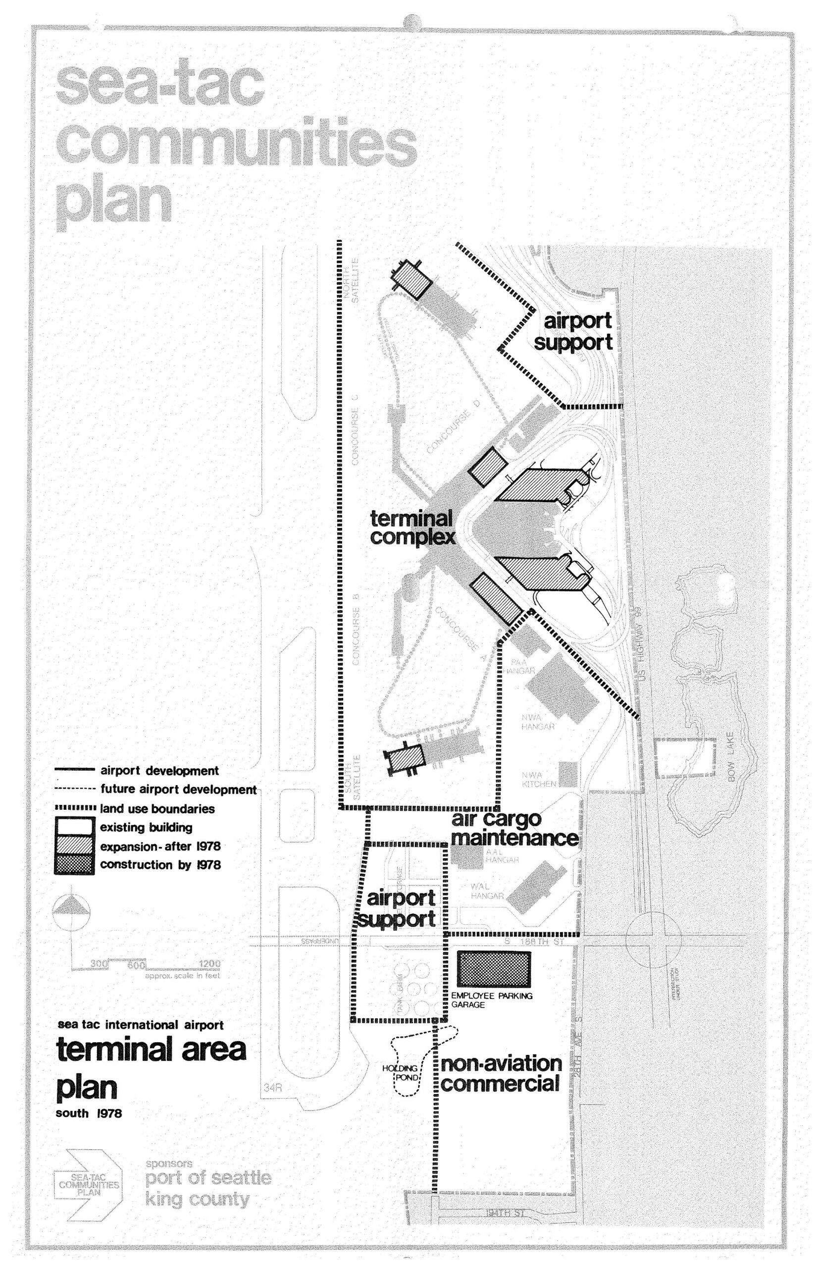
Sea-Tac International Airport Terminal Area Plan South — STCP, 1978
A planning map from the Sea-Tac Communities Plan, sponsored by the Port of Seattle and King County, depicting the Sea-Tac International Airport terminal area as of 1978. The map identifies land use zones including the terminal complex, airport support areas, air cargo maintenance, non-aviation commercial, and an employee parking garage, with a legend distinguishing existing buildings, post-1978 expansions, and construction completed by 1978. -
 1978-01-01
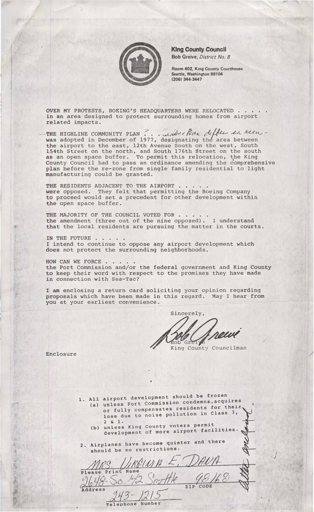
Letter from King County Councilman Bob Grieve on Boeing HQ Relocation and Sea-Tac Airport Development
King County Councilman Bob Greive wrote to constituents explaining his opposition to Boeing's headquarters relocation into an area designated as an open space buffer under the 1977 Highline Community Plan, which was meant to protect neighborhoods surrounding Sea-Tac Airport from noise and development impacts. Despite protests from nearby residents and three dissenting council votes, the majority approved an ordinance amending the comprehensive plan to allow rezoning from single-family residential to light manufacturing. Greive solicited public opinion on proposals to hold the Port Commission, federal government, and King County accountable for promises made regarding Sea-Tac's impact on surrounding communities. -
 1977-09-27
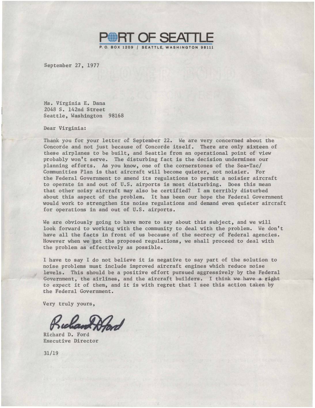
Letter from Port of Seattle Executive Director Richard D. Ford regarding Concorde aircraft noise concerns
In this September 1977 letter, Port of Seattle Executive Director Richard D. Ford responds to a community member's concerns about the Concorde supersonic jet, expressing alarm that the Federal Government amended its noise regulations to allow a noisier aircraft to operate at U.S. airports. Ford warns this decision undermines the Sea-Tac/Communities Plan, which was built on the expectation that aircraft would become progressively quieter over time. He calls on the federal government, airlines, and aircraft manufacturers to aggressively pursue quieter engine technology as a necessary solution to airport noise problems. -
 1977-05-26
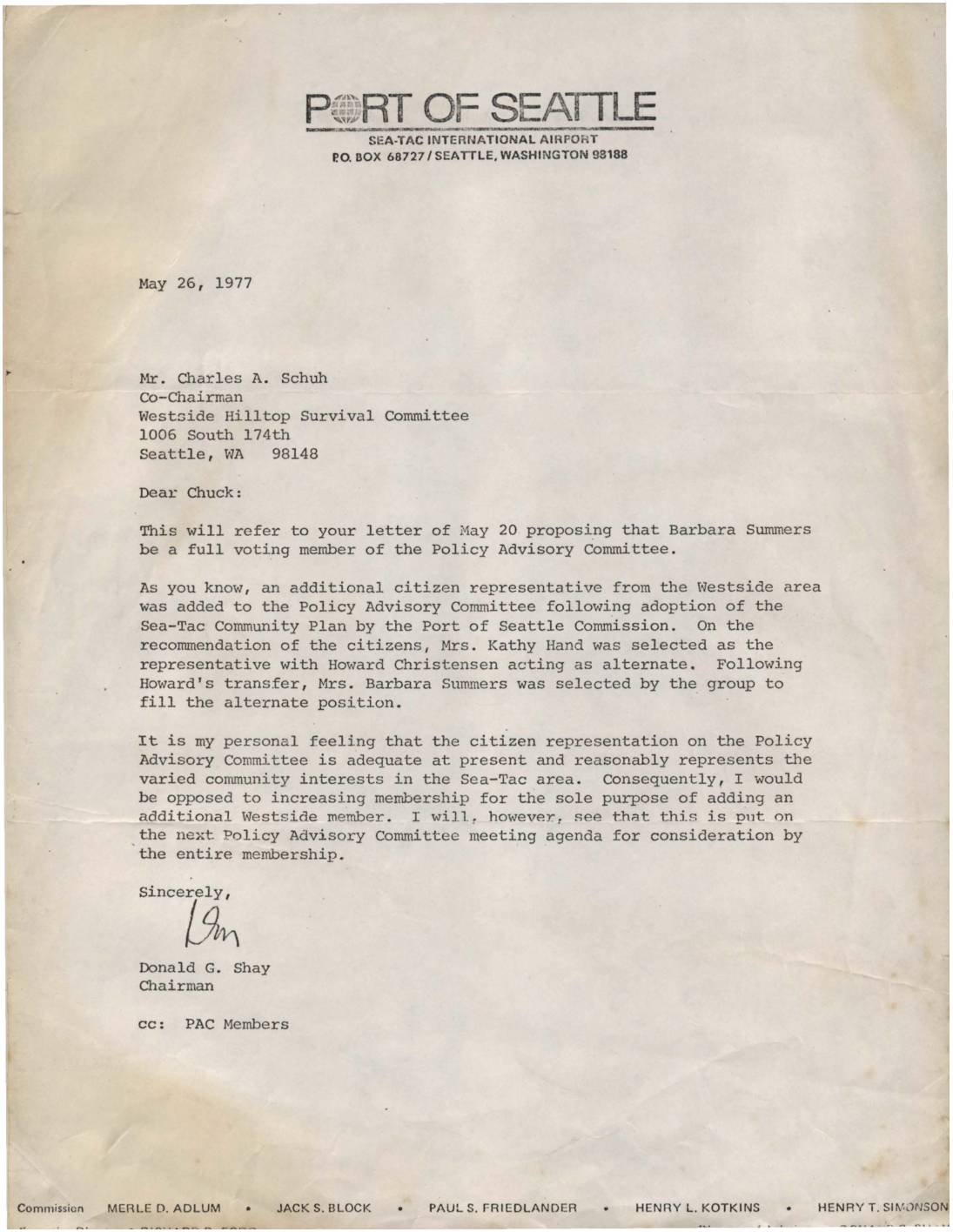
Letter to Charles Schuh regarding Barbara Summers and Policy Advisory Committee membership
In this May 26, 1977 letter, Port of Seattle Chairman Donald G. Shay responds to a request from the Westside Hilltop Survival Committee to make Barbara Summers a full voting member of the Policy Advisory Committee (PAC). Shay explains that Summers currently serves as an alternate representative for the Westside area and expresses his personal opposition to expanding PAC membership solely to add another Westside representative. He agrees, however, to place the matter on the next PAC meeting agenda for consideration by the full membership. -
 1977-01-01
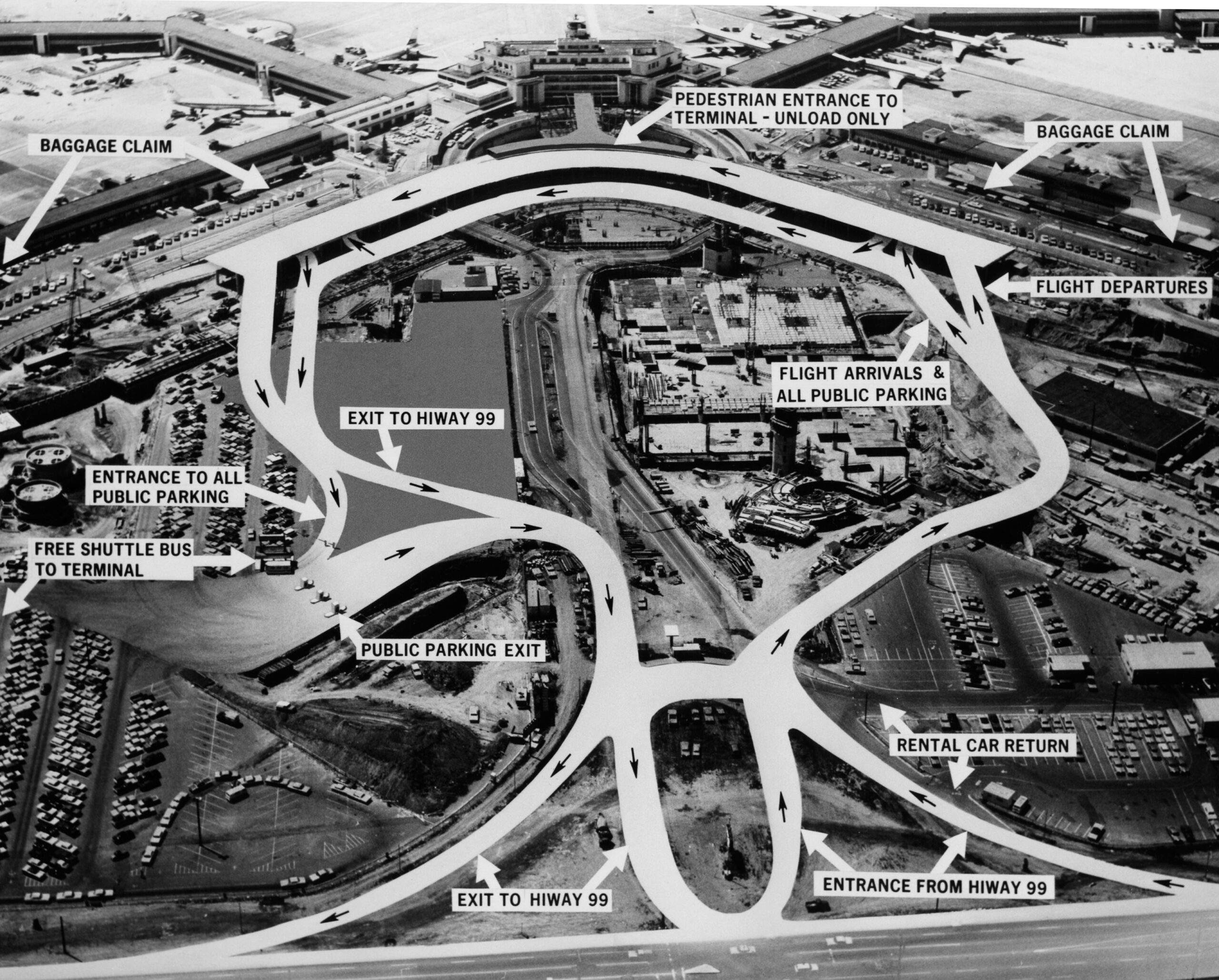
Sea-Tac access road patterns
An annotated aerial photograph of Seattle-Tacoma International Airport showing vehicular traffic flow patterns, with labeled destinations including Baggage Claim, Flight Arrivals, Flight Departures, Rental Car Return, Public Parking entrances and exits, and connections to Highway 99. A free shuttle bus service to the terminal from public parking lots is also indicated. -
 1976-06-16
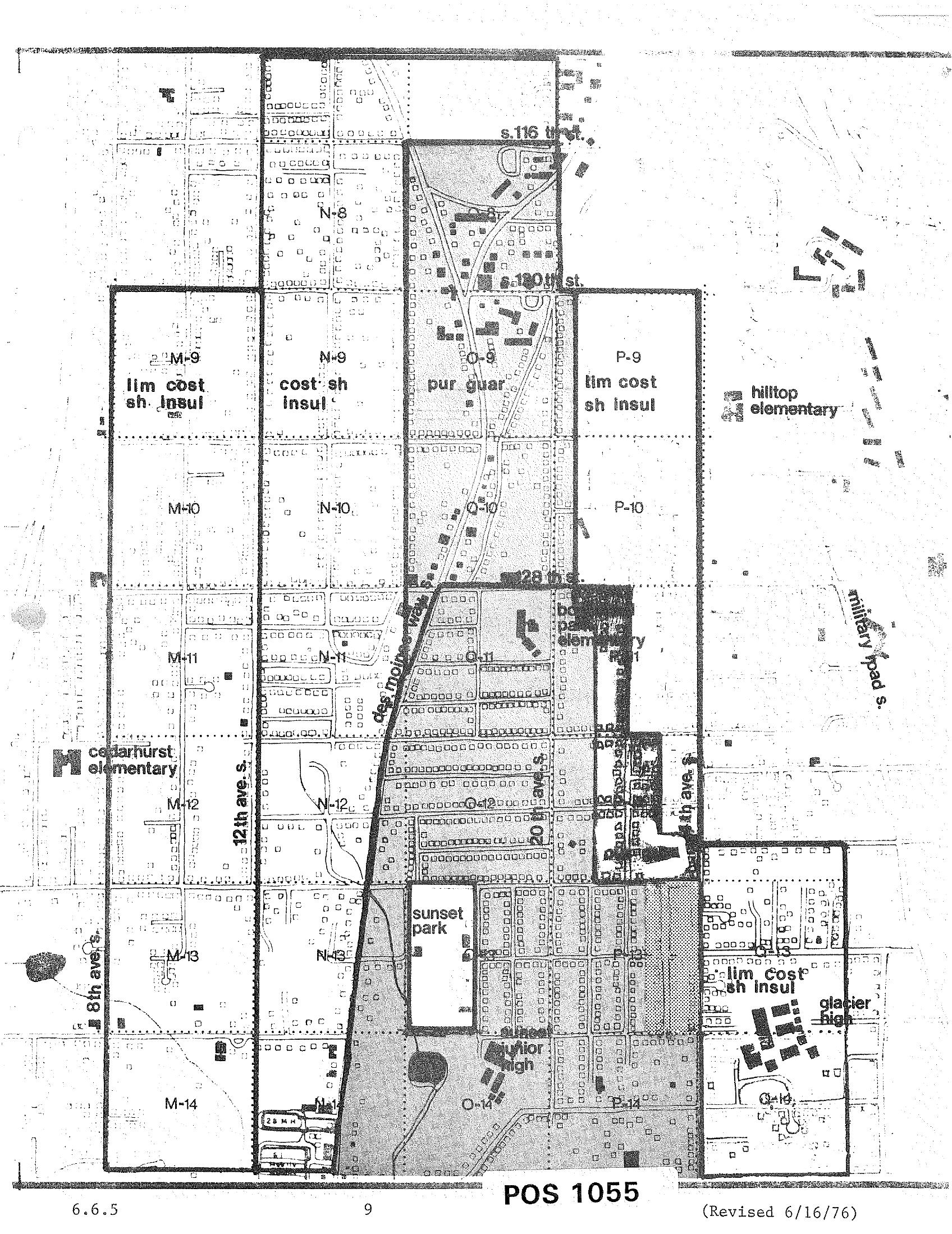
STCP Land Use and Noise Impact Zoning Grid Map, Revised June 16, 1976
A zoning/noise-impact grid map labeled 'POS 1055,' revised June 16, 1976, showing land-use designations (e.g., 'lim cost sh insul,' 'cost sh insul,' 'pur guar') in lettered and numbered grid cells around the Sea-Tac Airport corridor. Named landmarks visible include Cedarhurst Elementary, Hilltop Elementary, Bow Lake Elementary, Glacier High, Sunset Park, Sunset Junior High, 12th Ave S., 8th Ave S., Military Road S., and streets S. 116th, S. 120th, and S. 128th. -
 1976-06-16
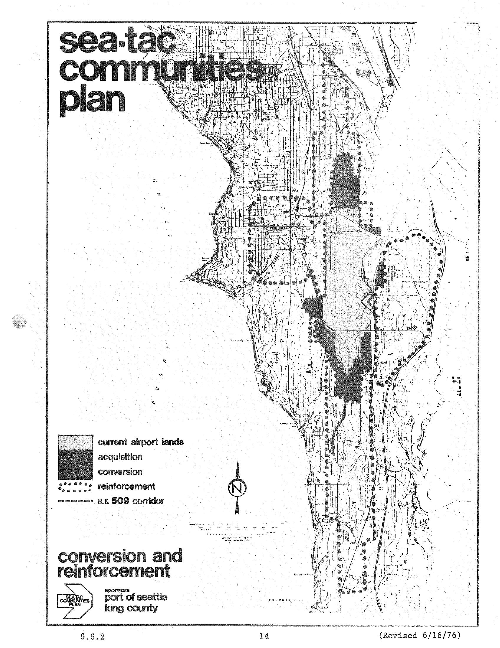
Sea-Tac Communities Plan Land Use Map — Conversion and Reinforcement Areas (1976)
A planning map from the Sea-Tac Communities Plan (page 14, revised June 16, 1976), sponsored by the Port of Seattle and King County, depicting current airport lands, acquisition zones, conversion areas, reinforcement areas (dotted pattern), and the S.R. 509 corridor in the Sea-Tac region along Puget Sound. The map illustrates land use strategies for communities affected by Seattle-Tacoma International Airport noise and expansion. -
 1976-06-16
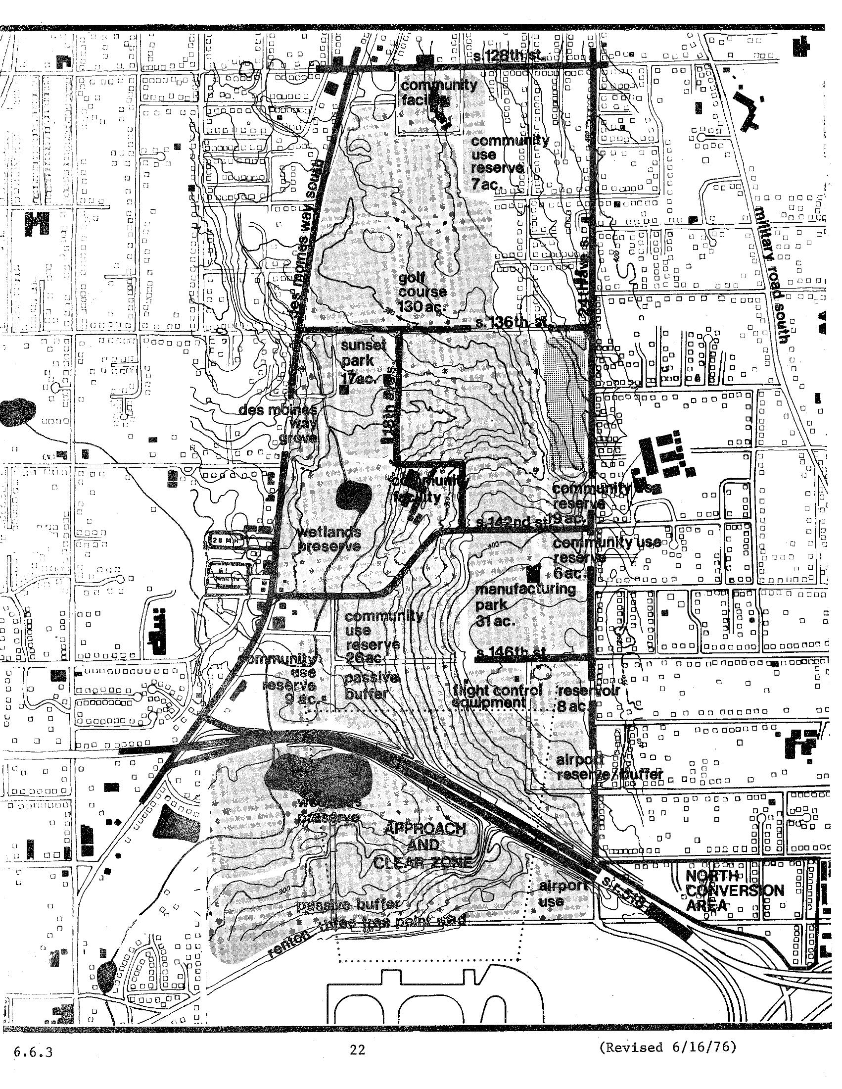
Sea-Tac Communities Plan Chapter 6, Page 22 — North Subarea Land Use Map (1976)
A detailed planning map (page 22, revised June 16, 1976) showing land use designations around Seattle-Tacoma International Airport, including a golf course (130 ac.), wetlands preserve, manufacturing park (31 ac.), community use reserves, sunset park (17 ac.), approach and clear zone, and airport reserve/buffer areas bounded by S. 128th St. to the north and the Renton–Three Tree Point Road to the south along Military Road South. -
 1976-06-16
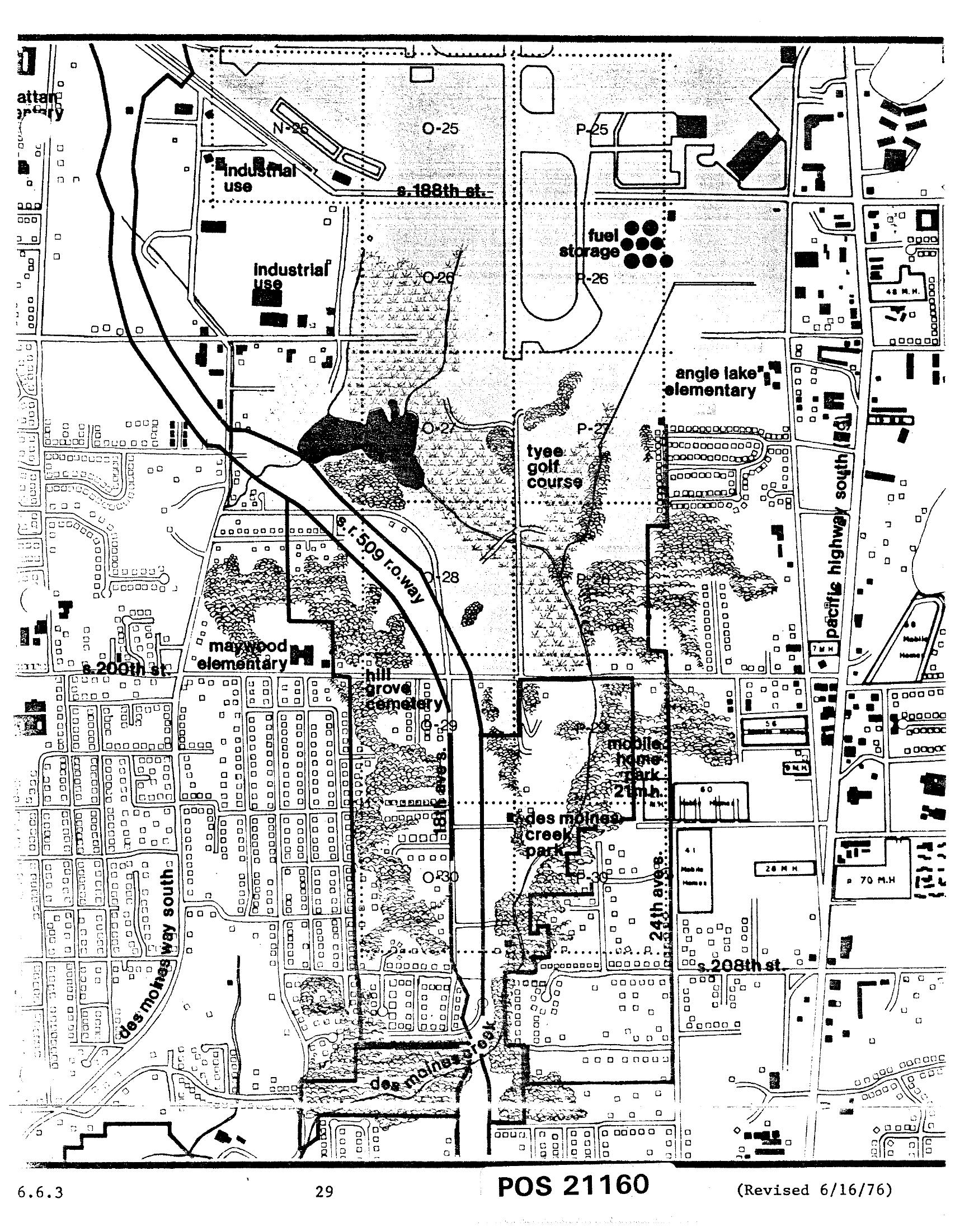
Sea-Tac Comprehensive Plan Land Use Zoning Map — Des Moines Area, Chapter 6, Page 29 (June 1976)
This is document POS 21160, revised June 16, 1976, a detailed land use map (page 29, section 6.6.3) showing the area surrounding Seattle-Tacoma International Airport. Visible features include industrial use zones, fuel storage areas, Tyee Golf Course, Angle Lake Elementary, Maywood Elementary, Hill Grove Cemetery, Des Moines Creek Park, a mobile home park, S. 188th St., S. 200th St., S. 208th St., Pacific Highway South, Des Moines Way South, and the S.R. 509 right-of-way corridor.