TagPort Of Seattle(2410)
-
 2003-08-18
Order granting defendants’ motions for summary judgment and denying plaintiff’s motion for summary judgment
A federal court ruled in favor of the U.S. Army Corps of Engineers and the Port of Seattle, rejecting a legal challenge by the Airport Communities Coalition — a group of cities near Sea-Tac Airport — over a Clean Water Act permit issued in December 2002 for the airport's Third Runway Project. The permit authorizes filling approximately 50 wetlands with over 23 million cubic yards of material to support construction of a new 8,500-foot runway. The court found the Corps' decision was not arbitrary or capricious under the Administrative Procedures Act's standard of review. -
 2003-06-24
Third Runway project budget update
A 2003 Port of Seattle memo updates the Commission on the ballooning costs of the Sea-Tac Third Runway project, which had grown from an approved budget of $773 million to an estimated $1.1–1.15 billion due to environmental permitting delays, litigation, and stricter regulatory requirements. The project, intended to reduce airport congestion by allowing simultaneous landings on two runways during poor weather, was projected for completion in 2008 if construction contracts were advertised promptly. Key cost drivers included $151 million in additional environmental permit requirements, $55 million in delay costs, and $55 million in project scope additions. -
 2003-06-24
Third runway update: Capital Improvement Program (CIP) briefing
This June 2003 Capital Improvement Program briefing provides an update on the Third Runway project at Seattle-Tacoma International Airport. It outlines the revised 1999 project cost of $773 million, a target completion date of Fall 2006, and the assumption that an Army Corps of Engineers 404 Permit would be obtained by December 1999. A project schedule chart shows the planned phases—permitting, runway embankment, and runway pavement—spanning from 1999 through 2006, along with progress made to date. -
 2003-05-20
Aviation Mitigation Zones – HB 2276 Striking Amendment (H-3175.2/03)
A 2003 Washington State legislative memorandum outlines a proposed striking amendment to HB 2276, which would establish Aviation Mitigation Zones (AMZs) around large regional airports like Seattle-Tacoma International Airport to address noise impacts on nearby communities. The amendment would require the Port of Seattle to levy $10 million annually from 2004 to 2007 into a dedicated mitigation fund, with spending restricted to affected areas within the AMZ. An advisory board and competitive grant process would be created to help distribute funds to eligible local governments, schools, and nonprofits in impacted neighborhoods such as Burien, Des Moines, Tukwila, and Normandy Park. -
 2003-05-16
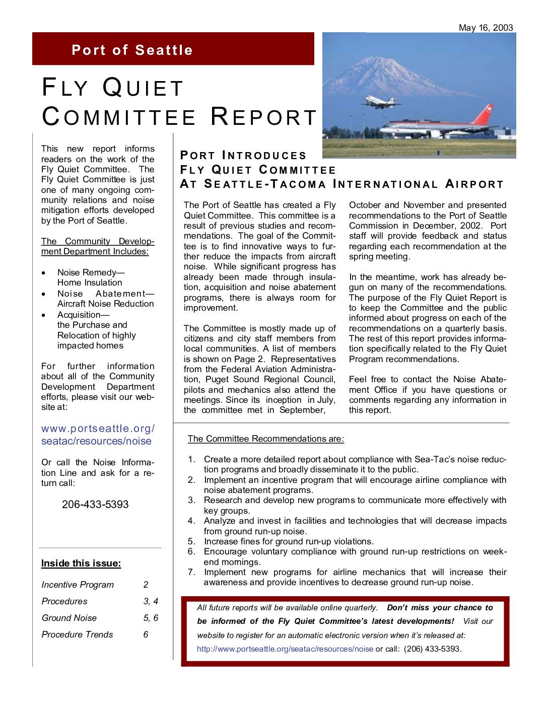
Fly Quiet Committee Report: Port Introduces Fly Quiet Committee at Seattle-Tacoma International Airport, Third Quarter 2002
The Port of Seattle introduced the Fly Quiet Committee at Seattle-Tacoma International Airport to find innovative ways to reduce aircraft noise impacts on surrounding communities. The committee, made up of local citizens, city staff, and aviation representatives, developed seven key recommendations including creating detailed compliance reports, launching an airline incentive program modeled after Chicago O'Hare's point-based system, and addressing ground run-up noise through increased fines and new technologies. The report also outlines existing noise abatement flight procedures governing how aircraft depart and arrive at Sea-Tac to minimize noise over residential areas. -
 2003-03-31
Response to comments: NPDES proposed waste discharge permit no. WA-002465-1, Port Of Seattle, Seattle-Tacoma International Airport
This document is a public responsiveness summary from Washington State's Department of Ecology regarding an NPDES wastewater discharge permit issued to the Port of Seattle for Seattle-Tacoma International Airport. It compiles and responds to comments received during a March 2003 public meeting and hearing, covering concerns about the airport's treated industrial wastewater, stormwater runoff, and construction runoff discharges. The summary addresses feedback from a range of stakeholders, including the Port of Seattle, local legislators, advocacy groups, and individual residents. -
 2003-02-17
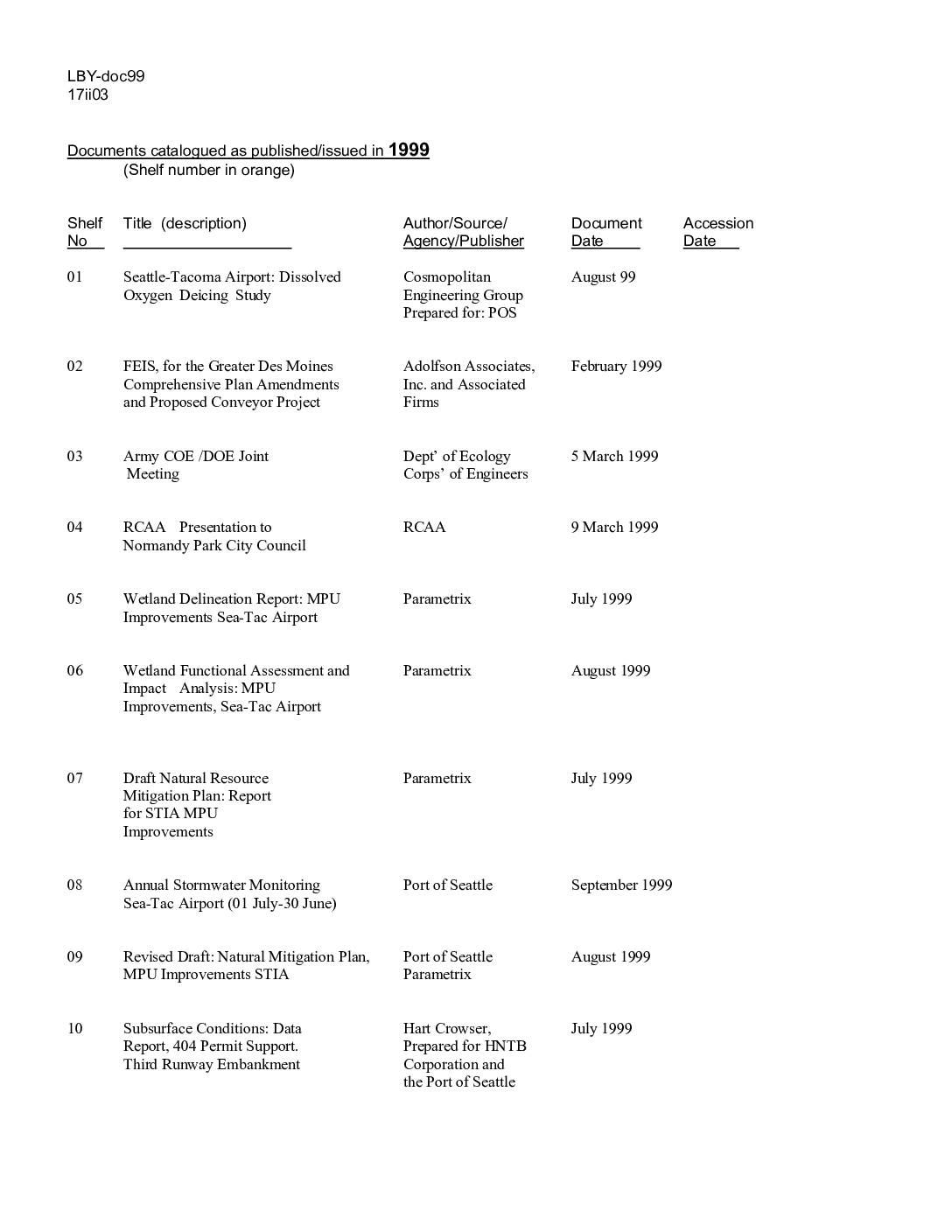
Documents catalogued as published/issued in 1999
This document is a catalog of 31 reports and studies published in 1999 related to Sea-Tac Airport expansion and environmental review, including wetland assessments, stormwater monitoring, subsurface conditions reports, and community health studies. Sources range from the Port of Seattle and U.S. Army Corps of Engineers to environmental consultants such as Parametrix and Hart Crowser. The materials primarily concern the proposed third runway project and its impacts on local ecosystems, waterways, and surrounding communities. -
 2003-02-01
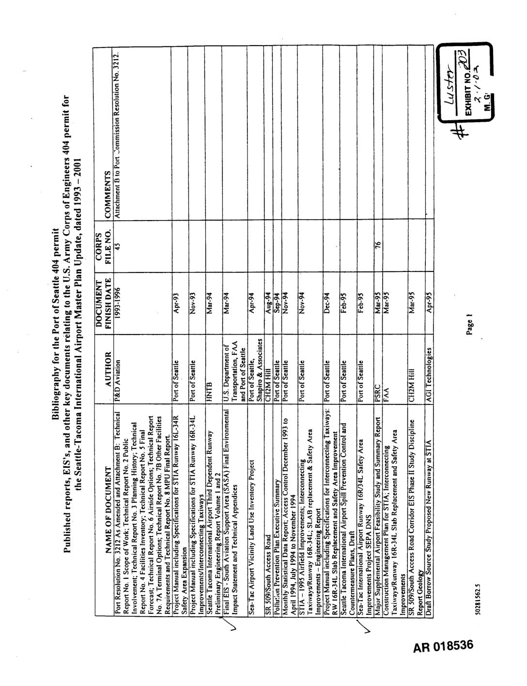
Exhibit 203: Bibliography for the Port Of Seattle 404 Permit — Seattle-Tacoma International Airport Master Plan Update, 1993–2001
This document is a bibliography listing published reports, environmental impact statements (EIS), and other key planning documents related to the Port of Seattle's U.S. Army Corps of Engineers 404 permit for Seattle-Tacoma International Airport (Sea-Tac), covering the period 1993–2001. It catalogs a wide range of studies including runway construction specifications, wetland mitigation plans, stormwater pollution prevention, safety area improvements, and master plan updates. Each entry identifies the document's author, finish date, and a Corps file number where applicable. -
 2003-01-01
SR 509: Corridor Completion/I-5/South Access Road final environmental impact statement and Section 4(f) evaluation
This January 2003 Final Environmental Impact Statement evaluates proposed highway improvements in southwest King County, Washington, including an extension of SR 509 and upgrades to I-5 between South 210th Street and South 310th Street to improve regional access to Seattle-Tacoma International Airport. Three build alternatives and a No Action Alternative are assessed, with the SR 509 extension designed to accommodate two general purpose lanes and a center high-occupancy vehicle lane in each direction. The project was jointly prepared by the Federal Highway Administration, Washington State Department of Transportation, Port of Seattle, King County, and the Cities of SeaTac and Des Moines. -
 2002-12-13
Permit issuance for the proposed third runway
On December 13, 2002, the U.S. Army Corps of Engineers issued a federal permit allowing the Port of Seattle to build a third runway at Sea-Tac Airport as part of its Master Plan Update. The project includes an 8,500-foot runway, two Runway Safety Areas, and related construction that will permanently impact nearly 20 acres of wetlands and up to 980 linear feet of Miller Creek. After weighing input from government agencies and the public, the Corps determined the project was not contrary to the public interest and approved the permit.