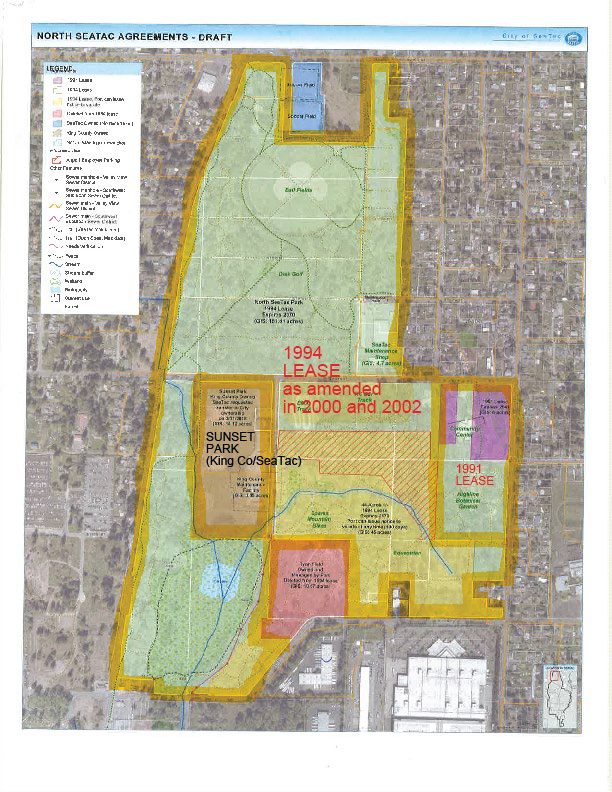
A draft aerial map produced by the City of SeaTac depicting land use agreements in the North SeaTac area, including the 1991 Lease, the 1994 Lease as amended in 2000 and 2002, and Sunset Park (King County/SeaTac). The map uses color-coded overlays and a legend to delineate lease boundaries, City-owned parcels, and facilities such as a Community Center and SeaTac Maintenance area.Open full document
Notes
A draft aerial map produced by the City of SeaTac depicting land use agreements in the North SeaTac area, including the 1991 Lease, the 1994 Lease as amended in 2000 and 2002, and Sunset Park (King County/SeaTac). The map uses color-coded overlays and a legend to delineate lease boundaries, City-owned parcels, and facilities such as a Community Center and SeaTac Maintenance area.