TagLand Use(212)
-
 2022-11-29
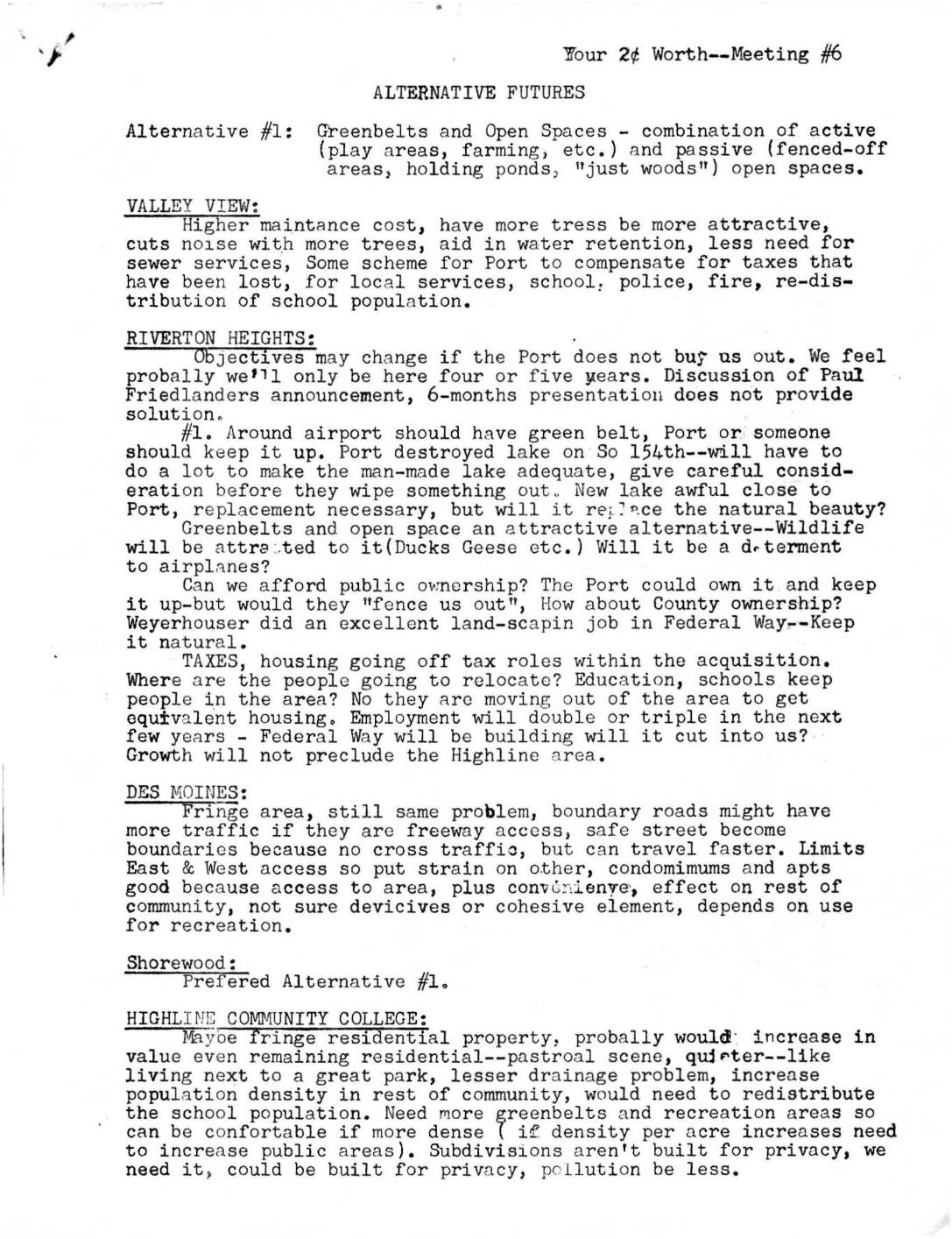
Your 2¢ Worth, Meeting #6: Alternative Futures
This document records community feedback from Meeting #6 of a public engagement series on alternative futures for neighborhoods near Sea-Tac Airport, where residents from Valley View, Riverton Heights, Des Moines, and other areas discussed three options: creating greenbelts and open spaces, pursuing a planned city renewal approach, or allowing an unrestricted free market. Participants raised concerns about airport noise, property taxes, displacement of residents, loss of natural resources, and the Port of Seattle's land acquisition practices. Communities generally favored enforceable planning with citizen input, and many preferred the greenbelt option, while expressing skepticism about government-led redevelopment and unregulated market approaches. -
 2022-11-29
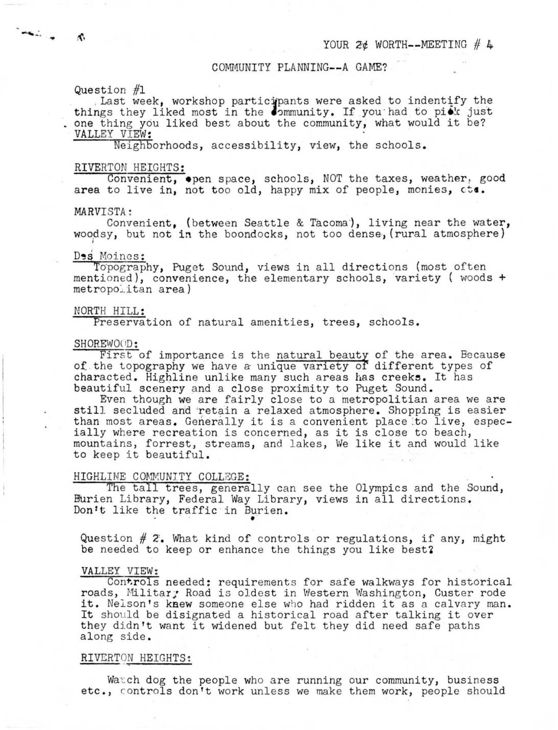
Your 2¢ Worth Meeting #4: Community Planning — A Game?
Minutes from a community planning workshop (Meeting #4) in which residents from neighborhoods near Sea-Tac Airport — including Valley View, Riverton Heights, Marvista, Des Moines, North Hill, Shorewood, and Highline College — identified what they valued most about their communities, such as natural scenery, views, schools, and open space. Participants also discussed what regulations might be needed to protect those qualities, including building height controls, green belt preservation, clean-air policies, and safe pedestrian pathways. A comprehensive land use plan was proposed that would balance residential, industrial, recreational, and conservation needs while ensuring local residents have a meaningful voice in decisions affecting their neighborhoods. -
2022-10-17
Section 163, Docket No. FAA-2022-1203: There’s a bigger game…
The comment period for this draft policy rule change ended today. https://www.federalregister.gov/documents/2022/09/15/2022-19665/draft-faa-policy-regarding-processing-land-use-changes-on-federally-acquired-or-federally-conveyed https://www.regulations.gov/document/FAA-2022-1203-0001 There are FAA policy changes like this all the time which are generally only noticed by people in ‘the biz’; especially if they don’t have any obvious connection with flight paths or noise or pollution. When we first started watching this sort -
 2022-10-17
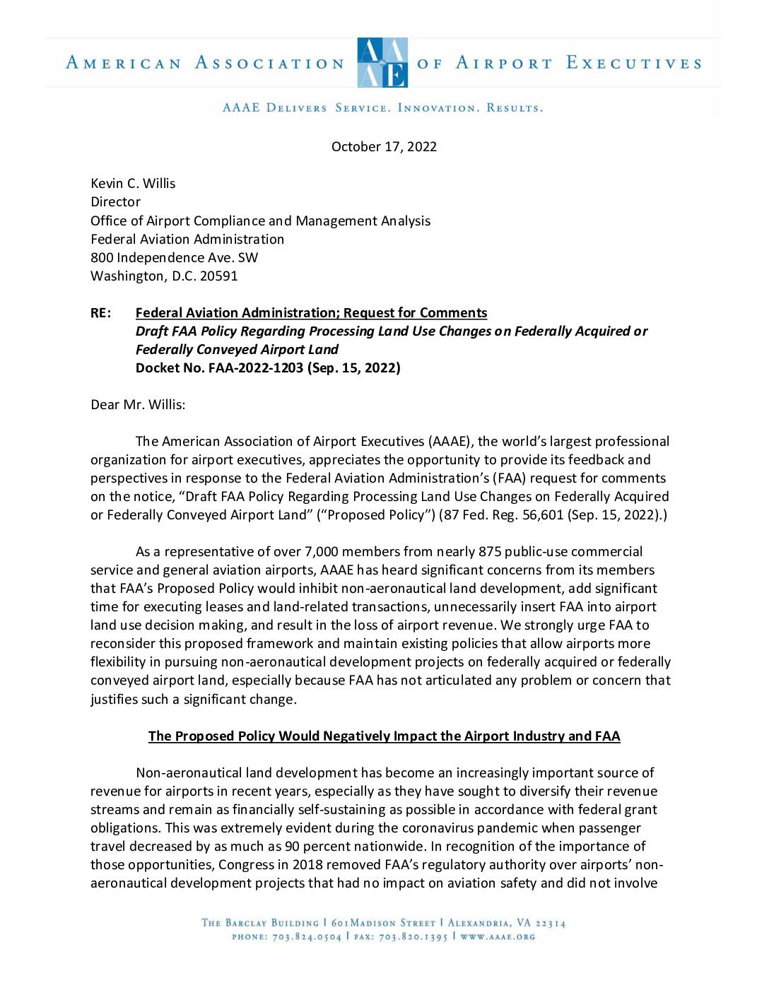
AAAE comments on draft FAA policy regarding processing land use changes on federally acquired or federally conveyed airport land
The American Association of Airport Executives (AAAE) submitted formal comments in October 2022 opposing a proposed FAA policy that would require federal review of individual leases, subleases, and non-aeronautical development projects on federally acquired or conveyed airport land. AAAE argues the policy would reduce airport revenue, slow development, and exceed FAA's appropriate role, which should be limited to aviation safety oversight rather than involvement in specific real estate transactions. The organization urges FAA to maintain existing policies and work collaboratively with the airport industry on any needed improvements. -
 2022-10-17
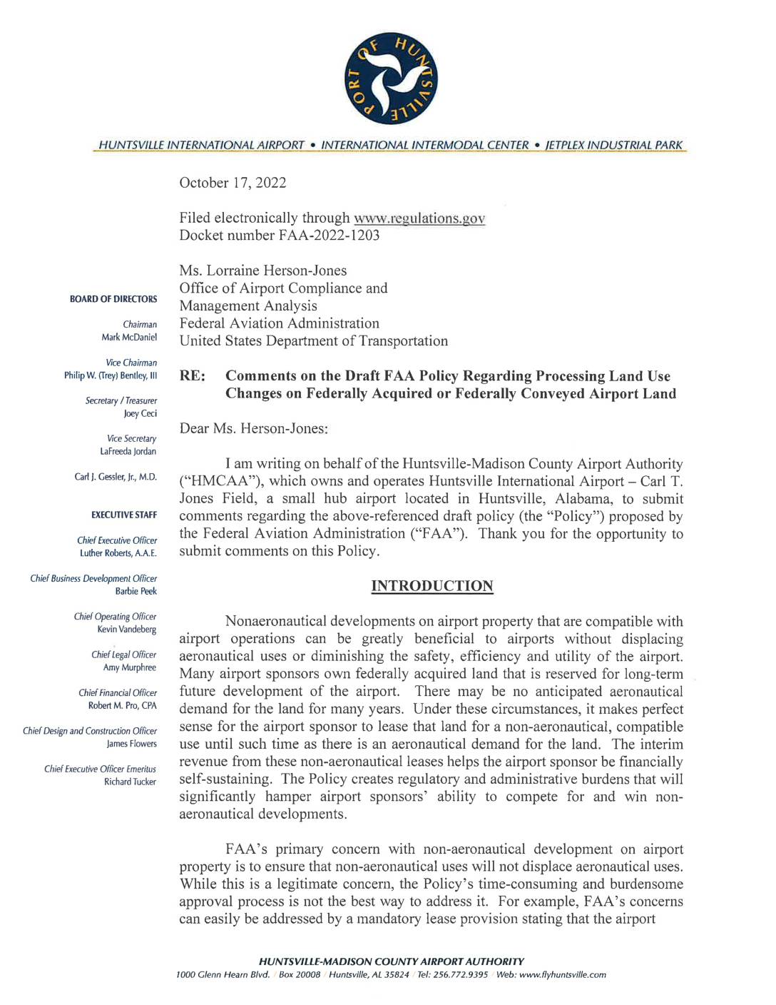
Comments on the draft FAA policy regarding processing land use changes on federally acquired or federally conveyed airport land
The Huntsville-Madison County Airport Authority submitted comments to the FAA in October 2022, objecting to a proposed federal policy governing land use changes on federally acquired or conveyed airport property. The authority argues the policy creates unnecessary regulatory burdens that hamper airports' ability to pursue compatible non-aeronautical developments, and calls for clearer, simpler rules — such as broader definitions of 'airport purpose' and airport-led category determinations rather than FAA approval for every land use change. -
 2022-10-17
Comments on Docket Number FAA 2022-1203: Draft Policy regarding processing land use changes on federally acquired or federally conveyed airport land
Charlotte Douglas International Airport (CLT) submitted comments to the FAA in October 2022 opposing a proposed new policy on land use changes at federally acquired airport land, arguing that existing regulations already adequately govern non-aeronautical land use. CLT requested that if the policy moves forward, the FAA clarify approval timelines, lease evaluation procedures, and criteria for mixed-use land decisions. The letter emphasizes that non-aeronautical development is essential for airports to remain financially self-sustaining and to ensure compatible land use around airport property. -
 2022-10-17
ACI-NA comments on draft FAA policy regarding processing land use changes on federally acquired or federally conveyed airport land
Airports Council International-North America (ACI-NA) submitted comments to the FAA in October 2022 opposing a draft policy that would impose new federal review and approval processes on how airports can use land that was federally acquired or conveyed. ACI-NA argued the policy is confusing, could lead to inconsistent decisions across FAA regional offices, and may delay airport development projects and increase costs. The organization urged the FAA to grandfather existing land use designations, clarify key undefined terms, and work collaboratively with airports to revise the policy. -
 2022-10-17
NASAO comments on draft FAA policy regarding processing land use changes on federally acquired or federally conveyed airport land
The National Association of State Aviation Officials (NASAO) submitted comments to the FAA in October 2022 regarding a draft policy on land use changes at federally acquired or conveyed airport land. NASAO raised concerns about lengthy lease review processes, the lack of defined timelines for approvals, and unclear procedures for lease renewals and extensions. The letter also questioned how the policy would affect existing leases and called for greater consistency across FAA regions. -
Section 163
Section 163 of the FAA Reauthorization Act of 2018 regulates the uses of properties acquired by airport sponsors using FAA funds. These include property buyouts for noise mitigation and other non-aeronautical uses. SEC. 163. LIMITED REGULATION OF NON-FEDERALLY SPONSORED PROPERTY. (a) <> In General.--Except as provided in subsection (b), the Secretary of Transportation may not -
 2022-09-16
Airport Law Alert: FAA Issues Potentially Sweeping Changes to Airport Land Use Regulation
The FAA proposed sweeping new rules in September 2022 governing how airports can use federally acquired or conveyed land for non-aeronautical purposes, such as hotels, warehouses, and car rental facilities. Under the draft policy, airports would need FAA approval for any non-aeronautical or mixed-use activities on such land, with approvals tied strictly to lease terms and requiring renewal each time a lease expires. The changes could significantly increase the regulatory burden on airport sponsors by eliminating the previous practice of permanently designating certain property as non-aeronautical and potentially triggering environmental review requirements under NEPA.