TagLand Use(212)
-
 2022-08-24
Noise sources and land uses: Are they compatible?
This paper by Edward P. Gorski examines how local governments can achieve noise-compatible land use planning through two main approaches: administrative techniques that officials and planners can use to require or encourage noise compatibility, and physical methods available to architects, designers, and builders to reduce noise impacts. By considering noise at the source, along its path, and at the point of reception, planners can integrate noise control into broader environmental and community planning goals. The paper argues that this integrated approach can improve quality of life in communities affected by noise sources such as airports. -
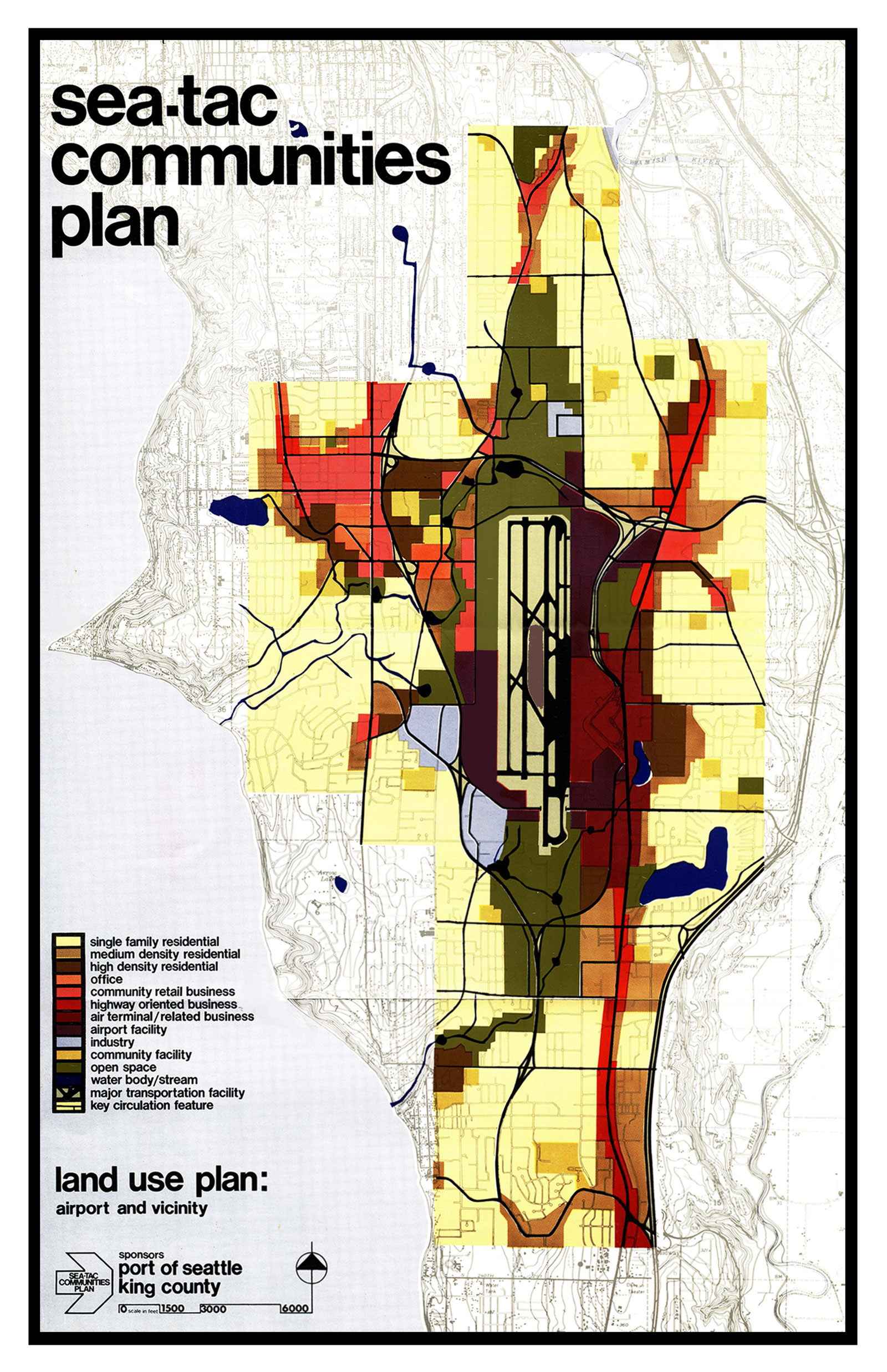
Sea Tac Communities Plan 1600
A land use planning map produced under the Sea-Tac Communities Plan, sponsored by the Port of Seattle and King County, showing zoning categories (residential, commercial, office, airport facility, open space, etc.) for the area surrounding Seattle-Tacoma International Airport. The legend identifies uses including air terminal/related business, highway-oriented business, community retail, industry, and key circulation features, with a scale bar indicating coverage at 1:500 to 6,000 feet. -
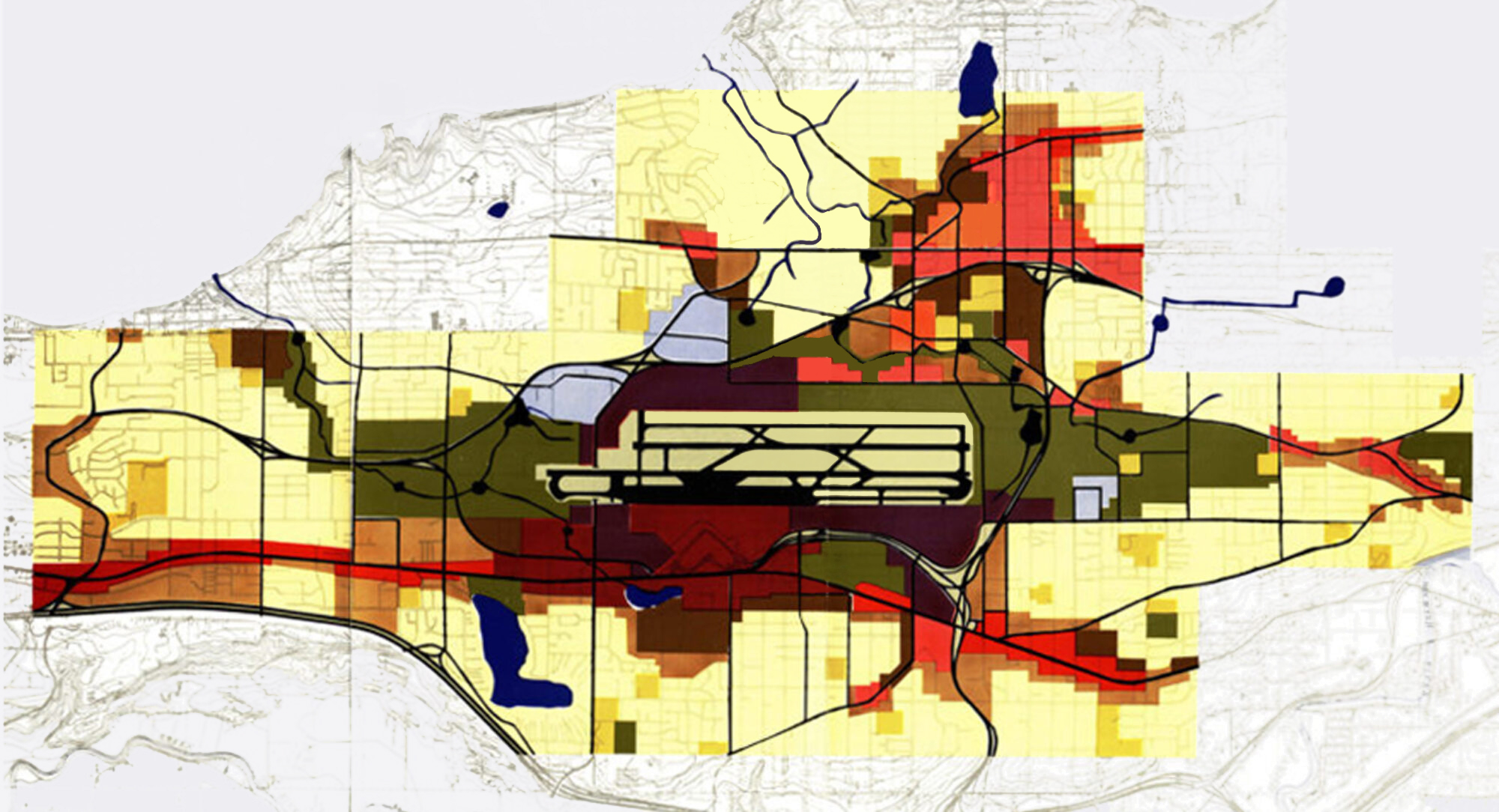
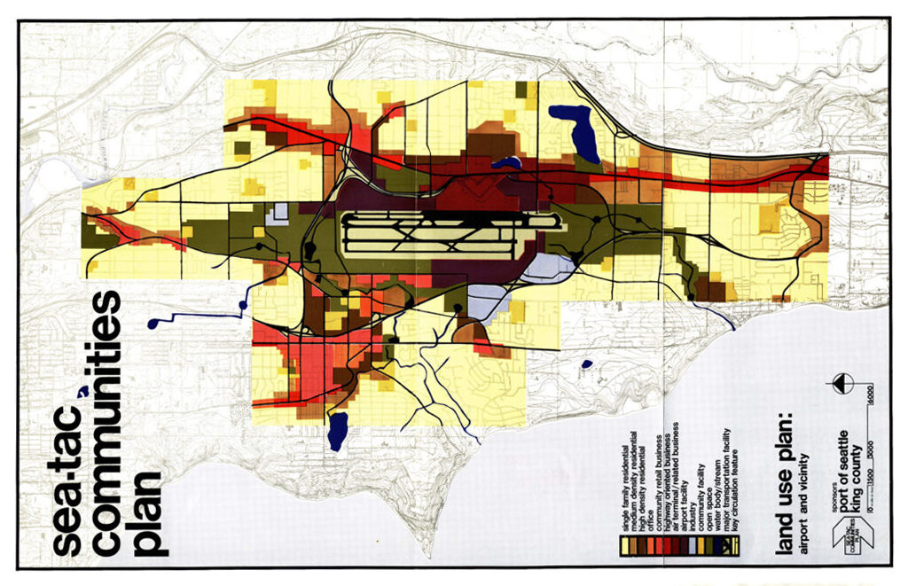
Sea-Tac Community Plan Land Use Sideways
A color-coded GIS-style map overlay showing noise contour zones or land-use impact areas surrounding what appears to be a major airport runway complex at center. Colors ranging from light yellow to deep red and dark olive likely represent varying levels of noise exposure or compatible/incompatible land uses, with road networks shown in black and red lines. -
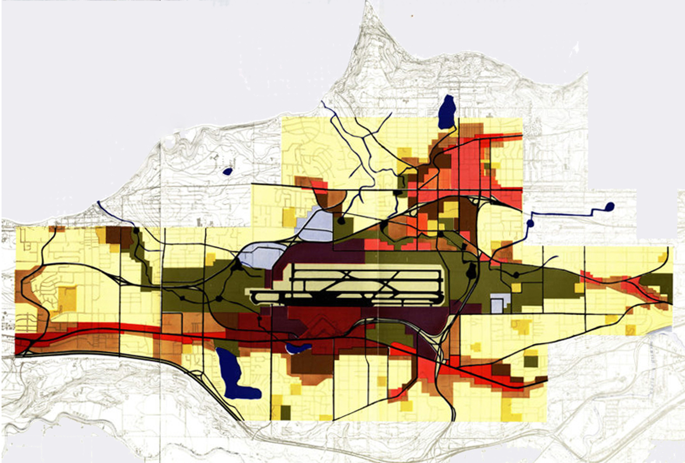
SCP_sideways
A color-coded planning map showing noise contour zones or land-use impact areas radiating from a central airport runway facility, depicted in shades of yellow, red, brown, and dark olive-green. Blue lines appear to represent waterways or transportation corridors, and bold black lines indicate road or grid infrastructure overlaid on a topographic base map. -
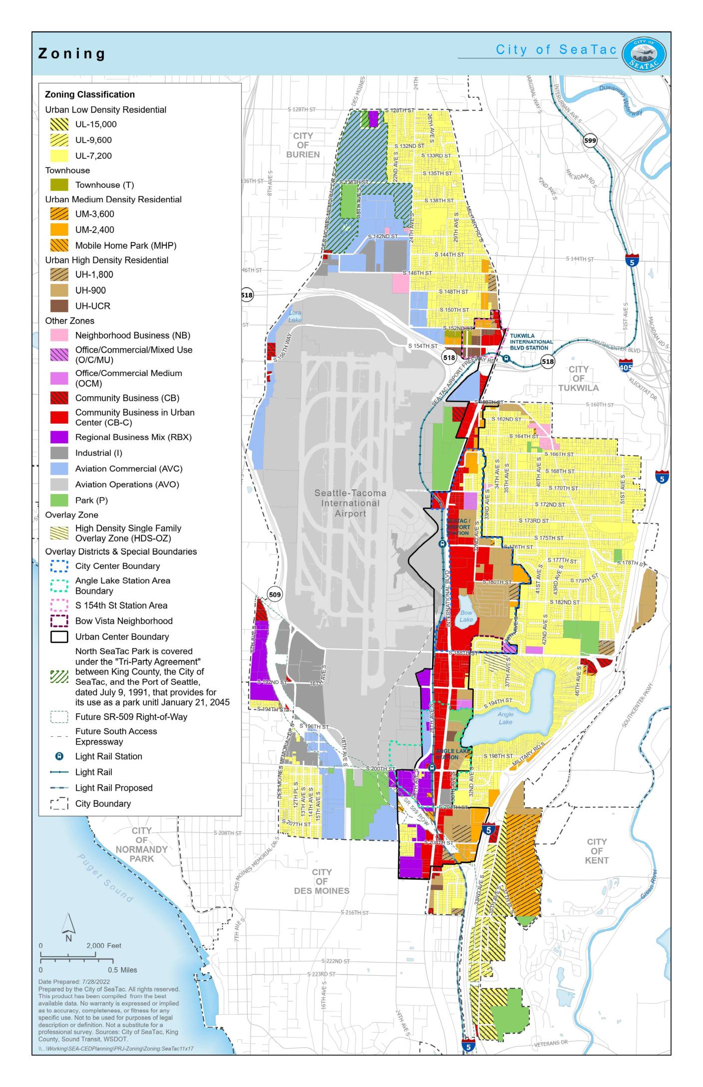 2022-07-28
Zoning: City of SeaTac
This zoning map from the City of SeaTac (prepared July 28, 2022) shows land-use classifications throughout the city, which borders Seattle-Tacoma International Airport. The map identifies a range of residential, commercial, industrial, and aviation-related zones — including Aviation Commercial (AVC) and Aviation Operations (AVO) designations — that reflect the airport's significant influence on surrounding land use and development policy. Special overlay districts, light rail corridors, and station area boundaries are also depicted, highlighting the city's efforts to manage growth and compatibility with airport noise and operations. -
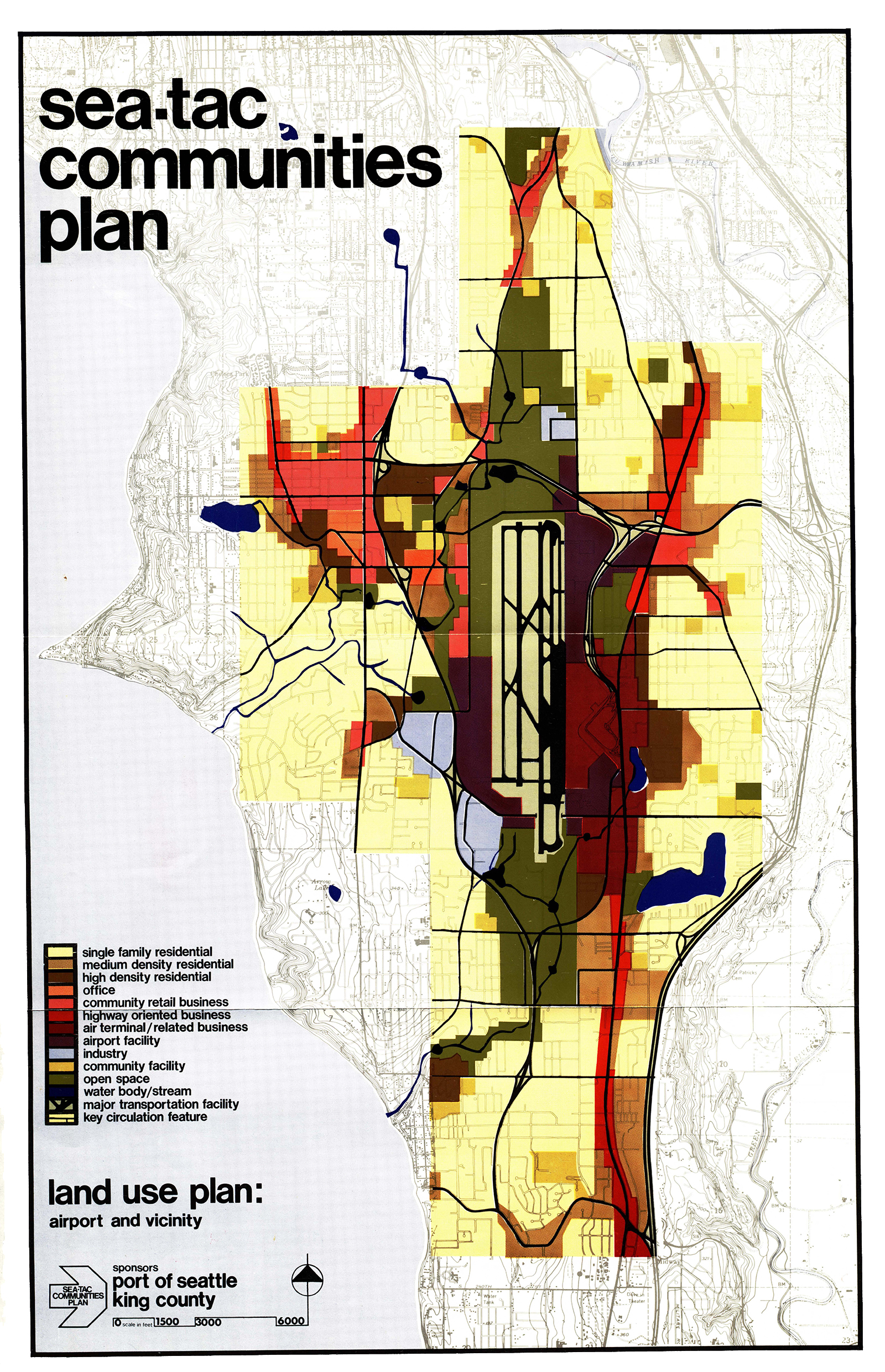
Sea Tac Communities Plan 6.7 Land Use Plan 1600 661×1024
A color-coded land use planning map produced by the Port of Seattle and King County as part of the Sea-Tac Communities Plan, showing zoning categories (residential, commercial, office, airport facility, open space, and circulation features) in the airport vicinity. The legend identifies uses including single-family residential, high-density residential, highway-oriented retail, air terminal/related business, community facility, open body/stream, major transportation facility, and key circulation features. -
Sea-Tac Communities Plan 6.7 Land Use Plan-1600
A color-coded land use planning map produced under the Sea-Tac Communities Plan, sponsored by the Port of Seattle and King County, showing proposed zoning categories (residential, commercial, industrial, airport facility, open space, etc.) for the area surrounding Seattle-Tacoma International Airport. The map includes a full legend and scale bar, with key circulation features and water bodies marked. -
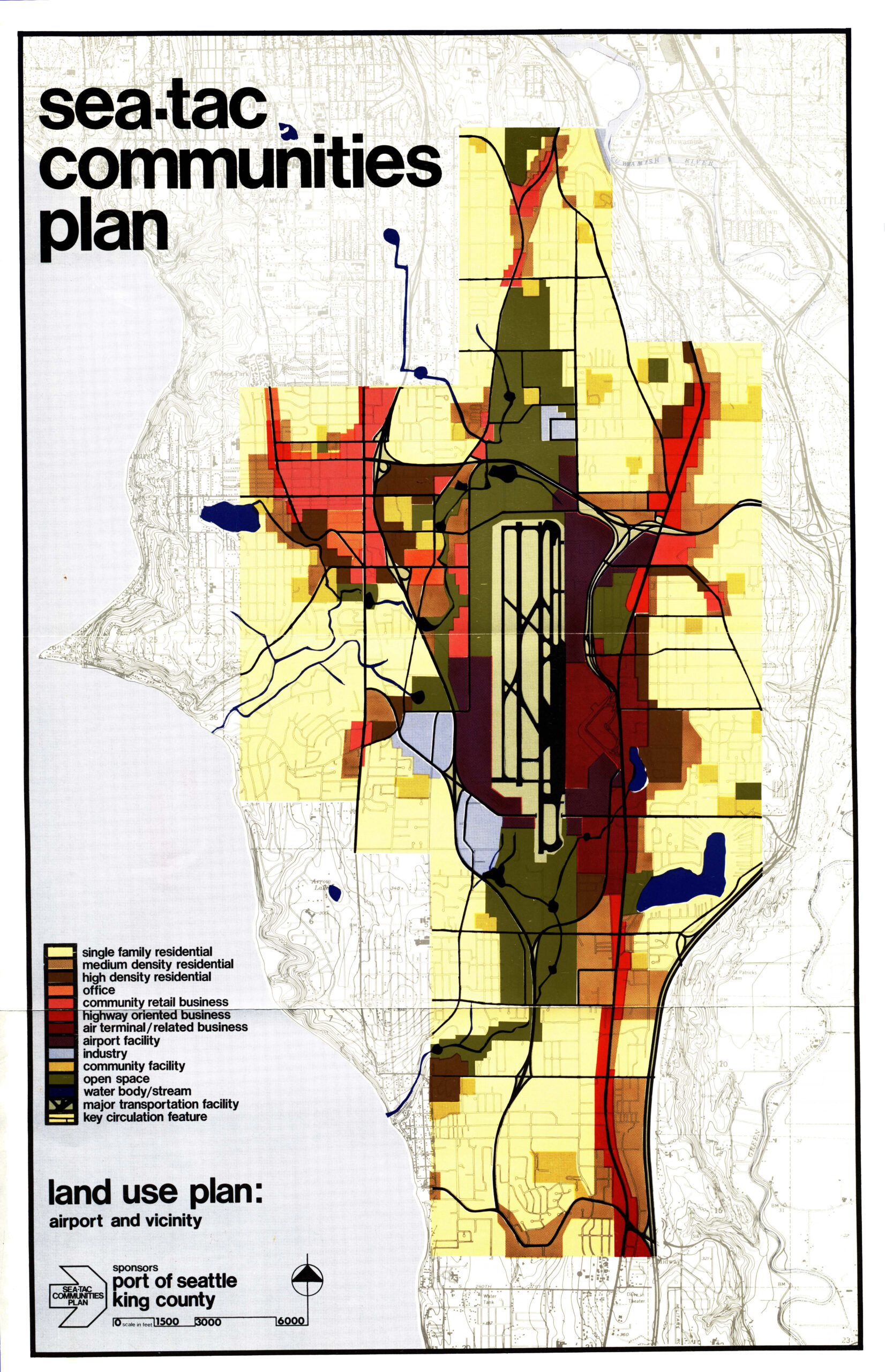
Sea-Tac Communities Plan 6.7 Land Use Plan
A color-coded land use planning map produced under the Sea-Tac Communities Plan, sponsored by the Port of Seattle and King County, depicting zoning categories (single-family residential, commercial, industrial, airport facility, open space, etc.) and circulation features in the area surrounding Seattle-Tacoma International Airport. The map's legend, title text, sponsor logos, and scale bar are all clearly legible. -
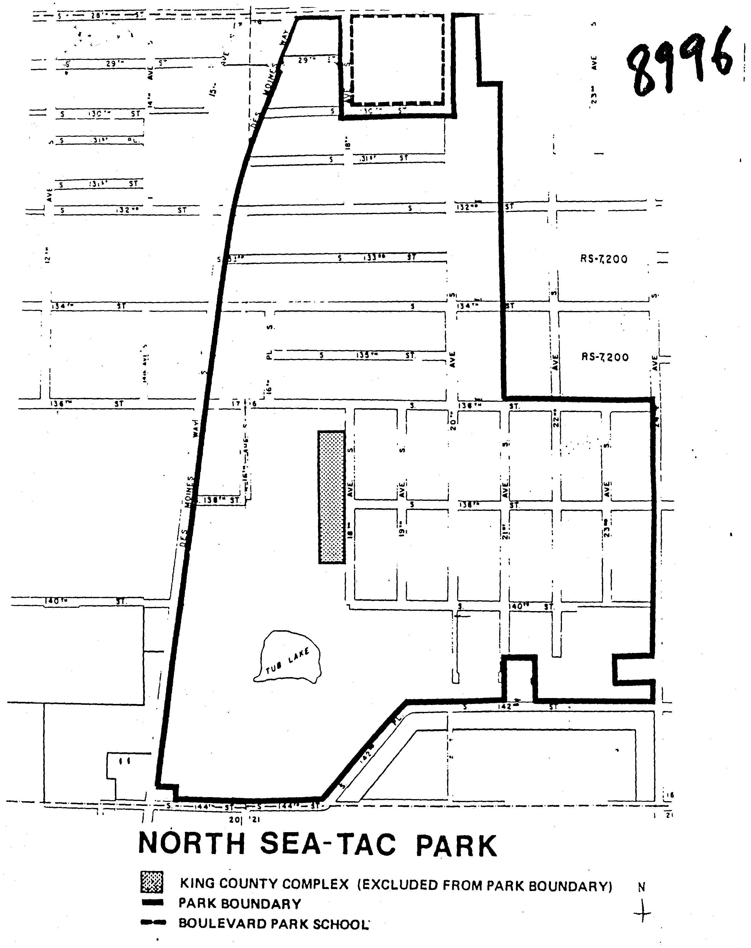
North Sea-Tac Park Original Map King County #8996
A zoning and boundary map of North Sea-Tac Park showing the park boundary (bold solid line), Boulevard Park School boundary (bold dashed line), and the excluded King County Complex (hatched area). The map identifies RS-7,200 zoning designations, street grid from approximately S 128th to S 144th Streets, Tub Lake, Des Moines Way, and is numbered 8996 in the upper right corner. -
 2022-07-10
Part 2: Use of the Report
This document outlines the official significance and structure of a comprehensive land use and community planning report for Sea-Tac International Airport and its surrounding communities, jointly produced by the Port of Seattle and King County. It serves as the primary guide for official decisions on land use, capital expenditures, and public and private development review. The report is organized into eight parts covering plans, policies, programs, background information, and implementation strategies.