TagHighline Community Plan(26)
-
 1980-02-20
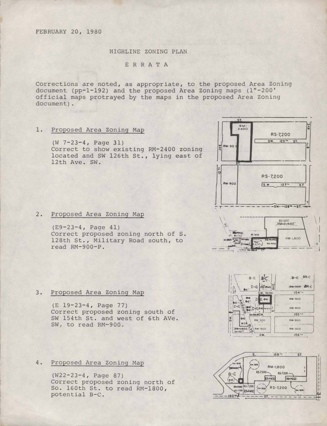
Highline Zoning Plan Errata
This February 20, 1980 errata document lists official corrections to the Highline Zoning Plan, a proposed area zoning document and accompanying maps covering communities in the Highline area near Seattle. The corrections update specific zoning designations on several map sections, such as changing certain parcels to residential multi-family (RM) or business-commercial (B-C) classifications, and fix a text sequencing error in the zoning document. These adjustments reflect policy decisions aimed at guiding land use—including residential density and commercial development—in neighborhoods in the vicinity of what is now Sea-Tac Airport. -
 1980-01-01
Highline Community Plan: Proposed Area Zoning
★This January 1980 King County Division of Planning report proposes new zoning maps for the Highline community, located south of Seattle between I-5 and Puget Sound, to implement the Highline Communities Plan adopted in December 1977. The plan translates land use policies into specific zoning classifications covering topics such as mixed-use development, mobile home development, an Airport Open Use Zone, and landscaping guidelines. It applies only to unincorporated King County areas and was subject to public community meetings and hearings before adoption by the County Council. -
 1979-08-02
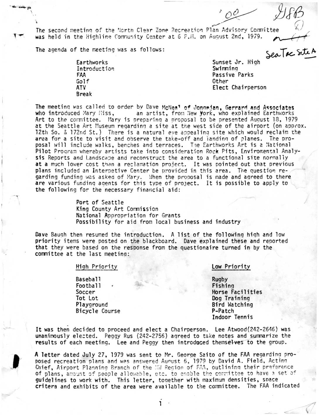
Minutes: North Clear Zone Recreation Plan Advisory Committee, Second Meeting – August 2, 1979
Minutes from the August 2, 1979 second meeting of the North Clear Zone Recreation Plan Advisory Committee, held at the Highline Community Center, covering proposed recreational uses for land near Sea-Tac Airport's north clear zone. Topics discussed included an Earthworks Art installation, FAA density guidelines (1.5 people per acre), a possible 9-hole golf course, ATV facilities, use of Sunset Jr. High School, and passive park development around Tub Lake and Lake Reba. Lee Atwood was elected Chairperson, and the committee agreed to reconvene with the consulting firm to develop workable recreation plan recommendations within FAA constraints. -
 1979-02-01
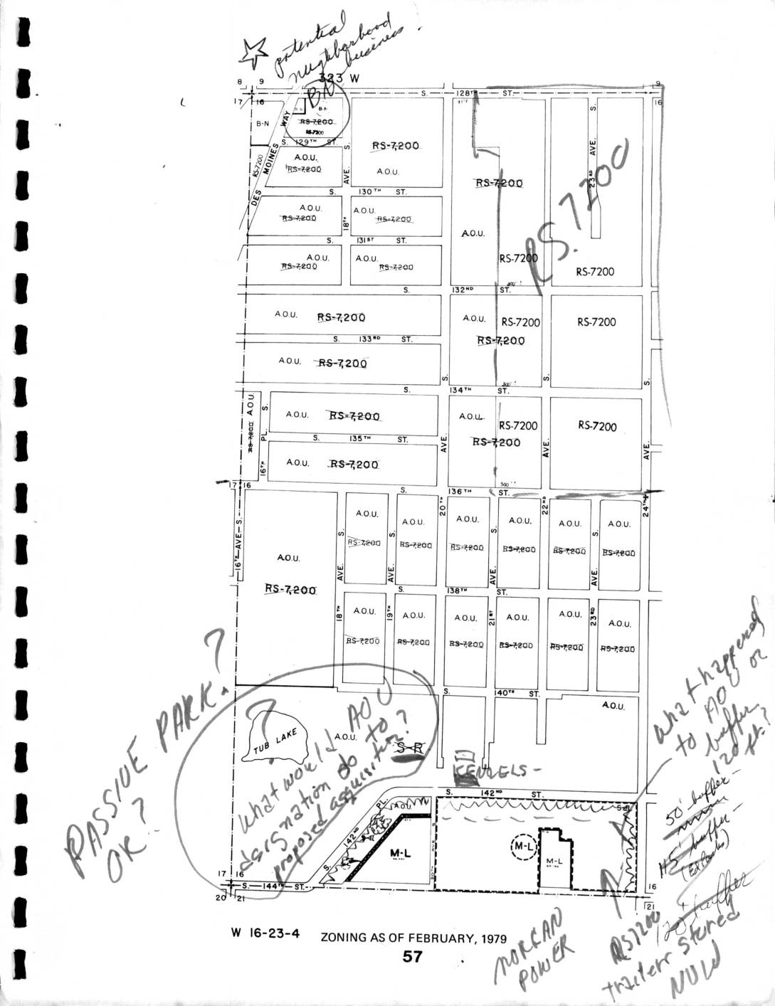
Zoning Map: North Sea-Tac Park Area, February 1979
This is a zoning map dated February 1979 for section W 16-23-4, showing land use designations—primarily RS-7200 (single-family residential) and A.O.U. (Airport Operations Use) zones—in the area south of S. 128th Street near Seattle-Tacoma Airport. Handwritten annotations raise questions about passive park designations, proposed AOC/AOU classifications near Tub Lake, buffer distances (50-foot and 45-foot buffers are noted), and the status of an RS-7200 trailer storage site. The notes suggest an active policy review regarding how airport-related zoning categories and noise buffers should be applied to residential and transitional parcels in this neighborhood. -
 1978-09-01
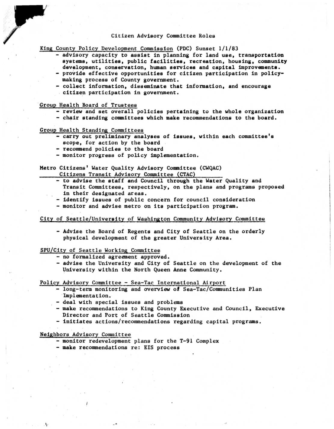
Citizen Advisory Committee Roles: Comparative Overview of King County, Group Health, Metro, Seattle, and Sea-Tac Advisory Bodies
This document outlines the structure and responsibilities of the Policy Advisory Committee (PAC) established in 1978 to oversee implementation of the Sea-Tac Airport Communities Plan. The 12-member committee—drawn from King County, the Port of Seattle, local businesses, government, schools, airlines, and community representatives—was charged with long-term monitoring, addressing special issues, and making recommendations to the King County Executive, Council, and Port of Seattle Commission. The PAC met quarterly at the Sea-Tac Conference Room, with members serving three-year terms and staff support provided jointly by the Port and County. -
 1978-03-23
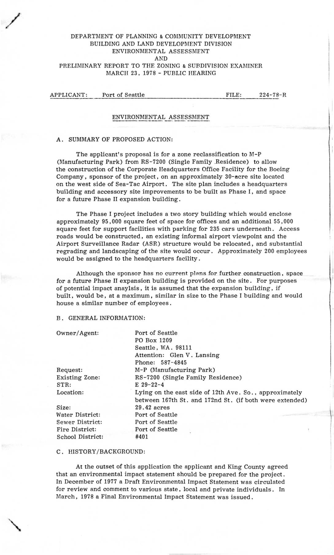
File 224-78-R: Environmental Assessment and Preliminary Report to the Zoning & Subdivision Examiner — Boeing Corporate Headquarters, Sea-Tac Airport West Side
In 1978, the Port of Seattle applied to rezone a 29-acre parcel on the west side of Seattle-Tacoma International Airport from single-family residential to Manufacturing Park (M-P) to allow Boeing to build its Corporate Headquarters Office Facility. The proposed Phase I development included a two-story, 150,000-square-foot building with underground parking for 235 cars and roughly 200 employees, along with road construction, radar relocation, and site landscaping. The application required an Environmental Impact Statement and raised land-use compatibility questions given that surrounding community plans had designated much of the site as open space or parkland. -
 1978-01-01
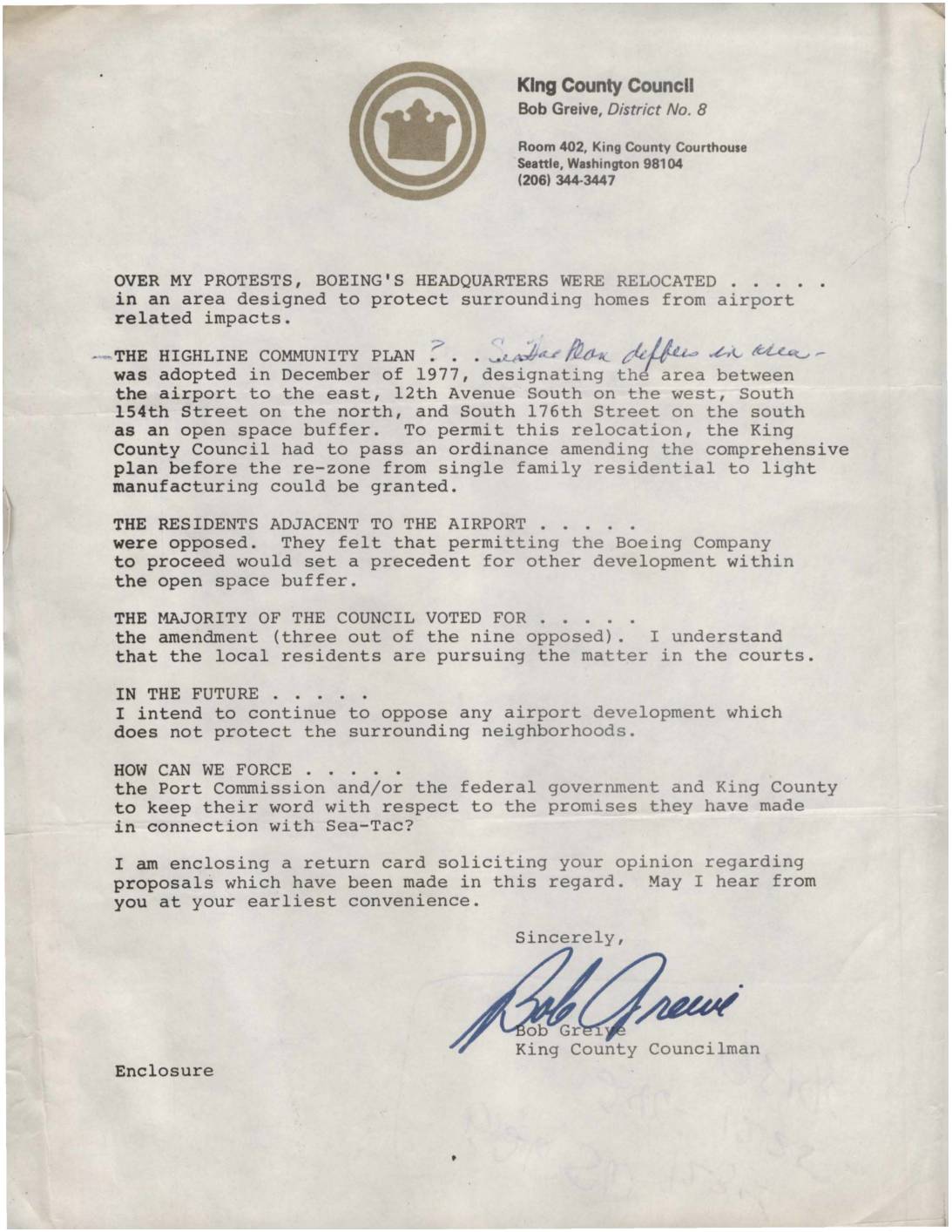
Letter from King County Councilman Bob Grieve on Boeing HQ Relocation and Highline Community Plan
King County Councilman Bob Greive wrote to constituents expressing his opposition to the relocation of Boeing's headquarters into an open space buffer zone near Sea-Tac Airport, an area designated under the 1977 Highline Community Plan to protect nearby residents from airport-related impacts. Despite his protests, the King County Council voted to amend the comprehensive plan and rezone the land from single-family residential to light manufacturing, with only three of nine council members opposing the measure. Greive vowed to continue fighting airport development that threatened surrounding neighborhoods and asked residents for their input on how to hold the Port Commission, federal government, and King County accountable to their promises regarding Sea-Tac. -
 1978-01-01
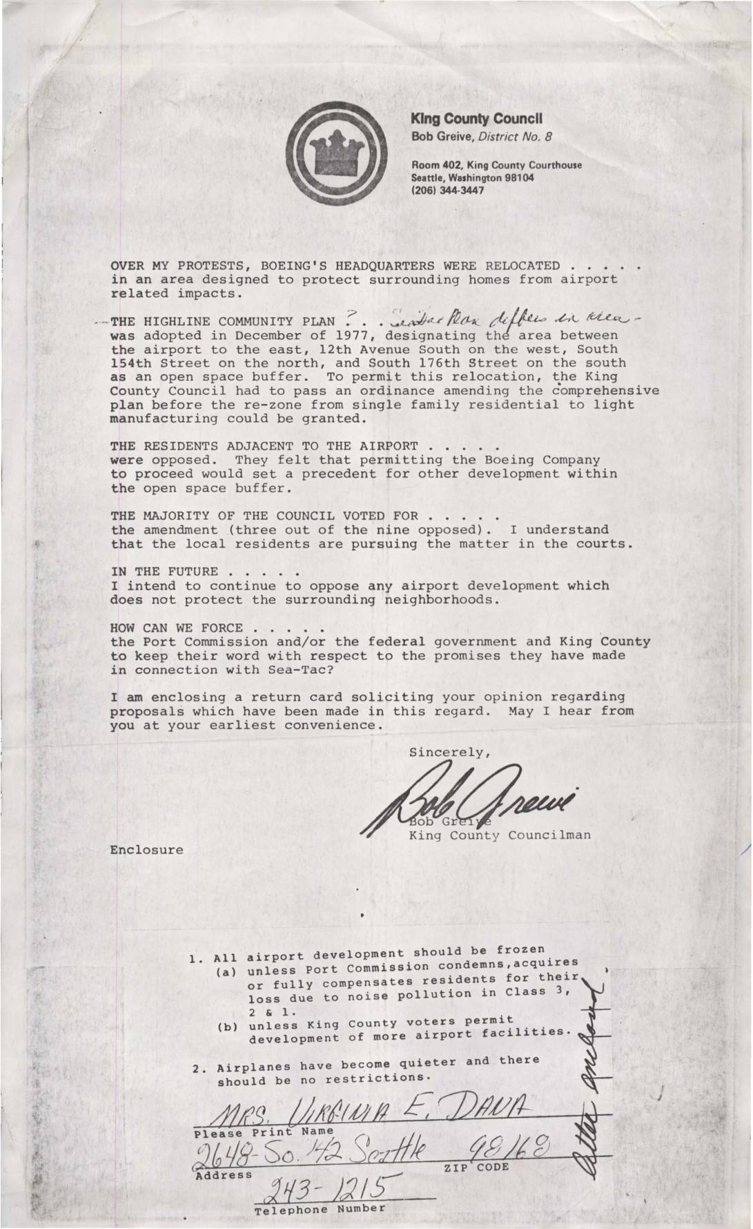
Letter from King County Councilman Bob Grieve on Boeing HQ Relocation and Sea-Tac Airport Development
King County Councilman Bob Greive wrote to constituents explaining his opposition to Boeing's headquarters relocation into an area designated as an open space buffer under the 1977 Highline Community Plan, which was meant to protect neighborhoods surrounding Sea-Tac Airport from noise and development impacts. Despite protests from nearby residents and three dissenting council votes, the majority approved an ordinance amending the comprehensive plan to allow rezoning from single-family residential to light manufacturing. Greive solicited public opinion on proposals to hold the Port Commission, federal government, and King County accountable for promises made regarding Sea-Tac's impact on surrounding communities. -
 1977-12-09
Highline Communities Plan: Final Environmental Impact Statement
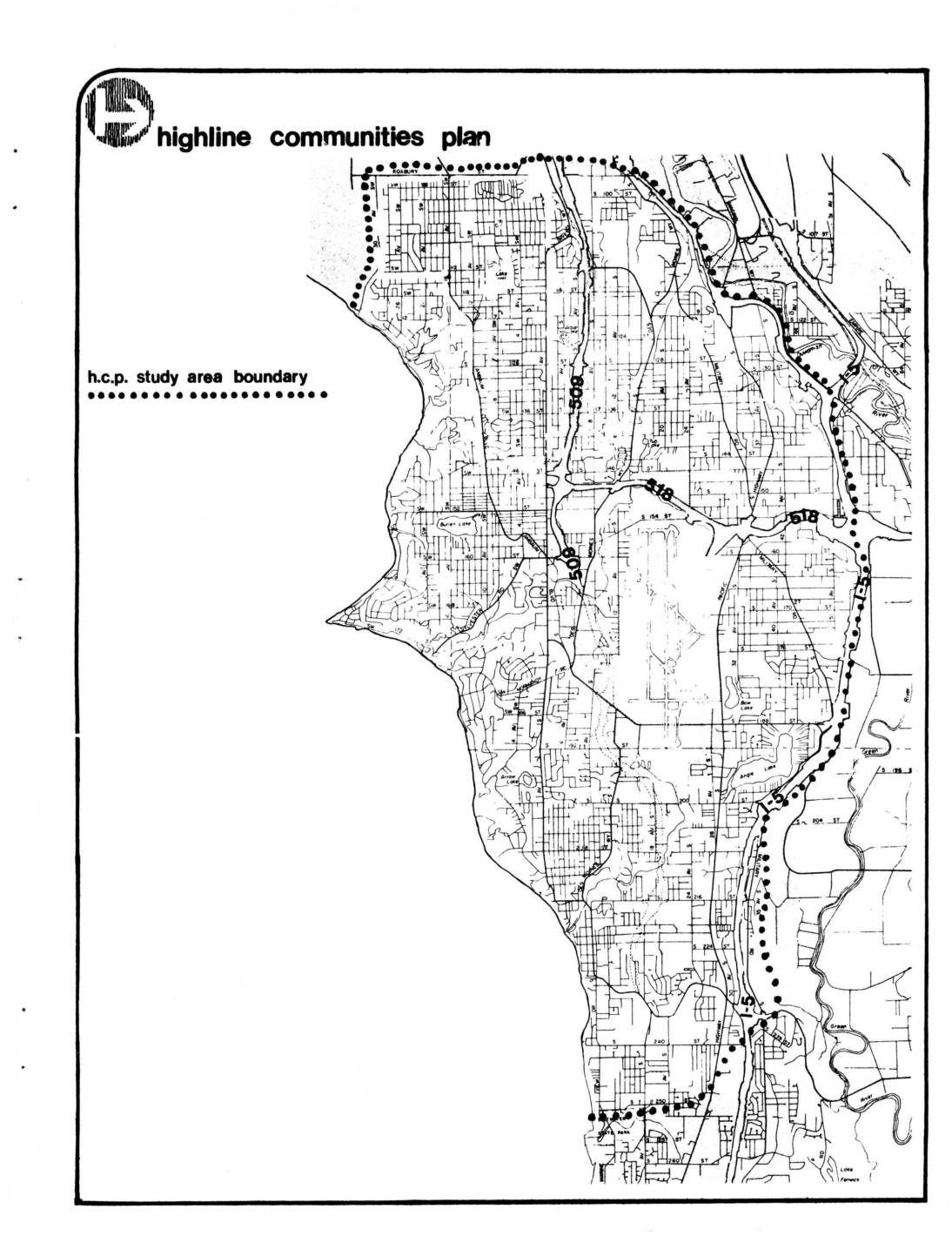
The Highline Communities Plan (HCP) is a King County land use and zoning proposal covering the area between Puget Sound and Interstate 5, from the City of Seattle south to South 252nd Street, including Des Moines and Normandy Park. Prepared by the King County Department of Planning and Community Development and issued in draft form in April 1977, the plan was intended to guide land use policy, area zoning, capital improvements, and housing programs for the Highline Communities Planning Area. Upon adoption, it became the official county policy framework for this coastal suburban region located adjacent to what is now Sea-Tac Airport. -
 1977-11-01
Highline Community Plan
The Highline Community Plan, published by the King County Planning Division in November 1977, outlines land use policies and development guidelines for the Highline communities in unincorporated King County near Seattle. The plan addresses topics including development limitations, drainage and pollution, neighborhood stability, transportation, and parks and recreation. It was developed through a structured community planning process under the King County Department of Planning and Community Development.