Tagaircraft(224)
-
-
 2001-06-22
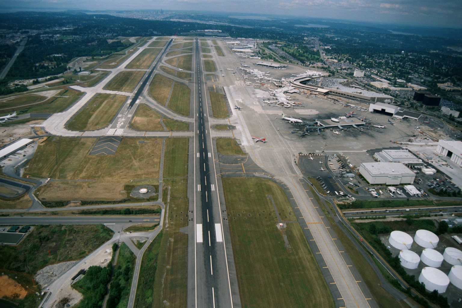
Aerial View of Sea-Tac Airport Looking North Toward Seattle and Puget Sound
Aerial photograph looking northward over Seattle-Tacoma International Airport, showing parallel runways, terminal complex with gates and aircraft at jetways, fuel storage tanks in the lower right, and the Seattle skyline and Puget Sound visible in the background. The image appears to date from the 1990s based on terminal configuration and aircraft liveries visible at the gates. -
 2001-06-22
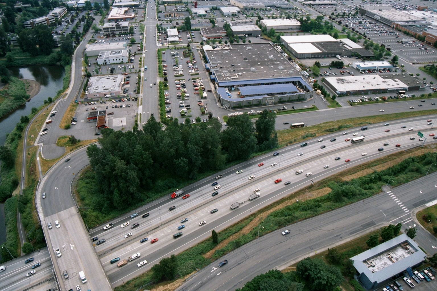
Aerial View of Freeway and Big-Box Retail Zone Including Lowe’s, with Waterway
Aerial photograph showing a multi-lane freeway (likely I-5 or similar Pacific Northwest interstate) intersecting with a commercial retail zone. A Lowe's home improvement store logo is visible among the big-box retail buildings, with a river or waterway visible to the left and extensive parking lots throughout. -
 1998-06-01
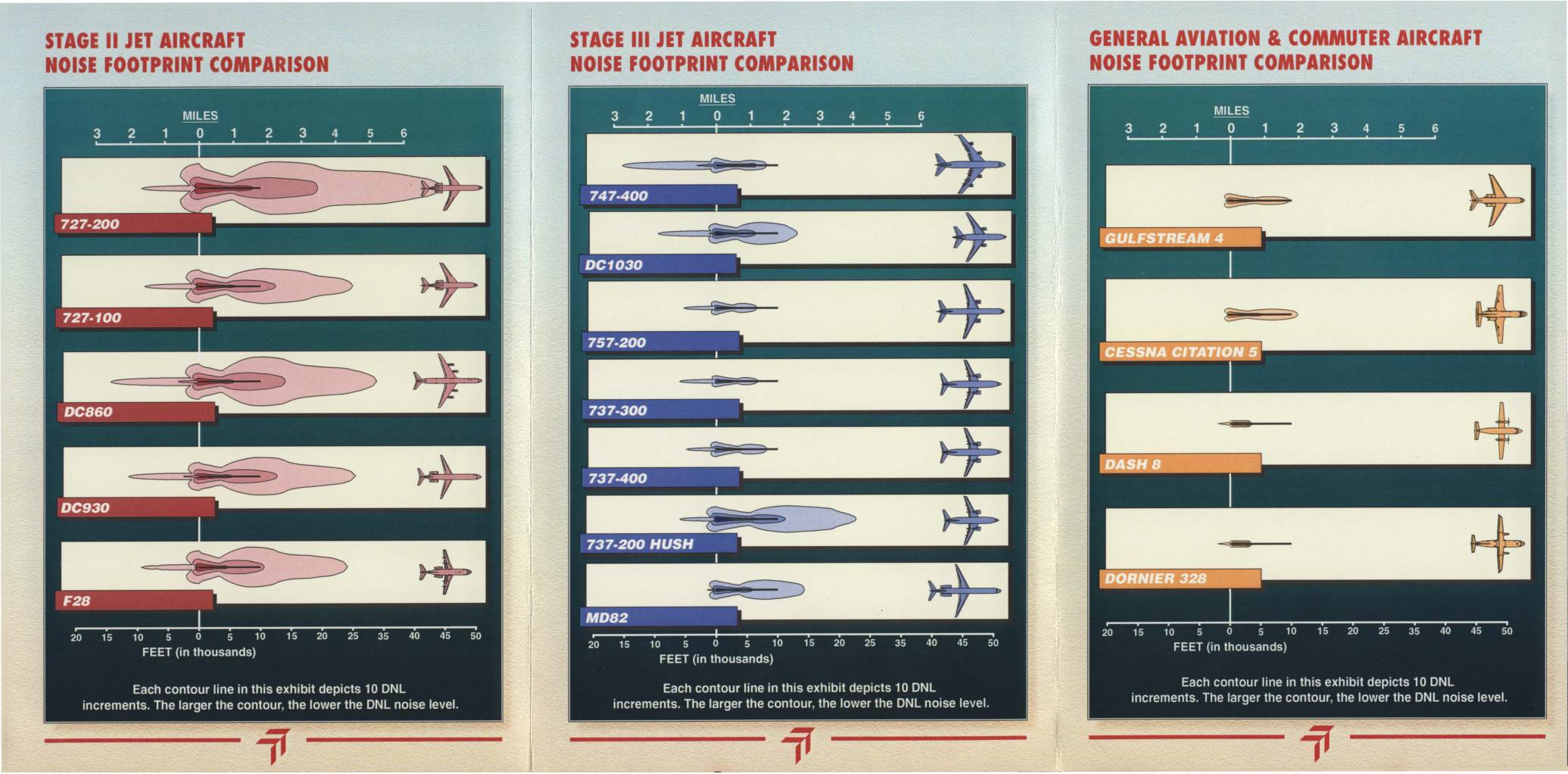
Sea-Tac International Airport: Commercial Aircraft Noise Footprint Comparison
This Sea-Tac International Airport brochure, prepared by the Port of Seattle in Summer 1998, compares the noise footprints of Stage II jets, Stage III jets, and general aviation/commuter aircraft to help residents understand the noise impacts of different aircraft types. It explains that Stage III aircraft are significantly quieter than Stage II aircraft, and that replacing older Stage II planes with newer Stage III models would meaningfully reduce noise levels in surrounding communities. The document also defines key noise measurement terminology, including DNL (Day-Night Average Sound Level), and notes that nighttime flights carry a 10-decibel penalty in noise accounting. -
 1995-06-28
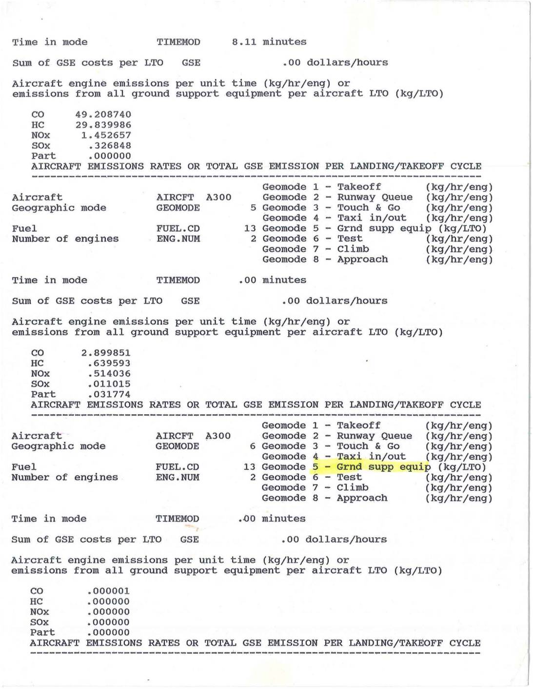
Aircraft Emissions Rates for Landing/Takeoff Cycles – A300, 757, and 737 Aircraft
Technical report showing aircraft engine emissions data for different aircraft types (A300, 757, 737) across various operational modes including takeoff, taxi, climb, and approach phases. Contains detailed emissions measurements for CO, HC, NOx, SOx, and particulates in kg/hr/engine units. -
 1981-01-01
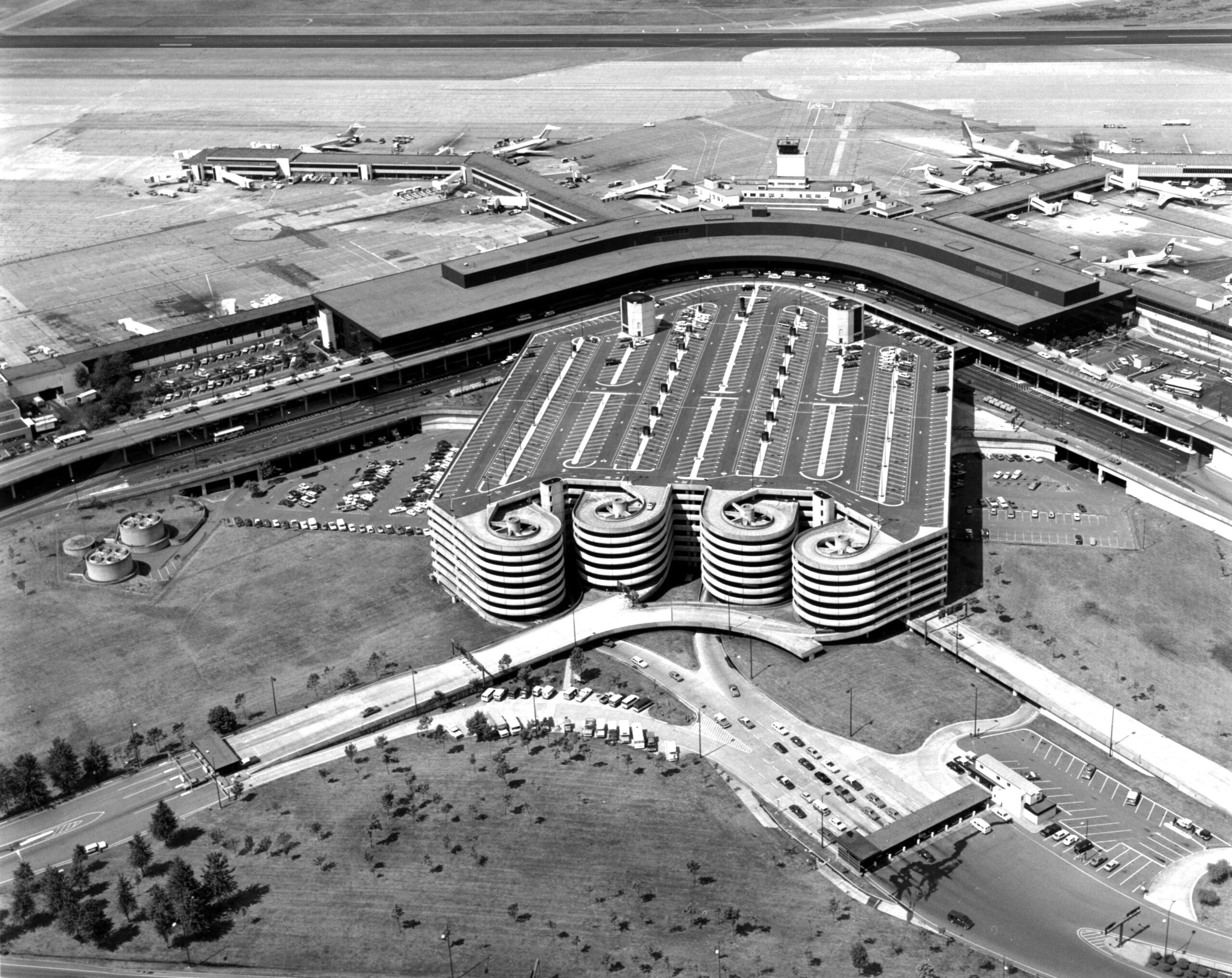
Sea-Tac Aerial July 1981
Black-and-white aerial photograph showing a large airport terminal complex with a curved horseshoe-shaped concourse, multiple jet aircraft at gates, and a distinctive multi-story parking garage featuring cylindrical spiral ramp towers. The image appears to date from the 1960s–1970s based on aircraft types and architectural style visible. -
 1981-01-01
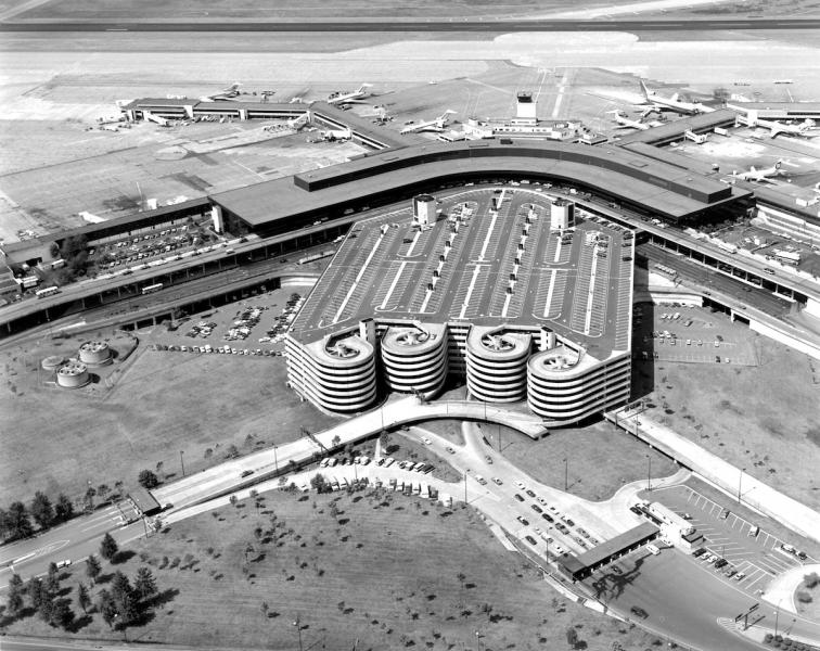
Sea-Tac Parking Lot
Black-and-white aerial photograph showing a large airport terminal building with a curved roofline, multi-level parking garage with circular ramp towers, and numerous propeller and early jet aircraft at gates. No visible text, logos, or captions are present to confirm the specific airport or date. -
 1979-01-01
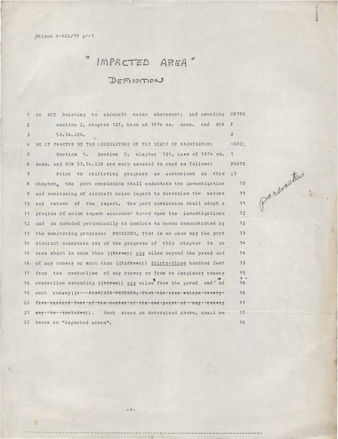
“Impacted area” definition: An act relating to aircraft noise abatement
This 1979 Washington State legislative act amends the definition of an 'impacted area' for aircraft noise abatement purposes near airports. It expands the eligible zone from three to six miles beyond the paved end of any runway, and from fifteen hundred to thirty-three hundred feet from the runway centerline, within which port districts may undertake noise mitigation programs. Areas meeting these geographic criteria are officially designated as 'impacted areas' subject to noise investigation and abatement efforts. -
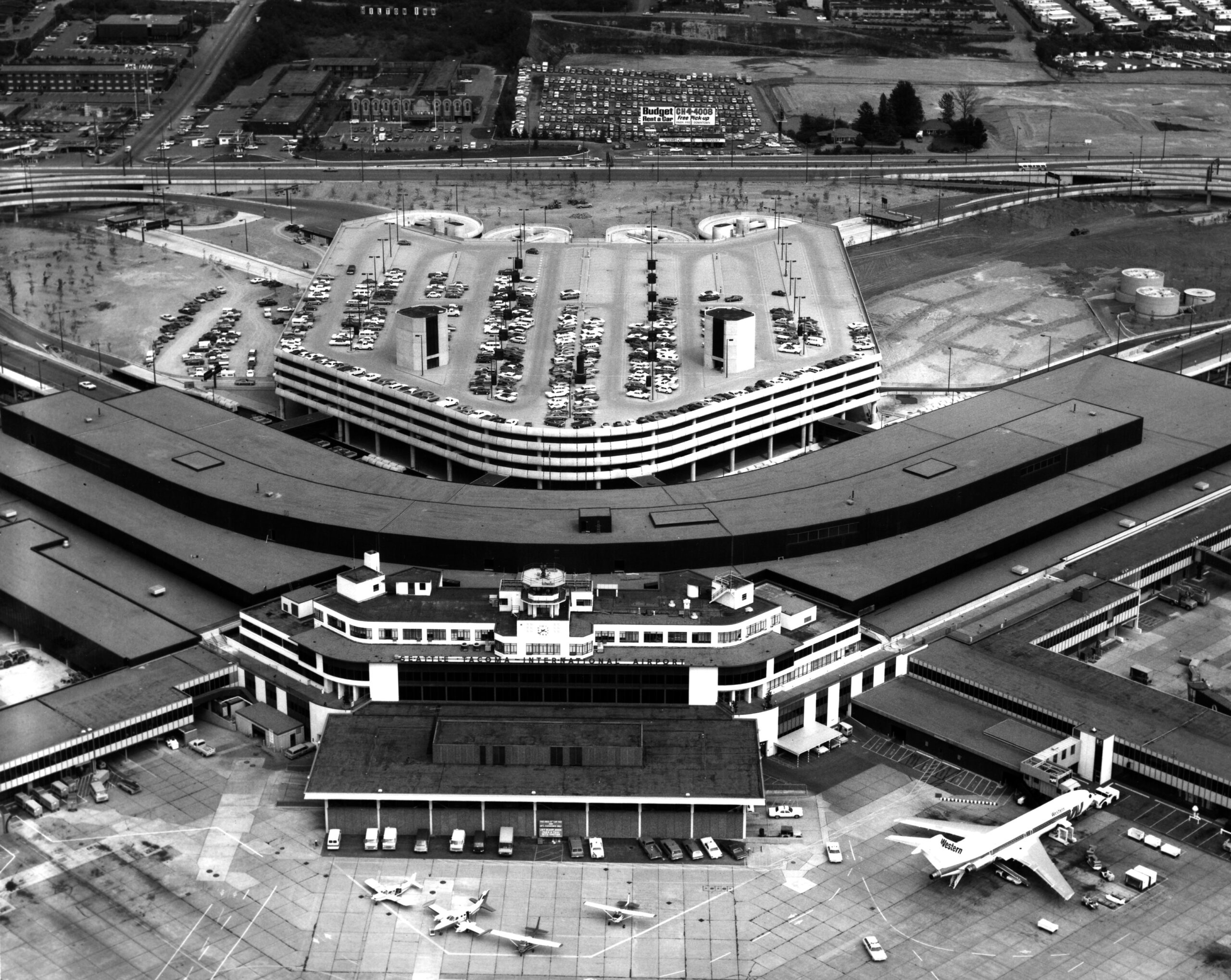 1972-05-24
Sea-Tac Airport Aerial View with Western Airlines Jet at Gate
Aerial photograph of Seattle-Tacoma International Airport showing the main terminal building, multi-level parking garage, and tarmac. A Western Airlines jet is visible at the gate, and a Budget Rent a Car billboard is visible in the background parking area. -
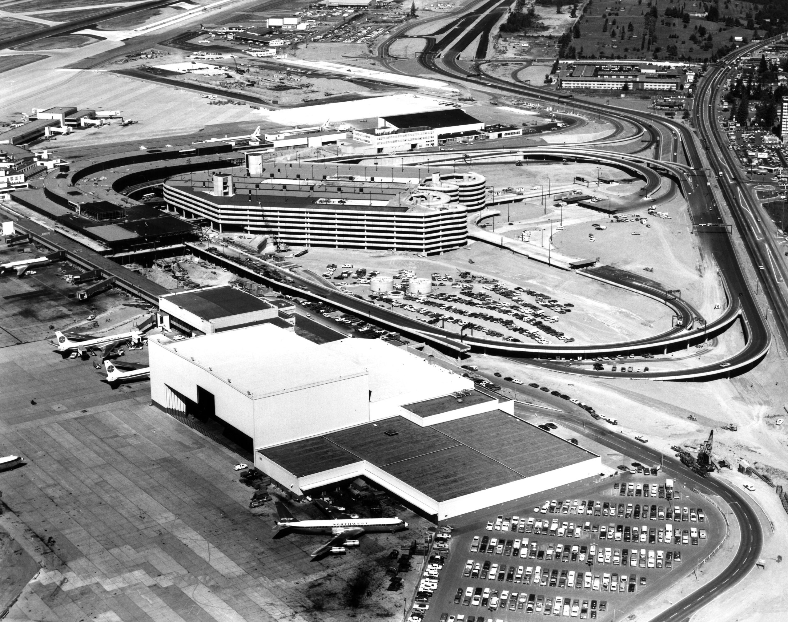 1971-09-16
Sea-Tac Airport Aerial View, 1971
Aerial photograph of Seattle-Tacoma International Airport showing the main terminal complex, multi-level parking garage, and aircraft on the tarmac. Visible aircraft include Pan Am and Northwest Airlines liveries, consistent with the airport's configuration during the early 1970s expansion period.